Headlines
- The Atlantic does not have a specific candidate for development over the next week or more.
- The Gulf may be an area to watch next week, but most modeling is mum on development chances.
- Tropical Depression 1C will likely become a tropical storm and pass just south of Hawaii in the Pacific.
Atlantic remains quiet
Yesterday’s post went in detail about some of the possible reasons behind the quieter overall pace of storms this season and especially in August. Today, let’s check in on the real time and forecast.
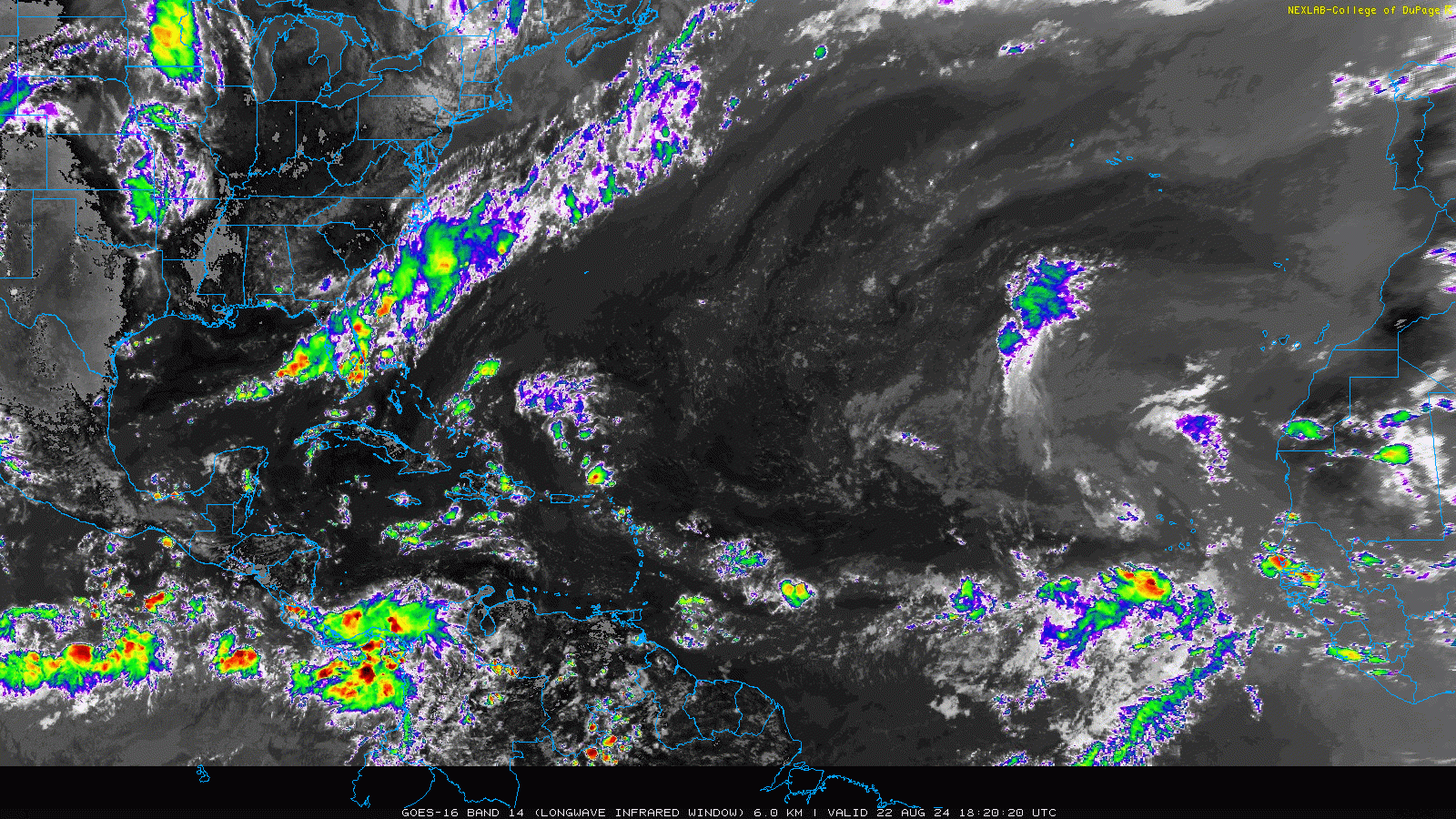
If you asked me to tell you the date of the satellite image above without knowing anything about it, I would easily tell you probably June or early July. Or later in October or something. The only real tell might be that my eyes are trained to discern Saharan dust off of Africa in the infrared band of the satellite. But whatever it is, the takeaway here is that this is about as quiet as you will ever see a late August satellite image look over the Atlantic. There are currently no areas of interest. And when you look at the very latest 12z European model for the next 3 weeks, there are only scattered pockets of “noise” showing up in the forecast, and no real specific tropical wave to focus in on.
And within that noise, there is little signal to really pick up on. Maybe there’s a wave late that’s a recurve candidate out to sea? That’s about all I see here. That isn’t to say that there will be no systems to track over the next 2 weeks, it’s just that there isn’t exactly a strong signal for anything in particular right now. Which is unfathomable for late August in any year, let alone this one.
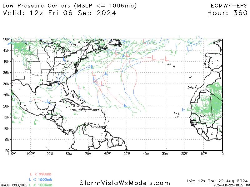
Now, I will say it’s wise to keep an eye on the Gulf next week. There is one little disturbance that comes ashore in Texas on Monday, ushering in a better chance of rainfall for much of the southern and eastern part of the (increasingly dry) state. Beyond that, I have seen the GFS model try to latch onto a tropical wave currently over Hispaniola. It never really develops it, but it does try to bring it into Texas or Louisiana later next week.
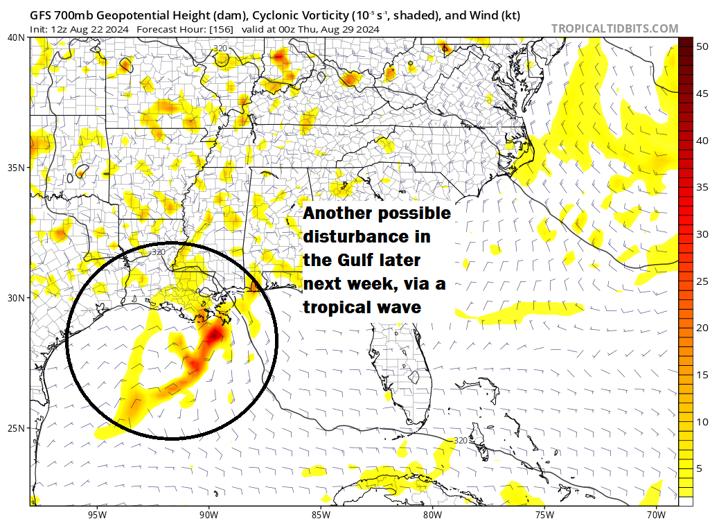
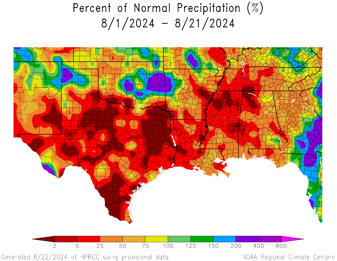
Do I agree with this? No. But any meteorologist worth their salt would not discount a tropical wave in the Gulf in late August. So it should be babysat, but I wouldn’t be too worried right now. At the least, hopefully all this opens up some rain risks in these areas. Since the calendar flipped to August, rain has been tough to come back in all of Texas and all of Louisiana. Houston is running about 20 percent of normal rainfall this month, while much of East Texas is less than 5 percent of normal. Louisiana is less the half of normal as well. Rain would be welcome.
We’ll keep an eye on this as it evolves.
The Pacific is busy
While the Atlantic is on hiatus, the Pacific is busy. Hurricane Gilma is now a strong category 3 storm, heading for nowhere. Another disturbance behind Gilma is likely to form. And just this afternoon, we have Tropical Depression 1C in the central Pacific.
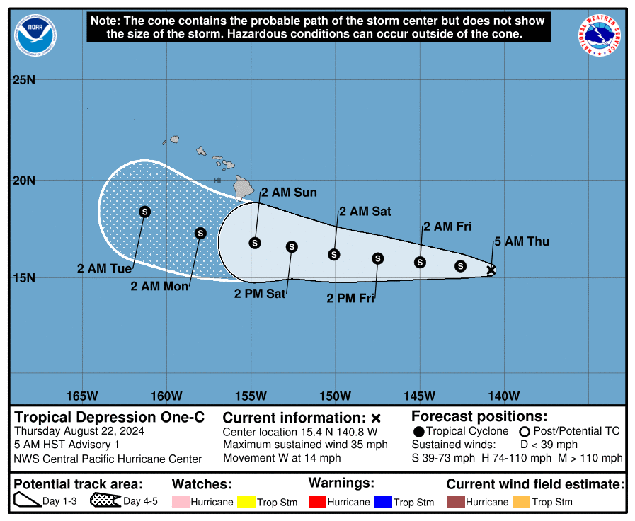
This one is not expected to become a significant storm, but it is expected to become a tropical storm as it passes south of Hawaii. Impacts to the islands may include heavy rainfall and gusty winds by Sunday or Monday, especially on the Big Islands, but it’s a little too soon to say much more than that at this point. We’ll keep an eye on this one as well.
I had been surprised that CSU earlier this month only revised their projection from 25 to 23 total storms. With 5 down and none projected for the rest of August on average we could need 8 in September, 8 in October and 2 in November to make that happen. Do you think there could be that many in the last 3 months? Would be thrilled if there were not.
I agree with your last comment entirely. But the answer is unfortunately, yes, there could be that much activity — *IF* things get their act together. That’s one of the issues this year. The upside is absolutely meteoric, and right now we’re just a little out of phase with things…a shift in features, and we’re churning out storms in bunches.
So, do you still see things possibly changing in September, as was previously mentioned by you or Eric?
That’s a definitely possibility. I think it’s the likeliest outcome. That said, there’s definitely a chance we’re wrong here. But given how much upside there is to everything, you cannot bet on a quiet outcome.
Maybe in these lulls your audience needs some PTSD therapy in the newsletters. Even armed with non-hyped knowledge and better understanding than ever, hurricane season is scary.
Wow. Lowry mentioned that the GOM is up to 85°F down to 160 feet. That’s a little over five atmospheres down.
I don’t want to think about how much fuel that is and what it could whip it, but I can’t help it.
Please tell me there’s some upcoming stifling elements.
One of the problems with this lull is that it’s allowing everything to warm above and beyond where it already has been. So, not great. But warm water without upper level support isn’t usually enough. You need the two working together. Right now, the atmosphere is cooperating to conspire against activity. Hopefully that can continue well into September, but yeahhhh..not great!
The CFS Climate model is showing above average anomaly for wind shear in the Gulf next month.
Fingers crossed.
The Caribbean could be a problem though.
Still seeing what appears to be a lot of Saharan dust coming off of Africa, plus there’s an Atlantic Nina in place or in the process of developing.