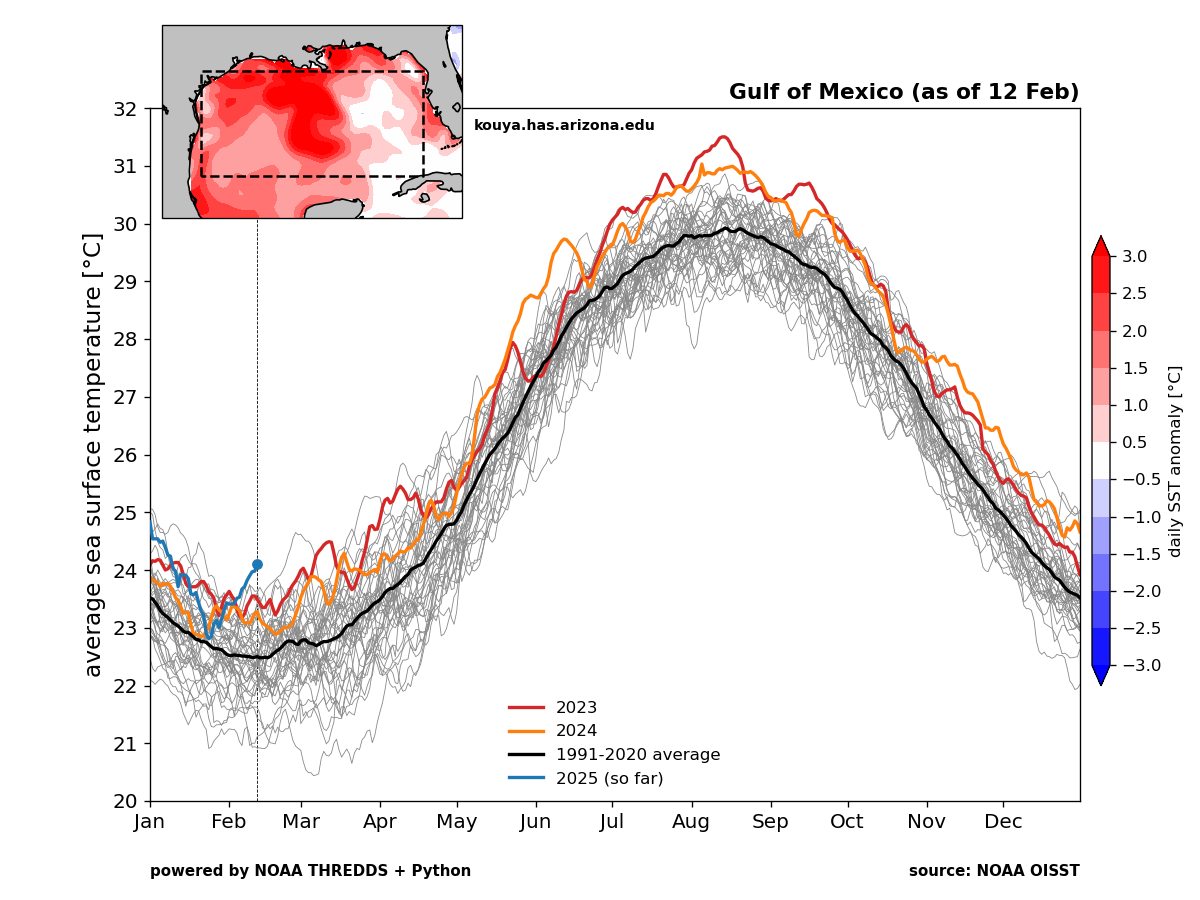
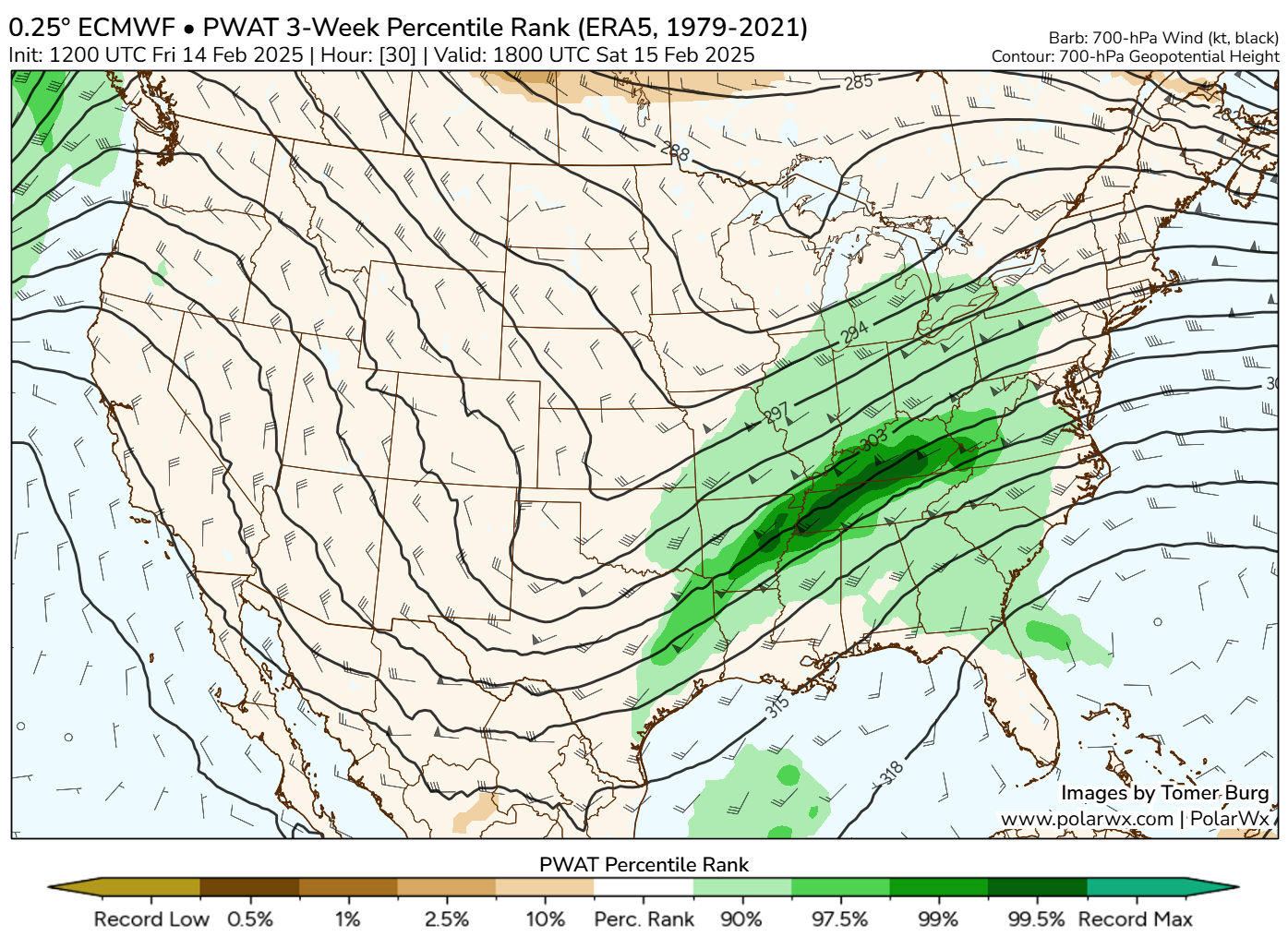
We’ve been talking a bit about the return of an active pattern to the Eastern United States, and indeed that is what has happened. Fueled in part by a record warm Gulf of Mexico, the amount of available moisture this weekend over the South will be just shy of records for the date.
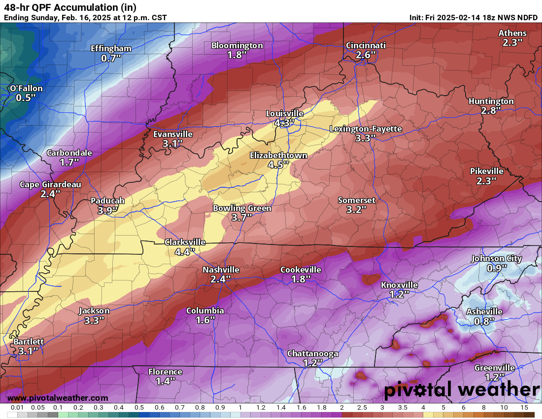
As all this moisture streams north out of the Gulf, you can see the bullseye setting up tomorrow over Kentucky and Tennessee.
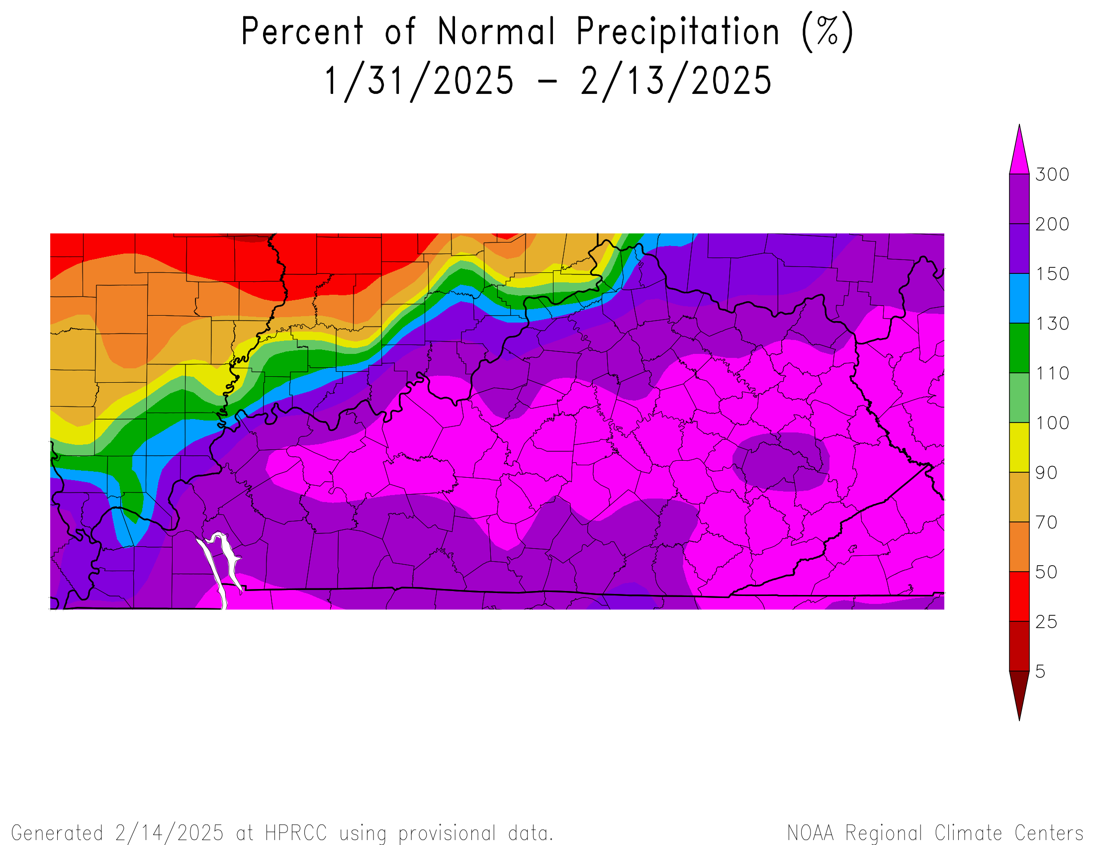
You’ve also had a period of rainfall over the last 2 weeks that has averaged 300 percent of normal or more across Kentucky and into West Virginia.
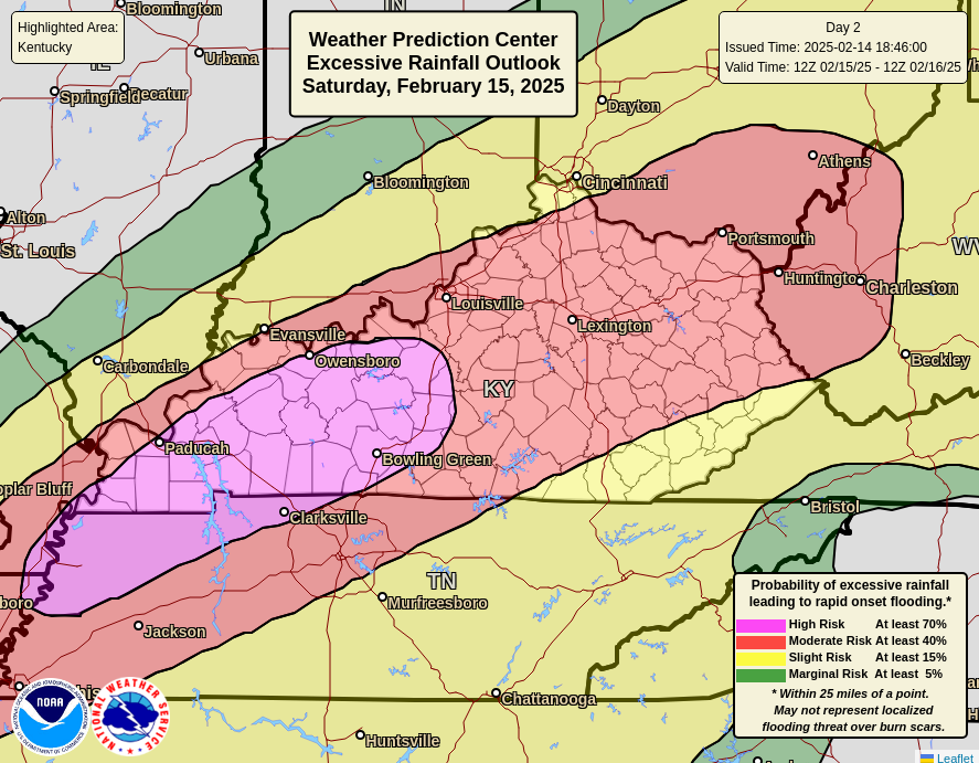
As a result, tomorrow’s storm carries a unique risk of being a major flooding producer for parts of Tennessee and Kentucky, as well as Arkansas, Ohio, and West Virginia. In fact, the unusual day 2 “high risk” (level 4/4) for excessive rain and flooding was triggered today by the hard-working and very busy meteorologists in NOAA’s Weather Prediction Center.
The HRRR model from earlier this afternoon shows just relentless rain setting up over Kentucky later tonight and continuing into most of tomorrow. This model shows risk for up to 5 or 7 inches of rain in parts of the state.

This seems more than reasonable, and indeed that’s about what the NWS forecast is for these areas.
The bottom line? Dangerous, damaging flooding is possible in Kentucky and portions of Tennessee in particular tomorrow with somewhat lesser risks (but still considerable risks) surrounding those areas. The good news at least is that next week looks quieter in this region, with a wintry system possibly bringing some generally light snow but no significant rainfall.
On the southern end of all this, there will be a fairly healthy severe weather risk tomorrow too. The potential for some strong tornadoes will exist in parts of Louisiana, Mississippi, and Arkansas to perhaps as far north as Memphis.
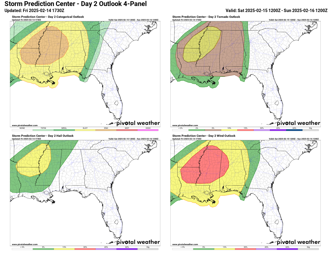
An enhanced risk (level 3 of 5) is posted from northern Louisiana north to about Memphis and east to western Alabama. The hatched tornado risk indicates the chances of strong tornadoes in the top right image. Hail isn’t a major risk tomorrow, but damaging winds will be. Either way, the warm Gulf does tend to add fuel to the overall fire, and between heavy rain in the southern Ohio Valley and severe weather over the Lower Mississippi Valley, it looks to be a very active Saturday.
I am driving from Fl to Mn next week and so I am looking forward to your possting fro next week!
Thanks for all you do!
Ty Matt! I always learn from you ⚘
I couldn’t see from these maps but wonder what is the impact on Helene impacted areas of these continual east-moving storms?
Most of this will fall well to the west of where Helene did most of its damage. I’d say thankfully, but it still sucks.
Those Gulf SSTs are not good. At ALL.
I had to do a double take 👀
It certainly does not bode well, but this has been almost typical heading into spring in recent years. While, yes, we’re at a record now, we’ve tended to surge up way warmer than average from later Feb through May the last several years. It usually eases up in summer somewhat, at least relative to normal. But, I’d be lying if I said I didn’t have a great feeling about things.