In brief: Our first investigative area of hurricane season has formed in the Atlantic, but Invest 90L will not threaten any land. Meanwhile, heat roasts the East this week, while flooding threatens New Mexico.
Subtropical mischief from Invest 90L
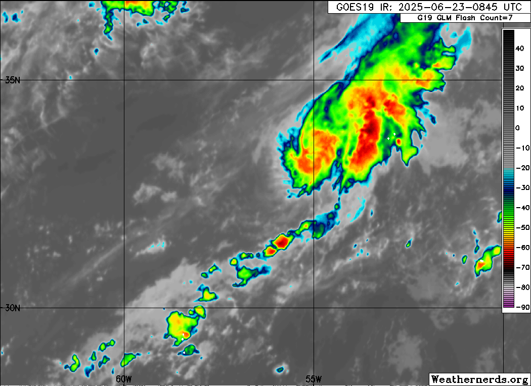
It’s easy to get so caught up in looking at the corridor between the Gulf, Caribbean, and Africa that mid-latitude systems out in the open Atlantic can sometimes just get lumped in with background noise. Indeed, it appears that this may be one of those cases.
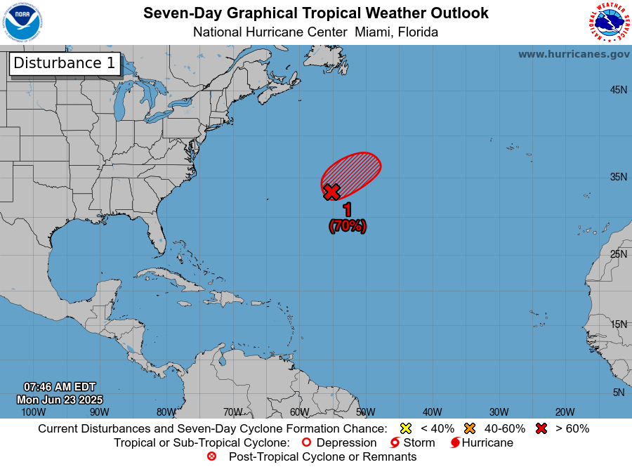
Invest 90L, our first “area of investigation” this season won’t be winning any hurricane look-a-like contests, but conditions may briefly be favorable for a burst of quick development before it launches out to sea. There is zero threat to land from 90L. It’s more of a curiosity than anything.
This one would firmly fall into the stat padding category for the season should it develop, though it would contribute virtually nothing to the overall depiction of the season beyond perhaps a name off the board. But it’s a sign that even in a generally unfavorable overall pattern, something can still spin up.
Rest of this week in the tropics
Quiet. There’s no sign that the overarching dominant pattern of “hostile” will change anytime soon. The medium range models which go out 10 to 14 days generally look quiet as well. We do expect the Pacific to continue somewhat active with another system likely later this week. But for the Atlantic, the best you’ll get out of this pattern in all likelihood is something either like we see in the North Atlantic right now, or some currently un-forecast complex of thunderstorms that ends up in the Gulf or off the Southeast coast. Good news for those of us that want calm.
Heat bakes on
The Eastern U.S. heatwave is going to continue onward. Some notable numbers from this weekend: Prior to Saturday, only 31 nights on record in Minneapolis had failed to drop below 80 degrees. Saturday was 32 and Sunday was 33. Sunday’s 82 degrees ties for the fourth warmest low temperature on record and first time since the Dust Bowl era that Minneapolis has been so warm at night. Yesterday was also the first time since 2019 that Chicago failed to drop below 80 degrees.
Heading into the next couple days, the heat will begin to peak in the Eastern U.S., with numerous records likely to be threatened or fall. The most impressive on the list below for some selected major cities is probably the 1888 record in New York City that should fall tomorrow or the 1923 record in Philly.
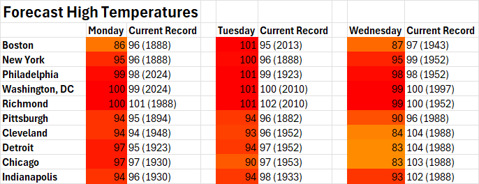
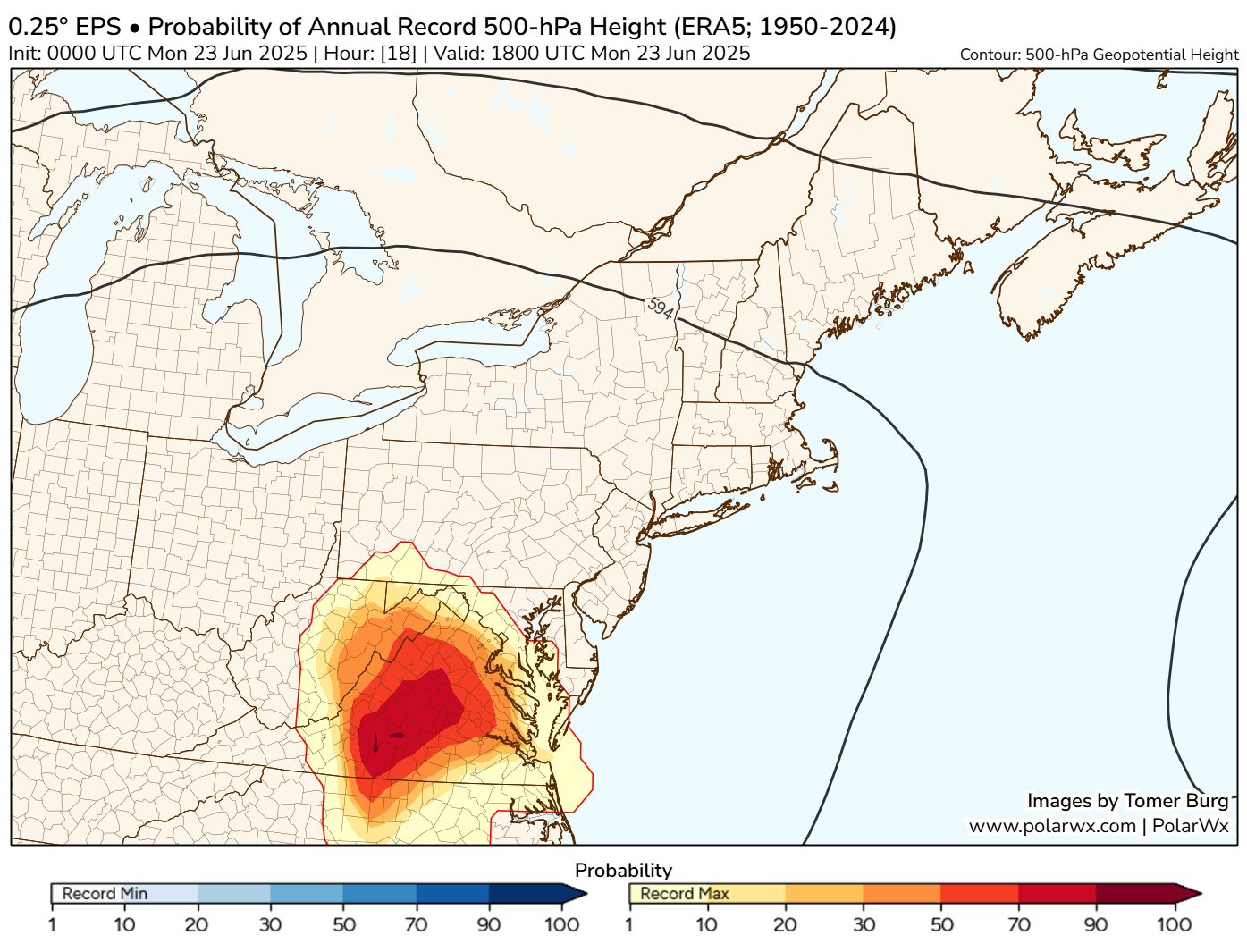
Whatever the case, there is a massive swath of the country under heat advisories and warnings. Models continue to suggest that upper level “heights” in the atmosphere have a fairly decent chance at breaking all-time records in parts of Virginia based on the historical data we have. And there’s a very good chance they’ll be setting new June records. Heights can help us determine the intensity of a ridge or trough in the atmosphere. The higher the values, the stronger the heat can be this time of year.
The good news is that as the week progresses, the ridge should break down, slowly. This will accelerate over the weekend and next week, allowing heat to rebuild in places to the west, like the Plains and Texas and possibly Southwest.
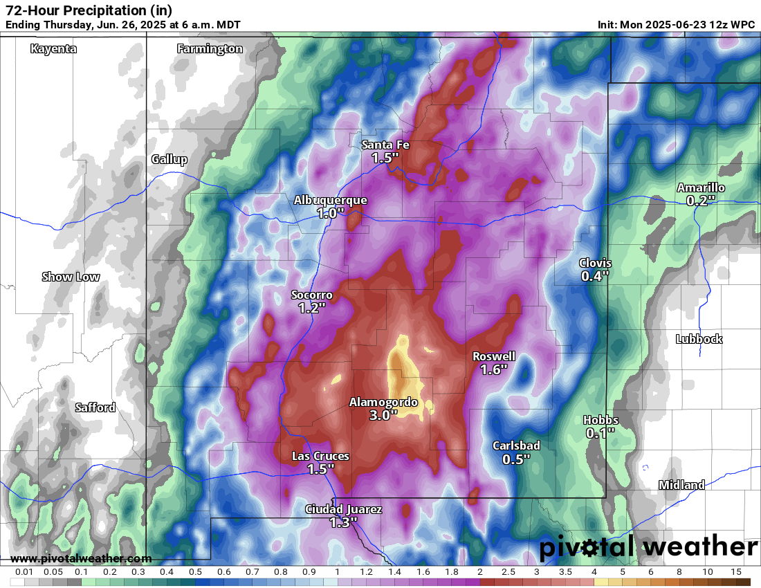
Southwest flooding risk
This pattern setup is allowing for a feed of monsoonal moisture from the Pacific into New Mexico and parts of West Texas. This, combined with a number of favorable factors for significant rain is likely to put a pretty substantial flooding risk into New Mexico and perhaps portions of western Texas tomorrow.
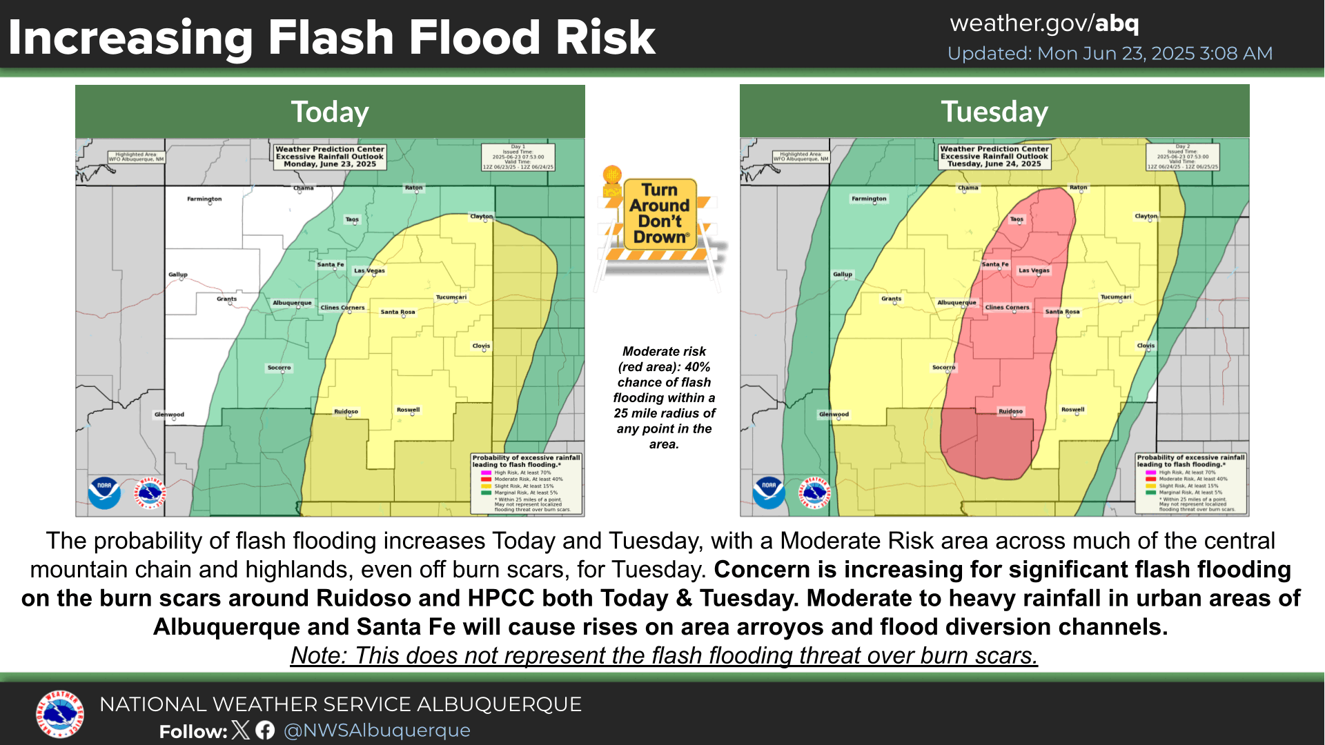
Burn scar flooding and mudslide risk is a major concern in New Mexico. But all forms of flooding look to be in high supply tomorrow. Conditions should ease up some in the back half of the week.