As of Tuesday Noon, a new post has been updated: Potential Tropical Cyclone 1 will potentially bring flash flooding to South Texas and Mexico – The Eyewall
Headlines
- A developing flash flood threat will occur in Texas this week, with heavy rain between Houston and Brownsville. Heaviest rains seem likely between Matagorda Bay and Corpus Christi.
- Invest 91L in the Bay of Campeche continues to show signs that it will develop into a lower-end system before coming ashore in northeast Mexico midweek.
- An Atlantic disturbance may approach the Southeast coast later this week, with low odds of lower-end development.
- An additional system or large area of rainfall may impact Texas and Mexico again next week.
Texas axis and Invest 91L
The focus for this week will be very much on Texas and Mexico as impacts from a combination of a long axis of atmospheric moisture and a possible Bay of Campeche tropical system work to deliver heavy rainfall to parts of the region.
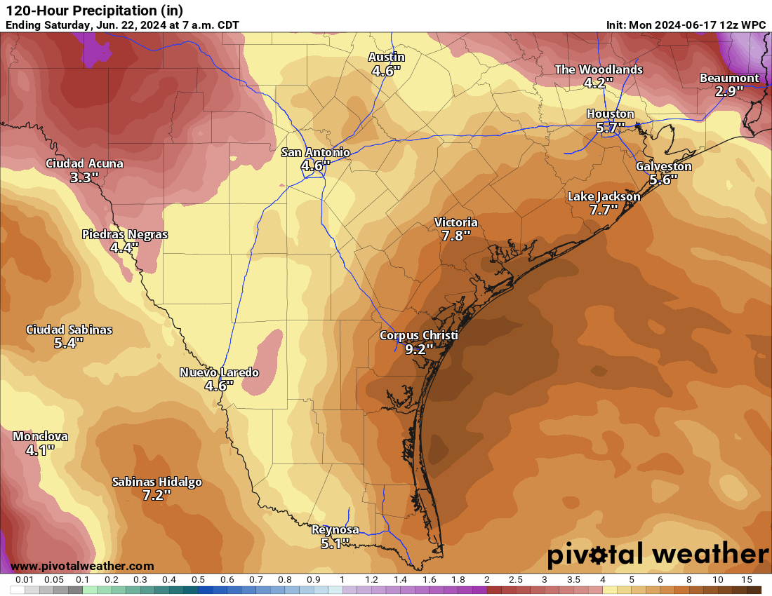
The rainfall forecast for this system will be tricky. Much like was witnessed in Florida last week, plentiful amounts of moisture in the atmosphere will lead to efficient (read: heavy) rainfall production. Put simply? The potential for some very high rain rates will be in play for the entire Texas coast this week. While the amounts above are a good average for the period, there will almost certainly be higher amounts in spots.
The biggest question we are faced with as forecasters is where those higher totals will occur. All weekend, we’ve seen some changes here and there in terms of where the “bullseye” of heavy rain will occur. In general, it looks focused on the Matagorda Bay region south into Corpus Christi, with locally heavy rain but gradually decreasing totals on either side of that. Given the moisture situation, we could easily see 10 to 15 inches in the most persistent bands, possible anywhere, but again most likely between Matagorda and Corpus Christi. Flash flooding will be a good bet in those areas, so please travel cautiously in coastal Texas this week.
In addition, coastal Mexico and the mountains south of the Rio Grande will likely see elevated totals, perhaps as high as 10 inches or so. Flash flooding is a good bet in parts of Tamaulipas and Nuevo Leon.
Conditions should gradually improve Thursday and Friday. Quick note: We are getting a lot of questions about vacation plans, flights, etc. We can’t get to all of those, so just use your best judgment and heed the advice of local officials around your travel. Prepare for at least some delays the next couple days.
In terms of tropical development, Invest 91L is what’s spinning in the Bay of Campeche and has a 70 percent chance of developing into a tropical system. Hurricane hunters will be out to investigate the system later today.
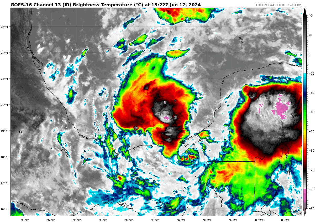
It seems that 91L has a broad circulation overall, mostly in the mid-levels of the atmosphere. To get declared as a tropical system, we’ll need a low-level circulation and low pressure at the surface. It’s got a little time to do this before it nudges inland over northeast Mexico midweek. Regardless of development, the broad southeast flow to the north side of it will help amplify the rain chances in South Texas and northern Mexico.
Southwest Atlantic rumblings
A disturbance sitting north of Puerto Rico will continue to backpedal to the west over the next few days, eventually approaching the Southeast U.S. coast by Friday or Saturday. It has about a 30 percent chance of developing right now, which seems reasonable given the amount of wind shear it will likely experience in the days ahead.
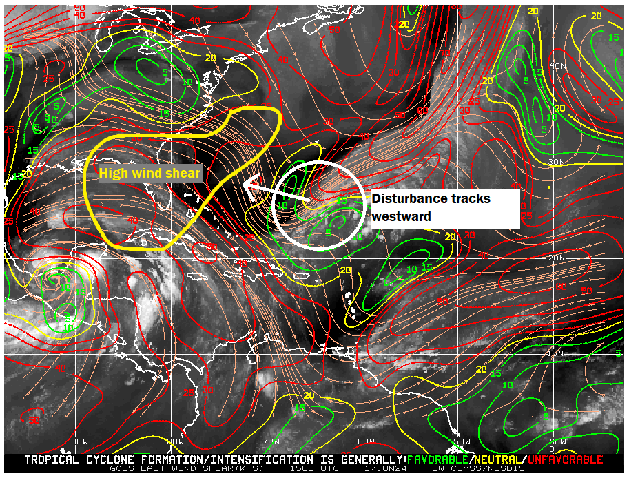
This remains an area to keep watching, but given the setup, it also seems likely that this will have a fairly low ceiling in terms of intensity and organization. The best guess for track would be toward Georgia or South Carolina, with perhaps some added rain up that way later this week.
Texas & Mexico rinse and repeat?
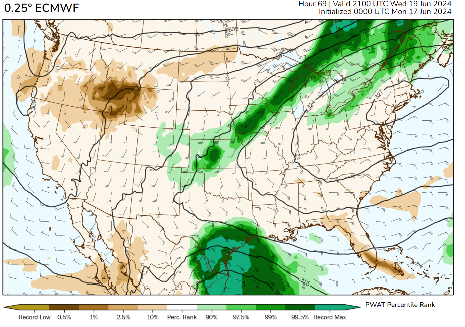
We continue to also keep tabs on the potential for a follow-up round of rain and low-end tropical development next week off the Gulf Coast. Models continue to indicate continued Central American gyre activity near the Yucatan and Bay of Campeche. The pattern will finally break down later next week, with high pressure likely building into the Gulf of Mexico. But before that happens, we could see another disturbance associated with the CAG begin to track into Mexico or South Texas. This shows up nicely when you look at the “spin” in the mid-levels of the atmosphere as forecast by the European ensemble model between this weekend and next Thursday below.
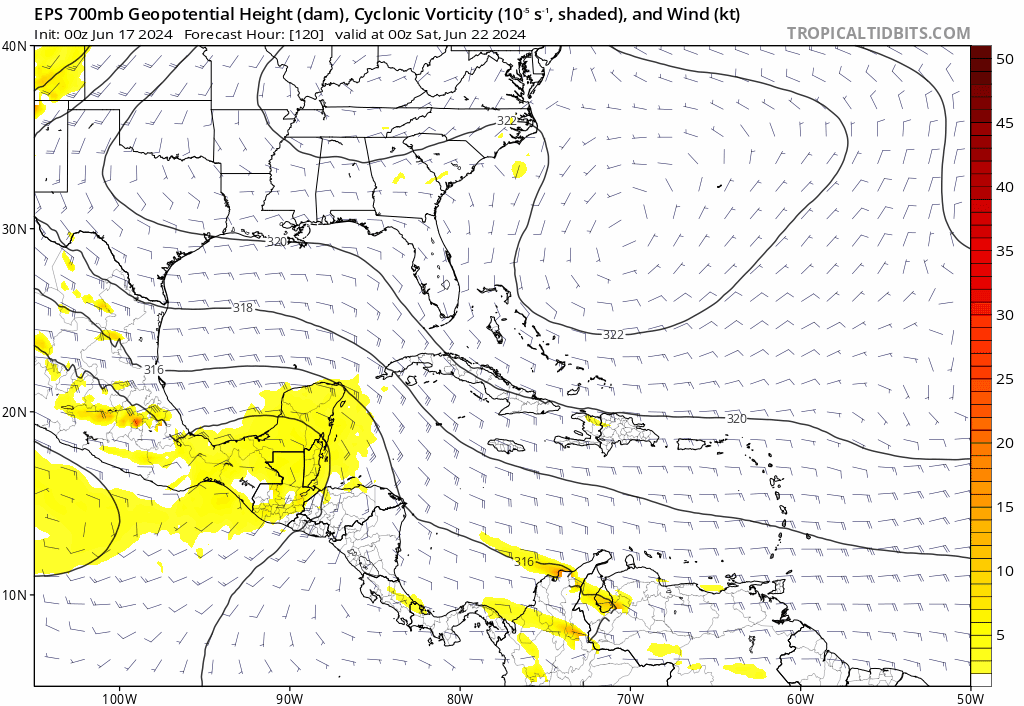
It’s far too soon to figure out exact details here. But what we see: A CAG that begins to move and break down, the potential of a tropical system forming within that mess, and a strong signal for above normal rainfall, if not much above normal rainfall again next week in Mexico and South Texas. We’ll continue to watch this closely, especially after one round of heavy rain this week.
Hi thanks for all you guys do!
What type of wind is expected in the Houston area and surrounding burbs, north of I-10, south of I-10 east west of 45
Thanks
Nothing notable. Maybe up to 20 mph or 25 mph in gusts. Coastal areas will see 25 to 35 mph gusts.
Thank you. After the derecho and the mini-derecho-thing 10 days later, wind is now on my Anxiety Radar.
Should Katy evacuate?
HaHaHa never gets old #IkeHumor
I’m in London, UK. Should I evacuate to Katy?
Bloody Hell Mate Get in your Rover and come on!!
Yall spelled Nuevo Leon wrong
Ugh. Fixed. Hate doing that. Thank you.
Should I worry?We live in Rosenberg Tx 45 mins away from Freeport tx coast
Nope. Just be aware of locally heavy rain.
We have friends on vacation in Port Aransas in a beach house—do they need to cut their vacation short and leave or is this going to be more a rain event and they can ride it out?
They can ride it out.
What about mission Texas? Will.we get any much needed rain or a cool down?
Expecting at least a few inches of rain there along with some cooler temps, yes.
My family lives in Seadrift tx…are they going to be ok?
Yep! Watch for flash flooding obviously, but most people should manage ok with this.