Headlines
- A weak low pressure system off the Southeast coast is unlikely to develop.
- It will bring locally heavy rain between South Carolina and South Jersey today and tomorrow.
- The rest of the Atlantic is entering slumber for the next couple weeks it seems.
- Our next update will come Monday.
Stormy Southeast
Low pressure off the Southeast coast only has about a 10 percent chance of development over the coming days before it scoots ashore. But it will be a decent rain producer from New Jersey into South Carolina, with a slight risk of excessive rain and flooding (level 2 of 4) for these areas today and tomorrow.
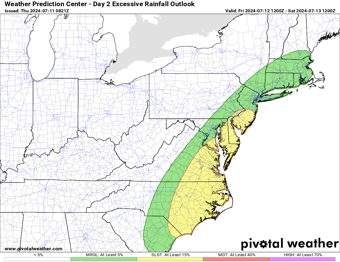
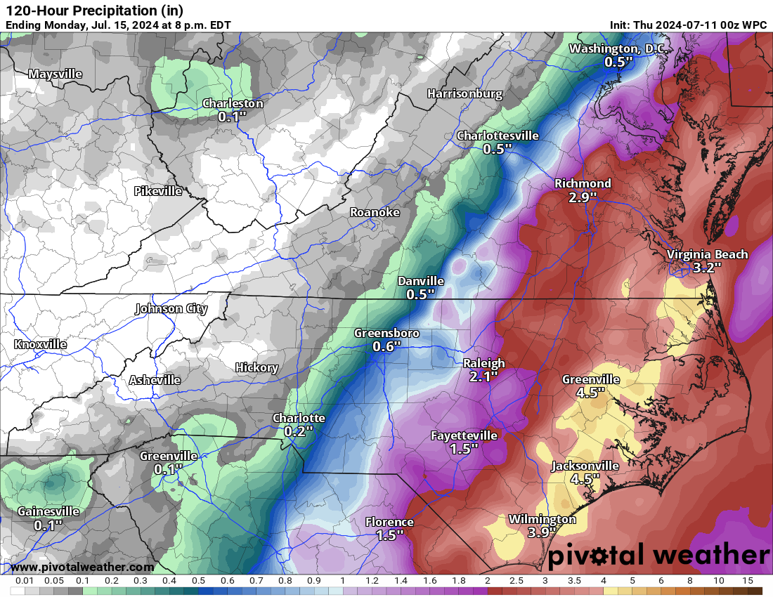
This will produce a fair bit of rain, especially in North Carolina, where some flash flood warnings and advisories are already in place this afternoon. Anywhere from 3 to 5 inches of rain is expected from Wilmington, NC north through Virginia Beach over the next few days.
While flooding risk is elevated, the good news is that development seems unlikely from this. No significant tidal flooding is expected at this time either. Everything should exit after tomorrow, and it will be back to periodic rain chances going forward.
Atlantic enters slumber
The three week tropical weather outlook from the Climate Prediction Center (CPC) is quite quiet for the Atlantic basin.
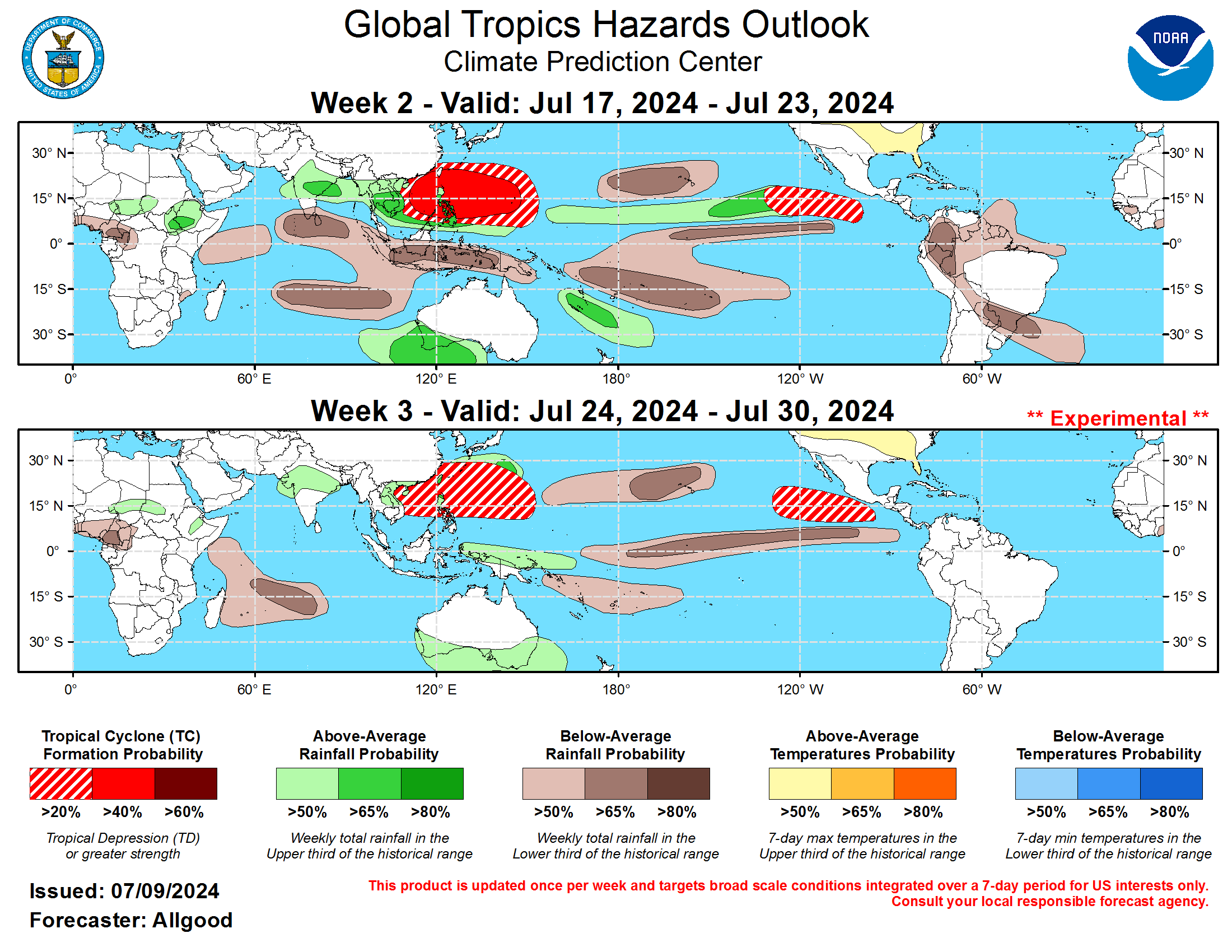
We seem to be entering a period where dust and sinking air dominates much of the basin. Sinking air and dust tends to suppress thunderstorm growth and development. This inhibits tropical systems from forming. Most of the rising air in the background of the atmosphere is over the Pacific right now, hence why development odds seem higher in that basin, both east and west. Does that mean nothing will form? No. It’s entirely possible that something could still develop over the next 2 to 3 weeks, but it would likely be more sudden and close to home than long tracked like Beryl was. For now, let’s just enjoy the fact that quiet is expected, because it would seem to be that August will see the switch flip back to “on” for the Atlantic.
With quiet weather generally expected, we will take Friday off as we continue to have limited power and internet here in Houston. We’ll return with our next update Monday. Enjoy the weekend.
Thank you guys, drove down to Kemah to secure our boat, stayed and rode it out, followed y’all before and after. Y’all did a great job, keep it going 👍👍👍👍
Matt, Would love to hear about your first-time hurricane observations. I was a little bitty girl during Camille and it’s the distinct sound of the wind that has stuck with me all these years. I literally have flashbacks to Camille when I’m near hurricane winds now.
A “sleepy Atlantic” is welcome after Beryl! I hope it stays asleep until about December!
And let’s give some sleeping pills to the Caribbean and Gulf as well!