The irony of writing about flooding from 34,000 feet above the Sonoran Desert doesn’t escape me at the moment, but here we are. I wanted to provide a Tuesday late day update on what’s ahead in the Southern Plains and Mid-South. Yesterday, we noted some thoughts about Mississippi River flooding and tied it back to another round of heavy rain potentially this weekend. The good news is that the hardest hit areas, such as Kentucky, southern Indiana, and Tennessee should escape significant issues if the current forecast holds between now and Monday. But, we are likely to see new issues crop up across Missouri, Arkansas, southeast Kansas, Oklahoma, or even northern Texas. This is reflected in the current flood hazard outlook.
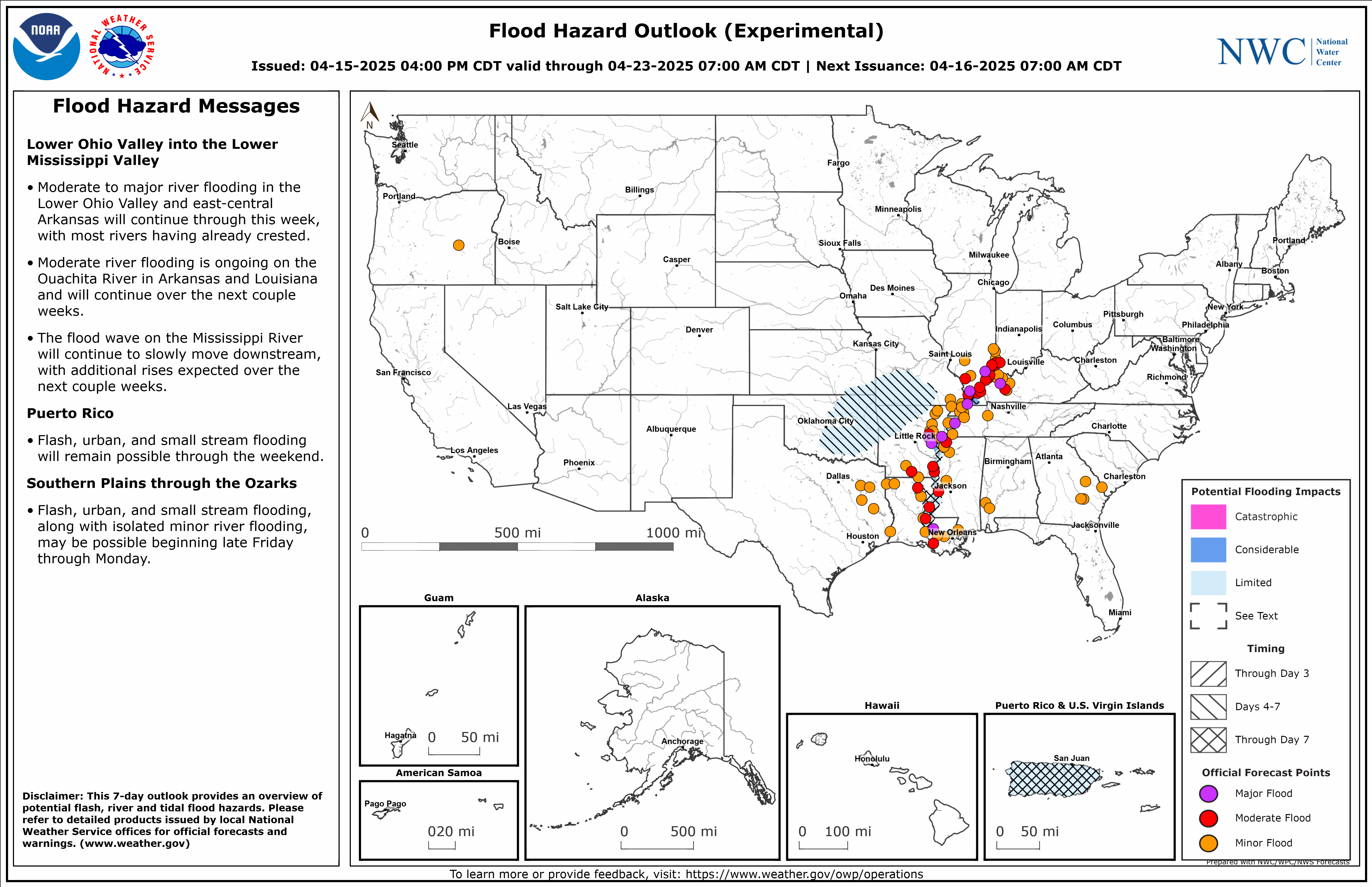
The area highlighted over the Plains and Mid-South is the area we’re keeping an eye on for the weekend and early next week.
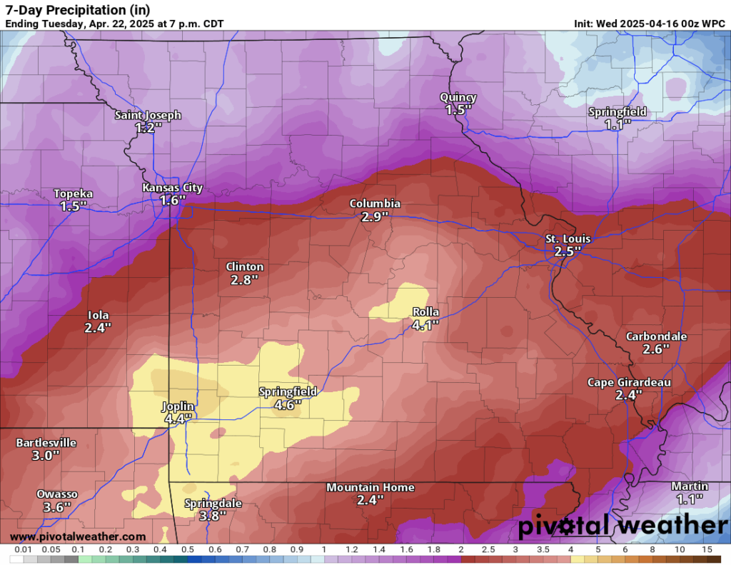
The current NOAA rainfall forecast centered over Missouri shows good odds of 2 to 5 inches of rain over the next 7 days. Other than some variations in exact placement among the various models (which you’d expect to see), this is fairly stable confidence outlook.
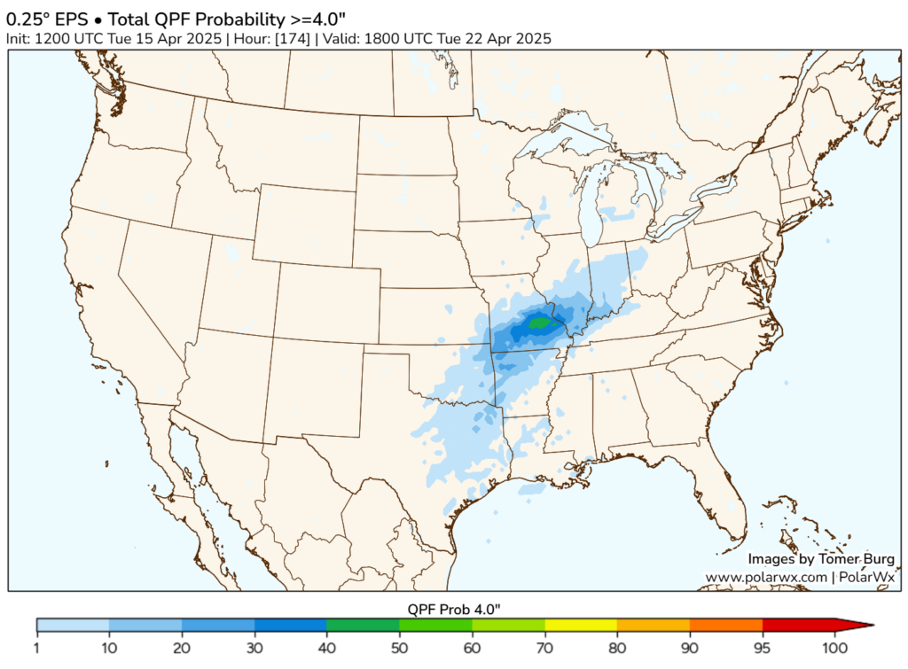
We’re starting to see some solid probabilities of 4 inches or more over the next week or so show up in this area now on the European ensemble’s 51 members. Almost half of them are in that territory now. So confidence in a fairly decent rain event are growing.
Exactly how much rain falls and how serious any flooding will be is yet to be determined. We’ll obviously have severe weather to consider too. Currently that looks like an issue Friday through Sunday, possibly into Monday to the east. Whatever the case, we’ll continue to monitor this. Flooding is a point of interest for me personally, so events like this catch my eye.