Headlines
- Yesterday’s invests are today’s named storms.
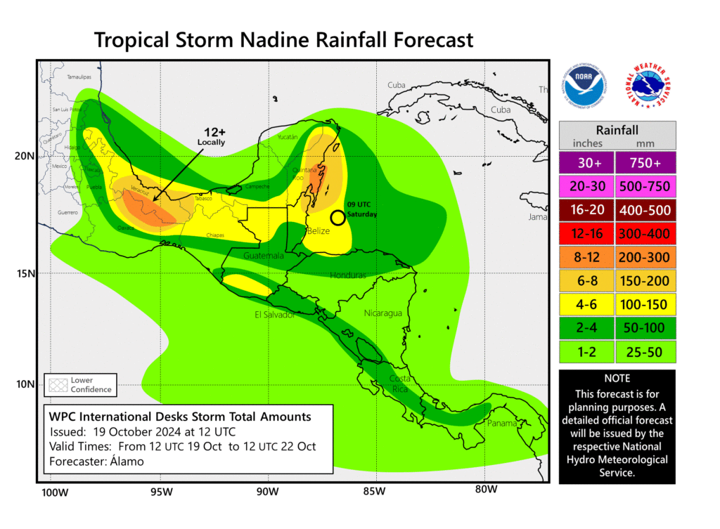
- Nadine is moving inland in Central America and Mexico, producing locally heavy rainfall.
- Oscar is a micro hurricane north of Hispaniola bringing rough conditions to the Turks and Caicos Islands and perhaps the southeastern Bahamas and parts of Cuba.
Tropical Storm Nadine
Yesterday we noted that Invest 95L had a shot to become a depression or low-end tropical storm before moving into Central America today. That is indeed what happened, as Tropical Storm Nadine formed from the mess, and it is now moving inland.

Nadine is primarily a rainmaker, and flash flooding is a good bet for portions of the Yucatan, Belize, and Veracruz and Oaxaca. No further strengthening is expected.
Hurricane Oscar
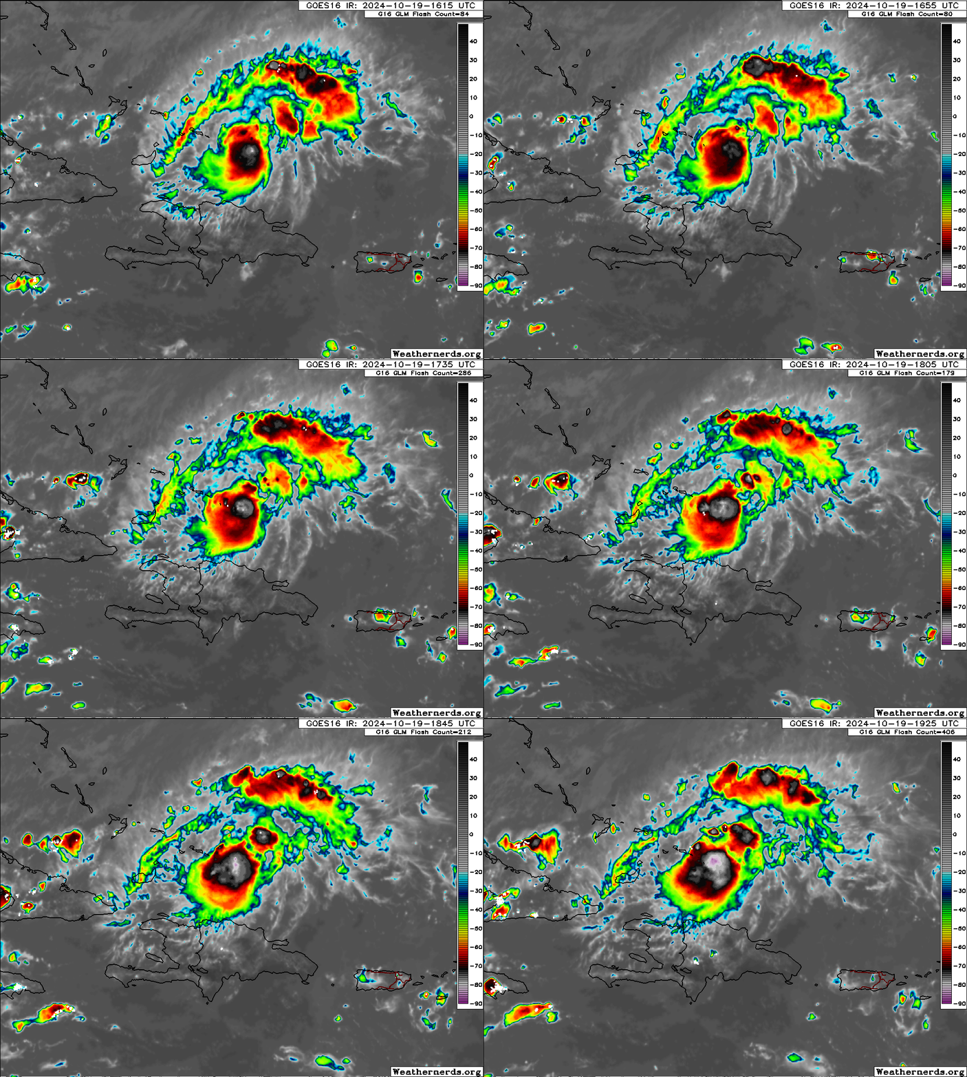
The Oscar for most surprising storm of the season goes to Oscar! Not only did we get a tropical storm out of Invest 94L, we got Hurricane Oscar.
Hurricane-force winds extend out a total of 5 miles from the center, while tropical storm force winds extend out about 45 miles. Oscar could best be described as a “microcane.” Still, those winds are bearing down on the Turks and Caicos Islands and moving toward the southeastern Bahamas. Widespread tropical storm and isolated hurricane conditions are likely with this as it passes through.

Nothing about Oscar is simple. Storms this small will periodically be big misses in the model world, underscoring the value of reconnaissance flights and other observational tools. Modeling completely whiffed on this yesterday and even up to this morning. This is another post for another day, but thankfully the forecast has been updated, and it now appears we have some solid footing on Oscar for folks in the Turks and Caicos and Bahamas, as well as in Cuba. At this point, no threat to the U.S. is seen, as wind shear is too high just west of here, something that should make Oscar grouchy early next week. Interests in Cuba and the southwest Atlantic should continue monitoring Oscar’s progress.

I guess that models systematically undervalue the impact of unlimited fuel on hurricane formation and development
From the recent behavior, it seems unlimited fuel can overcome windier and dry air more than the models predict.
I say unlimited fuel because of how hot for how deep the ocean is this year
I mean last year the El Niño made meteorologists unsure how the season would be because of the wind shear vs then-record heat in the ocean. As I understand it, last year the unlimited fuel allowed lots of storms to form but wind shear kept a lid on their strength.
To be clear I am not a meteorologist and this is just what I have inferred from reading Jeff Masters and Bob Henson, and now you, along with conventional news stories about hurricanes. so if I’m wrong, it would be great if you could correct me.
Sorry, typo
And I can’t figure out how to edit my post
It should’ve said, ‘…unlimited fuel can overcome wind shear and dry fuel…’, not windier
I I mean the fact that Helen didn’t leave a cold wake and Milton had plenty of fuel just demonstrates that fuel is currently unlimited.
There’s a term for that — ocean heat content! The OHC in the gulf when Helene formed was extremely high, meaning there is still warm water under the surface, allowing hurricanes to intensify without causing a cold wake. OHC was more depleted where Helene once was when Milton formed and rapidly intensified, which caused it to weaken right before landfall (although it was mostly wind shear). Mitlon then did leave a cold wake! It’s October now, not August, so after that cold front the Gulf is closed and completely inhospitable for hurricanes now.
Thanks, I get that, I read McNoldy too.
So thankfully in the Gulf the ocean heat content is no longer unlimited. But it seems like it is elsewhere in the Atlantic still. My basic idea, though, is that the forcing of effectively unlimited fuel may not be sufficiently captured by the models, given both last year’s uncertainty in how it would play, and also the total miss on Oscar and near total on Nadine. Again, I’d love to be wrong.
Pretty punny report today!