In brief: In the Pacific, while TD One-E (soon likely to be TS Alvin) isn’t a serious concern, it may bring an influx of moisture to the Desert Southwest this weekend. On the Atlantic side, it looks mostly quiet for the first week or so of the season.
As a meteorologist who is devoted to communication, it’s somewhat important to keep tabs on what is “out there.” In other words, what are people seeing or hearing about that they might want to know more about or understand? I have a bunch of news apps and weather news apps that I get push alerts for because I’m a masochist in order to accomplish this. And let me tell you: They are itching for the Pacific season to open up so they have something to alert the masses about. Of course, they keep the push alerts somewhat vague and general to give you a good scare and force you to open the app to find out what terrors may be lurking in order to cash in on that sweet, sweet engagement revenue.
But enough about them.
Pacific system may bring welcome moisture to the Southwest
Yes, folks, the Pacific hurricane season is underway now. It officially began on May 15th. Our first depression has formed, and while it’s not expected to become a big storm, it will take on the name Alvin, assuming it becomes a tropical storm.
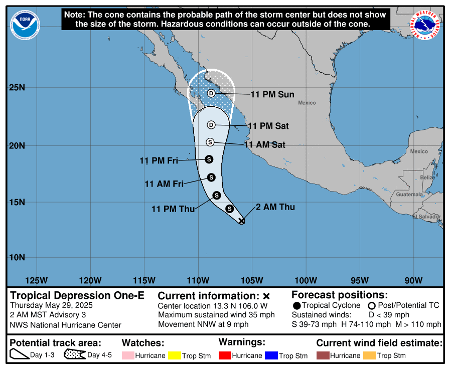
From a wind and surge perspective, this won’t be a big story. I am somewhat intrigued by the track it takes, which should send it up into Baja because the moisture from this system is likely to push into the Desert Southwest by later this weekend.
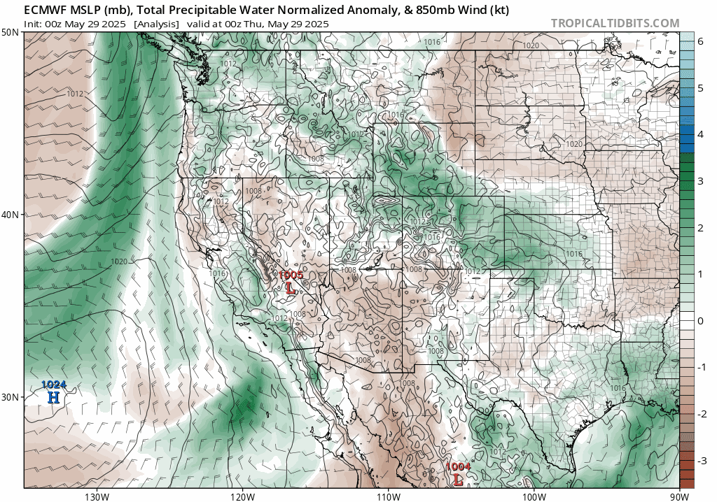
That will rev up the rain and storm chances across parts of Arizona in particular but also perhaps Utah, portions of southeast California, Nevada, New Mexico, and Colorado.
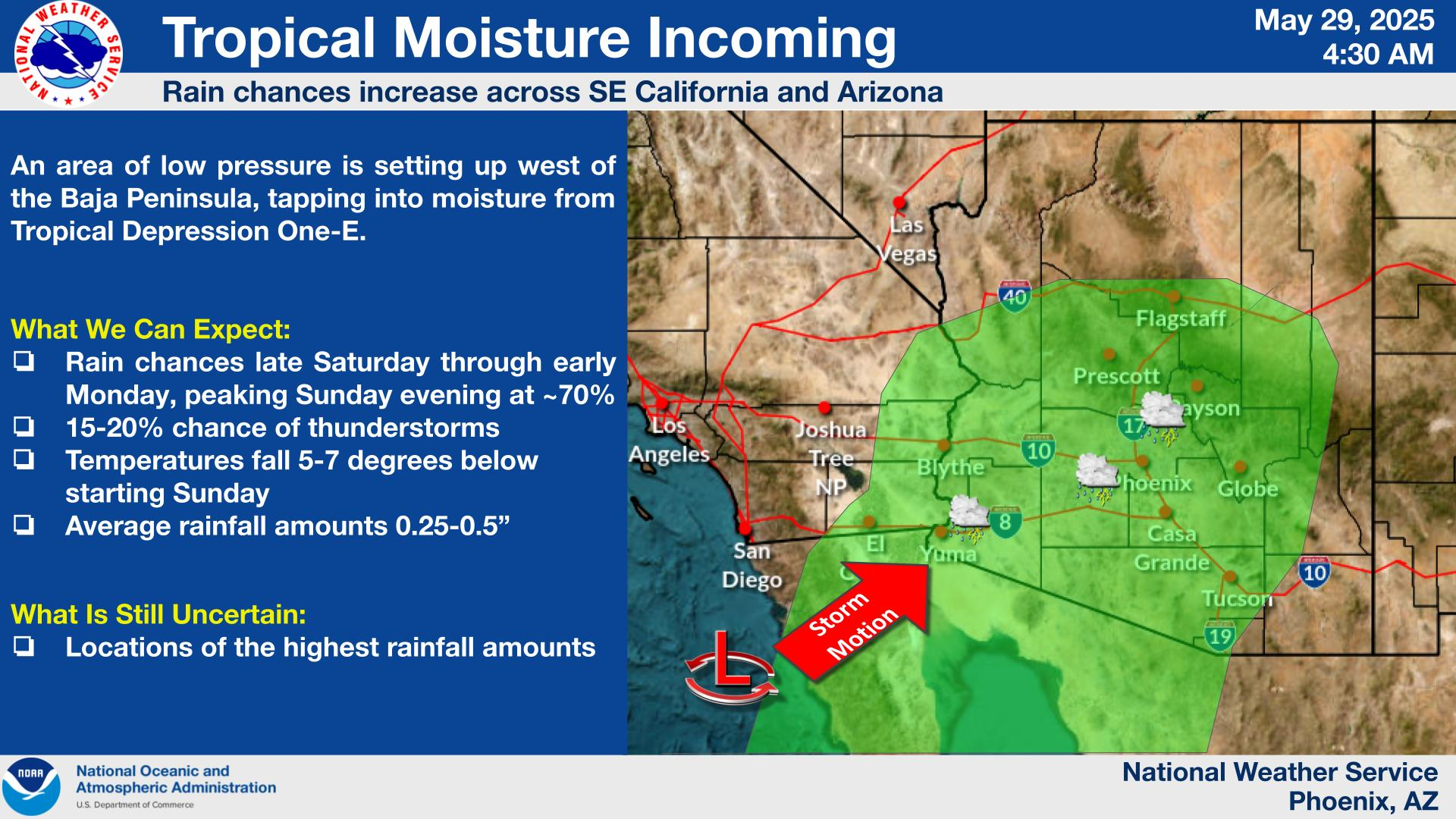
At this point, it does not look like a major rainfall event, but any sort of tropical moisture plume into the desert can end with flash flooding somewhere.
Regardless, it will help cool things off. Phoenix sees highs near 105 degrees this Saturday, but the rain chances will nudge high temps back into the mid-90s, a few degrees below normal. Overall, this should hopefully be more beneficial than troublesome.
The Atlantic stays quiet — mostly
On the other side of Central America, the Atlantic looks to open the season Sunday on a calm note. For now, there are no signs of any realistic attempts at development and most reliable model guidance is showing quiet. That being said, by the end of next week we may start to see some semblance of unsettled weather near the Yucatan. That’s a common feature in early June, and it can periodically lead to development (usually sloppy) in the southern Gulf or western Caribbean.
So, at this point, I suspect that the first 10 days of June will be mainly quiet in the Atlantic. But if I were to at least keep track of a place, it would be that Yucatan region starting late next week. More in the days ahead.
Sponsorship
After two summers of The Eyewall and nine summers of covering the tropics for Houston with Space City Weather, we are seeking sponsor(s) for The Eyewall. Please see this post for more details and scroll to the bottom of it to contact. Thanks for your consideration!
Ty Matt 🙂
There are no crowd funding options for The Eyewall?
We will get there!
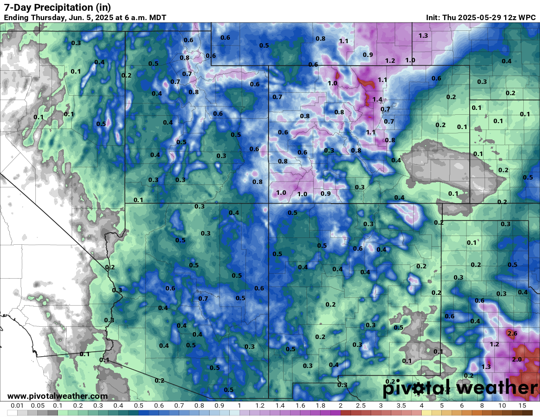
Matt, thanks for the heads up on the incoming pacific moisture. Any chance some of this moisture might make it into the Trans-Pecos region of Texas? The precipitation graphic was chopped off just enough to be a teaser!
HA…we don’t control the maps! Though I wish we did sometimes. But in all seriousness, it does look like increasing storm chances by Monday there, though it may be somewhat short lived. A pretty potent storm in the N Plains and Upper Midwest will try to schlep everything eastward by midweek. That said, there will continue to be some periodic storm chances out that way unrelated to Alvin. We’ve got a little time before the summertime death ridge sets up.