In brief: Invest 92L is on the cusp of becoming a tropical depression later today or tomorrow in the Atlantic. Neither it nor the wave behind it appear to be land threats right now. A coastal storm will deliver wind, tidal flooding, and heavy rain to the Virginia Tidewater and northern Outer Banks today and tonight. Mario’s moisture will play a role in a very, very active pattern for California beginning tomorrow.
Invest 92L
We got the invest overnight. The Atlantic tropical wave is now designated Invest 92L, and it looks as though this is on its way to getting an upgrade at some point in the next 12 to 36 hours.
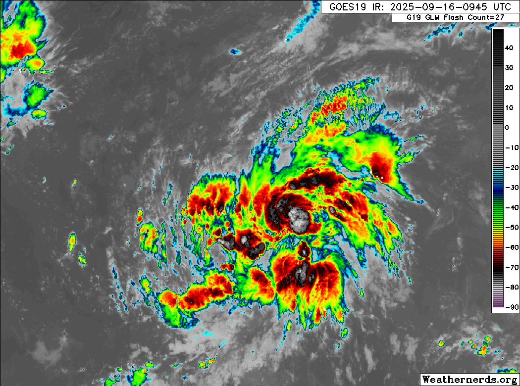
Over the next week or so, 92L will track west-northwest or due northwest in the Atlantic, tracking over gradually warming water.
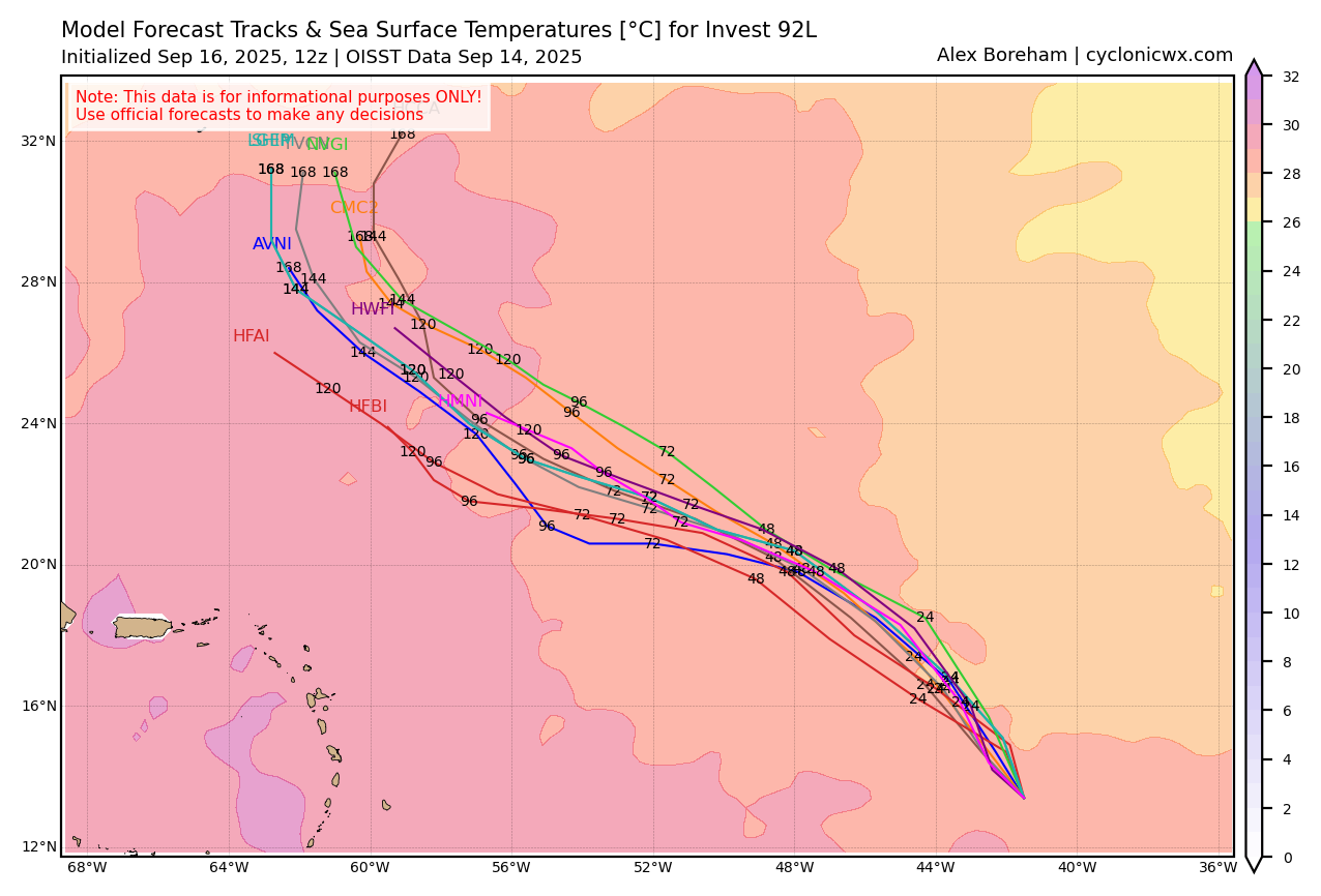
The current forecast track shows minimal concern for any land mass. Bermuda can’t be entirely ruled out here, but that’s at least 6 to 7 days out. For now, this isn’t one to worry about, but we’ll continue to watch to be safe. The next name on the list remains Gabrielle.
Behind 92L
The NHC has identified the next wave as another area of interest. This one is smaller in size than Invest 92L, and it also has a little less model support for development than 92L had at this stage.
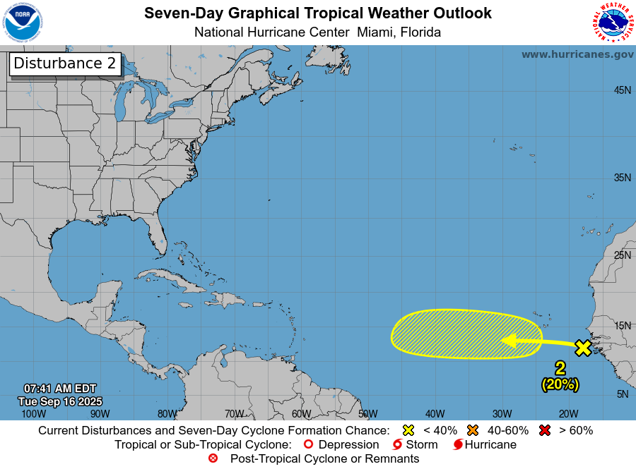
The initial odds of 20 percent feel right at this point. We’ll keep an eye on this as well, but it seems less likely to be a development issue than 92L should be. No threat to land at this point either.
Gulf/Western Caribbean
We continue to see some “noise” from the usual suspects (cough, the GFS model) far out in time in the Gulf or western Caribbean. This is a normal model bias for late September and October, so get used to seeing spurious tropical systems on that specific model guidance.
That said, there is some very, very modest support for some potential “noise” in that area on other guidance. We can’t latch onto a specific disturbance right now, nor can we say something will come of this with any confidence whatsoever. But the reality is that it’s the time of year we watch there, and the models are producing noise there to a small extent. In other words, we’ll be looking there to see if anything can emerge to close September or start October. For now, no one need be worried at all.
North Carolina & Virginia coastal storm
A storm system deemed non-tropical is moving ashore in North Carolina and Virginia today. We’ve had wind gusts since midnight as high as 50 mph in spots, including Duck, NC and Cape Henry, VA.
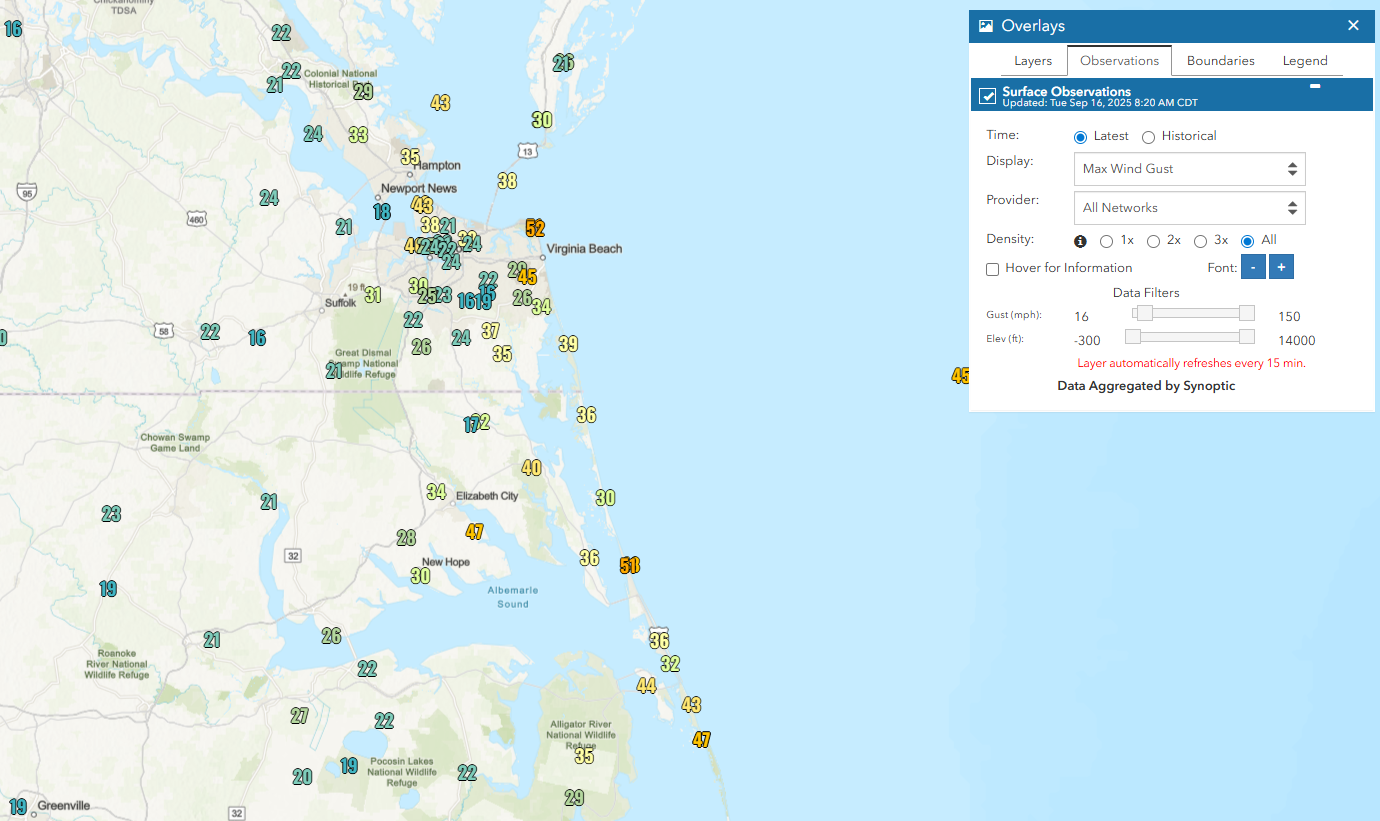
In addition to the wind, we’re seeing coastal flooding, with the highest tide occurring later today.
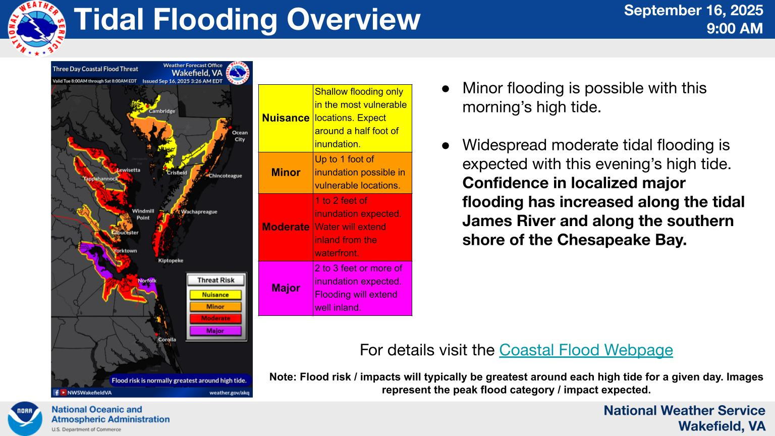
None of the current tidal forecasts look like records, but they should at least be near the higher values seen with passing storms this year and last year. Rain won’t help matters, with heavy rainfall compounding drainage issues in areas with tidal flooding. A slight risk (2/4) for flash flooding is in place today in southeast Virginia and northeast North Carolina, along with flood watches.
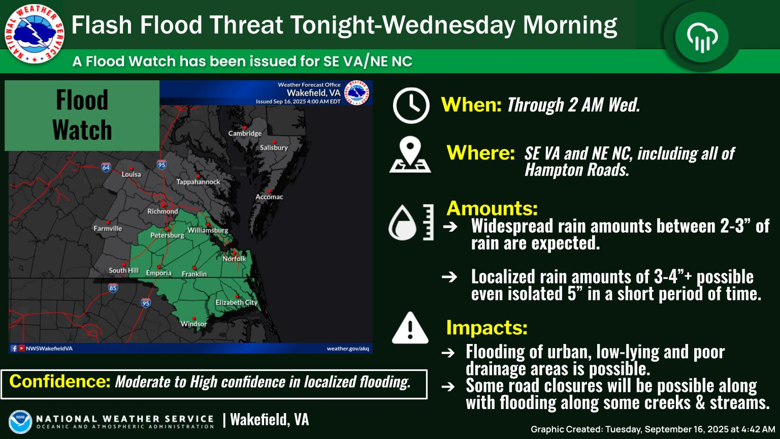
Definitely a day to take it easy in this part of the world, watch for flooding, and never drive through flooded roadways. The Virginia Tidewater is one of the most vulnerable locations in the country for coastal flooding, and with a combination of sea level rise and land subsidence, this will continue.
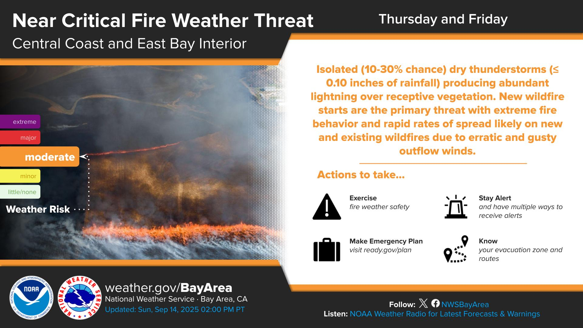
Mario’s impacts to California
With Mario slowly lifting north, the overall weather pattern off the West Coast will favor tropical moisture being funneled northward around the east side of a dominant upper level low pressure system. As this happens, moisture will surge into California later this week bringing a good chance of localized heavy rain, thunderstorms, or possibly dry lightning.
While the rain could produce localized flash flooding, it will be interesting to see if dry thunderstorms play a role here also. The risk of dry lightning looks highest Wednesday night into Thursday, especially north of Los Angeles, up into San Luis Obispo and Santa Barbara and northward into the Bay Area.
There may be more to come heading into next week with Pacific Invest 96E possibly playing a role in that. For more details on the situation in California, I strongly encourage checking out (and subscribing to) Daniel Swain’s Weather West blog.