In brief: Invest 91L is going poof in the eastern Atlantic, so we do some informed speculation on what happens next, which is to say nothing imminent. Meanwhile, Kiko is likely to pass north of Hawaii, with few direct impacts but some serious surf potentially.
Invest 91L: See you later!
Being in Houston, I want to invoke my inner Robert Ford (Astros radio broadcaster) and shout “See you later! See you later!” regarding Invest 91L.
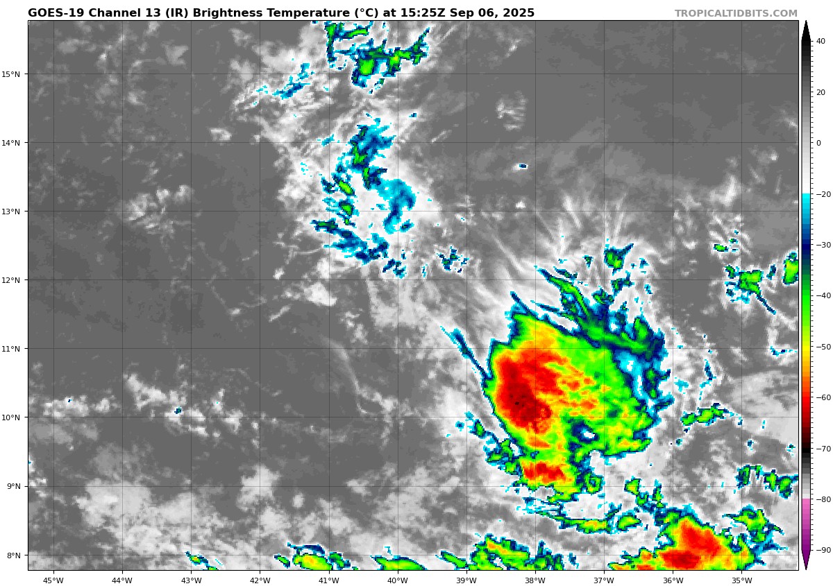
Invest 91L was always a curious case. Earlier this week, I noted that with the small size of the wave “storms like that have a window to do what the operational modeling says they’ll do. And if they miss the window, you can forget development.” Well, it seems 91L missed the window. Odds of development have dropped from 90 percent 24 hours ago to 30 percent this morning, the first time I can recall such a precipitous drop off in development risk from the NHC. There is virtually no more model support for development out there. Could it make another attempt as it approaches the islands? I guess it could, but that seems far less likely than the alternative, which is nothing at all. If you live in or have interests in the islands, keep an eye on this, but you can probably sleep a little easier.
What else is there in the Atlantic?
Well, modeling is pretty excited about the next wave, particularly AI modeling. Where have we heard this before? AI modeling has had an interesting go of it this hurricane season. For specific storms, it has done fairly well. For genesis of still-not-developed storms it has had mixed results. A lot of false alarms peppered in, and it could be that the Atlantic is just too hostile this year. Perhaps in 2020 or 2017 we would have seen these systems actually make a run at development, but in 2025, whatever appears to be holding things back is having a say.
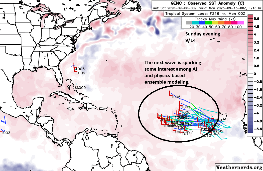
In this case, there seems to be some support, and the background state of the Atlantic should, in theory, be improving. I am not as bullish on this happening as some others are at the moment. However, it does look like the post-September 20th period may be when we finally get a chance to get busy in the Atlantic.
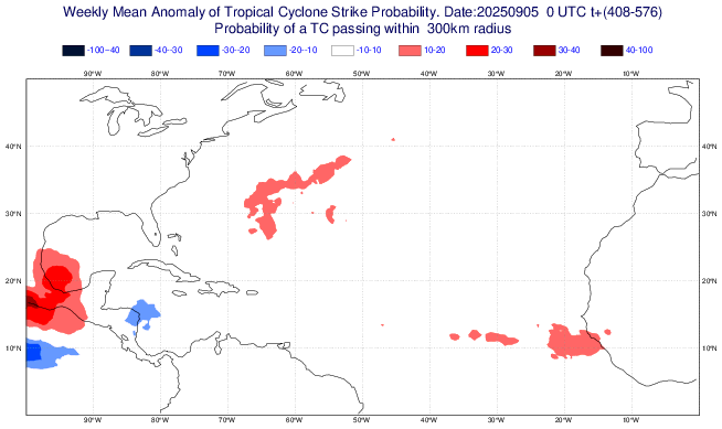
It may begin in the southwest Gulf, or it may begin via some sort of Central American gyre, a common later season pathway to development. It’s too early to speculate on anything specific, but I would probably say that the last week and a half of September looks at least more interesting in theory than the rest of the month. We’ll see.
Kiko’s brush with Hawaii
Hurricane Kiko blew back up with authority yesterday afternoon and evening, reattaining category 4 intensity. Kiko is currently responsible for about 30 percent of the Eastern Pacific’s accumulated cyclone energy this season, a pretty impressive storm.
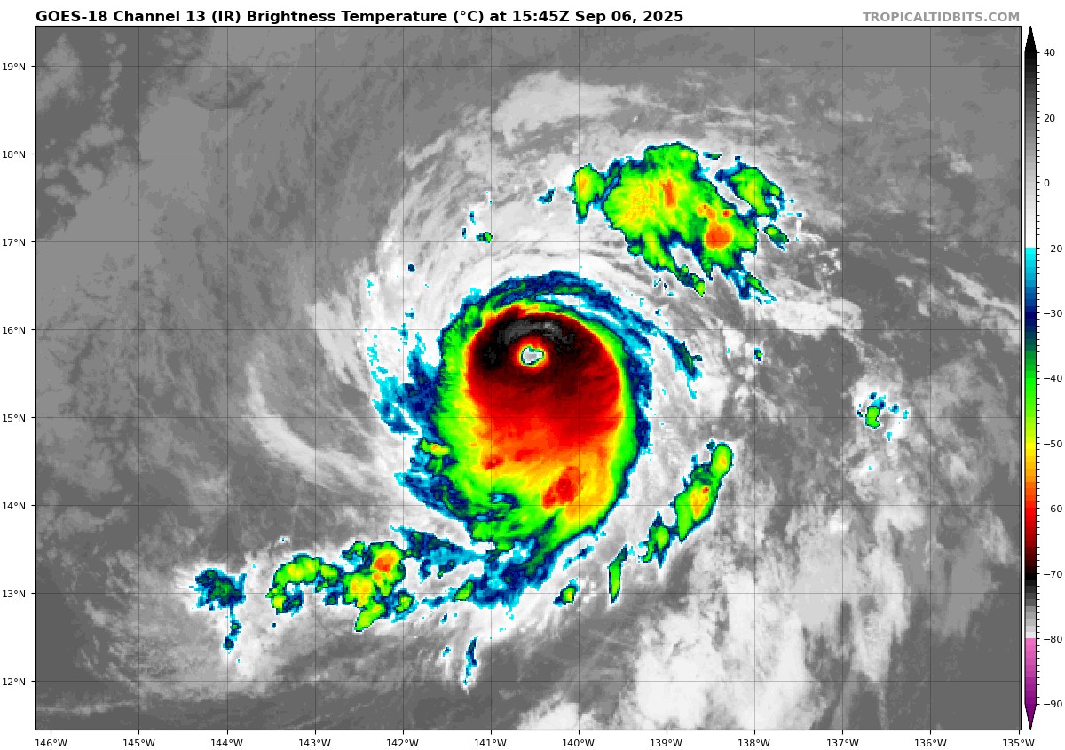
Kiko will continue west northwest toward Hawaii, but model guidance has begun to shift north off the islands a bit in the last 24 to 48 hours.
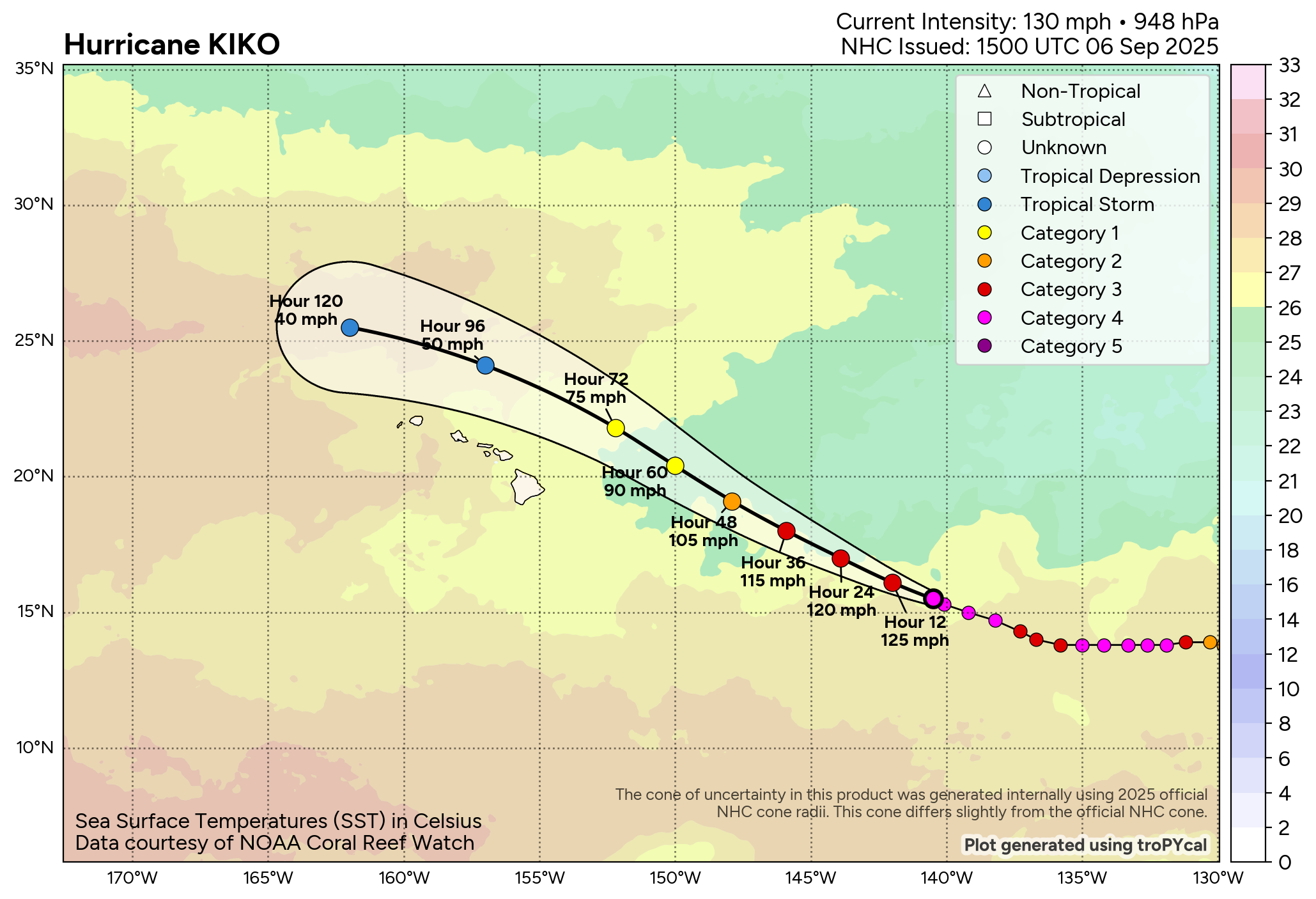
With Kiko’s path north of the islands, this will probably mean most of the direct impacts will remain away from land. Clouds, showers, and humid weather will probably arrive as Kiko passes by, with heavier rain risks on the east and north upslopes of higher terrain. It may be a surfer’s paradise at times, particularly on east facing shores. But waves all over the islands may be a bit rough at times early next week. In addition, some minor coastal flooding is possible with Kiko in the vicinity and peak high tides for the month occurring.