In brief: Today, a brief post to just offer up some details on the Colorado State hurricane forecast release, as well as a quick update on the weather the next few days.
A muted hurricane season? Maybe.
The most prominent hurricane outlook of 2026 was released today, as Colorado State University’s experts unveiled their expectations for the 2026 Atlantic Hurricane season. You can read the full report here, or a nice summary from Michael Lowry here. Bottom line? They’re calling for a slightly below average season of activity, which would be the weakest in over a decade. Justifications include the developing El Niño and less warm water in the Atlantic than we’ve seen in several years. The Atlantic MDR, main development region is close to 2025 levels and well off 2023-24 levels, which were extreme.
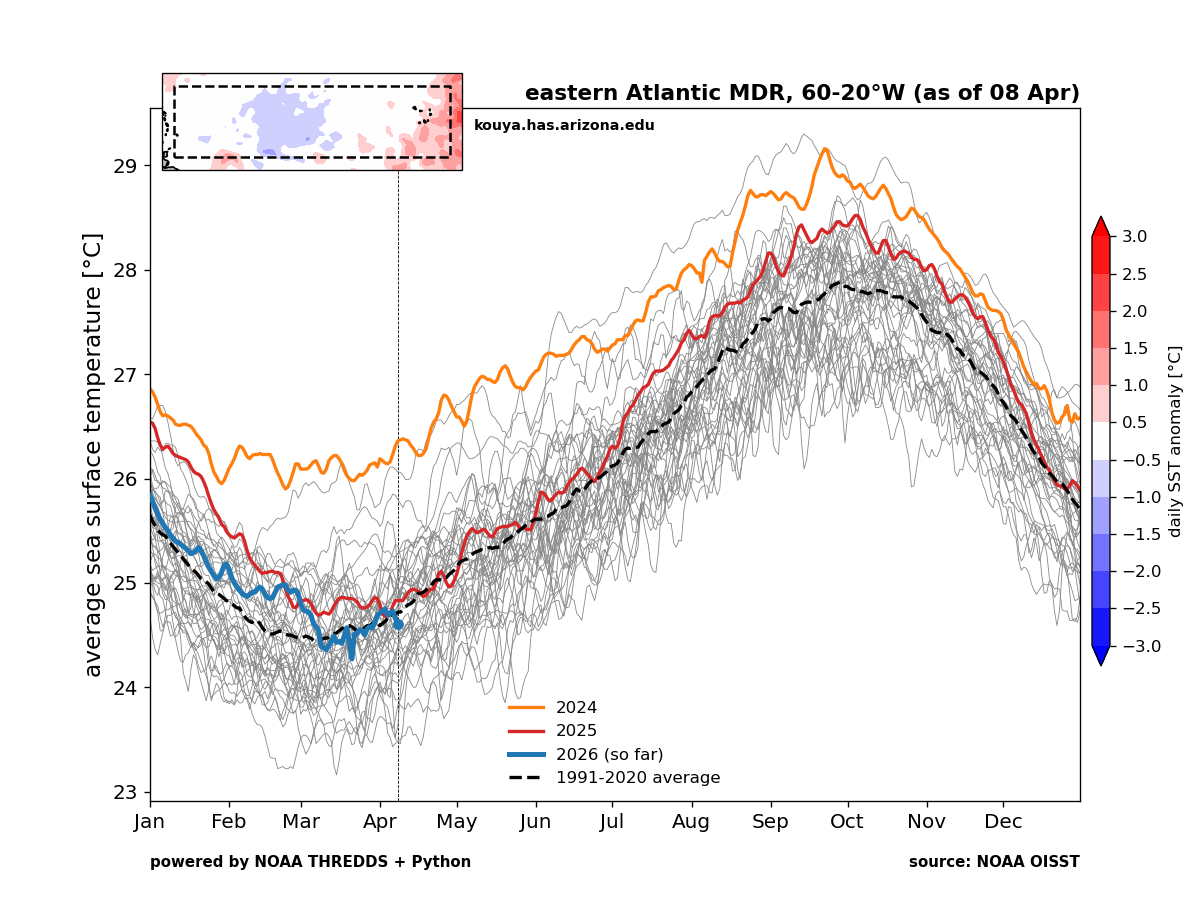
I will caution that while the Caribbean is also tracking cooler than recent years, the Gulf of Mexico and the subtropical Atlantic are not. In fact, they’re still up near record levels, sometimes above them. So all it takes is the wrong 5 day period for something to come together. Which is why we so often preach that “it only takes one” and that seasonal forecasts are mostly amusing scientific pursuits and less actionable in any meaningful way. Whatever the case, it serves as a reminder that hurricane season is coming, and even in a quiet year, you should prepare accordingly.
Severe weather risks
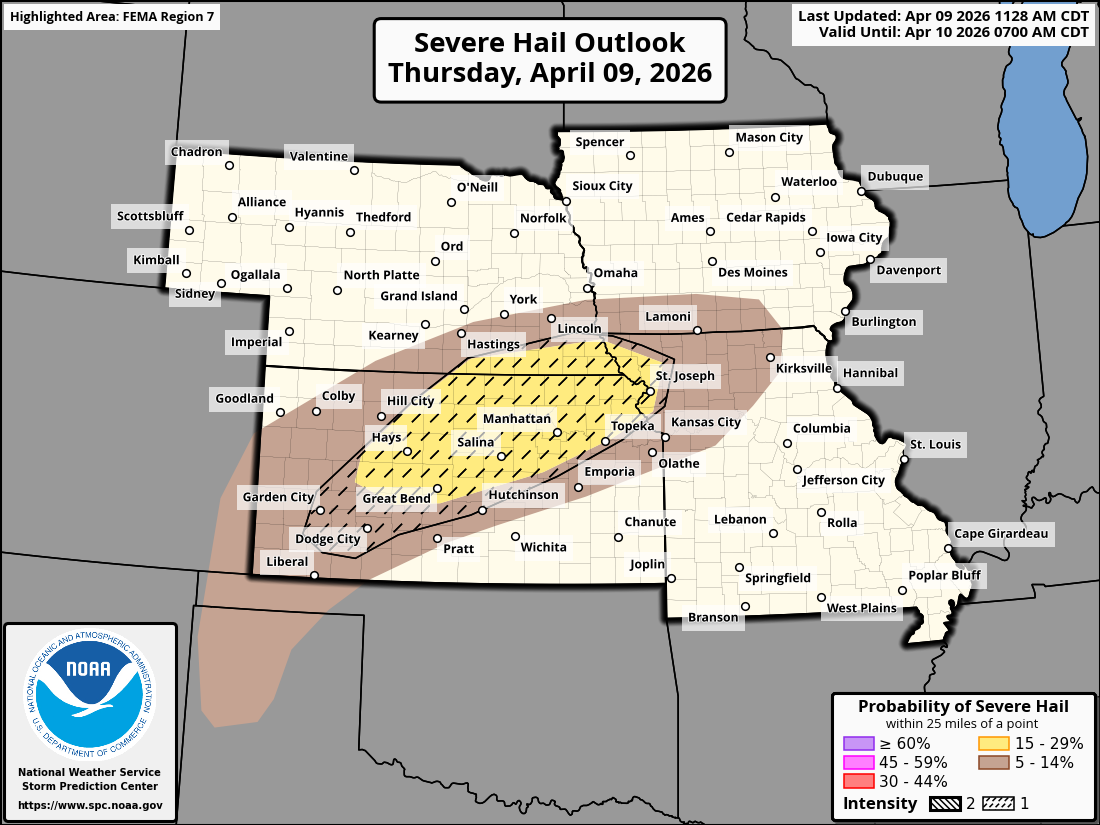
Severe weather is possible today with a slight risk across the Plains. Large hail is possible from Kansas into southeast Nebraska and northwest Missouri this afternoon.
We see a slightly lower risk of severe storms into Kansas and Oklahoma tomorrow, but there should be another ramp up on Saturday in West Texas.
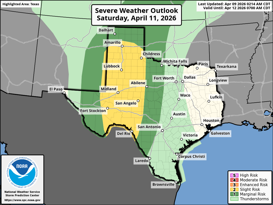
A slight risk is in place (level 2/5) from Amarillo to Del Rio for large hail and strong wind gusts in any storms on Saturday.
Subsequent severe weather risks are going to follow in the days after this. Much of the Central U.S. and Plains, including the Midwest, Ohio Valley, and Mississippi Valley are highlighted on at least 1 or 2 days from Sunday through Wednesday next week for potential severe storms. More to come on that.
Heavy rain risks
A large swath of the country into Ontario and Quebec are in the crosshairs of a solid 1 to 4 inches of rain over the next week. Model guidance shows the potential for isolated pockets of 4-7 inches of rain in spots as well. This includes perhaps Texas and the Great Lakes.
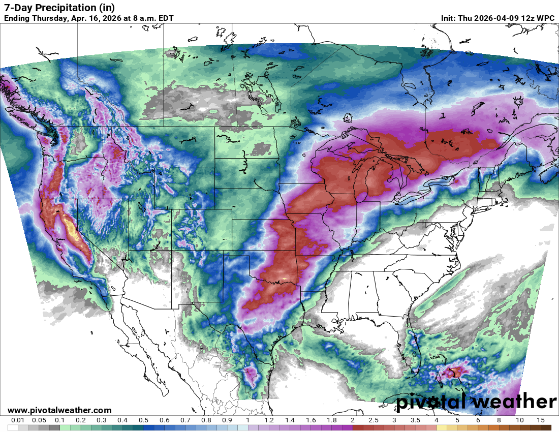
While much of this rain is going to fall over drought-impacted areas, the Great Lakes are already above normal in the soil moisture department. Flooding risk may be slightly higher there than elsewhere.