In brief: The Pacific looks to get a series of lower-end tropical systems, while the Atlantic remains dusty and quiet for the time being. We also examine Canadian wildfires today.
Pacific buzzing — with limits
It’s busy times in the Pacific over the next week, as there are three areas earmarked by the National Hurricane Center today for possible development.
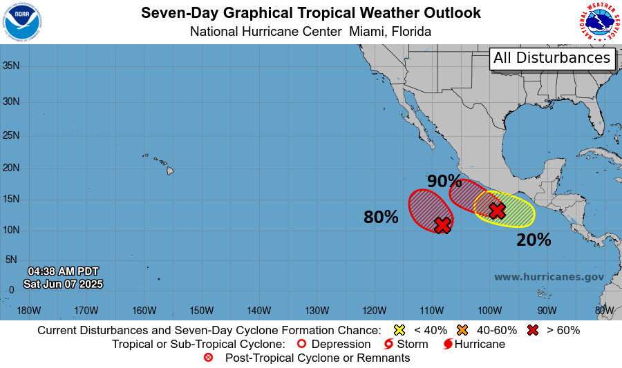
None of these systems appear to be a threat to the Mexico coast at this time. Nor do any of them look to get especially strong. The 20 percent area has a wee bit of support to perhaps get a little stronger, particularly via the ICON model. But I would classify that risk as “low to very low” at this time. The next two names in the Pacific are Barbara and Cosme.
Quiet Atlantic will continue
The Atlantic remains out of play for now. We continue to see GFS model runs showing Gulf activity, but more likely than not it’s just whiffing on what may end up in the Pacific later next week.
At present, just dusty.
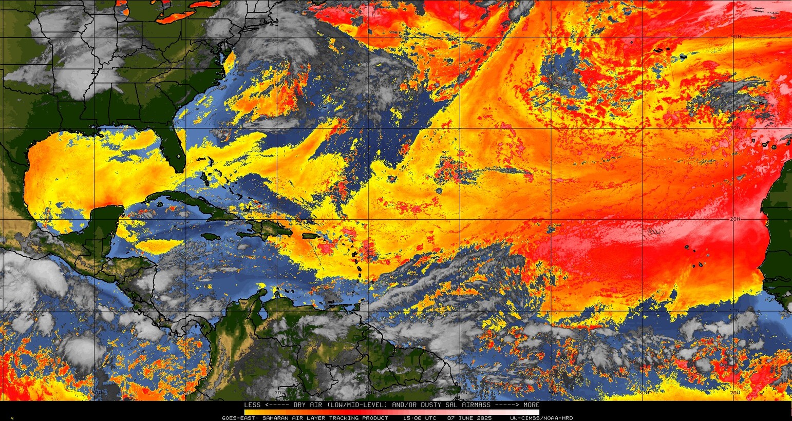
There’s one batch of dust impacting Florida and much of the Gulf Coast this weekend. A second batch of dust is thick out in the eastern Atlantic. That will thin out some as it comes west, but it may reach the Caribbean next week and the Gulf late next week. Although we don’t usually look far out in the Atlantic for development in June (Beryl last year being a glaring exception), at the least, conditions look poor for any development over the next 7 to 10 days.
Maybe around the 18th through the 20th we’ll get to monitor something sloppy in the Caribbean or near the Yucatan or coast of Mexico. AI modeling hints that this could be the case, but it’s not showing anything notable or troublesome at this time.
Canadian blazes adding to the haze
In a very glaring example of what happens in one place directly impacts another, for the third straight summer, Canadian wildfire smoke is a feature not a bug.
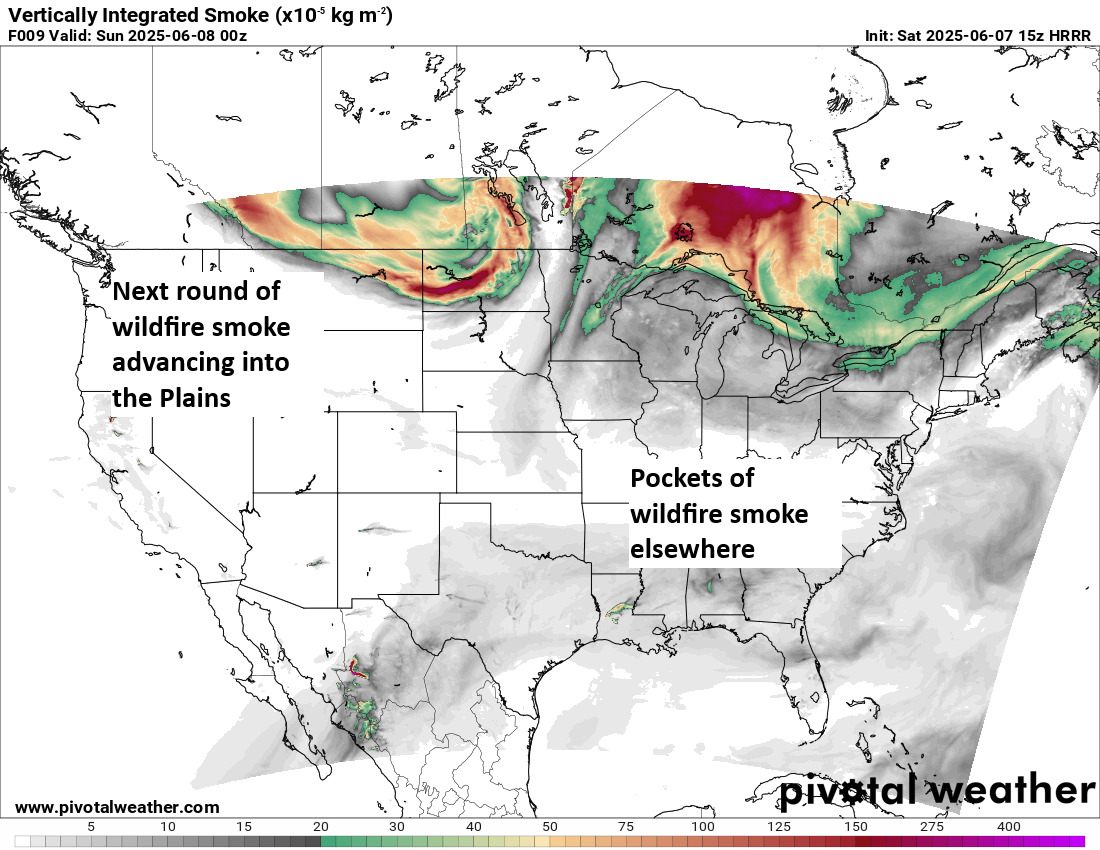
Canada is a mess right now, with numerous wildfires burning in the Prairie provinces and portions of western Ontario and northeast British Columbia.
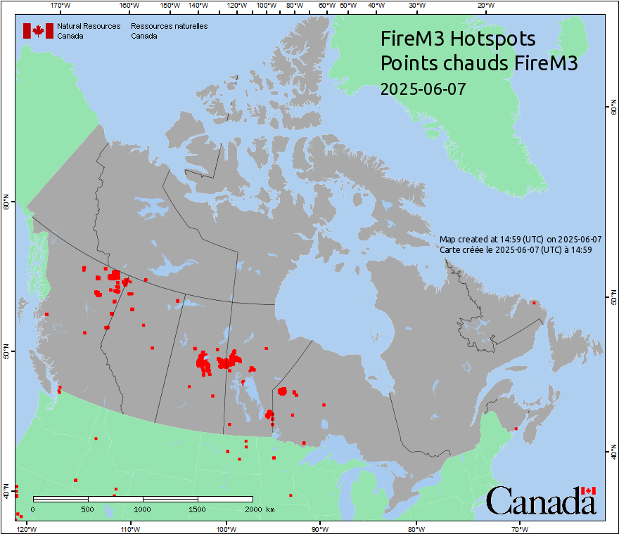
Conditions in Canada are exacerbated by long-term drought, below normal snow, and long-term fires. Some of the fires in Canada are actually relics of fires started in 2023! They basically burn or smolder as “zombie” fires in the winter season and then flare up again as summer arrives. Canadian winters have had their harsh periods, as they normally do. But punches of cold in short bursts can’t make up for the overwhelming warmth we’ve seen at times in the winter months recently in Canada. The winters of 2023-24 and 2024-25 have averaged warmer than normal in western Canada.
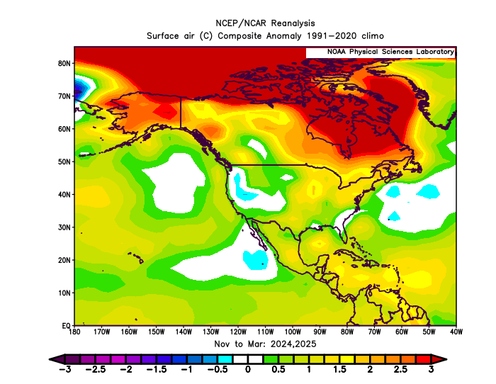
Canadian wildfires themselves aren’t abnormal, and neither are warm winters. But the frequency and intensity of wildfire and warmer winters tends to be increasing as the climate changes. You have to be careful about saying that this is “the new normal,” but you can safely assume there will be more years and scenarios like this coming in the future.
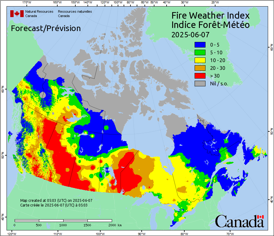
In the short-term, the risk for wildfire growth or new wildfire starts is high and expected to remain quite high over the next 7 to 10 days. And so it goes.