In brief: A disturbance in the Central Atlantic may try to develop before it dissipates near the Caribbean. Former Invest 93L may return to the Gulf next week as a new disturbance, but no signs of development are showing yet. More flooding concerns continue today in the Midwest and Mid-Atlantic. And some stronger than normal heat remains in the cards next week and into August.
Tropical Atlantic
Yesterday we mentioned the possibility of something low-end in the open Atlantic, and today we’ve got a lemon showing up on the National Hurricane Center outlook.
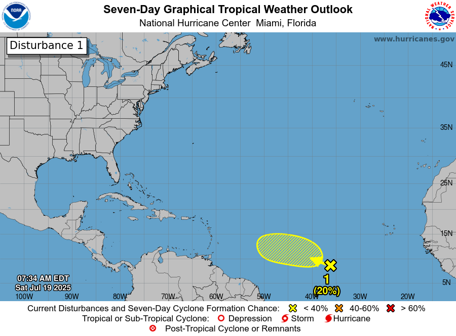
This one has about a 20 percent shot at development before it runs into a wall of wind shear in the Caribbean next week. Currently, it’s not a whole heck of a lot to look at. It’s a very broad area of thunderstorms from about 29W to 48W, with the primary disturbance to watch around 36W.

Wind shear is pretty relaxed out there right now, which could help it to develop, but there is a bunch of dry air and Saharan dust lying just north of this axis of thunderstorms. I would assume if this did develop, as a handful of various models show, it would be brief and lower-end. Semi-permanent high wind shear awaits this once it gets near the islands however, which should spell the end of the road for whatever it can become out there. Perhaps we’ll get an Invest out of this today or tomorrow though, so we’ll just keep an eye on it. But for now, this should not be a worry for anyone.
Ex-Invest 93L’s circle of life
The artist formerly known as Invest 93L is just going to meander around the Southeast this weekend and early next week. Eventually it’s going to be forced south again toward the Gulf and it could re-emerge around late week, likely as a new disturbance. There’s a fair bit of uncertainty as to exactly where this shows back up and in what shape it would be.
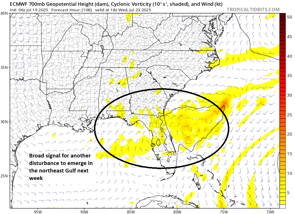
But at this time, there’s not any real reliable data showing development. For now, it’s mostly just a curiosity that could bring more rain to parts of the Gulf Coast between Texas and Florida by later next week. Still, we’ll keep tabs on it.
Flooding concerns continue
We saw an interesting assortment of weather on Friday, including a funky, odd system tracking east to west across Southern California bringing some flash flood warnings to the region. MCV’s (or a Mesoscale Convective Vortex) are not especially large, but they can bring some localized intense rainfall to an area as they pass through.
In fact, we saw some heavy rain in spots between Death Valley (yes it does rain there!) southwest into the San Gabriel and San Bernardino Mountains. There was also a pocket of heavy rain near the Castle Mountains south of I-15 in the Mojave Desert as well.
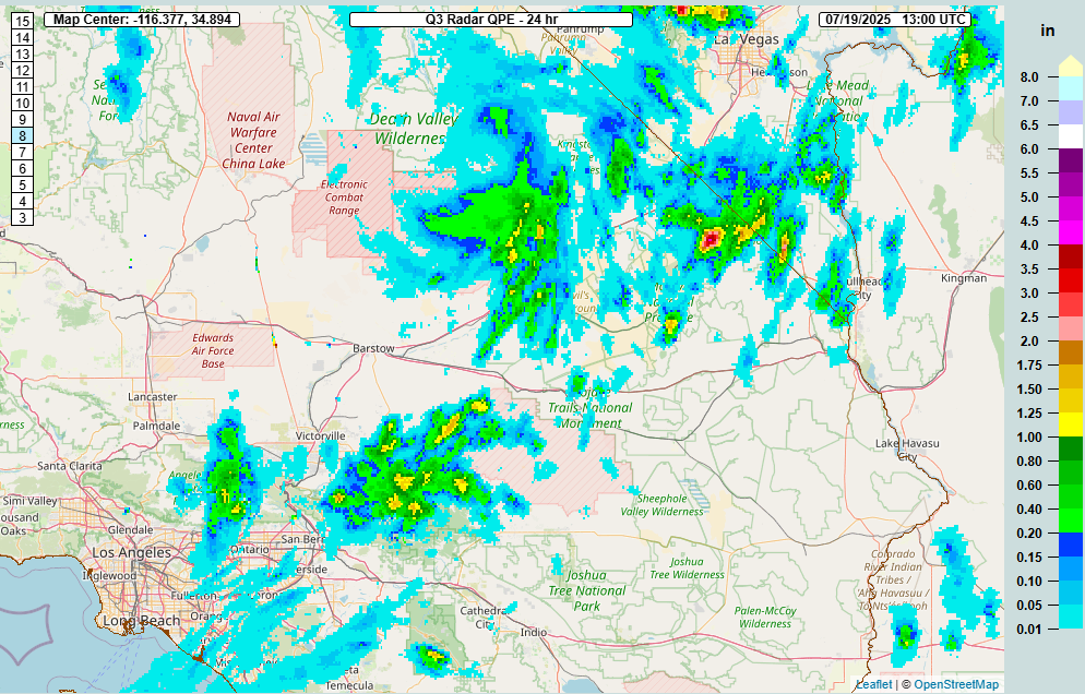
Additional heavy rain fell in other parts of the Southwest, as it has the last few days, with the area north and west of Las Vegas cashing in, as well as much of southwest Utah and northern Arizona, as well as New Mexico. Given the dry winter this past year in this region, rainfall is certainly welcome.
There were also additional flooding issues in other parts of the country as well, including Evansville, Indiana and (again) Petersburg, Virginia, which had another flash flood warning yesterday.
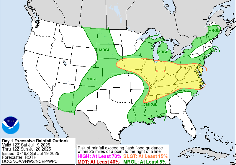
A slight risk (2/4) is in place over a wide swath of the country for flooding today, covering Iowa, most of the Midwest, and the Mid-Atlantic.
Heat wave cometh
We continue to see plenty of signs of a stout, long-duration heat wave establishing this upcoming week into the following week across much of the Midwest and Mid-South. There aren’t a whole lot of record highs being forecast yet, but there are a number of warm minimum temperature records being forecast. Models continue to indicate some risk of near-record strength to this ridge as it builds.
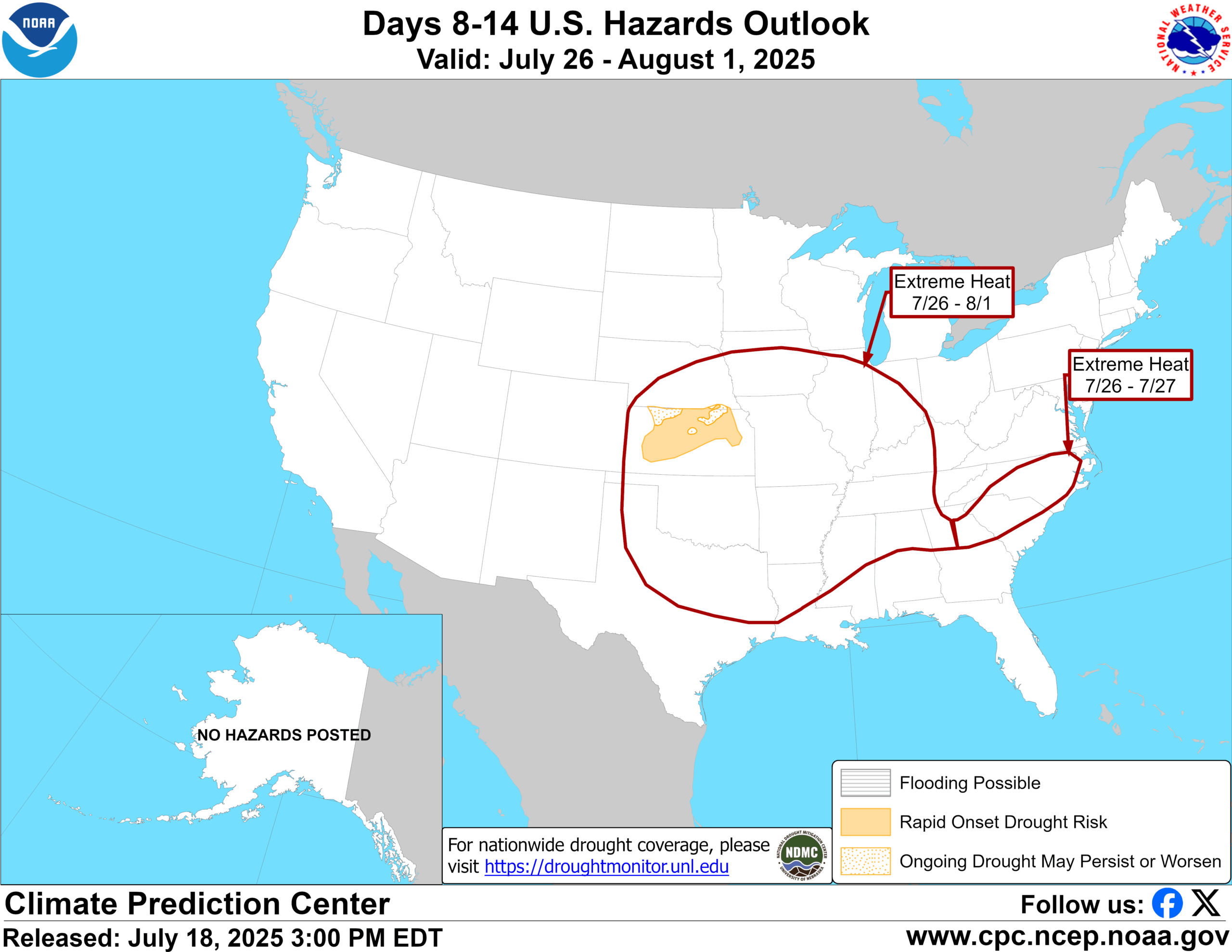
Regardless of anything, a wide area is expected to see risk for extreme heat next week and into the beginning of August. Numerous pockets of “extreme” heat risk from the newer NWS product that factors in other things besides just temperature show up by next Thursday and Friday (shown below).
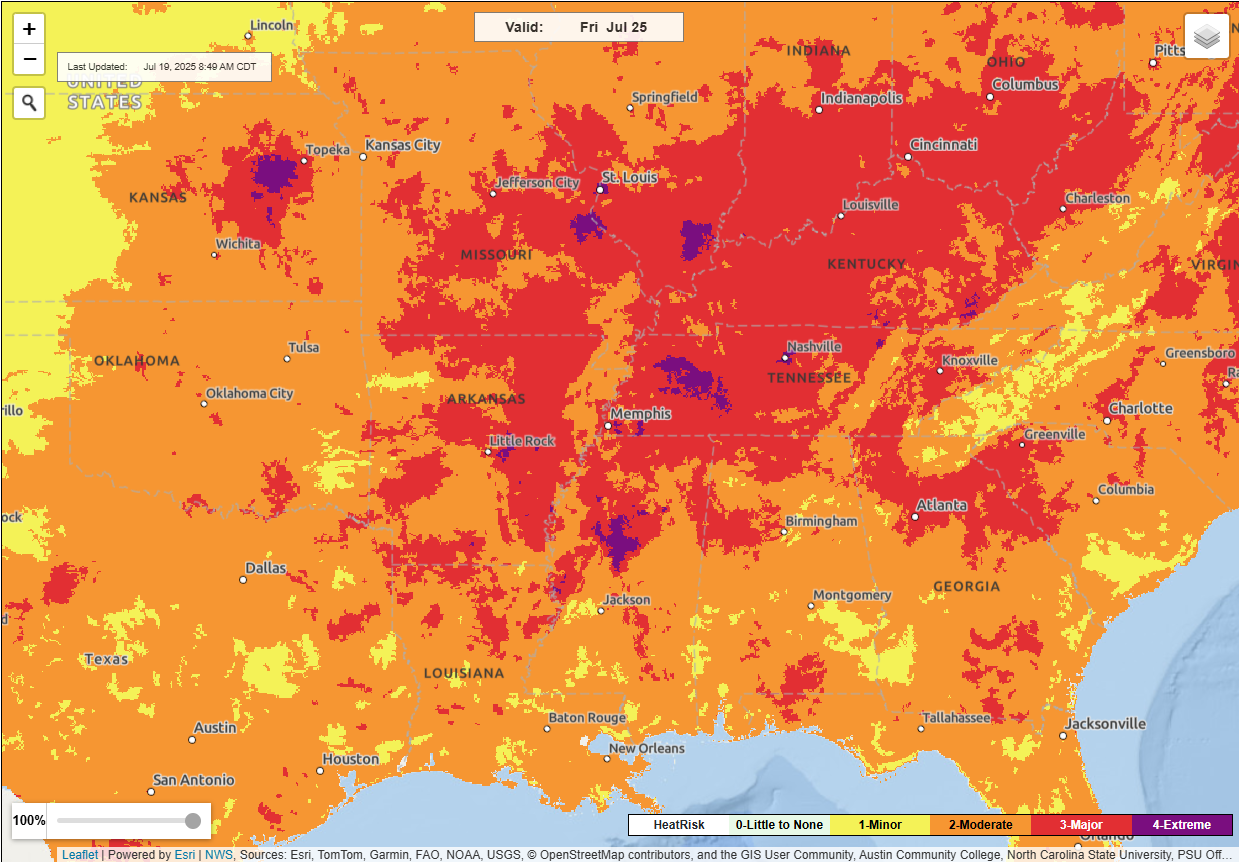
The combination of these heat risk maps and wet-bulb globe temperatures reaching extreme values in spots means that the heat precautions will be necessary, particularly for vulnerable communities across the Midwest and Mid-South next week. Stay tuned.