In brief: Invest 95L continues to look likely to develop later this week as it mostly stays offshore and away from land. Hurricane Priscilla in the Pacific may deliver some decent rain chances to the Desert later this weekend. Meanwhile, a coastal/potential tropical or subtropical storm off the Southeast is beginning to show up on models this weekend. We discuss the potential for more beach erosion and coastal issues.
Invest 95L
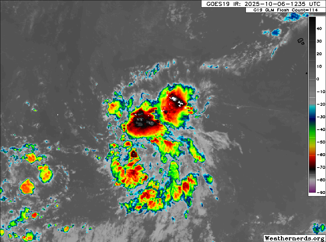
Our Atlantic tropical wave, Invest 95L, is sitting around a 70 percent chance of development this week.
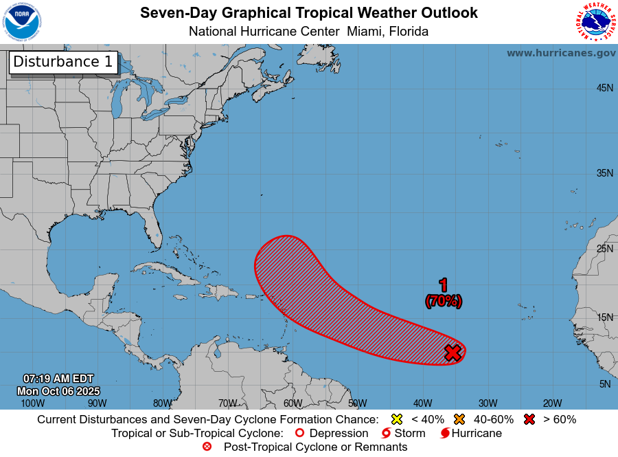
95L is actually looking a bit better on satellite this morning, though it still is not quite organized just yet. Models have actually gotten a little more lukewarm on development chances here. Most indicate something akin to a tropical storm as this comes west-northwest toward the islands. It will likely curve back to the north and northeast eventually and likely before it reaches the islands.
Models vary drastically on intensity from the typical HWRF enthusiasm of a major hurricane to various other models keeping it a lower-end tropical storm. My guess is that if this can maintain thunderstorms and get its act together sooner than later, we’ll see something of a significant hurricane, particularly as it turns northward away from land. If we sort of wax and wane the next 36 hours, we’re probably looking at a slowly intensifying system as it passes the islands to the northeast.
Either way, this does not appear to be a serious land threat, though folks in the extreme northeast Caribbean (Virgin Islands through Barbuda) should keep tabs on this in case you get broad brushed by something later this week.
Southwest US rain risk
Moving to the Pacific, Hurricane Priscilla has gotten its act together off the coast of Colima and Jalisco in Mexico. Tropical Storm Watches are posted from Puerto Vallarta to south of Manzanillo as some fringe impacts from Priscilla are possible there. Priscilla will track northwest, paralleling the coast of Mexico and Baja but likely remaining offshore.
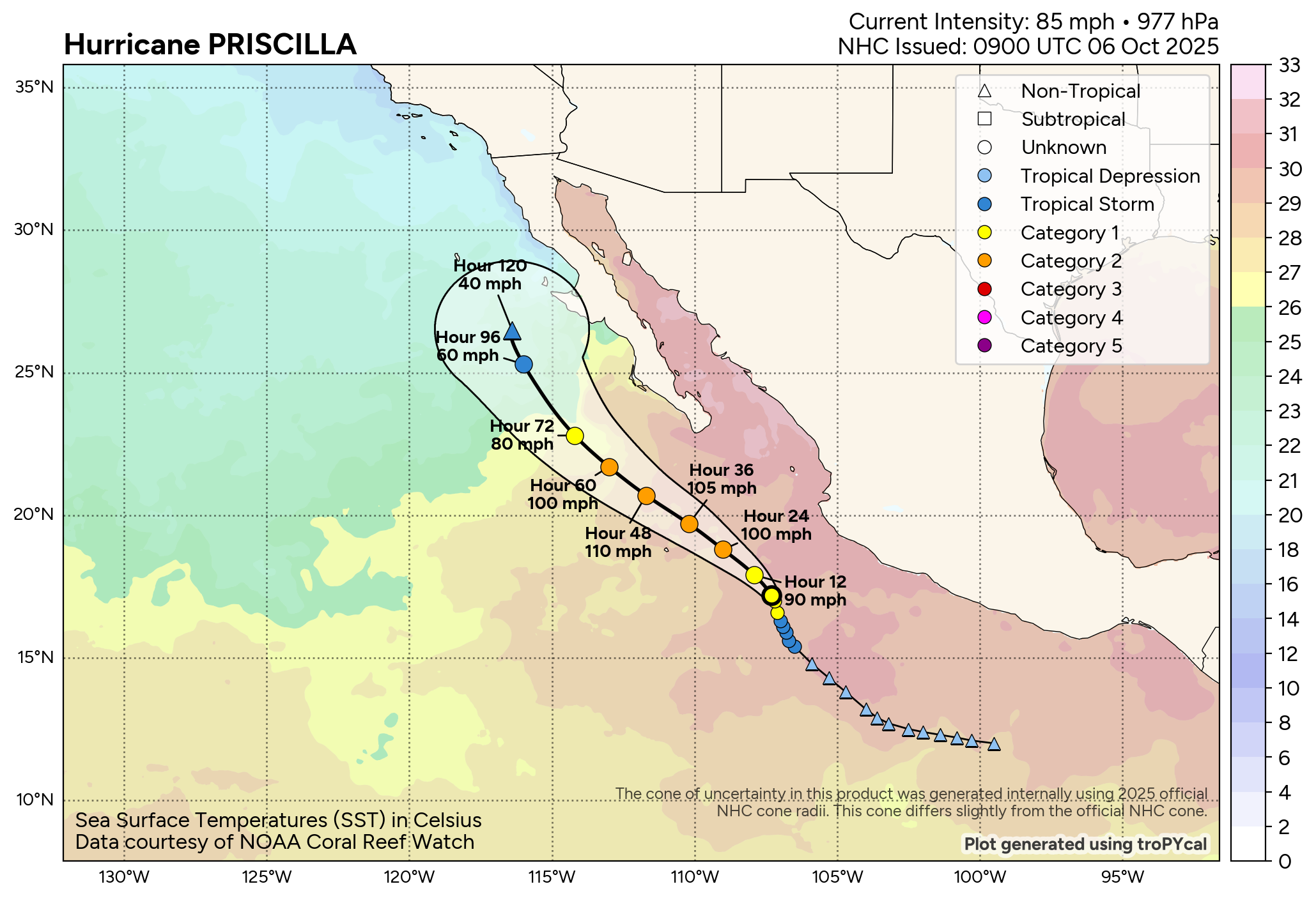
Priscilla should peak in intensity tomorrow, close to a major hurricane. As it tracks over cooler waters off Baja, it will begin to weaken. The question from there is how much moisture it will deliver into the Southwest. This process should begin over the weekend, peaking on Sunday through Tuesday. The current rainfall forecast stops on Monday morning, but you can see a pretty widespread bit of rain across the area is forecast.
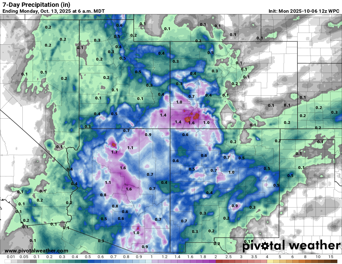
This is still 5 to 7 days out, so a lot can change, as we saw most recently with Lorena, where it failed to really deliver. But it is worth watching for folks in the Southwest.
Southeast coastal storm?
Another area to watch will be off the Southeast coast in about 4 or 5 days. We have a bit of a complicated setup with a cold front dropping southeast off the coast, low pressure trying to develop near the Florida Keys, and a disturbance trying to form off the Southeast. How exactly this plays out will determine a.) if it’s tropical and b.) what sorts of impacts we may see. Right now, it looks like a possible “nor’easter” type storm off the Carolina coast by the weekend. You can see how the operational European model brings all this together around 10,000 feet up.
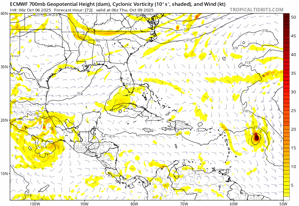
The meteorological side of things is pretty complex here. This appears to be a frontal low that perhaps acquires some tropical characteristics as it develops. This would classify it as sub-tropical. However, in reality, this would be a significant coastal storm, regardless of classification, particularly along the Mid-Atlantic and Carolina coasts that have been beaten up this summer by passing storms offshore. We’ve seen numerous houses get washed away in the Outer Banks as rough seas and erosion from storms like Erin and Imelda and Humberto churn up the ocean. Another coastal storm would be suboptimal particularly so close in proximity to the Humberto/Imelda churn that we’re just moving past now.
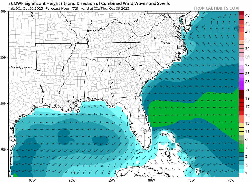
You can see the forecast wave heights from last night’s European model. This definitely is something to watch and monitor in the next few days for coastal folks in particular. The compounding effect of multiple storms in short proximity to each other can create some serious beach hazards and challenges on the oceanfront. More to come.