In brief: A massive storm is impacting most of the eastern half of the country today and tomorrow with hazards ranging from possibly record snow to fire weather to strong winds and severe weather. Meanwhile, the West is likely to see arguably the strongest early season heat wave ever recorded there begin this week.
There is a whole bevvy of issues across the country this weekend. Let’s walk through them.
Severe weather Sunday
The Ohio Valley and mid-Mississippi Valley are under an enhanced risk (level 3 of 5) today for severe storms, as are portions of Georgia, Alabama, and the Florida Panhandle.
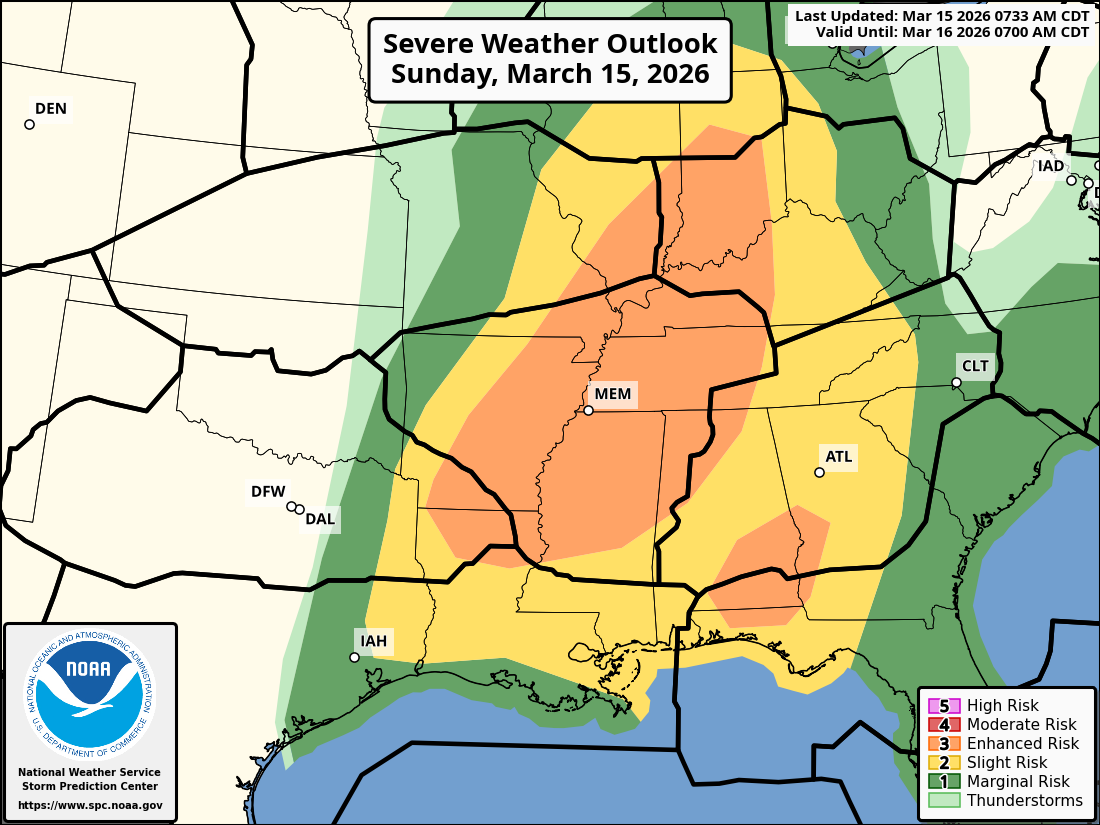
While there may be an early element of tornado risk with the storms today, the primary concern will be damaging winds as a line of potent storms cruises south and east later today and tonight. Wind gusts of 50 to 70 mph are likely in the stronger storms, along with an isolated tornado. This should be a QLCS type system, which tend to be notorious for damaging winds in spots and brief “spin up” tornadoes that can cause narrow corridors of damage.
Severe weather Monday
That line of storms will move east of the Appalachians on Monday. What should occur is development of showers and thunderstorms over the Carolinas in the later morning and early afternoon, racing south to north. An additional squall line (another QLCS) will push into the Mid-Atlantic in the afternoon hours. You’ll see severe weather with this, including the potential for damaging winds with the squall line and a somewhat higher-end tornado risk, particularly in the Carolinas and Virginia. As such, a moderate risk (level 4/5) has been issued for the Mid-Atlantic.
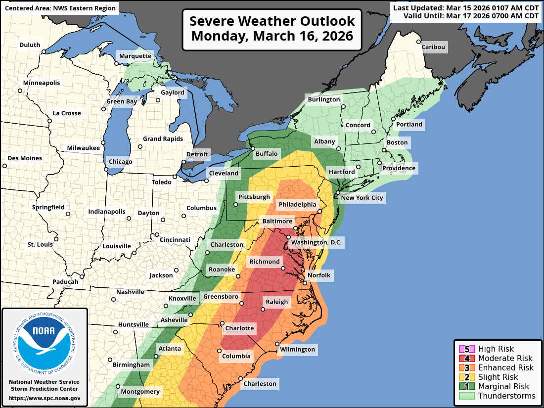
We don’t see too many moderate risks in this region. In fact, the last day 2 moderate risk from Richmond north appears to have been in 2013. South of there, it appears to be 2021.
Blizzard conditions
On the northern edge of this storm, a massive snowstorm is going to bury parts of Wisconsin and the U.P. of Michigan.
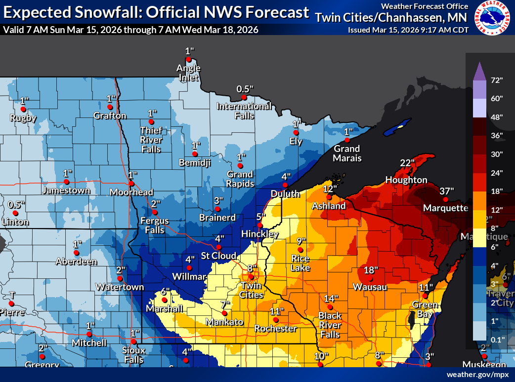
The snowstorm has backed off a good bit for parts of western Wisconsin and Minnesota based on recent model runs. But it has definitely escalated for the U.P. Surprisingly, the 2-day snowfall record in Marquette, Michigan is 31.9 inches in March 1997, almost 29 years to the day. We could blow past that with this storm.
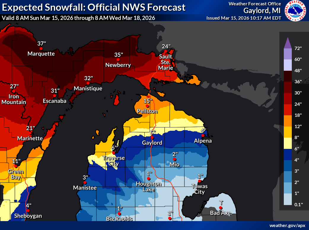
The 2-day snow total in Wausau, Wisconsin may also be threatened (22.1 inches in March 1959). Notice how these big snow records seem to align in March. Some of winter’s biggest storms happen in March. The northern Lower Peninsula of Michigan is going to be right on the edge of more nuisance (6 to 12 inch) snows and significant (12 to 24+ inch) snows, including Traverse City through Sault Ste. Marie.
Blizzard warnings are hoisted from the U.P. back west into southern Minnesota, almost all of Iowa, and parts of the Dakotas and Nebraska. While snow totals will be lower to the west, the winds may be stronger. Wind is the main component of Blizzard Warnings, as the criteria are falling or blowing snow, wind gusts, and low visibility. Snow intensity and amounts are not considered.
Wind and fire weather on the Plains
On the backside of this storm, high wind warnings and red flag warnings are in effect now.
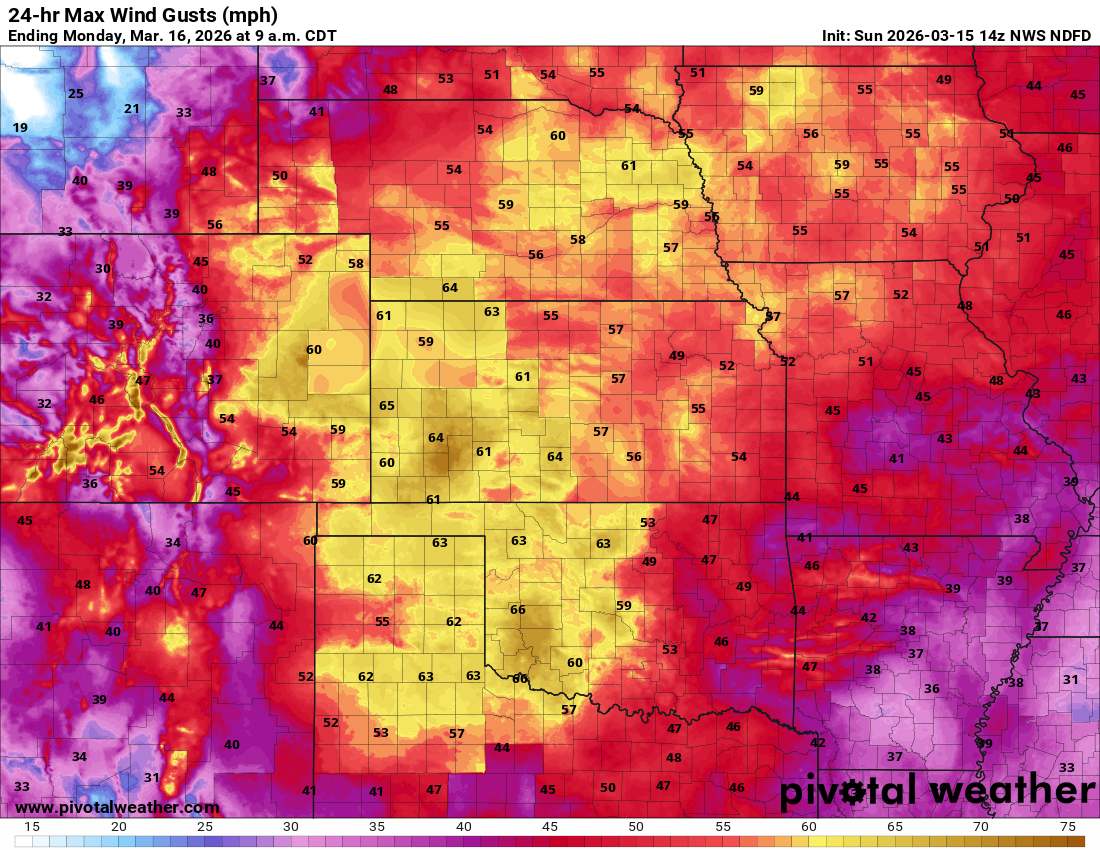
Fire weather looks especially concerning in the Texas Panhandle and New Mexico. There is a critical fire weather risk there, and the Texas A&M Forest Service forecast fire weather risk for today is extreme in those areas.
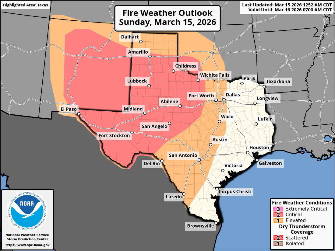
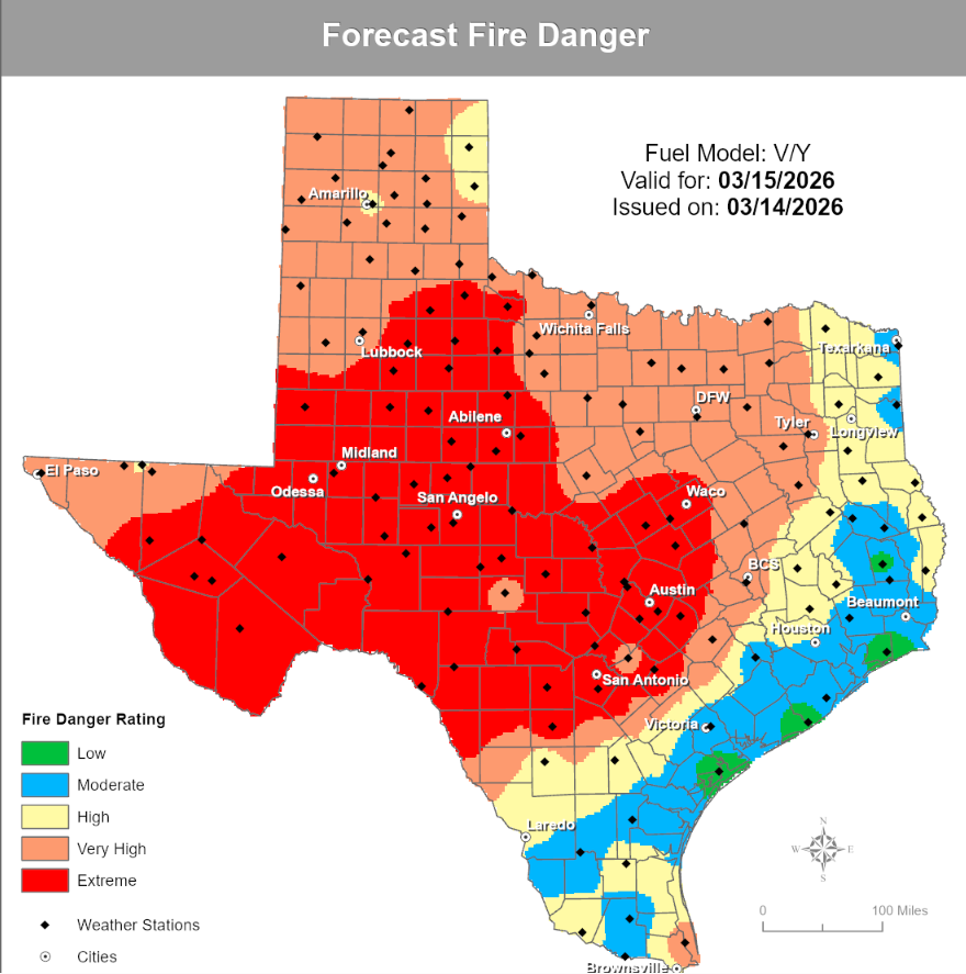
With this area in drought, the combination of dry fuels, low humidity, and strong winds makes today and parts of Monday important fire weather days in this region.
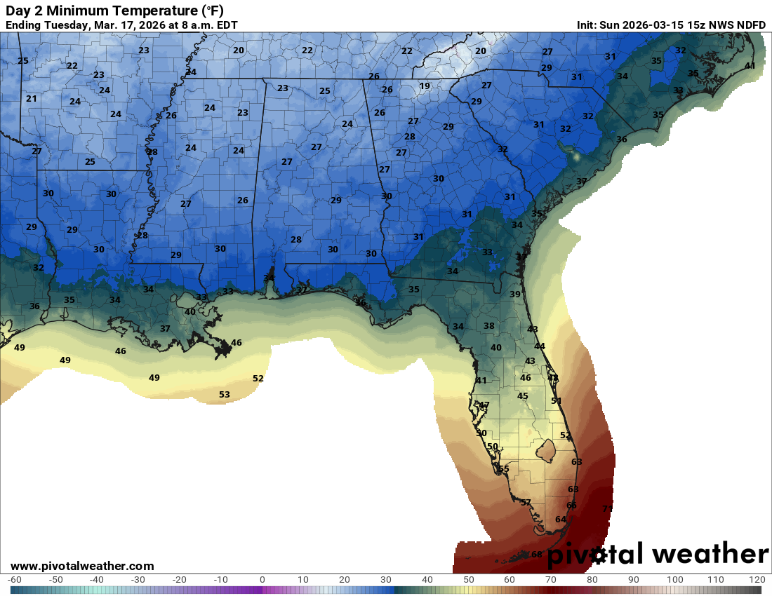
Cold weather behind the storm
While the cold behind this storm won’t be too extreme, a few records are at risk in the Midwest, Mid-South, and Southeast tomorrow and Tuesday mornings. In addition, frost and freeze advisories and warnings are posted across the Southeast and Mid-South as the growing season has started in some of these areas.
Cold will be short-lived as we see a big warm up into next weekend. Temps will stay fairly cool in the Northeast and Lakes.
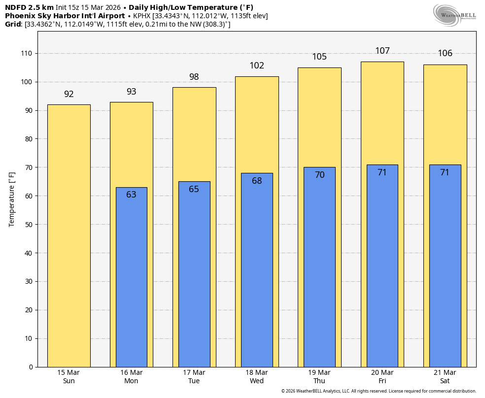
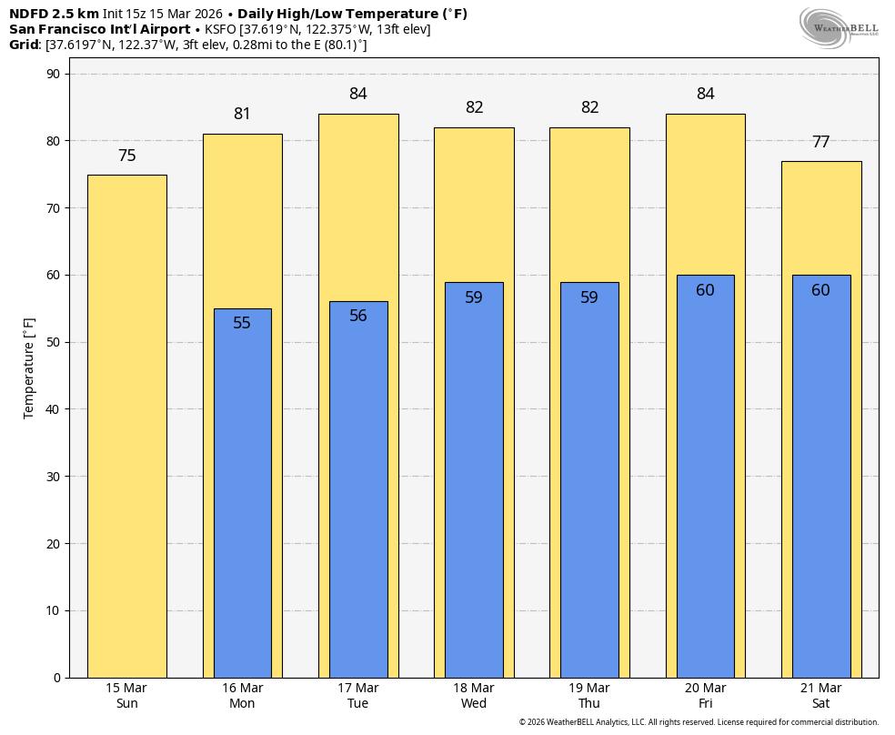
Western heat wave
As noted last week, a pretty epic, if not historic heat wave is going to clamp down on the Western U.S. this week. Hundreds of record highs will fall this week in the West, including numerous monthly records and numerous “earliest first” records for 90s and 100s.
In San Francisco, the monthly record temperature is 85 degrees. That will be threatened on more than one day.
Even Salt Lake City is likely to break past their March temperature record of 80 degrees.
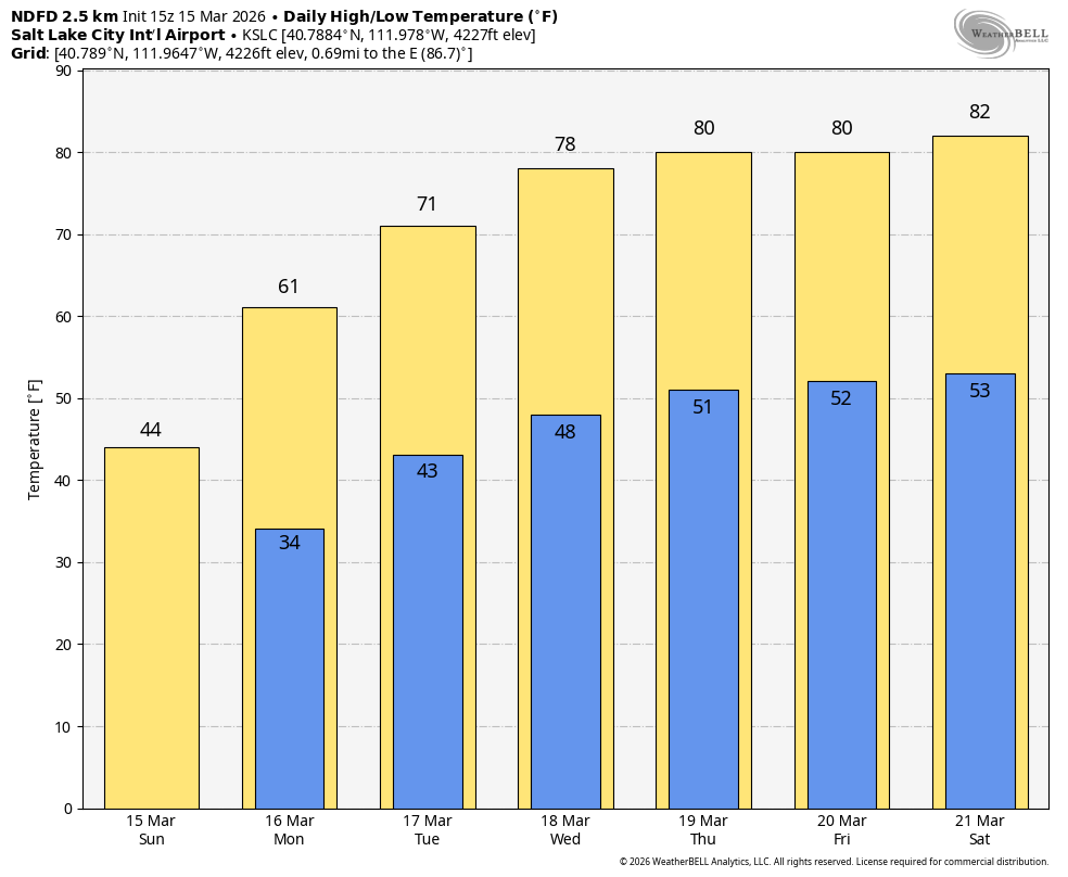
This is going to be one of the most intense, if not the most intense early season heat waves in the West on record.
The weather pattern should calm down some later this week and next weekend.