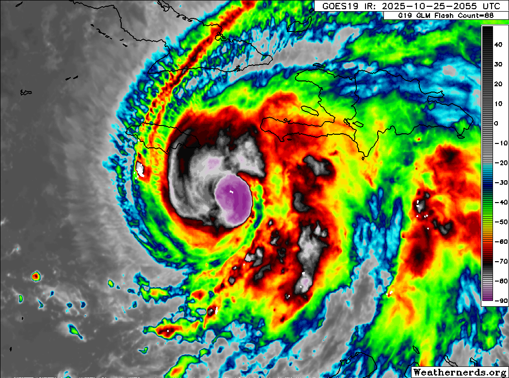
In brief: Hurricane Melissa has officially become a category 5 storm, and all the bad forecasts for Jamaica and elsewhere are mostly unchanged today. Notably, Melissa will also be the strongest storm since Sandy to hit eastern Cuba and may very well be worse, possibly the strongest on record there. Melissa will continue across the southeast Bahamas and into the open Atlantic, though it may impact Bermuda on the way out as well. Overall, Melissa continues to look like a catastrophic storm and the worst of 2025 in the Atlantic basin.
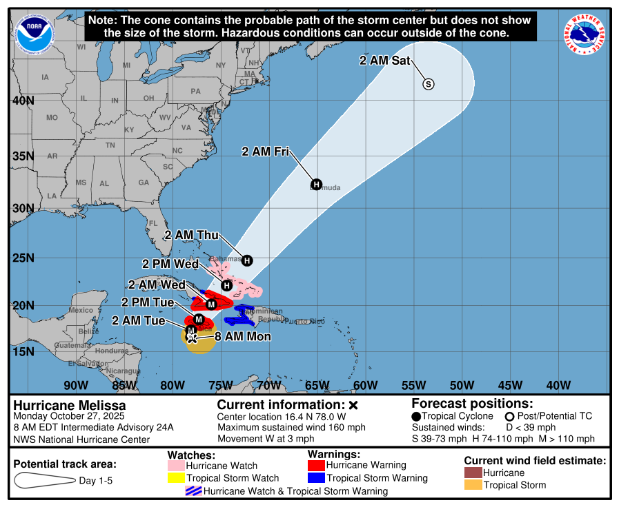
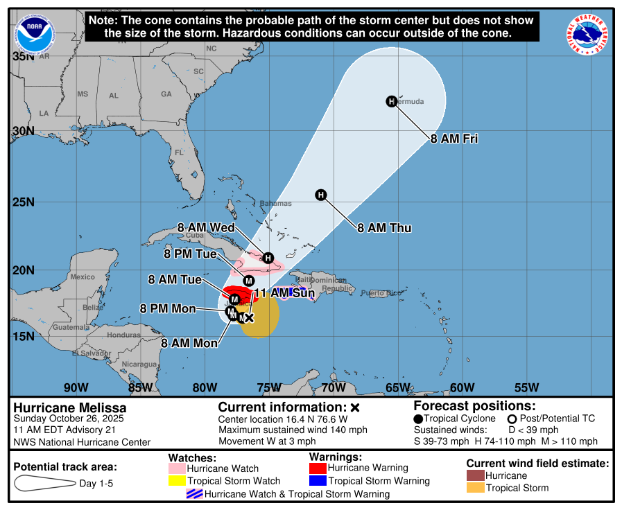
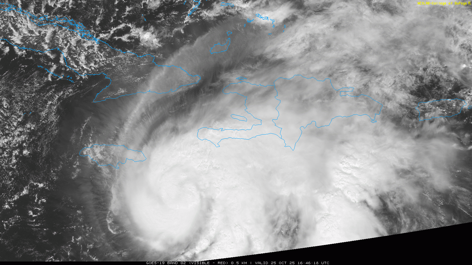
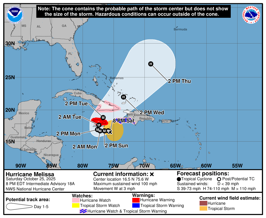
Hurricane Melissa finally crossed the threshold into category 5 status this morning. Maximum sustained winds are 160 mph, and it is moving west at 3 mph.
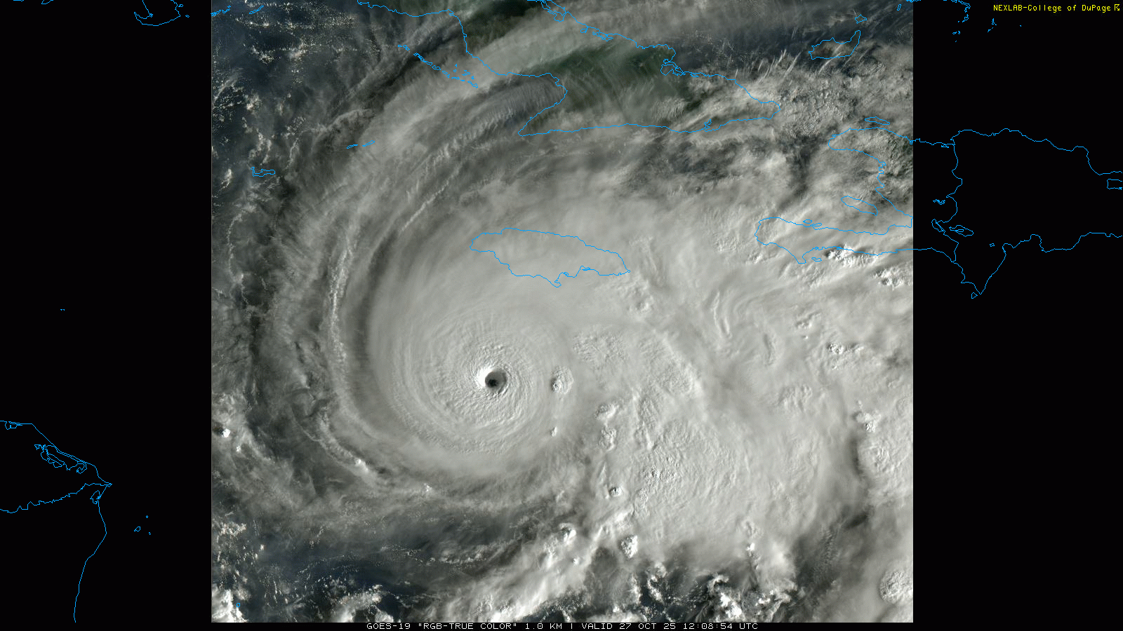
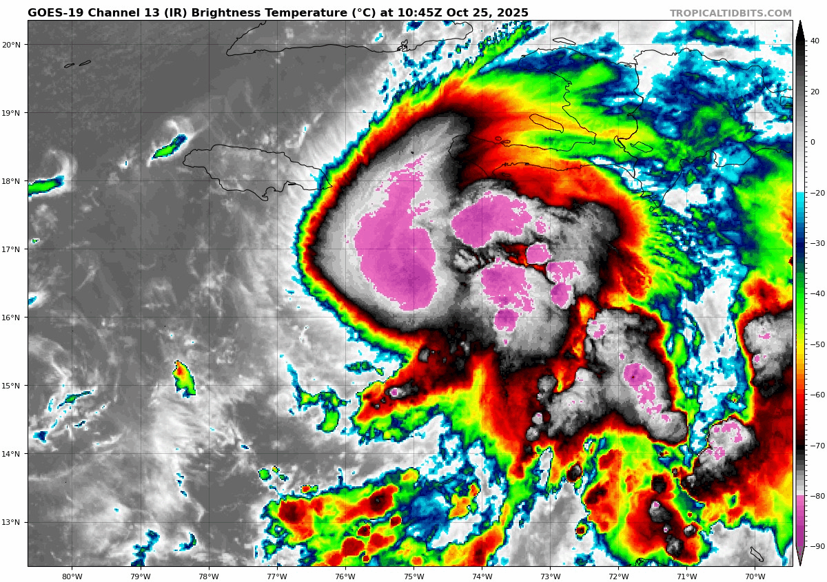
There is little to say about Melissa’s intensity and threat that has not already been said. It’s as dangerous an outcome as we’ve seen for Jamaica in many years.
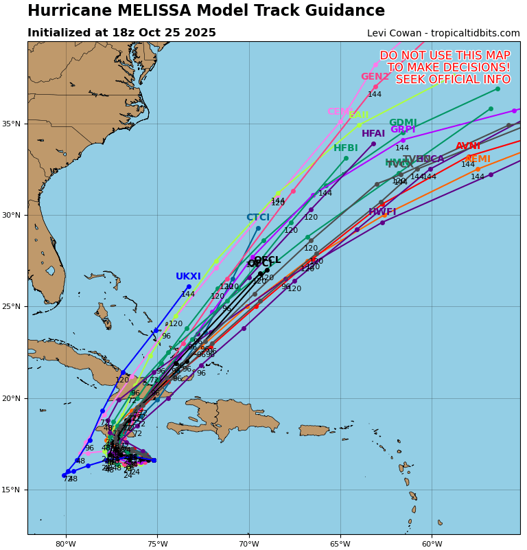
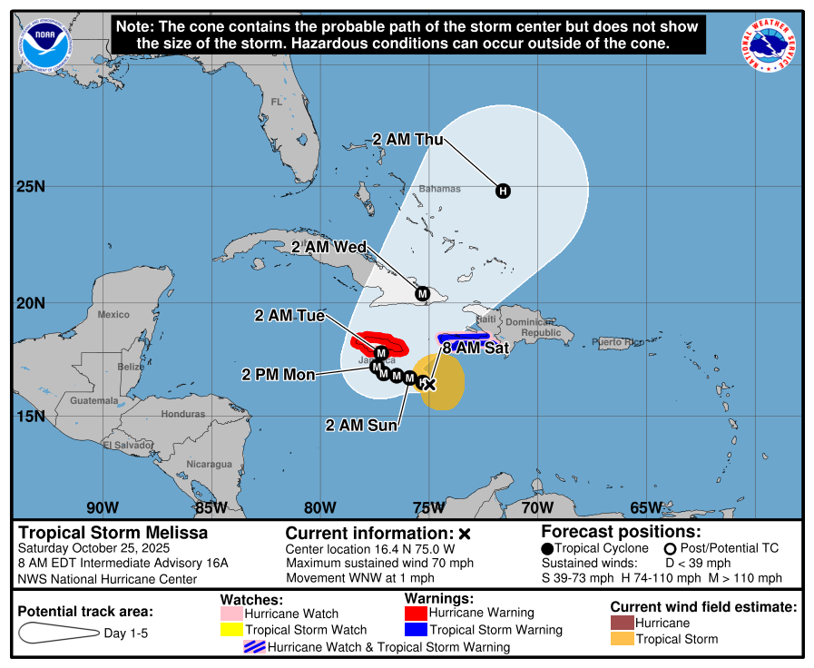
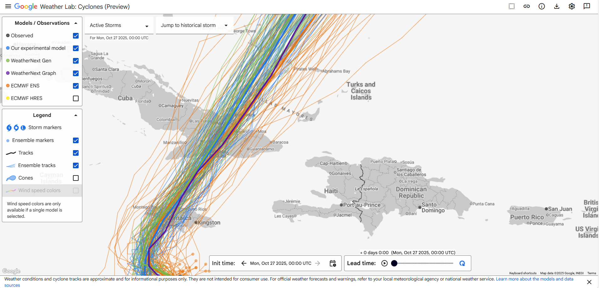
The only perhaps subtle change we’ve seen for Jamaica is probably that the track has nudged a little farther south than expected initially and landfall in Jamaica proper probably will occur a smidge farther west. Whether this practically means anything different, it’s tough to say, but little nudges and wobbles will be evident over the next 24 hours that end up leading to some degree of good and bad luck in parts of Jamaica. As it stands right now, the center should cross the island about 60 miles west of Kingston, the population center of Jamaica. Of course, that places Kingston on the stronger side of the storm but with hurricane force winds confined to about a 30 mile radius from the center, there’s likely going to be a buffer between the capital and the worst wind of the storm. That said, there will be significant rainfall, catastrophic winds in the mountains in particular, and likely significant damage and isolation for a number of smaller towns and villages across the country. Storm surge will also be catastrophic on parts of the south shore of Jamaica in particular.
As far as intensity goes, expect either a high-end cat 4 at best or a cat 5 of some intensity. Strengthening is possible through the day today, but typically once at category 5 intensity, the storm does become prone to internal processes that can lead to intensity fluctuations after no more than 18 to 24 hours. At this point, you just hope it comes into Jamaica in a downward intensity cycle due to those internal processes, such as an eyewall replacement cycle. Those can’t typically be forecast well in the current state of the science.
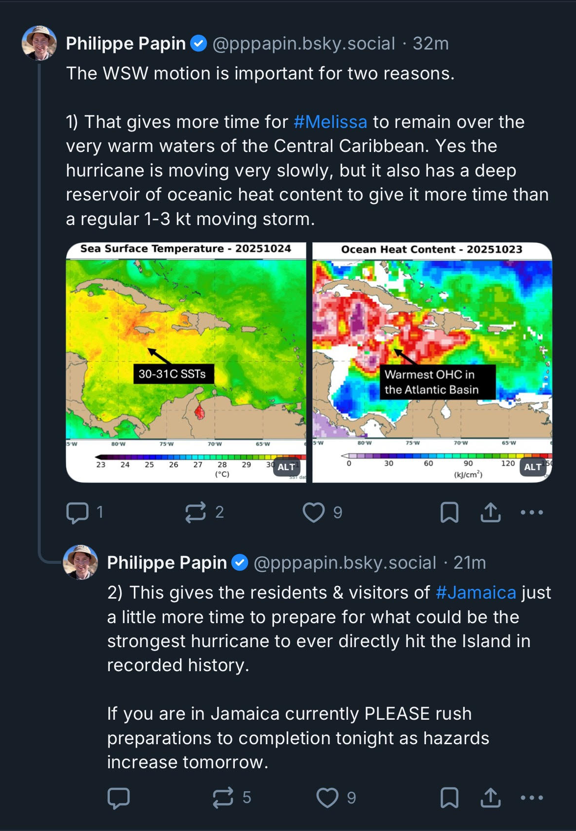
For Cuba, Melissa will have some time back over warm water to recover some of what it inevitably loses over land, so I would still be expecting at least a major hurricane, with some chance of a category 4 storm. The track brings it very near Santiago de Cuba, the second largest city in the country. While the focus remains on Jamaica, don’t lose sight of the fact that this is going to be a particularly severe storm for eastern Cuba. This should be the strongest storm since Sandy to hit this part of Cuba from the south, and there’s a good chance it may be even stronger than that at landfall. Sandy killed 11 and destroyed over 15,000 homes in Santiago de Cuba.
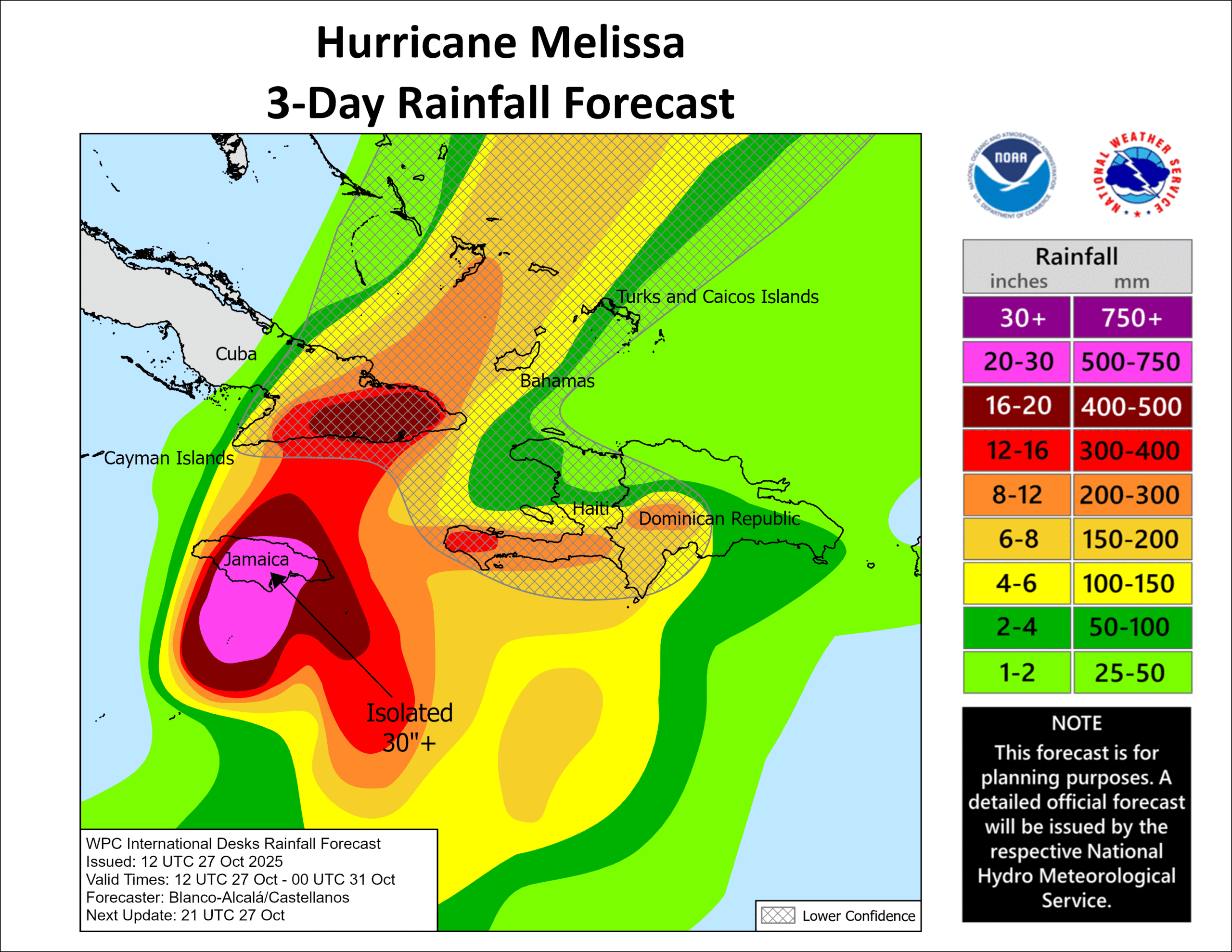
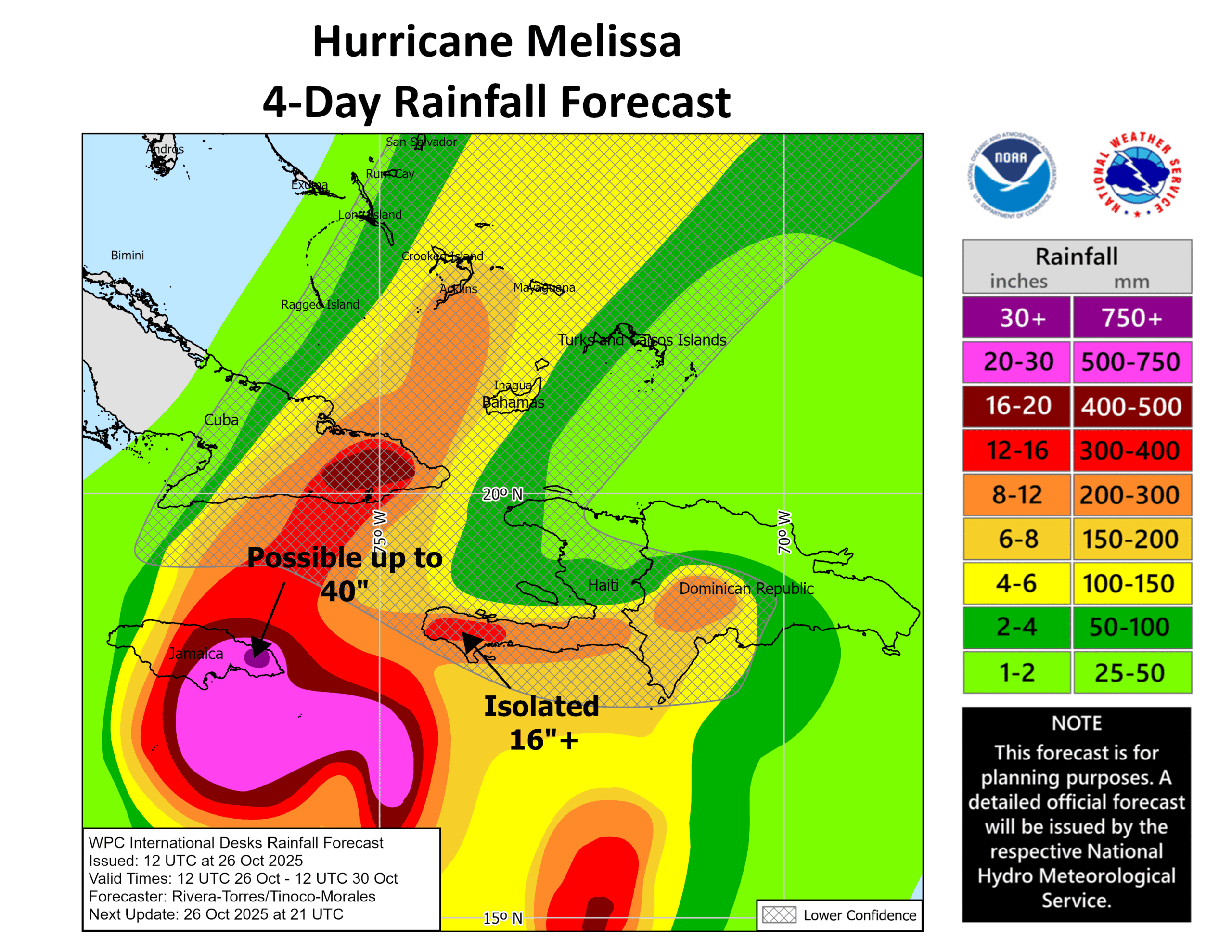
Rainfall continues to look horrific for parts of Jamaica, where 20 to 30 inches (500-750 mm) or more may fall in spots in addition to what has already fallen. For Cuba, eastern provinces will see 15 to 20 inches of rain (375-500 mm). There could still be another foot (300 mm) of rain coming to Haiti’s Tiburon Peninsula, as well as up to 10 inches (250 mm) or so in some of the Dominican Republic. In the Bahamas, we could see up to 8 inches (200 mm) or so near Crooked Island.
Looking down the road, there remains a fair bit of uncertainty, but a track placing the storm very near Bermuda on late Thursday night and Friday morning, possibly as a major hurricane seems plausible. A lot will depend on what Melissa’s structure looks like once it exits Jamaica and Cuba, but as long as its core is in-tact, there’s no reason a little re-strengthening could not occur in the southwest Atlantic before it levels off and begins to weaken south of Bermuda. For Bermuda, that means another possible hurricane impact this season.
Bottom line:
Jamaica: A top-end hurricane impact with catastrophic damage in parts of the country, substantial damaging flooding, and historic storm surge.
Cuba: One of the strongest recorded storms to hit the eastern provinces of the island and the worst since Hurricane Sandy in 2012. A major hurricane is likely to make landfall tomorrow night with severe wind, surge, and rainfall.
Hispaniola: Lingering heavy rain will cause additional flooding, mudslides, and landslides, particularly within the Tiburon Peninsula in Haiti.
Bahamas: A major hurricane passing through the areas around Crooked and Long Islands will occur Wednesday with significant wind and rain and surge in those southeast islands.
Turks and Caicos Islands: Mostly fringe impacts of locally heavy rain, gusty winds, and moderate surge. But still some uncertainty on exact track so vigilance is encouraged.
Bermuda: Potential for a direct hurricane impact by Thursday night and Friday, though uncertainty is high.