In brief: Tropical Storm Melissa’s forecast has undergone mostly cosmetic changes this morning. A damaging, severe hurricane with wide-ranging impacts in Haiti, Jamaica, and Cuba is likely. We continue to be focused on heavy rainfall and multiple days of hurricane impacts in very vulnerable locations. But the story is mostly unchanged today.
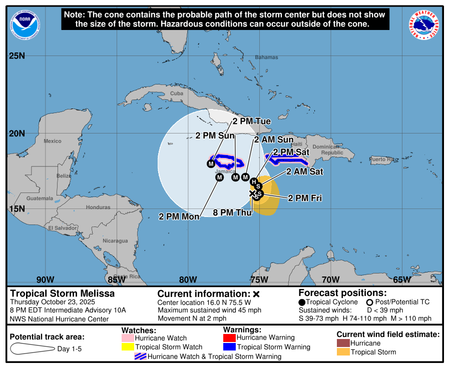
Melissa this morning
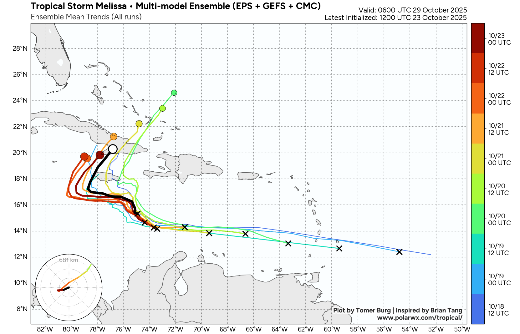
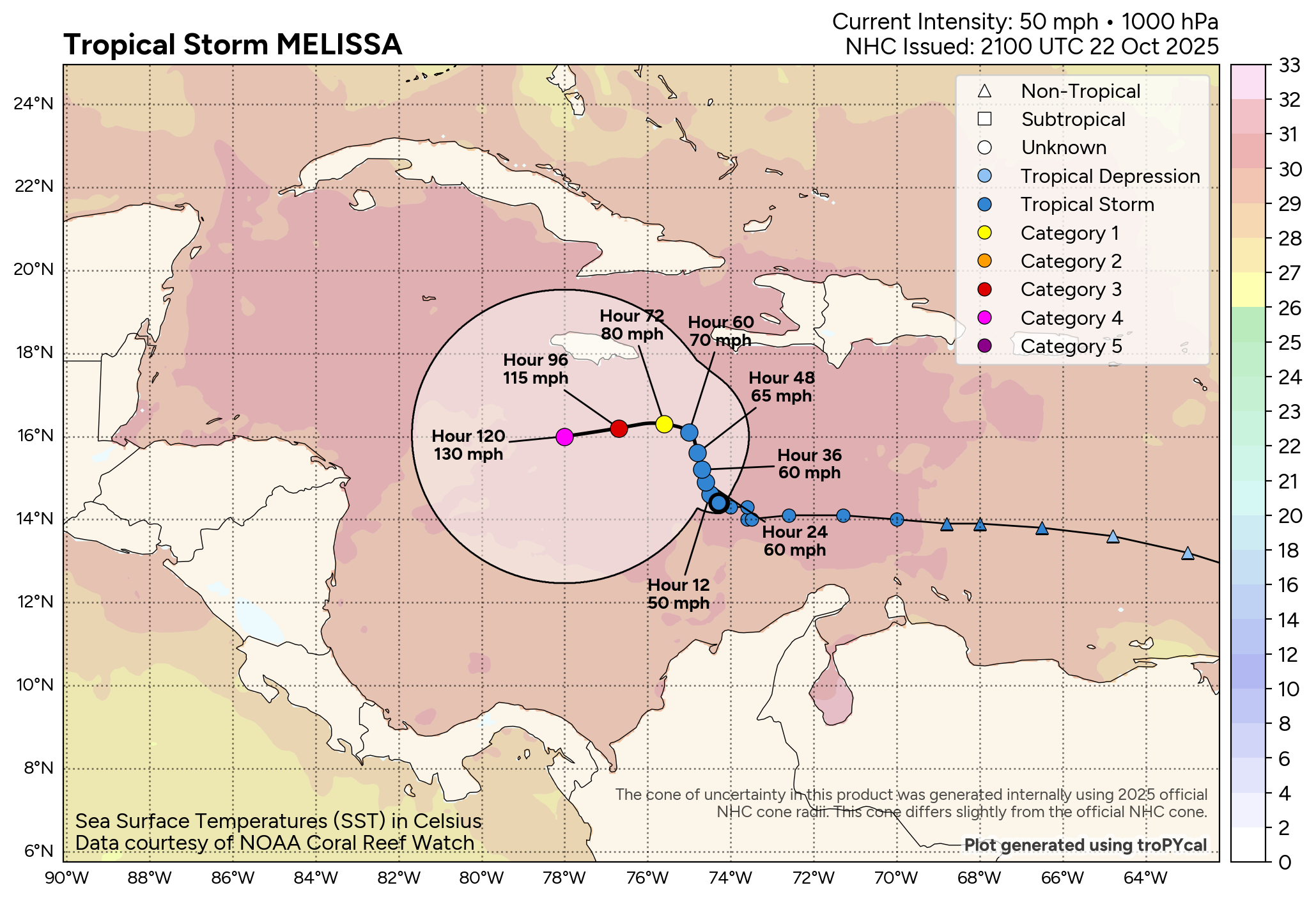
Changes since yesterday have included Melissa’s center either shifting or reforming to the south and east. The storm itself remains fairly disorganized and lower-end intensity-wise.

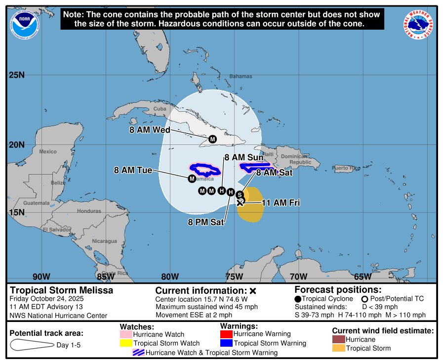
Maximum sustained winds are 45 mph, but Melissa is expected to emerge in a more favorable area for intensification soon. We have about 24 hours more of these sloppy upper level conditions, with center drift or reformation possibly leading to an erratic, meandering track.
Where is Melissa headed?
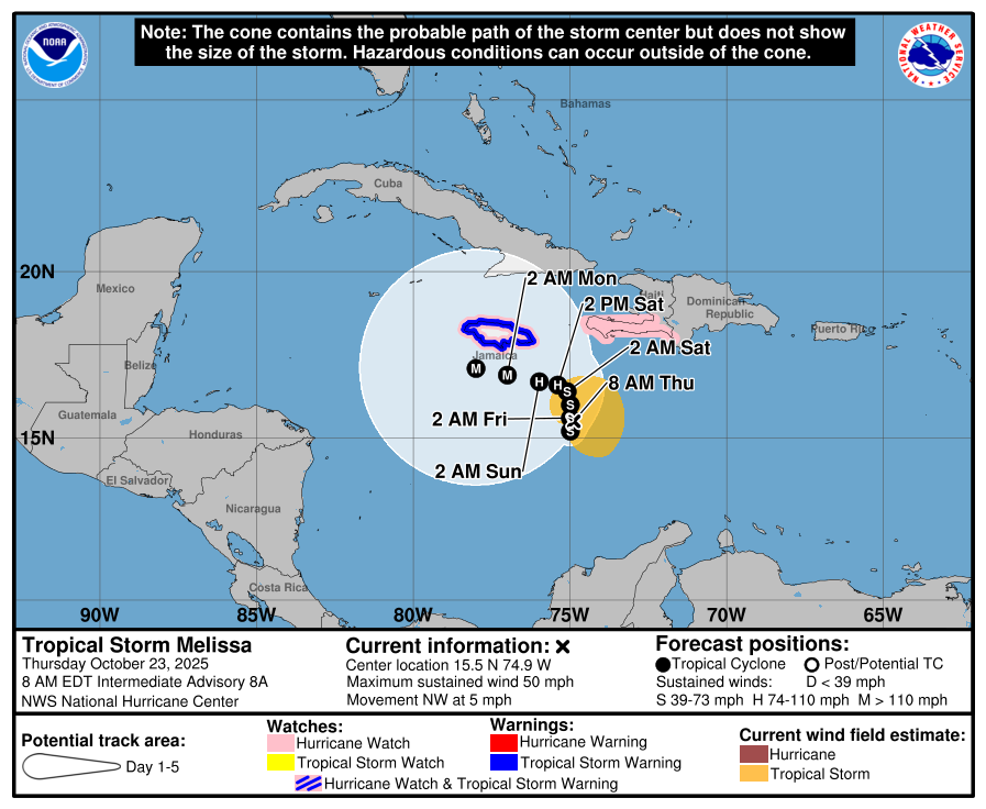
After tomorrow, a general west drift will continue through Tuesday. From there, Melissa will finally have an escape path emerge, allowing it to turn north and northeast. Exactly where that occurs will determine where it tracks in relation to Jamaica and Cuba. It will be a major hurricane at that point, so wide ranging impacts from surge to torrential rain, high seas, and obviously wind will be a concern. The NHC track above represents a close mix of the historically well-performing consensus track forecast, as well as the strong performing Google Deep Mind model.
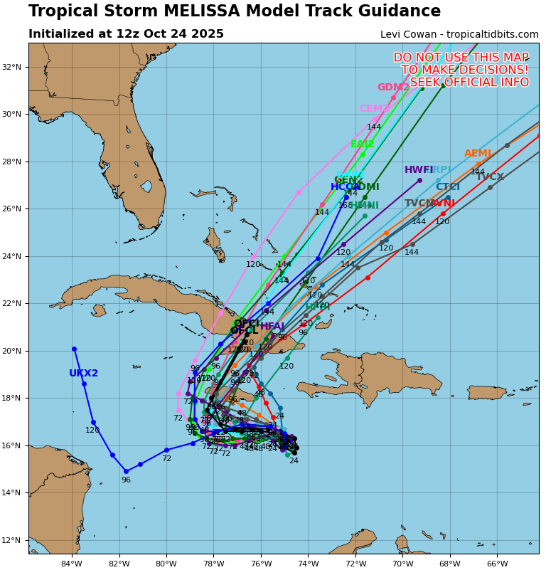
The track spread has narrowed since yesterday, though it remains broad and highly sensitive for potential landfall risks in Jamaica and Cuba, as well as downstream into the southeast Bahamas and Turks and Caicos. And with a center that seems vulnerable to reformation over the next 24 hours, this whole spread could shift a bit in either direction over the next 24 hours.
But the bottom line, this storm is going to produce significant, high-end impacts in Jamaica, Cuba, and Haiti and parts of the southeast Bahamas and Turks & Caicos Islands.
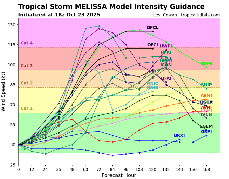
How strong will Melissa get?
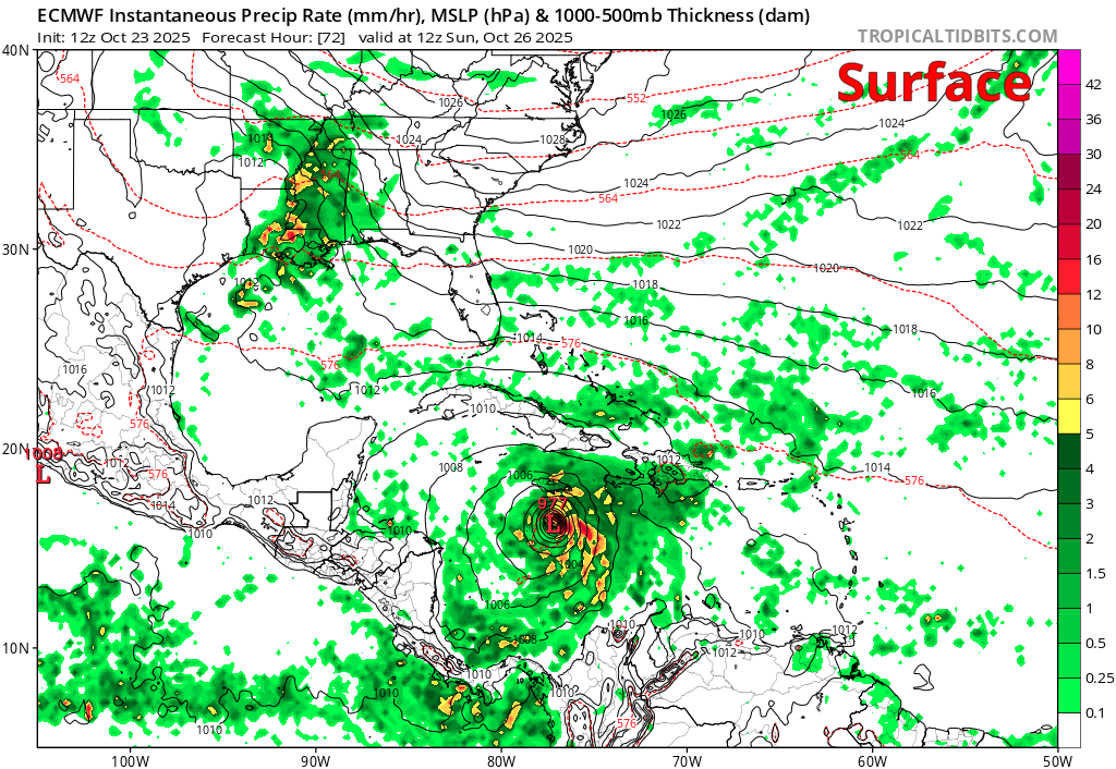
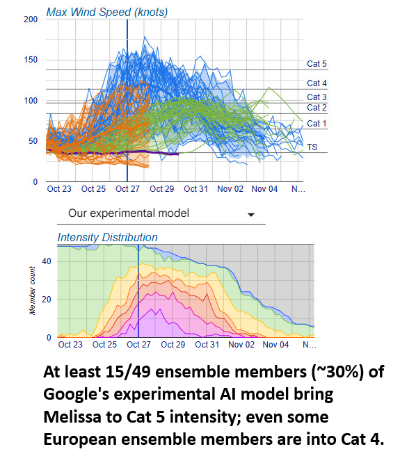
The NHC shows Melissa eventually becoming a high-end category 4 hurricane by Tuesday. Depending on exactly where the center tracks and how much the shear relaxes will determine how quickly Melissa can undergo transformation from ordinary to extraordinary.
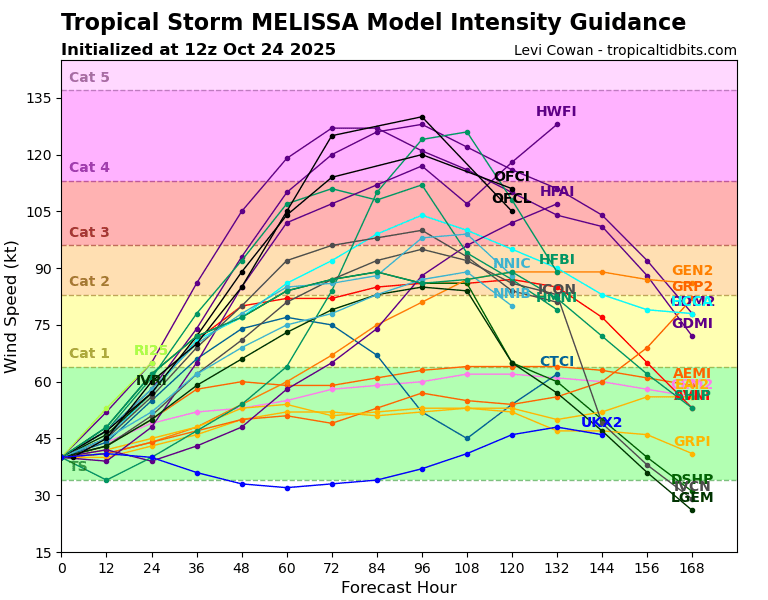
Notably, the NHC said in their discussion this morning that every Google Deep Mind ensemble member is showing a Cat 4 or 5 intensity. Basically, expect at least a major hurricane, probably a high-end major hurricane.
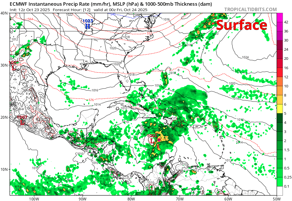
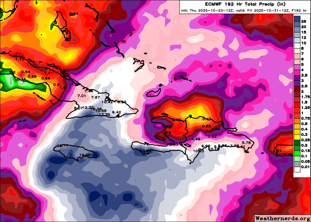
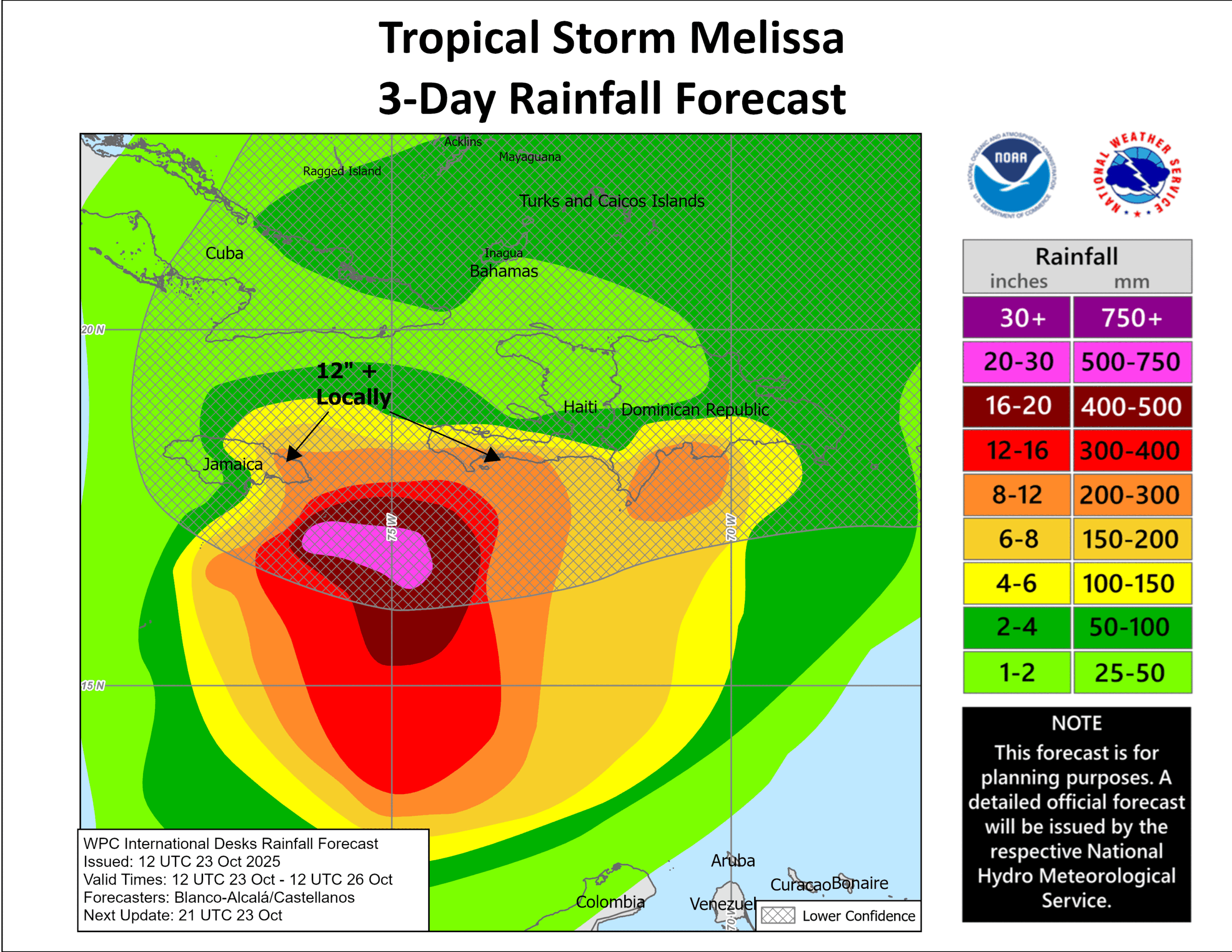
The rainfall story continues to look bad
Rain totals are expected to pile up in Haiti, Jamaica, and Cuba over the next several days into Tuesday or Wednesday. So we have about 24 hours or so more beyond the forecast below. I would expect numerous 20 inch totals in southern Haiti, parts of Jamaica, and perhaps 10 to 15 inches or more in southeast Cuba.
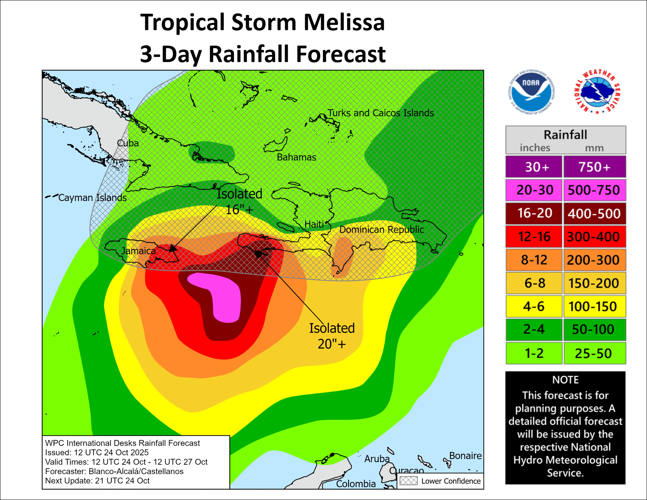
About 5 to 10 inches will fall in the southeast Bahamas and/or Turks and Caicos Islands by the time all is said and done. 20 inch totals in Haiti and/or Jamaica will be potentially catastrophic. The problem continues to be a slow-moving major hurricane in close proximity to Jamaica. Several days of strong winds and torrential rain and pounding surf. It’s just a very bad story. I am sure folks in these areas, while hurricane hardy and prepared for this storm, will be severely impacted. Please make sure any relatives or friends you have in these areas are monitoring this and doing whatever they can to get to a safe, sturdy shelter and location for several days.
We’ll have another update on Melissa this evening.