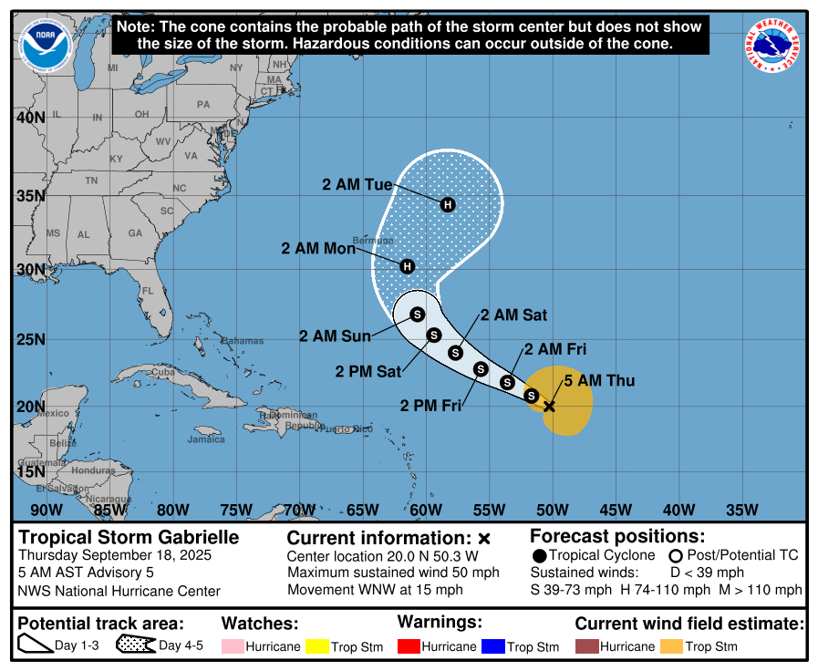
In brief: Gabrielle is struggling mightily this morning, with 50 mph winds but very little thunderstorm activity. It looks unlikely to threaten Bermuda but should still be watched. Not much else on the horizon. Locally heavy rain could produce flash flooding from southern California and southwest Arizona north into the Sierra today and tomorrow.
Tropical Storm Gabrielle
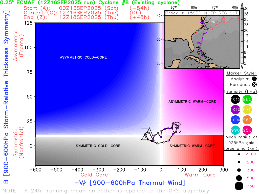
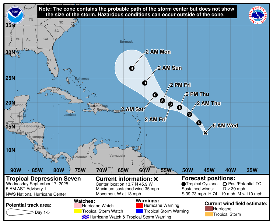
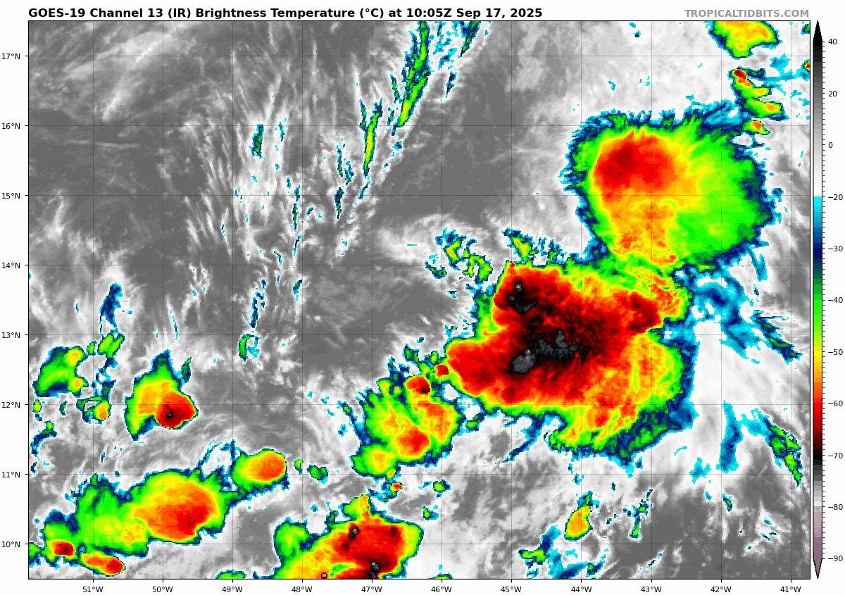
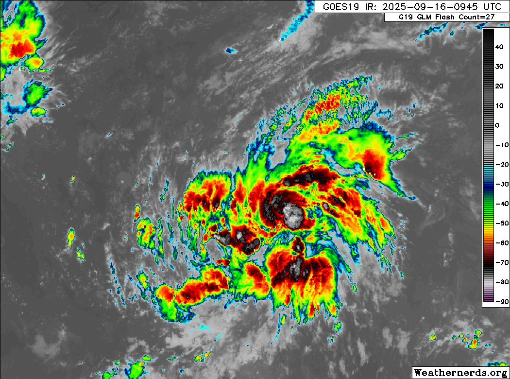
Well, we finally got our “G” storm! Gabrielle formed out of the slop that was Tropical Depression 7 yesterday. And if there ever were a storm to typify this season, Gabrielle may be the one. It’s essentially a naked swirl this morning. Looking at it on satellite, you can literally see the wind shear impacting the storm.
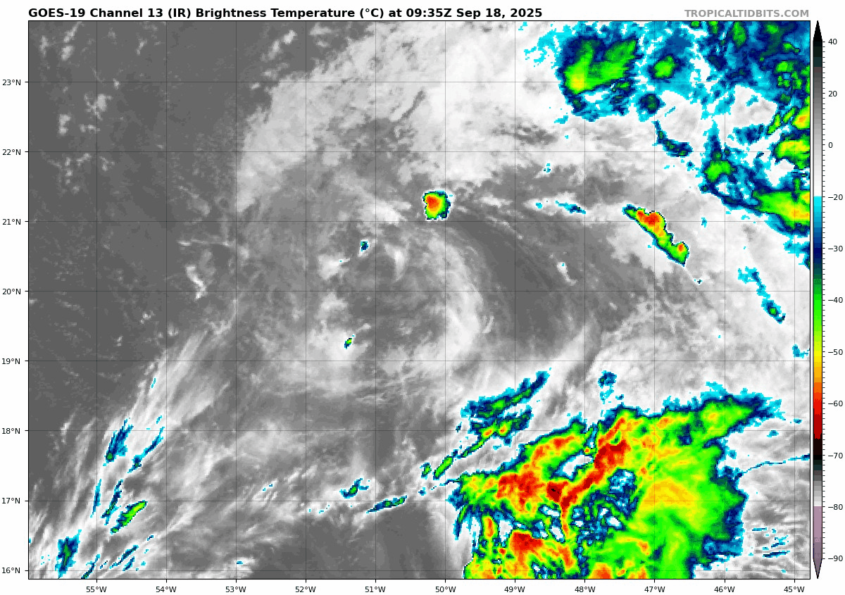
In addition to the shear, Gabrielle is also fighting dry air. Overall, this is about as pathetic as it gets for a tropical storm. It seems as though this is going to struggle mightily for the next 2 to 3 days. I wouldn’t be shocked to see it even be reclassified to a depression again at some point. Beyond that, the environment looks to get a little less hostile. This should support strengthening as the storm turns north and (likely) passes east of Bermuda. Some models still drag Gabrielle close to the island, but over 90 percent of the suite of solutions keeps it to the east.
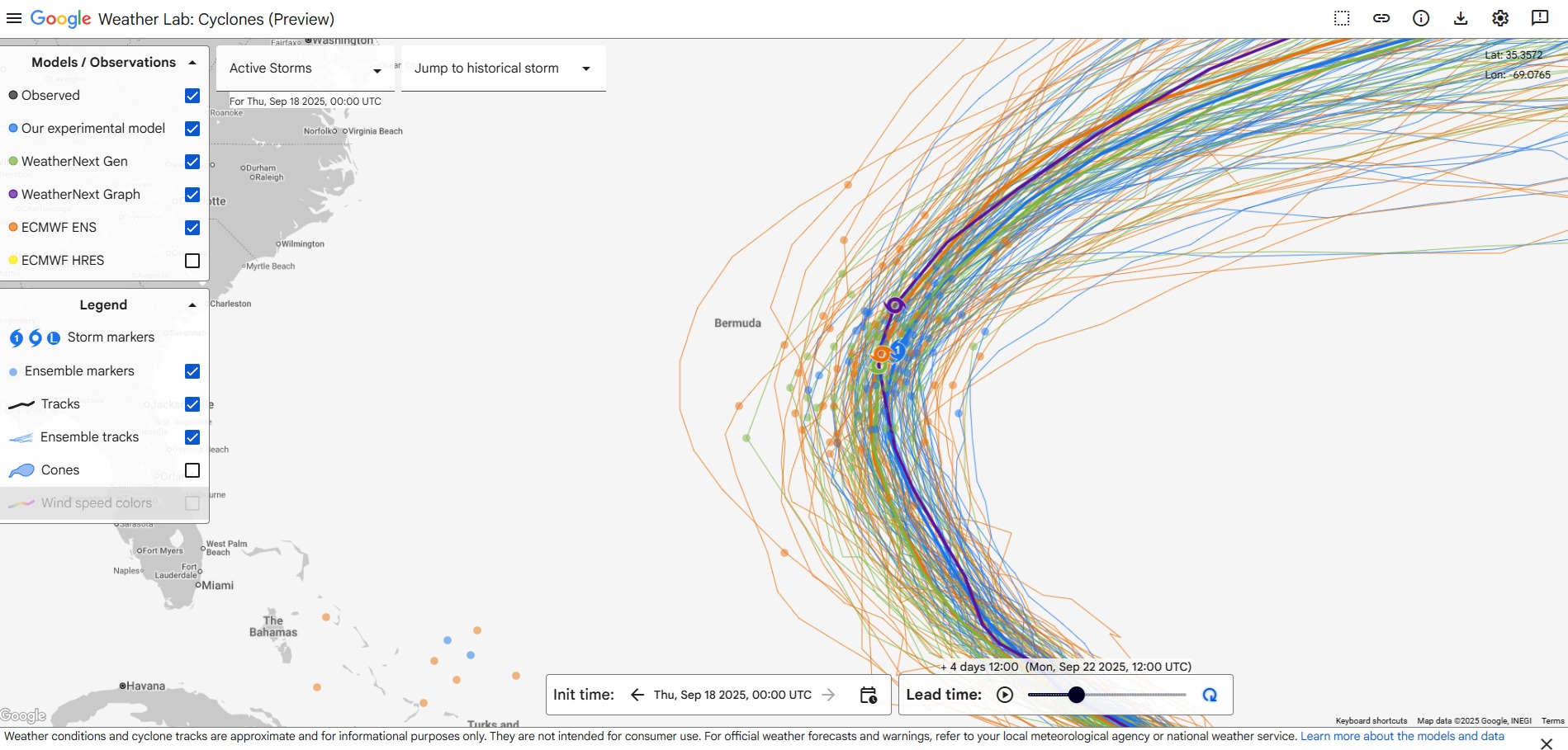
Given Gabrielle’s disorganization, it probably remains worth watching for Bermuda, because weird things can happen track-wise when you’re dealing with a system like this. Water temperatures in the subtropical Atlantic are quite warm, so assuming this gets to an environment that is less hostile, whenever it does get its act together (if it does), it could come together rather quickly. But at least for now, it’s not a real serious threat.
What comes next?

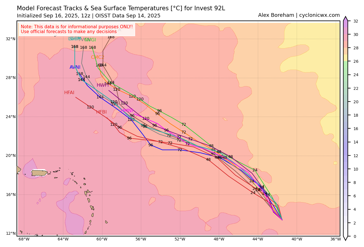
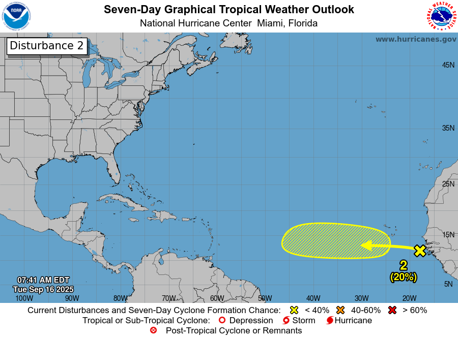
Well, the NHC took the 20 percent area off the board in the Atlantic and replaced it with a more generic 20 percent area for the next wave behind that one in the pipeline. This seems to be the season of “well, let’s watch the next wave.” Truth be told, when I look out beyond days 5 to 7 right now, I cannot point to much of anything other than vague “well, it’s September so we’re watching here and here maybe I guess.”
The background state of the Atlantic has been hostile all season, and it remains hostile, and I’m not sure I see where that’s changing. A lot of folks have mentioned the MJO, or Madden-Julian Oscillation, which is a periodic pattern of favorable conditions for thunderstorms (rising air) that works around the globe in the tropical regions. There is a fairly good correlation between supportive MJO activity and increased tropical risks. Much of this season has been spent in the unfavorable side of the MJO, with sinking air dominating the Atlantic. And it seems that every time the models suggest this may change…

So here we are in mid-September, without really much of anything showing up over the next 7 to 10 days. This gets us to about September 26-28, give or take. It’s important to recognize that October can still do bad, bad things. Very bad things. But at this specific moment in time we’re in good shape.
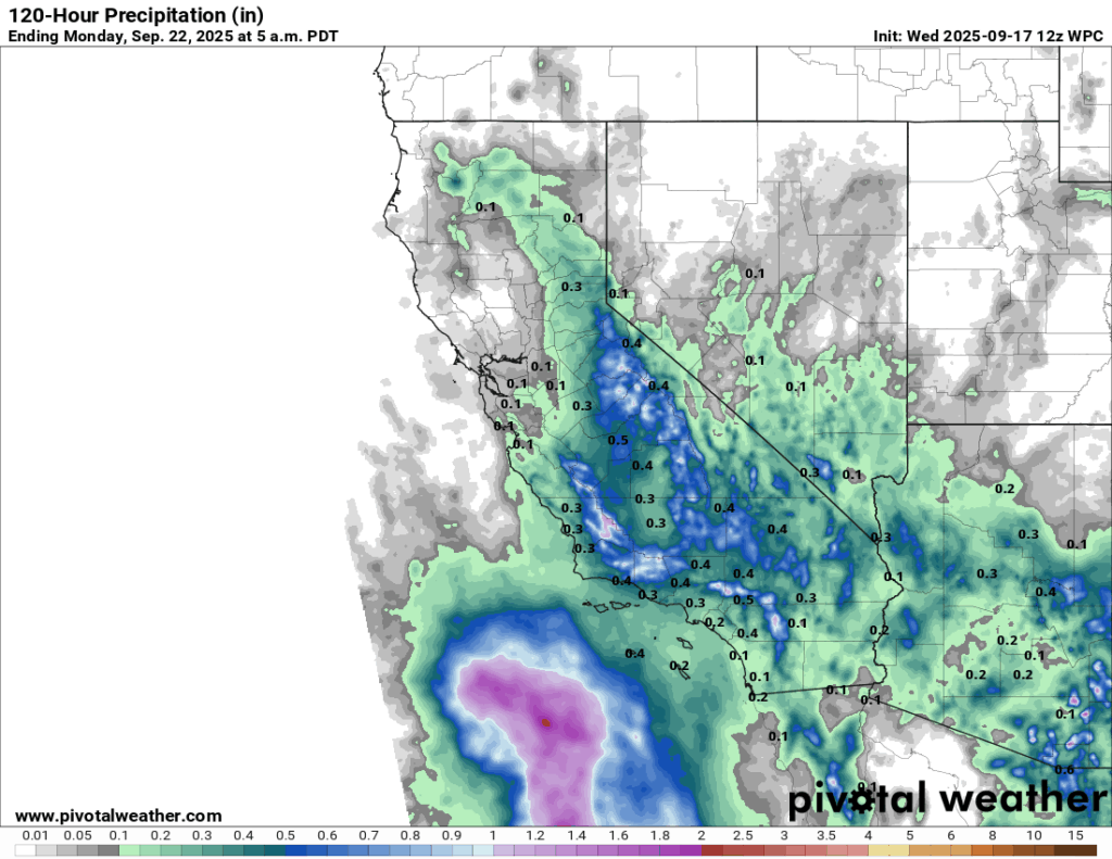
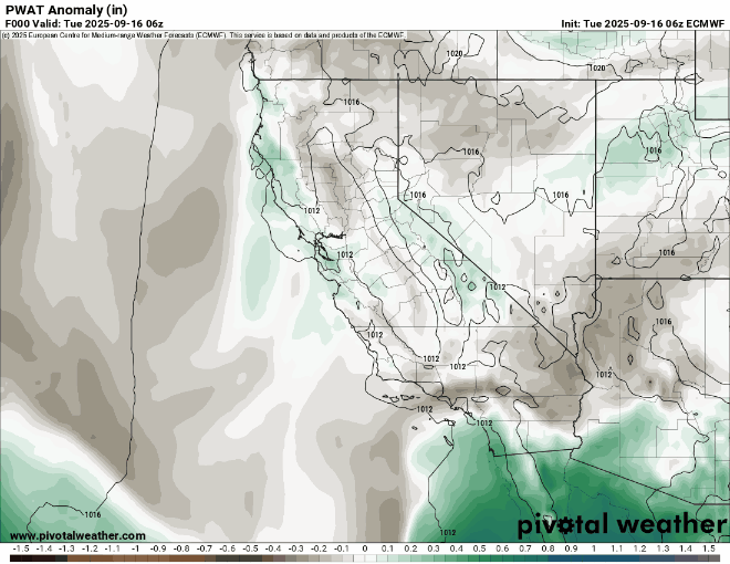
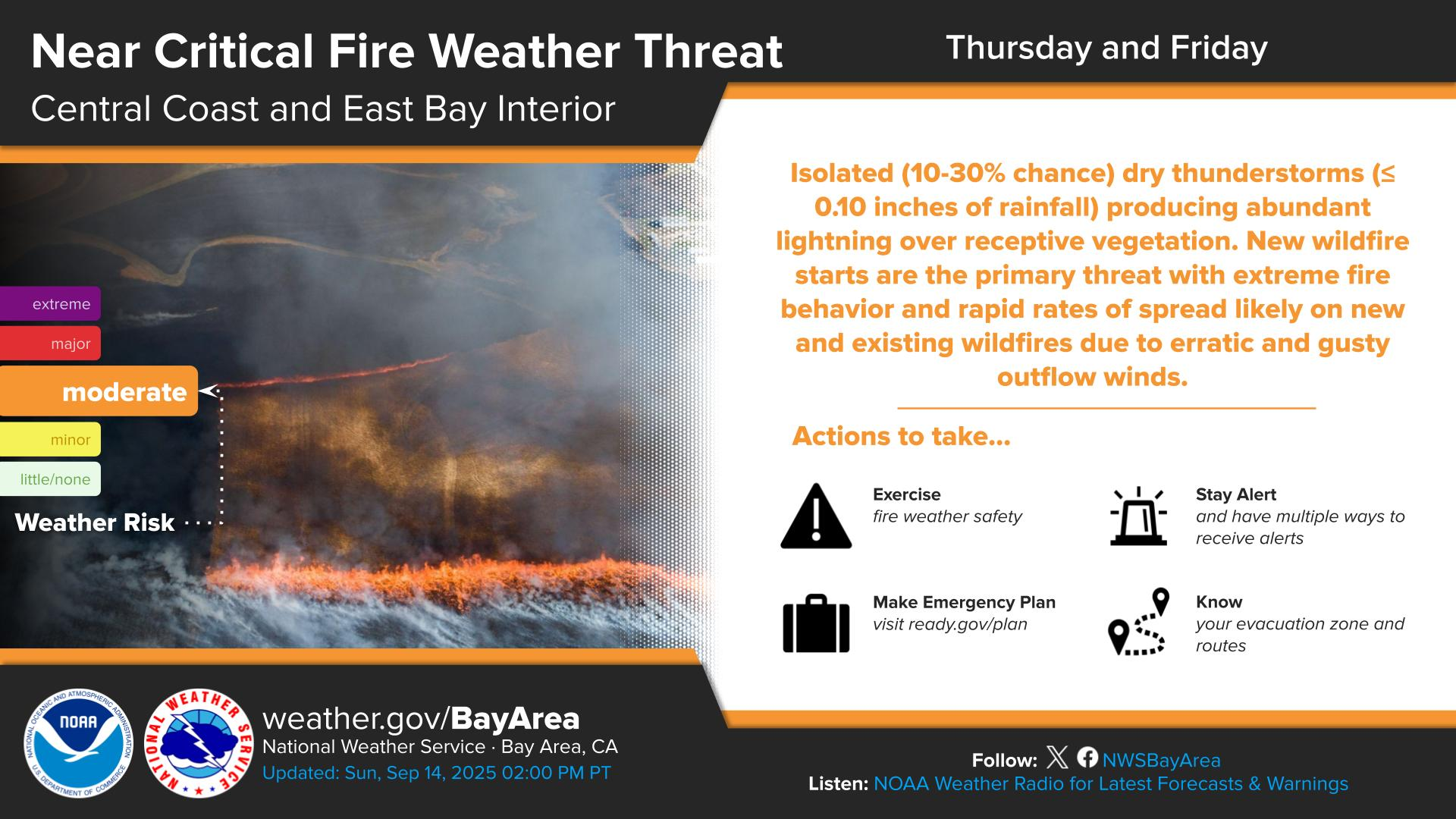
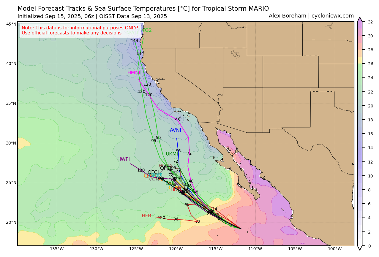
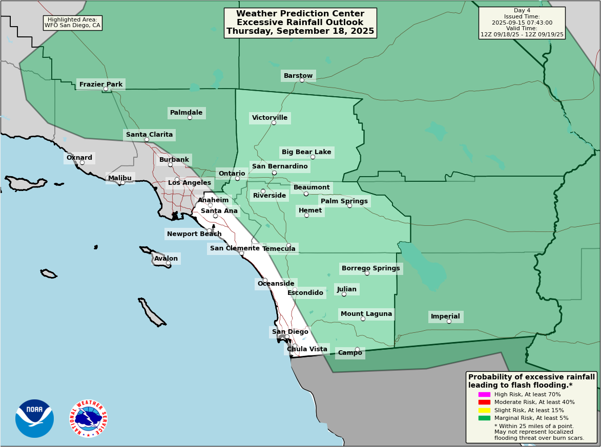
California rain
A slight risk of excessive rainfall and flash flooding is in place today for much of southern California’s mountains and deserts.
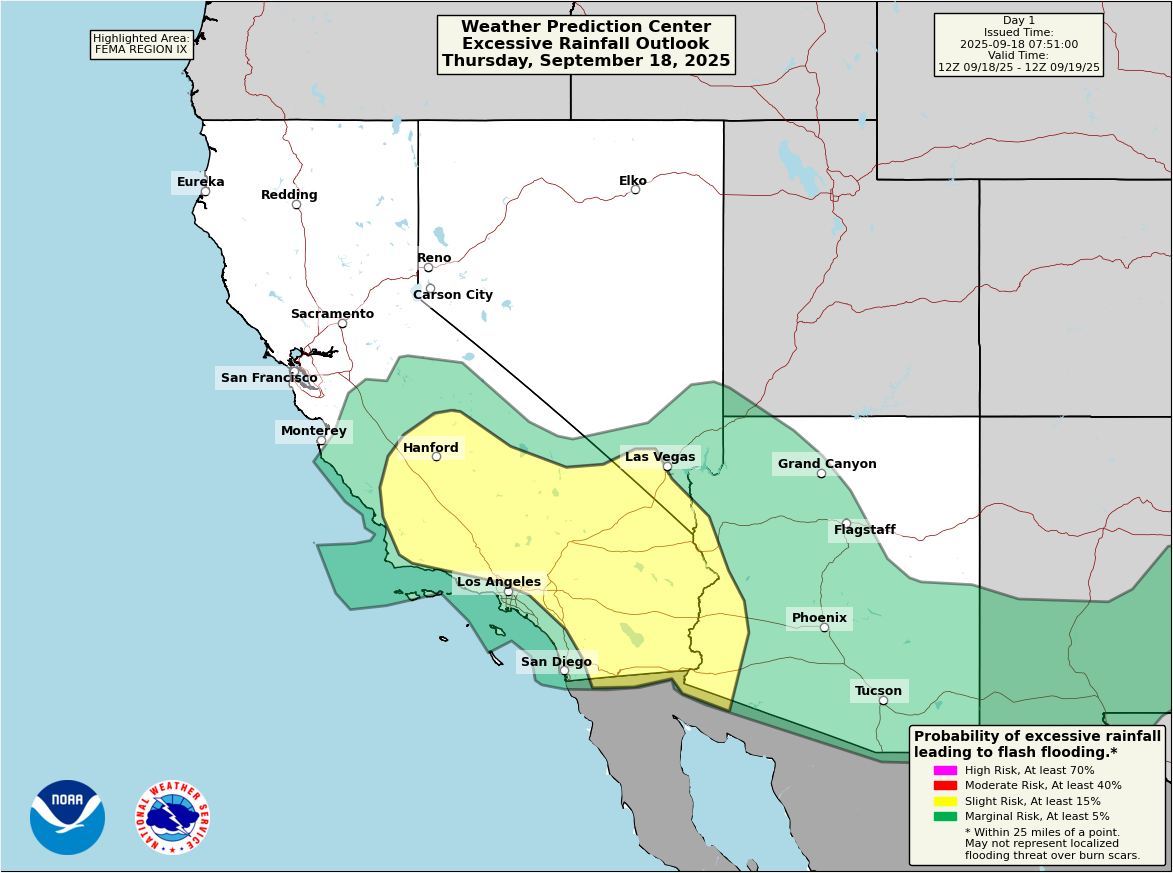
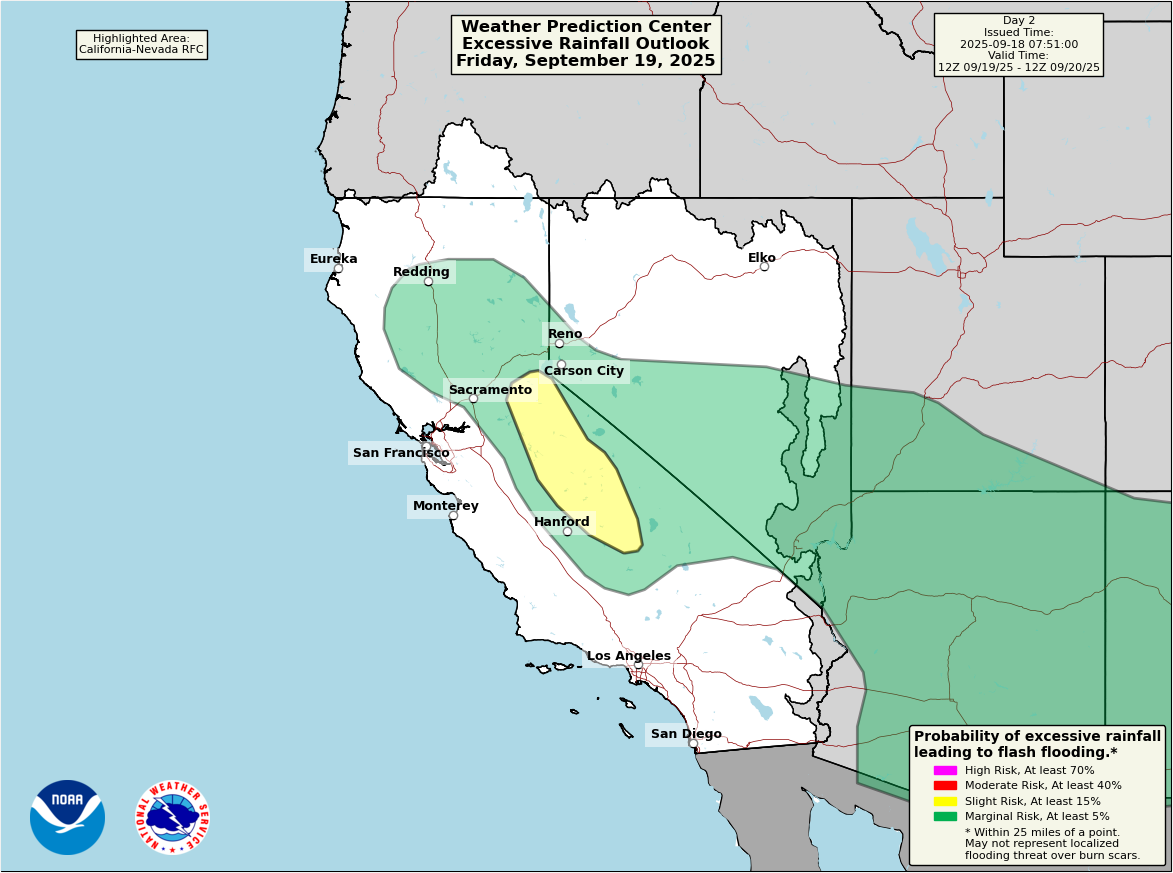
Flash flood watches are posted from Yuma, Arizona through Yosemite National Park. While any flooding risk today is more or less isolated in nature, there could be some healthy rainfall rates with any storm. We could see some places with a tenth of an inch or less, and others that pick up 1 to 2 inches of rain in short order with flooding. A good day to be weather aware across SoCal, particularly north of LA up into the Central Valley as well as between Los Angeles and Las Vegas or east of San Diego to Yuma. The slight risk (2/4) focuses more on the Sierra on Friday.
Another round of moisture increase could occur Sunday into early next week, bringing more rain chances to parts of California.