In brief: The tropical wave in the central Atlantic is becoming more likely to develop over the next few days as it moves west northwest across the Atlantic. No land concerns are expected right now. Meanwhile, Pacific Tropical Storm Mario is likely to spread thunderstorm chances across Southern California later this week. We also check in on the Dakotas which had a mini tornado outbreak on Sunday.
Atlantic tropical wave
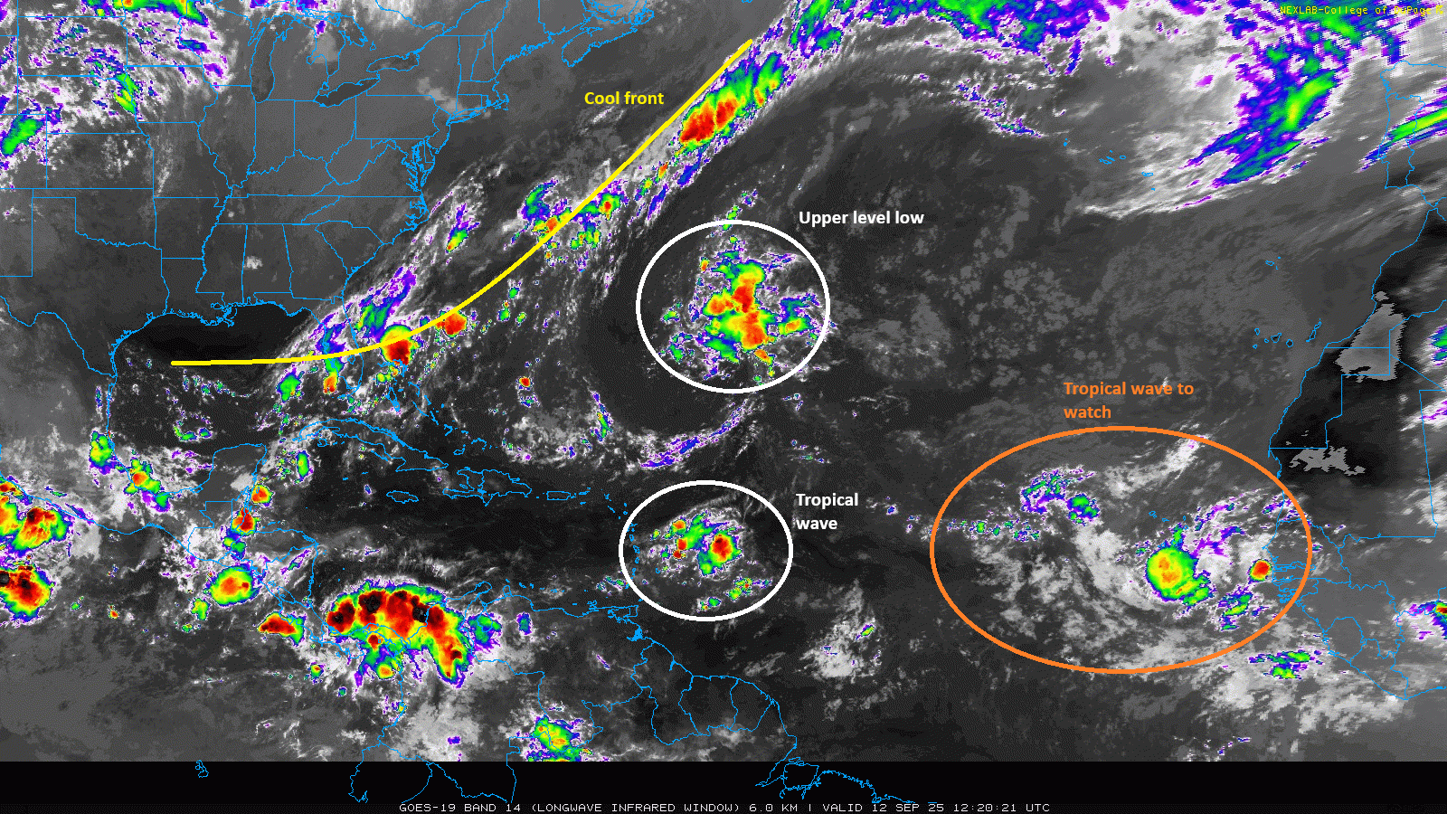
The wave we’ve been talking about since last week in the middle of the Atlantic looks pretty decent this morning. It’s certainly better looking than the previous wave we were tracking out there.

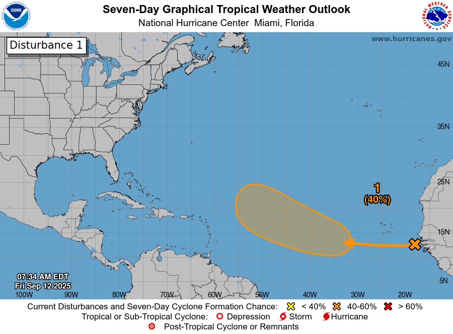
This wave now has 80 percent odds of development per the NHC, and I imagine this will get tagged as an Invest within the next day or so. Whereas the previous wave we tracked out here had high development odds and failed to make it, this one has much less of an “all or nothing” chance to develop. There is strong model agreement in some development by as early as Wednesday or Thursday (shown).
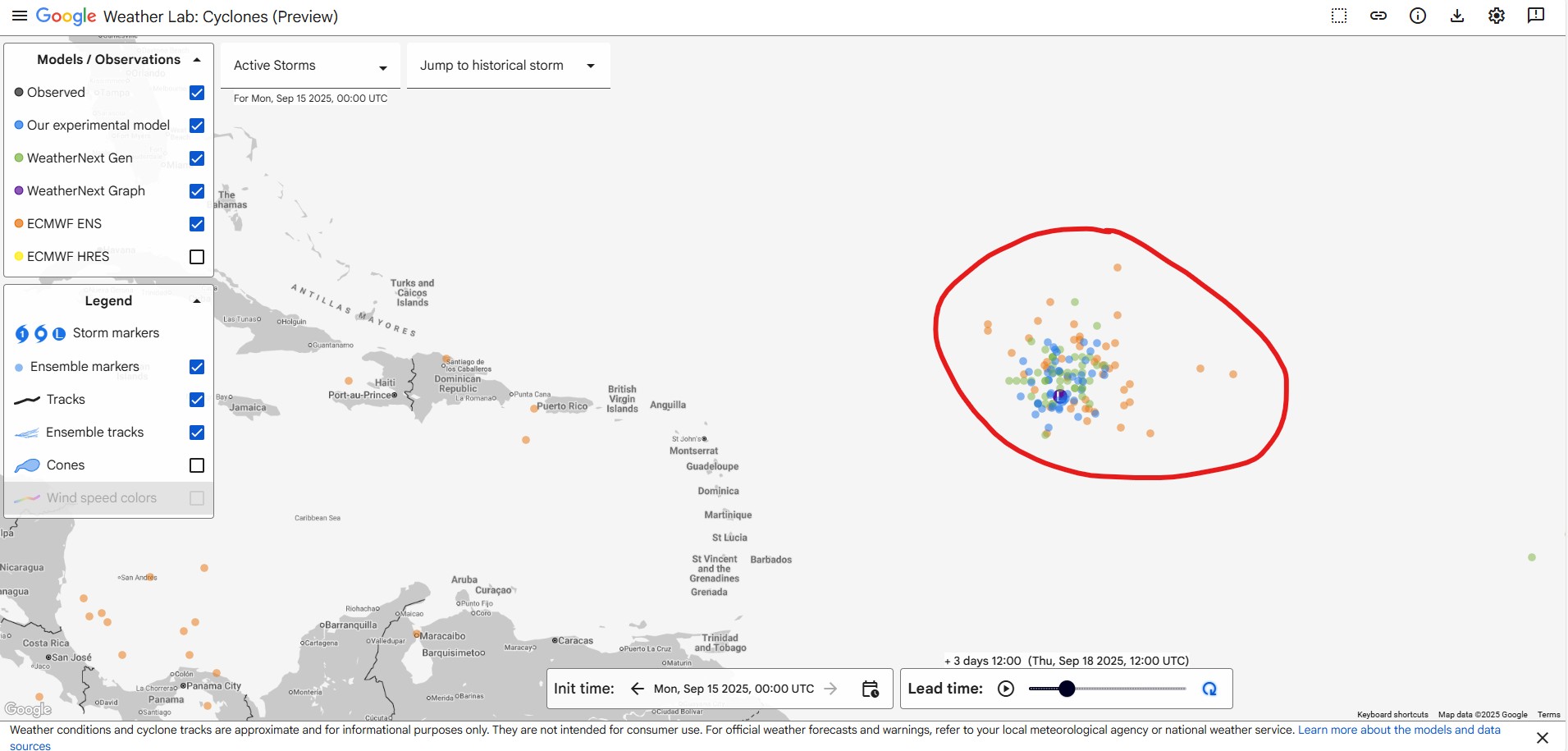
Notice that this system is already at a fairly moderate latitude by mid to late this week, and with it continuing west northwest, we should see this pass fairly well north of the Caribbean islands. From there, it seems as though it will either curve back north and northeast out to sea, or it will continue west northwest to the north of the islands, sort of in the fashion of Hurricane Erin earlier this season, particularly if it’s on the weaker end of the spectrum. The most likely outcome is some loosely organized storm turning out to sea. But for folks in Bermuda, it probably makes sense to keep a side eye on this one through the week, unlikely as it would be to impact the island.
Generally speaking, while this is the most interesting item we’ve had in what seems like weeks in the Atlantic, it’s thankfully not a serious land threat at this point.
What’s next in the Atlantic?
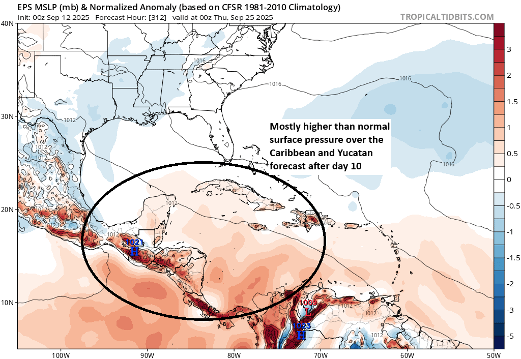
The background state of the Atlantic may revert back to hostile again after about September 20th, meaning that we’re probably going to continue to see systems struggling for the end of September. Probabilities for tropical development are not exactly strong looking outside of that one tropical disturbance in the middle of the Atlantic.
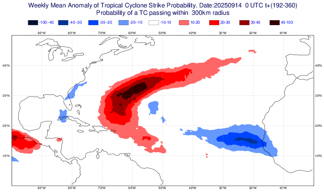
In fact, if anything, they’re below average off Africa and below average off the Southeast coast. I do suspect we’ll begin to see more noise in the southwest Gulf or western Caribbean, as is typical for late September and October, but aside from that, it’s becoming apparent that this is probably going to end up being one of the more subdued hurricane seasons in recent memory. Of course, one bad outcome in early to mid-October can change the whole perception, but we currently don’t see anything else out there.
Tropical Storm Mario

In the Pacific, Tropical Storm Mario was declared dissipated this weekend, but it turns out the princess was just in another castle. So, Mario is back to life.
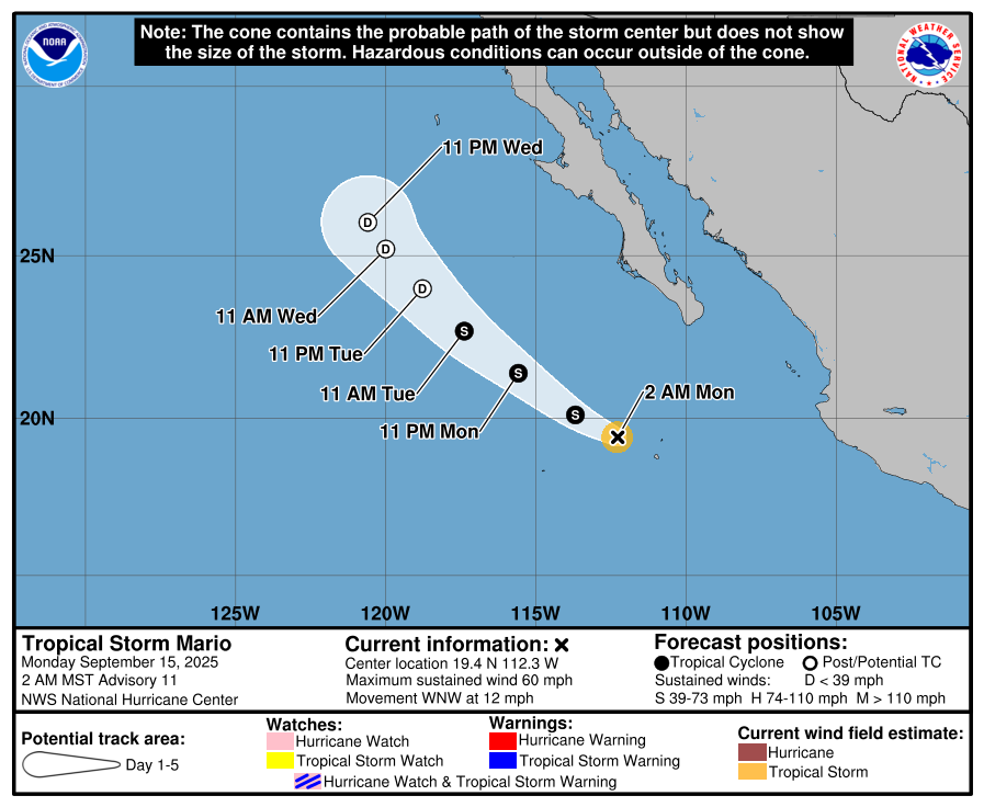
Mario should continue off to the northwest, eventually succumbing to King Koolpa, as sharply cooler water awaits it to the north.
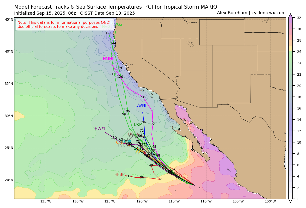
So why am I taking up virtual oxygen talking about a storm that will remain offshore and dissipate. Besides the ability to add Mario puns to the post, the moisture from Mario is going to play a role in the weather in California later this week, with showers and thunderstorms likely to infiltrate from the south, particularly in SoCal. In addition to the potential for locally heavy rainfall in Southern California, there could also be some isolated dry lightning issues with respect to fire starts in parts of the interior. The entire region is under a marginal (1/4) risk for locally heavy rainfall on Thursday.
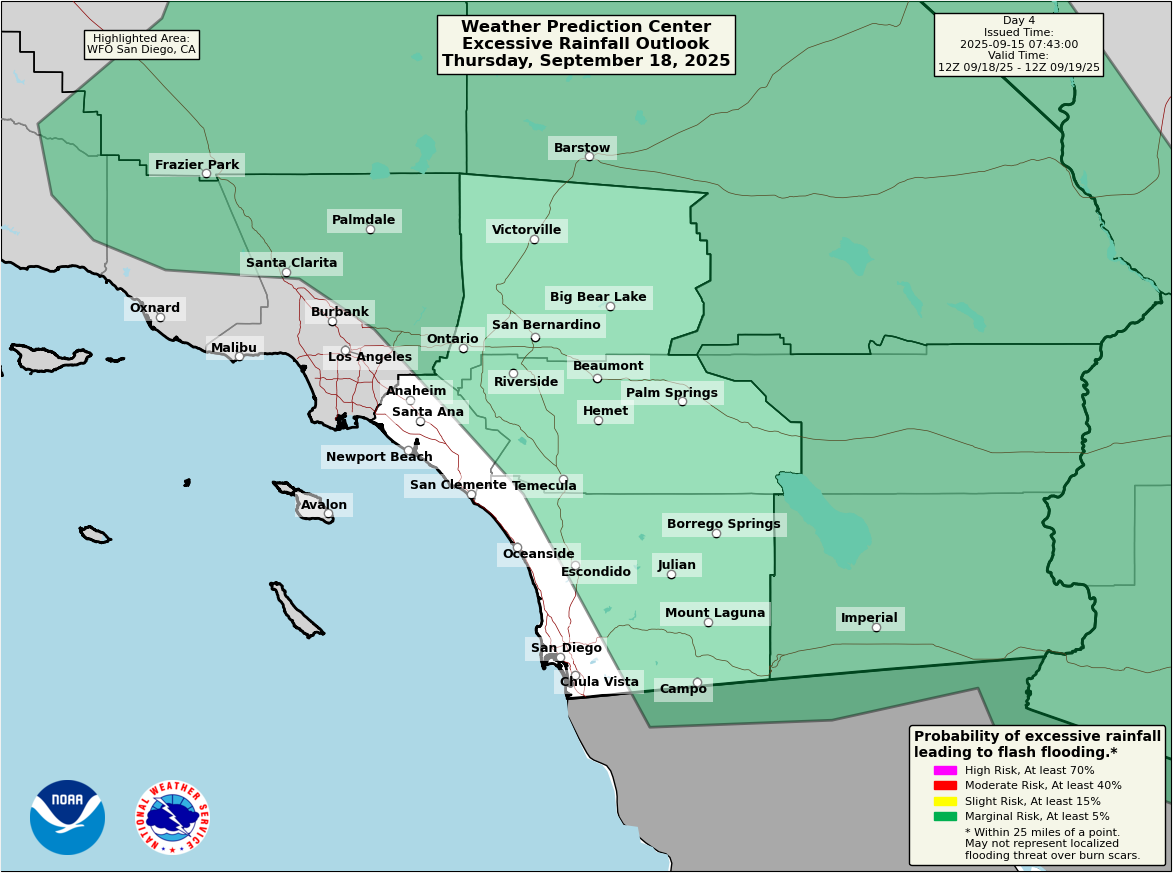
Rainfall amounts will be minimal in most places, but there will be areas that see a solid half-inch to 2 inches of rain, which could cause some flash flooding in spots.
North Dakota ‘naders
Quite a day yesterday in the Dakotas. Historically, not a tornado-prone location in September (there have been only one or two historical noted reports of tornadoes in this corridor of the Dakotas since at least 1950 in September), there were nearly 20 reports of tornadoes on Sunday from at least 4 tornadoes. Reports ranged from near Mobridge, SD through Bowman, ND, Golden Valley County, and Hettinger, ND.
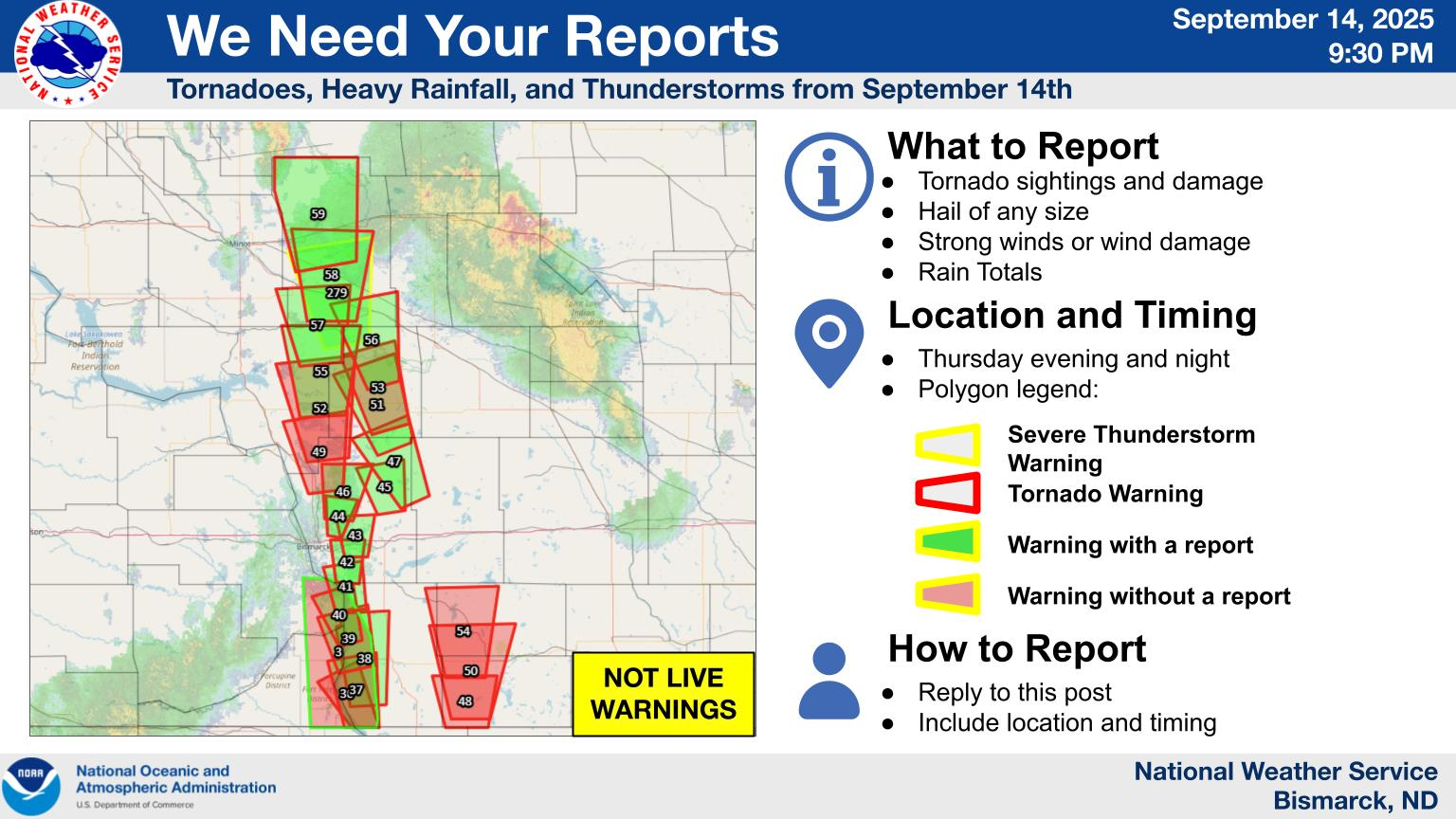
The National Weather Service office in Bismarck is looking for reports from yesterday across the corridor in northwest South Dakota and western North Dakota. Certainly, there were a number of chasers on these storms. But overall, this was a bit of an impressive, somewhat surprising September event this far north.