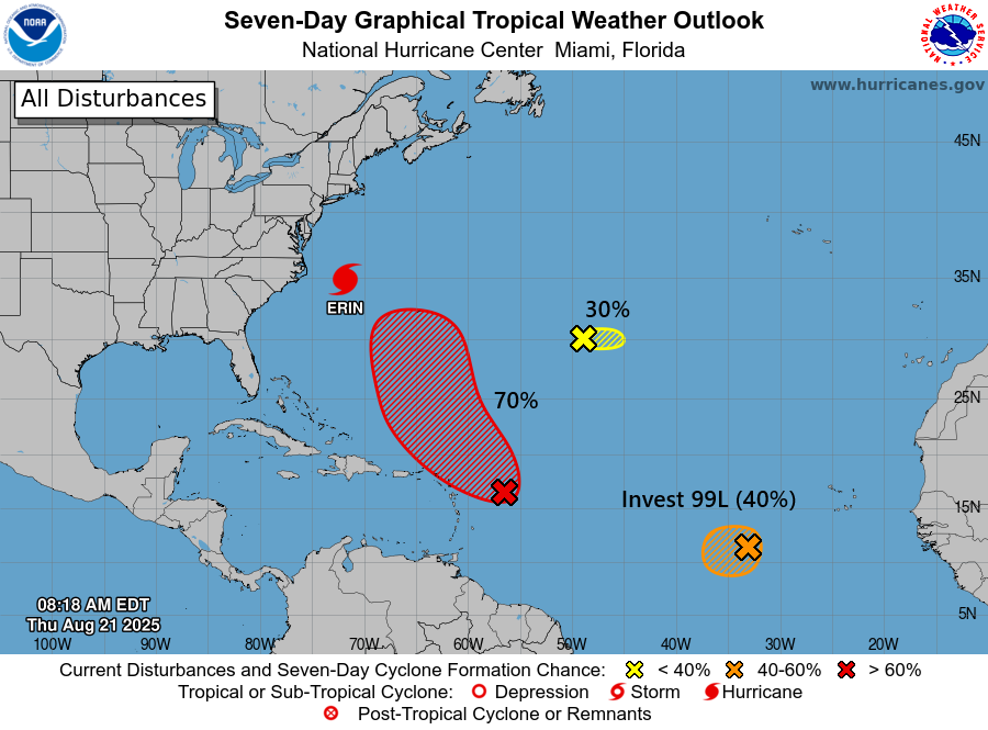
In brief: Hurricane Erin has transitioned to post-tropical, but it will still churn up waves, tidal flooding, and rip currents from the Mid-Atlantic into Atlantic Canada. An enhanced wildfire risk exists today and tomorrow from Maine into Atlantic Canada as well. Invest 99L is nothing to worry about. Invest 90L may broadbrush Bermuda tomorrow or early Monday as a tropical storm. But the tropics may be going into a calm period for a week or two after these systems.
Current state of the tropics
Let’s walk through our systems in the Atlantic to start today.
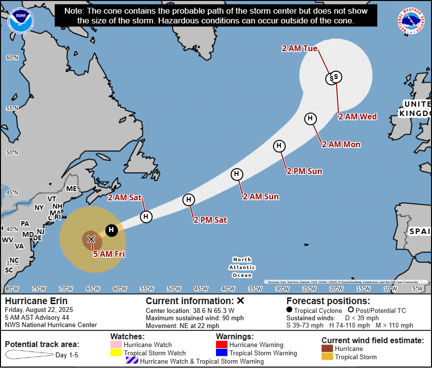
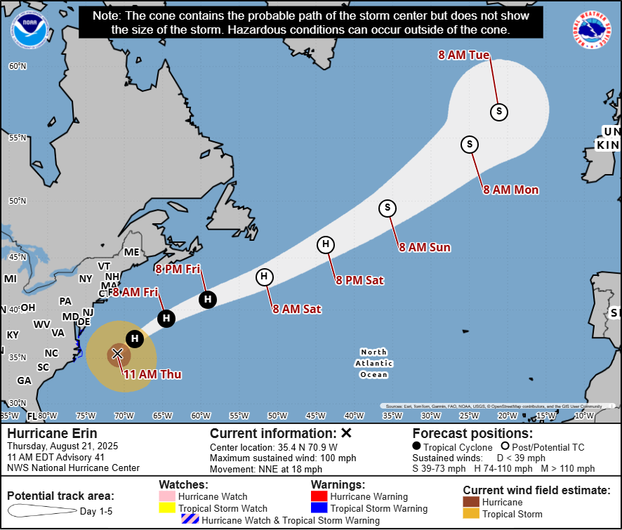
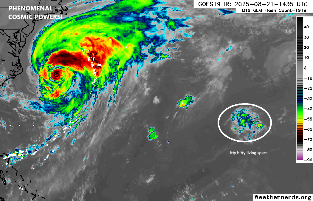
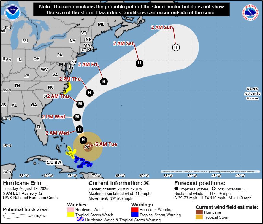
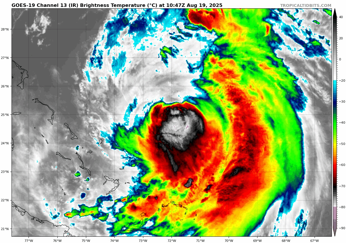
Hurricane Erin (post-tropical)
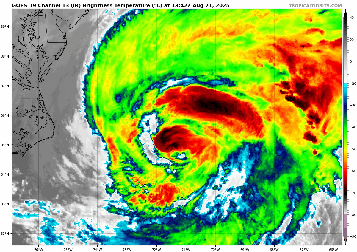
Erin has been deemed non-tropical now and would be considered an extratropical storm or post-tropical. The Canadian Hurricane Centre is still issuing forecast maps for Erin.
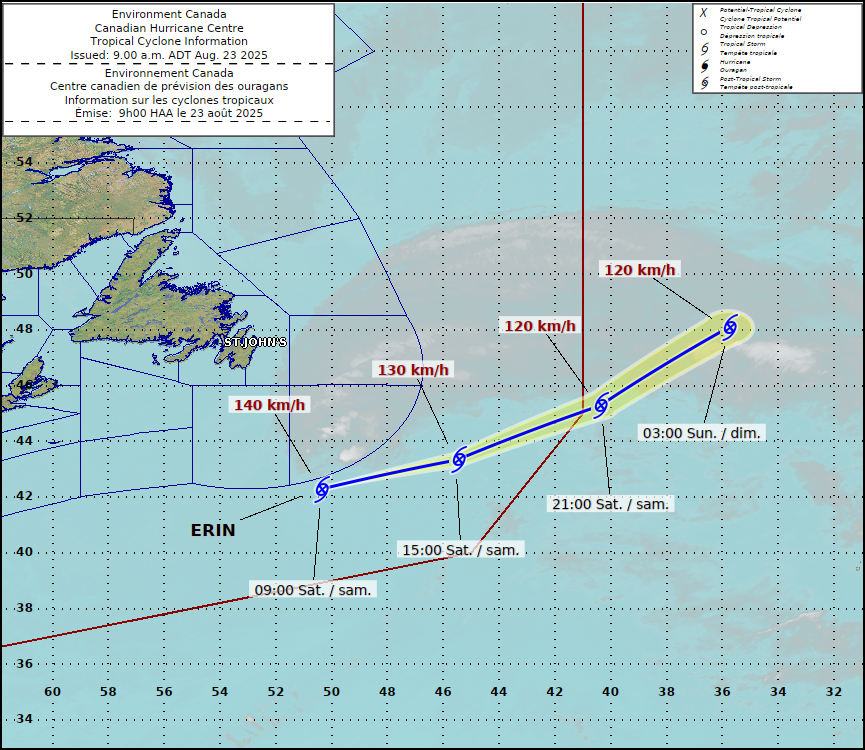
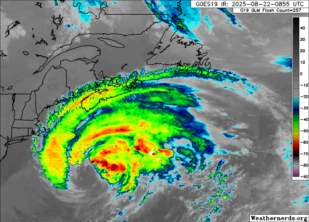
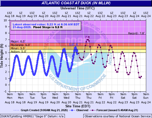
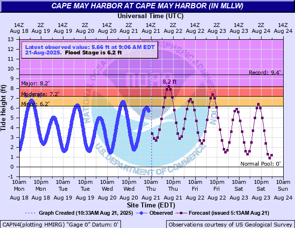
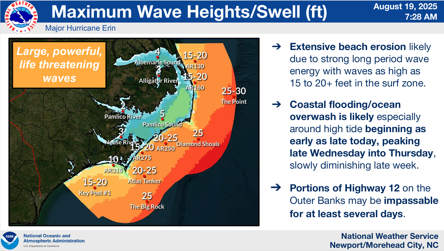
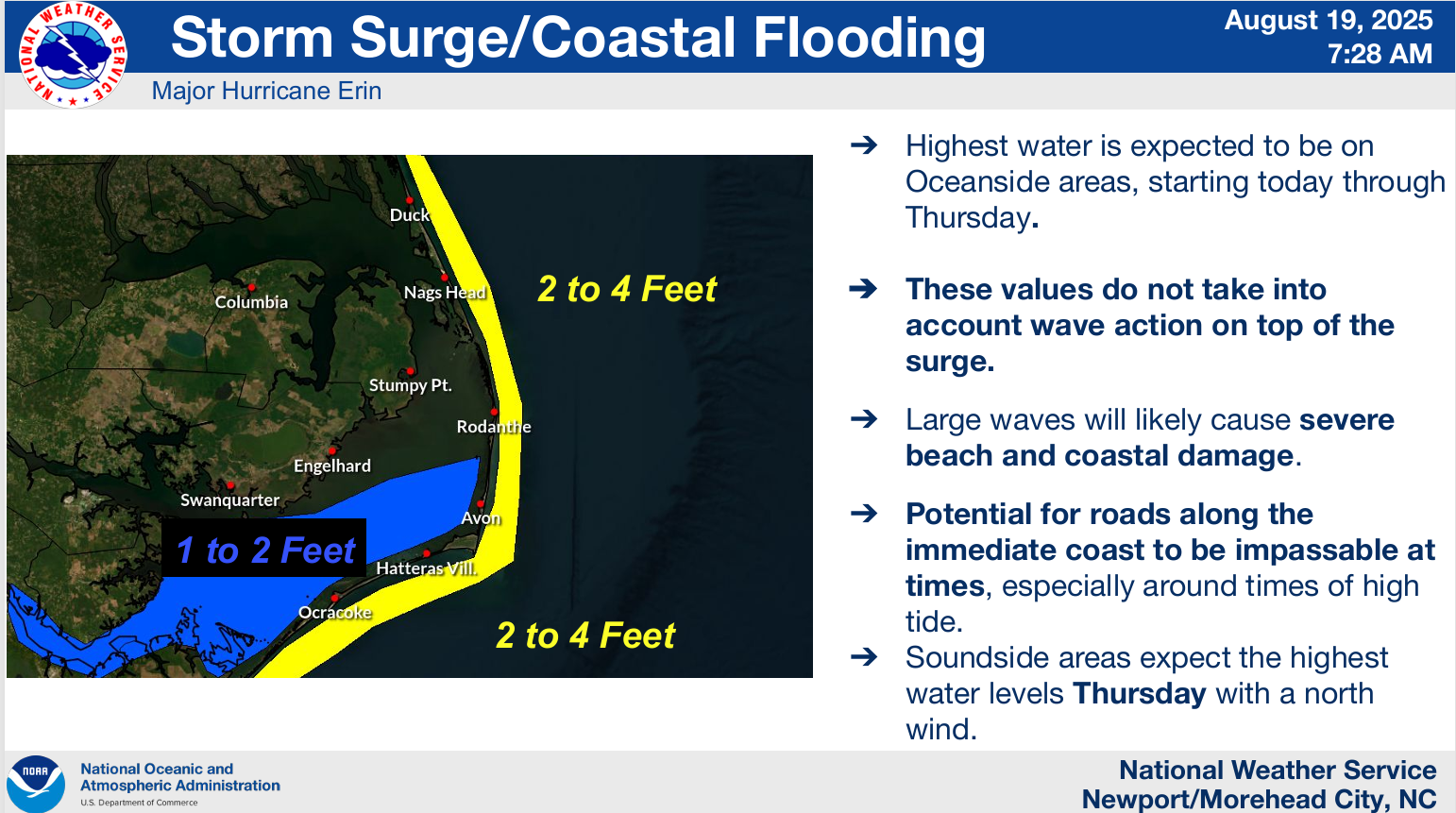
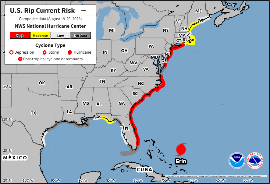
Erin is accelerating out to sea now, passing well south of Newfoundland. Erin still has maximum sustained winds around 80 to 90 mph, however as it plows east-northeast. Again, post-tropical does not mean non-hazardous! Large waves will continue to generate outward from Erin, pounding the coast of Atlantic Canada, particularly along the south-facing coast of Newfoundland. High tides and tidal flooding are expected to continue from the Mid-Atlantic into New England as well, though those conditions will ease up some relative to where they were a day or so ago.
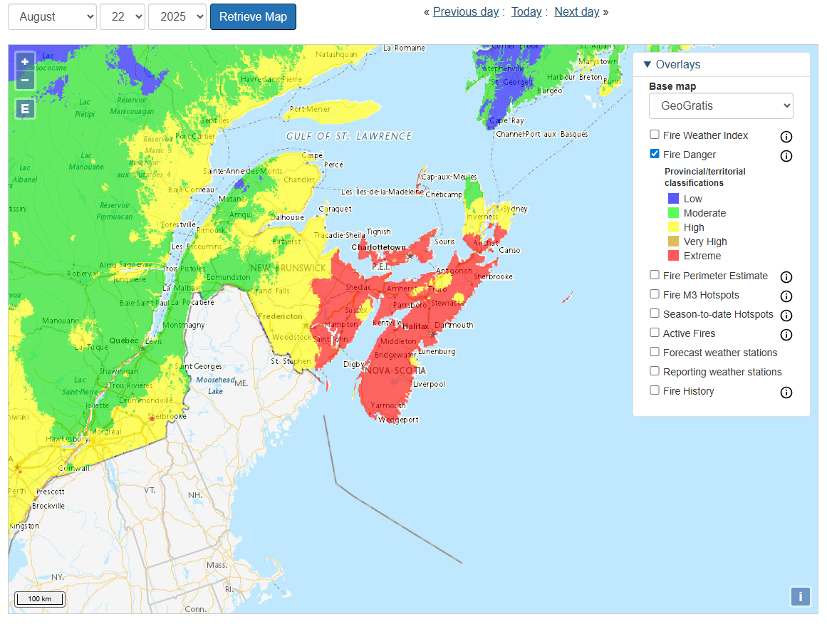
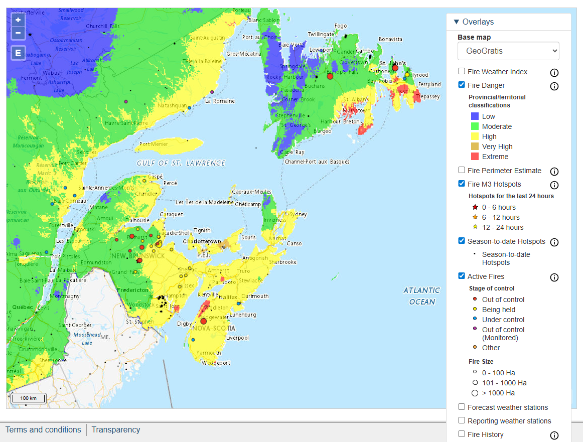
Wildfire risk remains high in Atlantic Canada today and tomorrow, with “extreme” risk for Nova Scotia, New Brunswick, and PEI today and tomorrow. While this is not directly related to Erin, the slightly breezier conditions from the storm and drier air in spots will not help matters should a fire start occur.
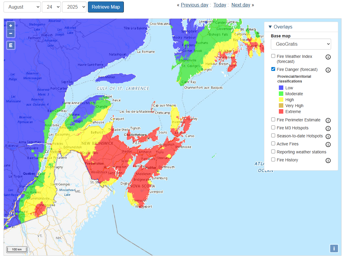
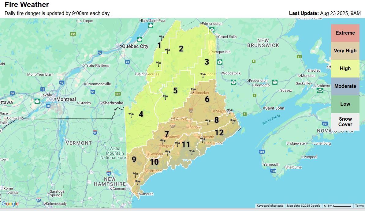
For Maine, the risk of wildfire is not considered high by the Storm Prediction Center, so this highlights a bit of a discontinuity between how the U.S. and Canada assess fire risks. That being said, the State of Maine has highlighted Downeast and some other parts of the state for a “very high” wildfire risk today.
Either way, conditions will gradually improve after tomorrow with some rain chances possibly returning to Maine on Monday and Atlantic Canada on Monday and Tuesday.
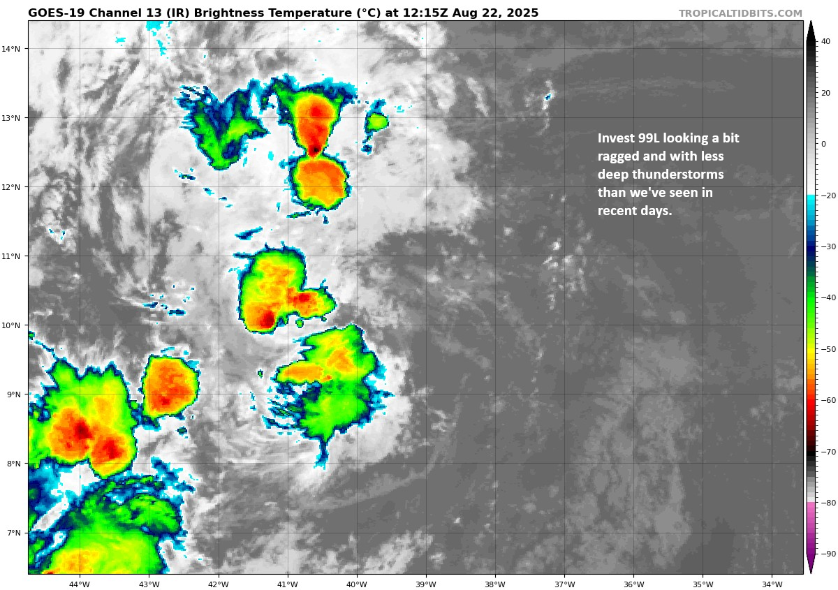
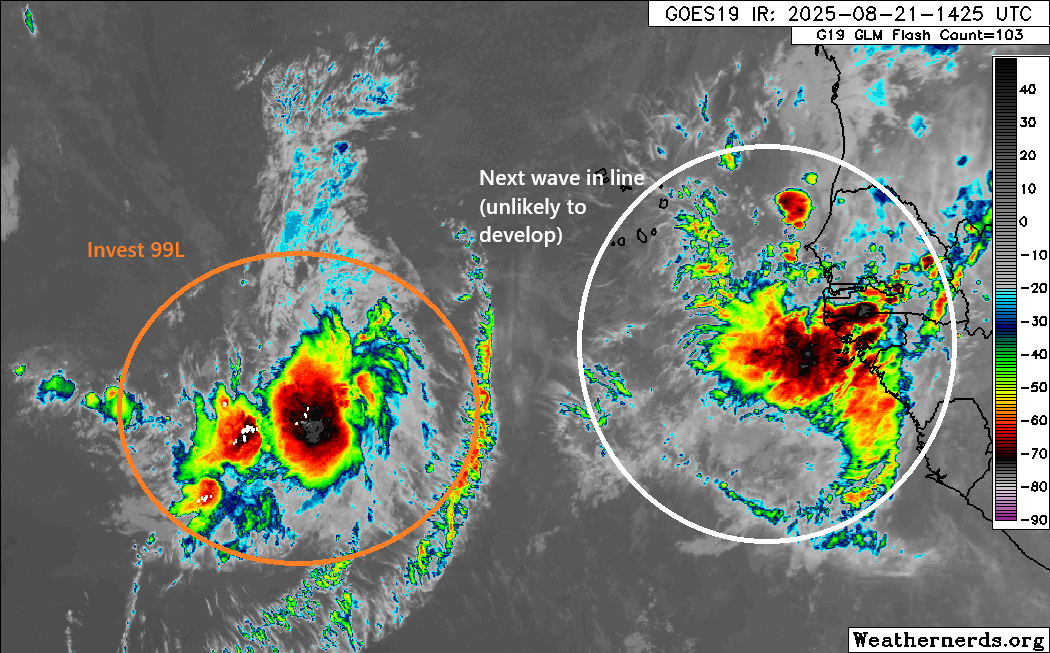
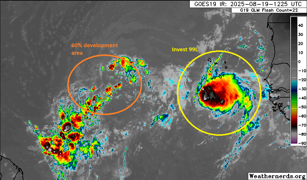
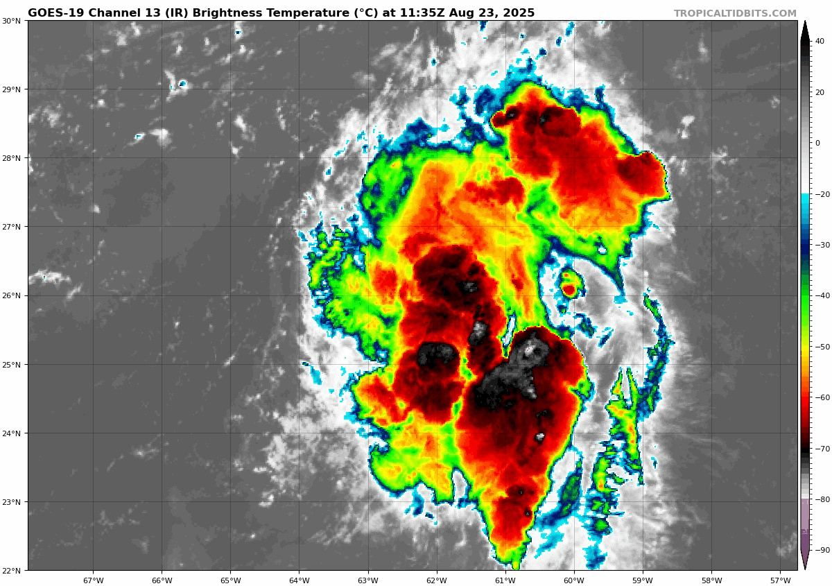
Invest 99L east of the Islands
Well, Invest 99L has not changed a whole lot since yesterday, meaning it’s still got thunderstorms but it has little to no organization.
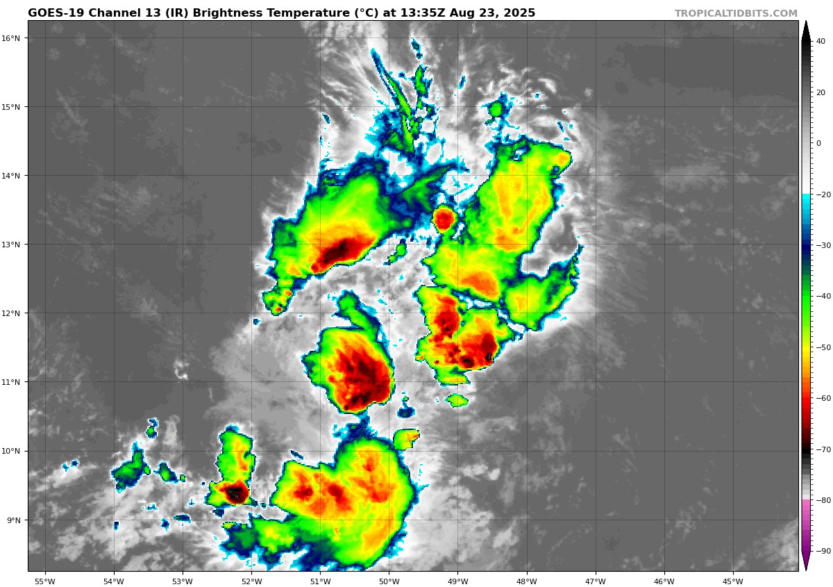
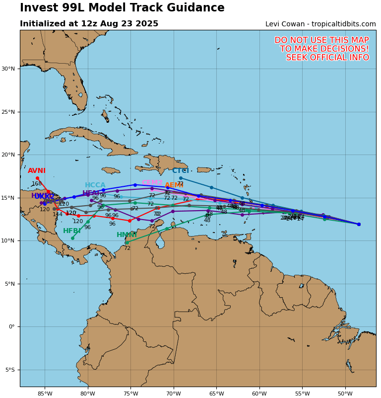
This disturbance is running through the gauntlet of significant wind shear at the moment, so you can forget any development today or tomorrow. The system will continue to book it westward into the Caribbean by Sunday night or Monday, bringing some locally heavy rain and thunderstorms to the Windward Islands in particular. This disturbance is pretty far south. In fact, of the August and September cases of a tropical depression moving through this area, almost all end up in Central America. Based on the model forecast tracks of this one, I would suspect 99L never develops and tracks straight into Central America between Belize and Nicaragua as a locally heavy rain producer.
That said, we’ll keep an eye on it just in case, but right now I don’t foresee this one becoming a problem.
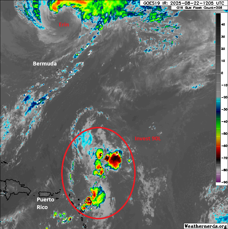
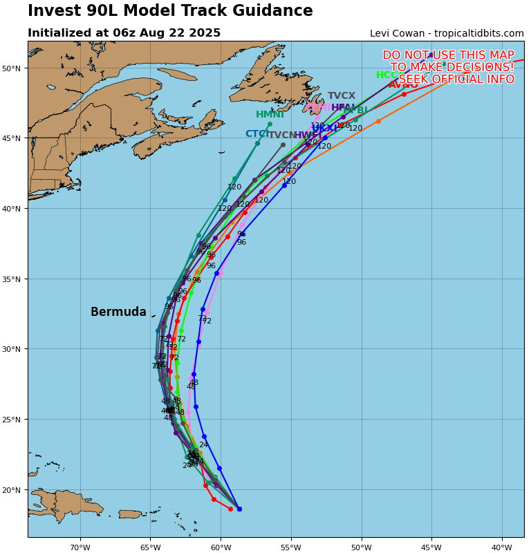
Invest 90L south of Bermuda
The system south of Bermuda that’s designated as Invest 90L is a little more interesting than the other items on the map. In fact, the National Hurricane Center gives 90L a 100 percent chance of developing this weekend. Basically, expect our next tropical depression before the end of today.
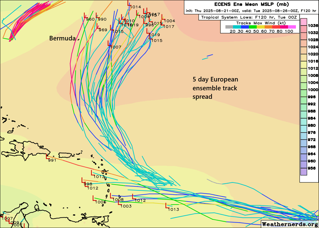
The disturbance is moving northward, and that motion should continue over the next several days. This should keep the center of the system about 200 to 300 miles east of Bermuda at its closest pass on Sunday night. Impacts would probably be limited to rough seas and some gusty winds. From there, this system will track north before merging onto the same highway Erin is taking to exit off to the east-northeast and out to sea. Look for this one to get on that highway by Monday night or Tuesday. Invest 90L will be a quick one to exit the pipeline. The next name on the list is Fernand.
Looking ahead in the tropics
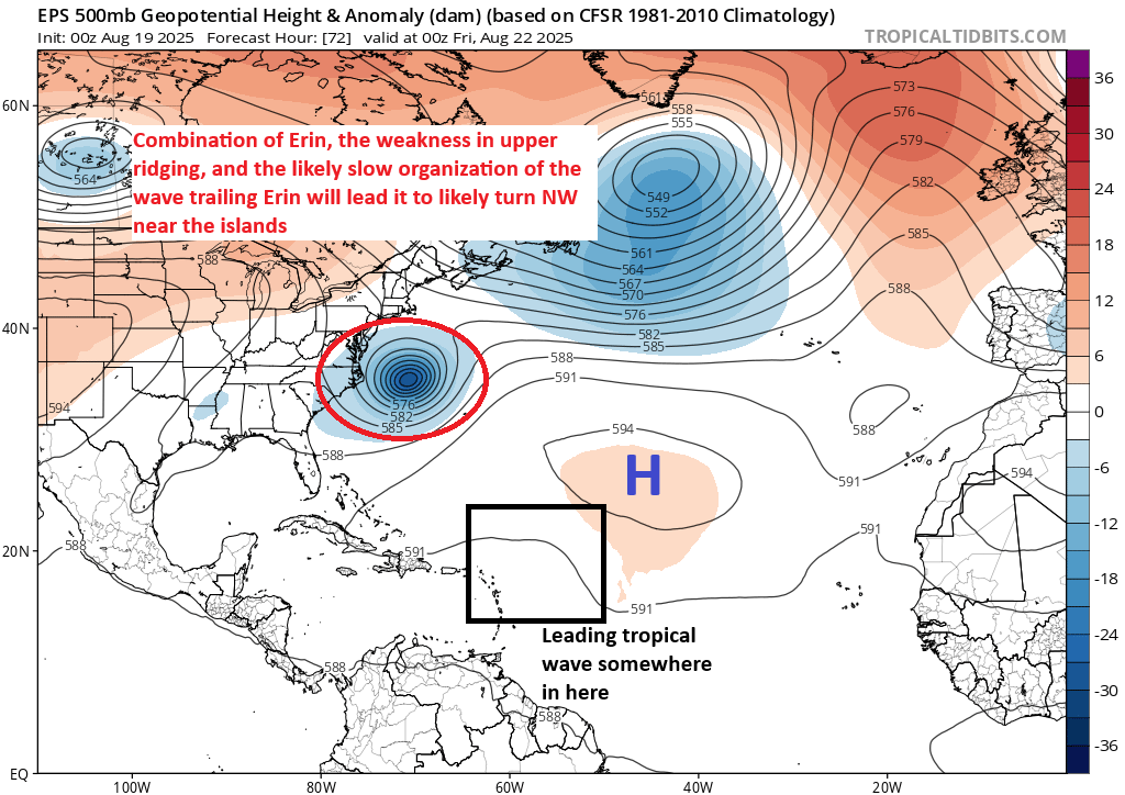
So, we’ve been talking about the above systems all week, and in some cases longer than that. What comes next? I…honestly don’t know. There may be some marginal support for a wave to come off Africa next weekend, but the models are not particularly bulled up on this one right now. I suppose low pressure could form along a cold front off the Carolina coast next week; that’s a common pathway to development, but there isn’t exactly significant model support for that right now either.
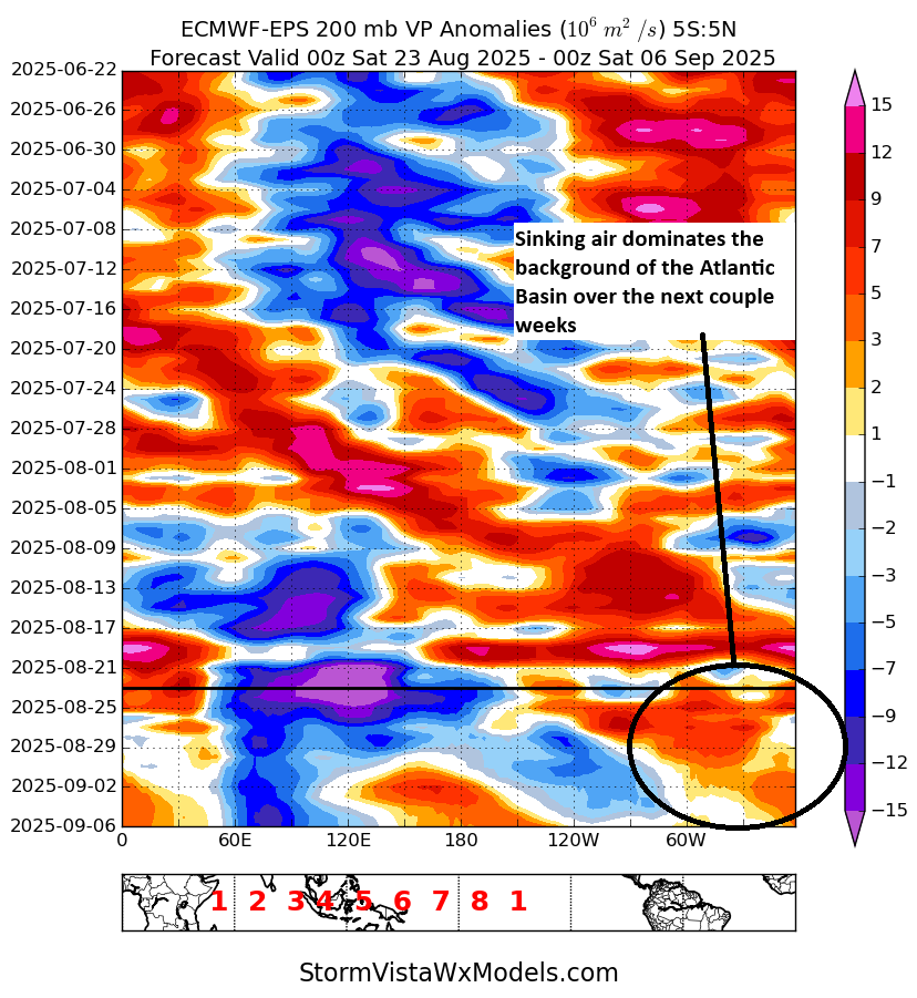
There are two important signals right now in model guidance. Above, I have a plot showing rising air (blue/purple) and sinking air (warmer colors) in the background of the atmosphere. This is called a Hovmoller plot. Where there is rising air, in general, that’s supportive of thunderstorms in the tropical latitudes. Where there is sinking air, that is not conducive to thunderstorms in the tropical latitudes. While this doesn’t exactly tell you everything, it indicates that the Atlantic is likely going to be fighting an uphill battle over the next 2 weeks, trying to shrug off a background state that leans it more toward subsidence, or sinking air. This likely suggests below average activity, especially given that this is occurring in two of the most active weeks of hurricane season historically.
The ECMWF model backs this up, as it shows the entire Atlantic basin with below average activity forecast in the first week of September (Sept 1-8).
What should you take away from this? We have a long way to go in hurricane season, but the next two weeks, some of the most active historically, may see a well-timed relaxation in the Atlantic.
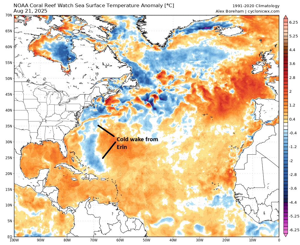
Of course, a quiet period will eliminate most of the benefits of Hurricane Erin’s cold wake from all the water it stirred up. Across the Atlantic water temperatures are warmer than normal but generally well short of records set in 2023 and 2024, with one exception, the Gulf, especially the eastern Gulf. Gulf water temperatures are near the top of the charts historically right now, and if and when activity does get back to normal, we’ll hopefully see the Gulf avoid things. For now, we have a nice stretch of time to not worry, which is always welcome in August and September.