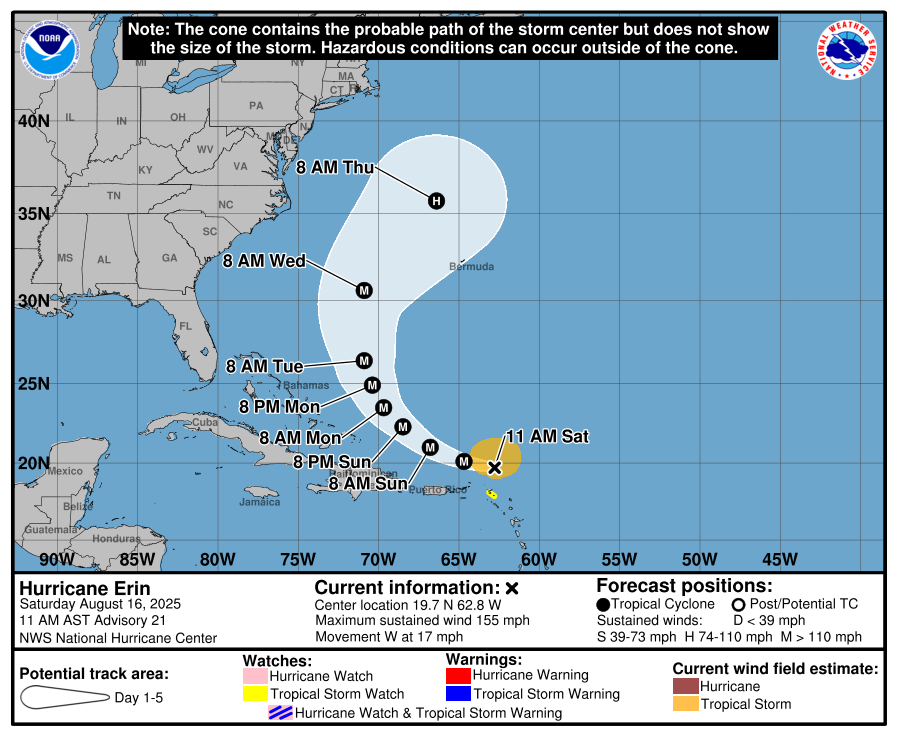
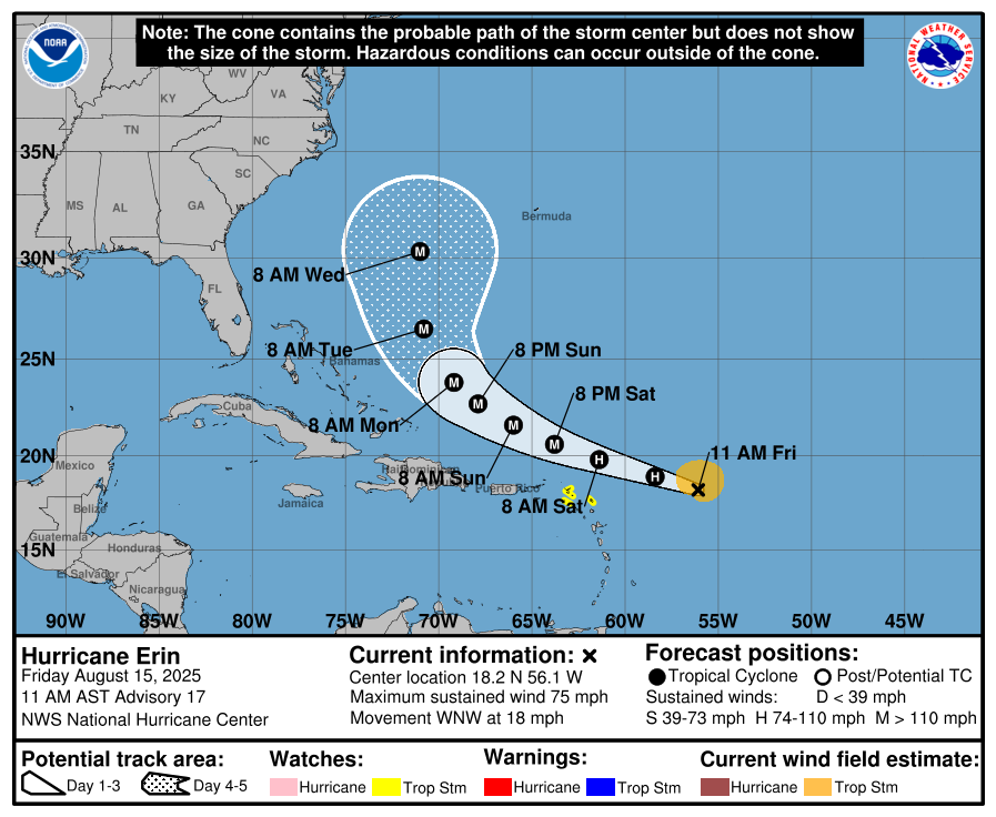
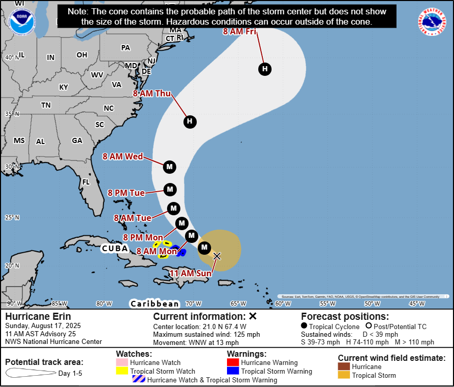
In brief: Erin is weaker but larger today. As the wind field continues to expand and Erin reintensifies, look for significant impacts on the East Coast from rip currents and rough surf. Near term tropical storm impacts will affect the southeast Bahamas and Turks and Caicos Islands. Fringe impacts remain possible later this week for the Outer Banks, Bermuda, and Newfoundland.
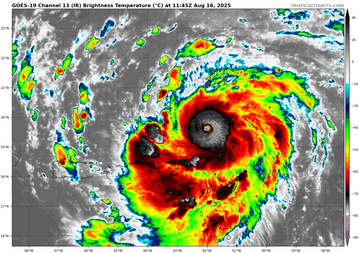
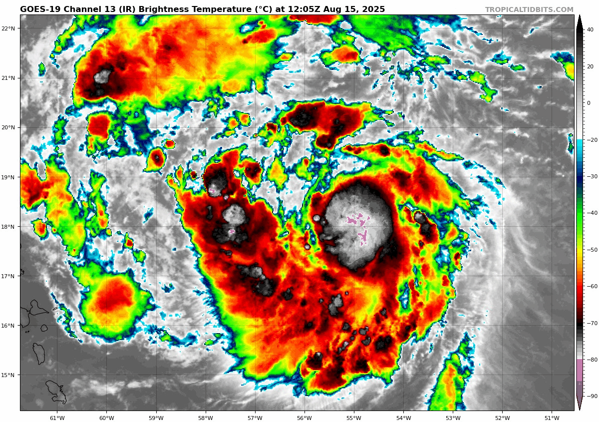
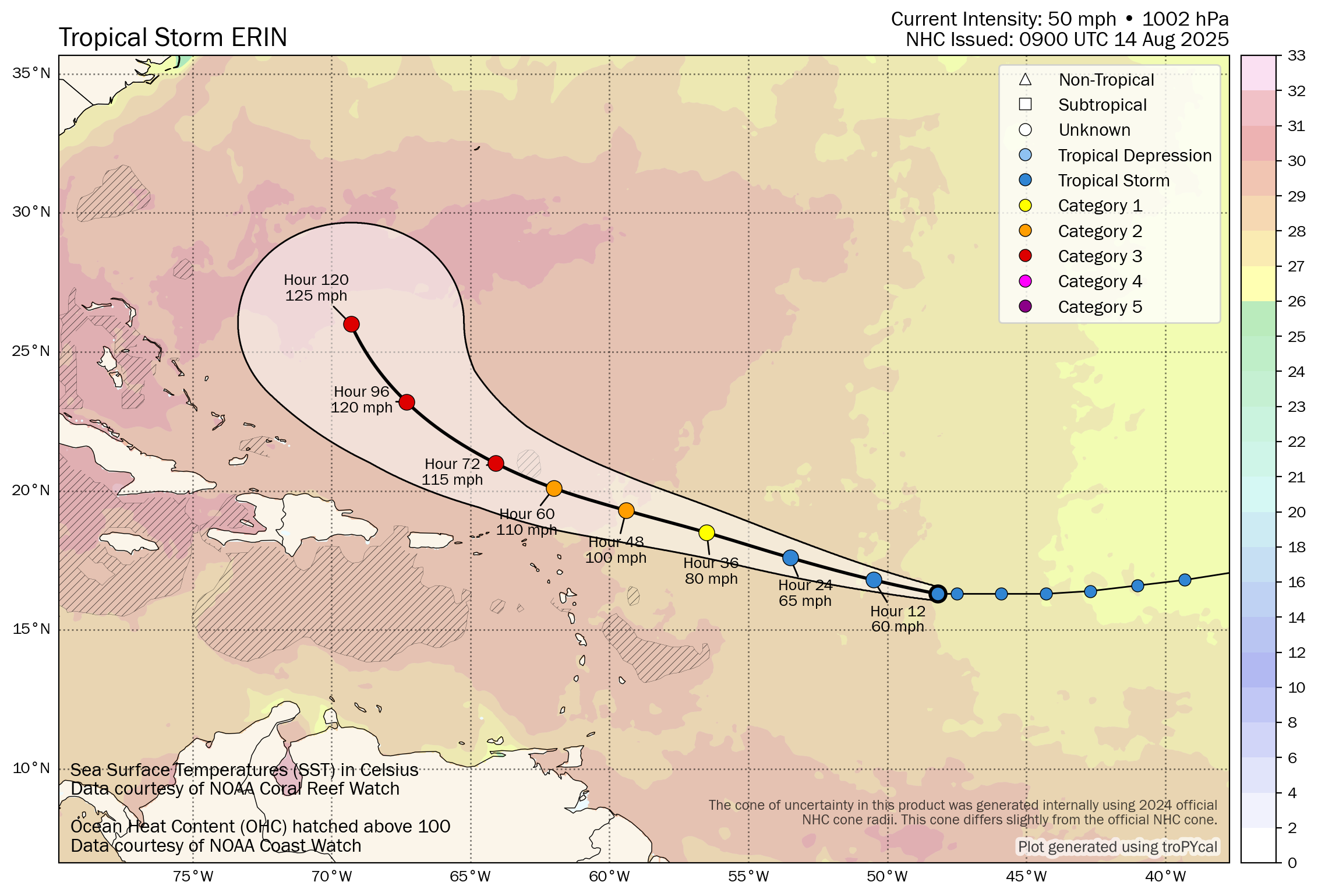
Erin underwent an eyewall replacement cycle (ERC) overnight. An ERC is essentially a way for a storm to press the reset button while it’s at a powerful intensity. A new eyewall forms on the outside of the original eyewall, allowing the storm to expand in size. The trade-off is that when an ERC occurs, the storm loses intensity. Then, typically it will begin to reintensify. In Erin’s case, it weakened from a category 5 to a category 3 storm this morning, and now it should undergo another round of intensification.
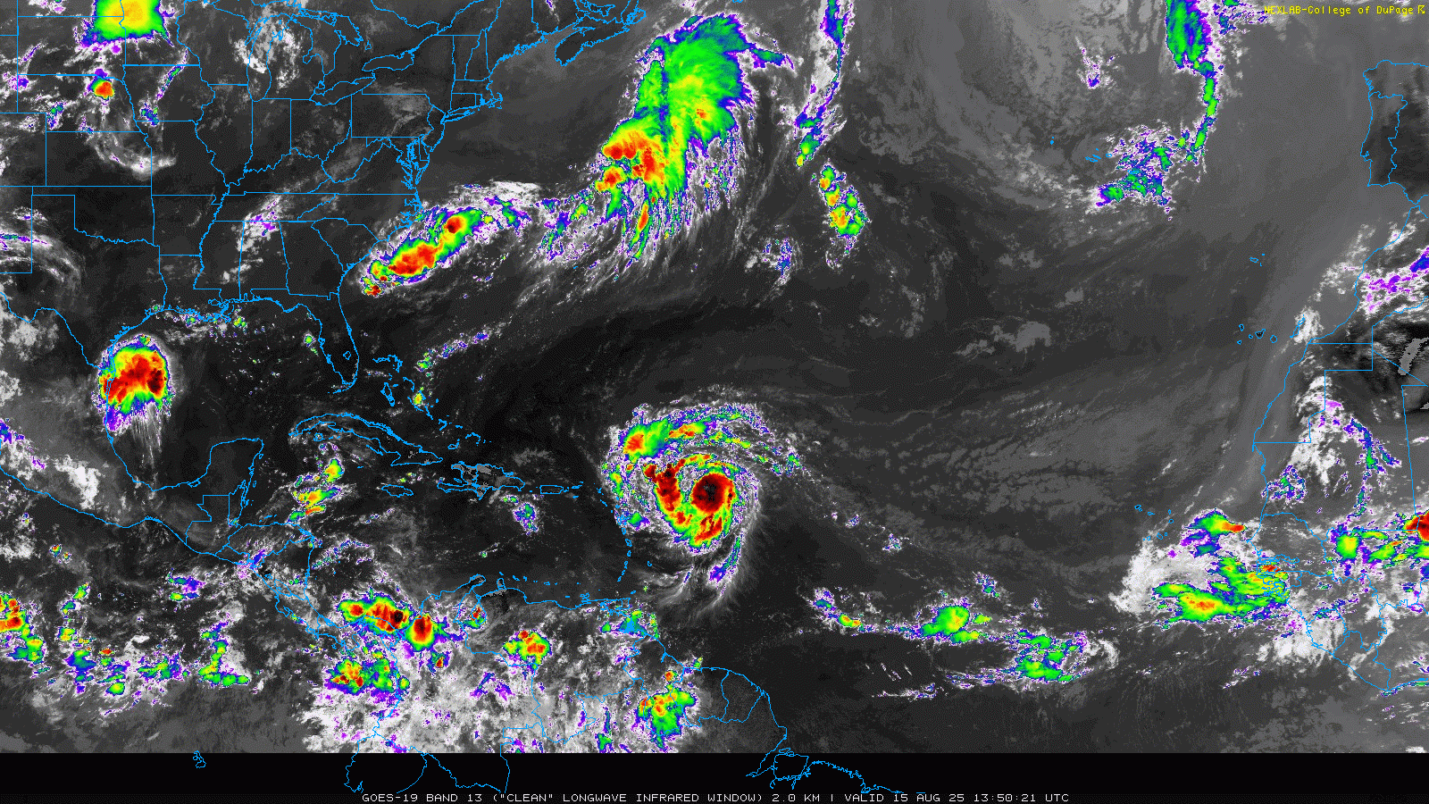
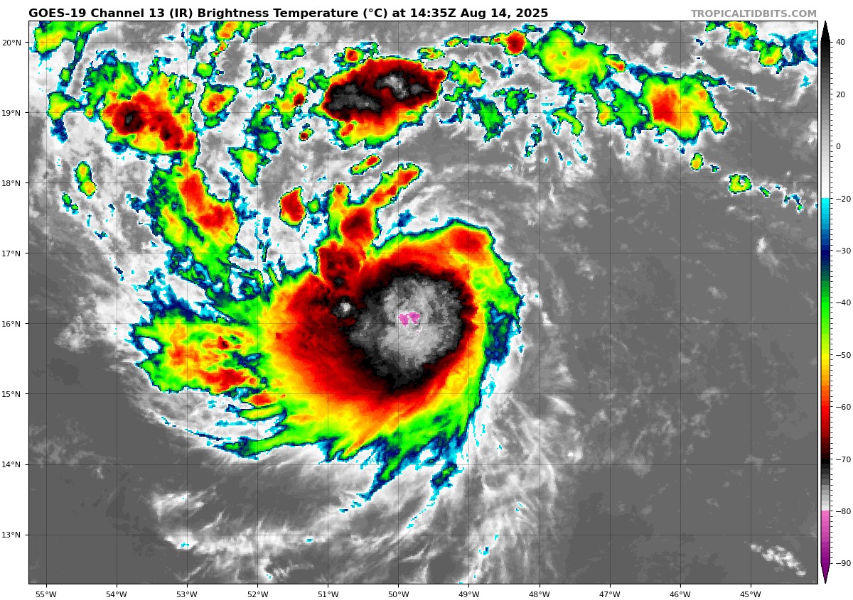
If you look at the satellite imagery above, you’ll see Erin pretty clearly near the Caribbean islands. You can see how ragged it looked on Friday morning, how potent it looked on Saturday morning, with a very, very clear eye. But if you look close enough, you can see how it expanded in size today. Erin’s tropical storm-force wind field has expanded markedly since yesterday. It went from a 125 mile radius yesterday to 205 miles today. Hurricane-force winds remain relatively tightly wound to the center, only extending out 25 miles. The ERC will most often expand the tropical storm wind field, making the storm a bigger surge and wave maker than anything else. Whatever the case, expect Erin to remain a major hurricane the next 2 to 3 days with winds fluctuating between category 3 and 4 intensities. More importantly, Erin could continue to slowly grow in size.
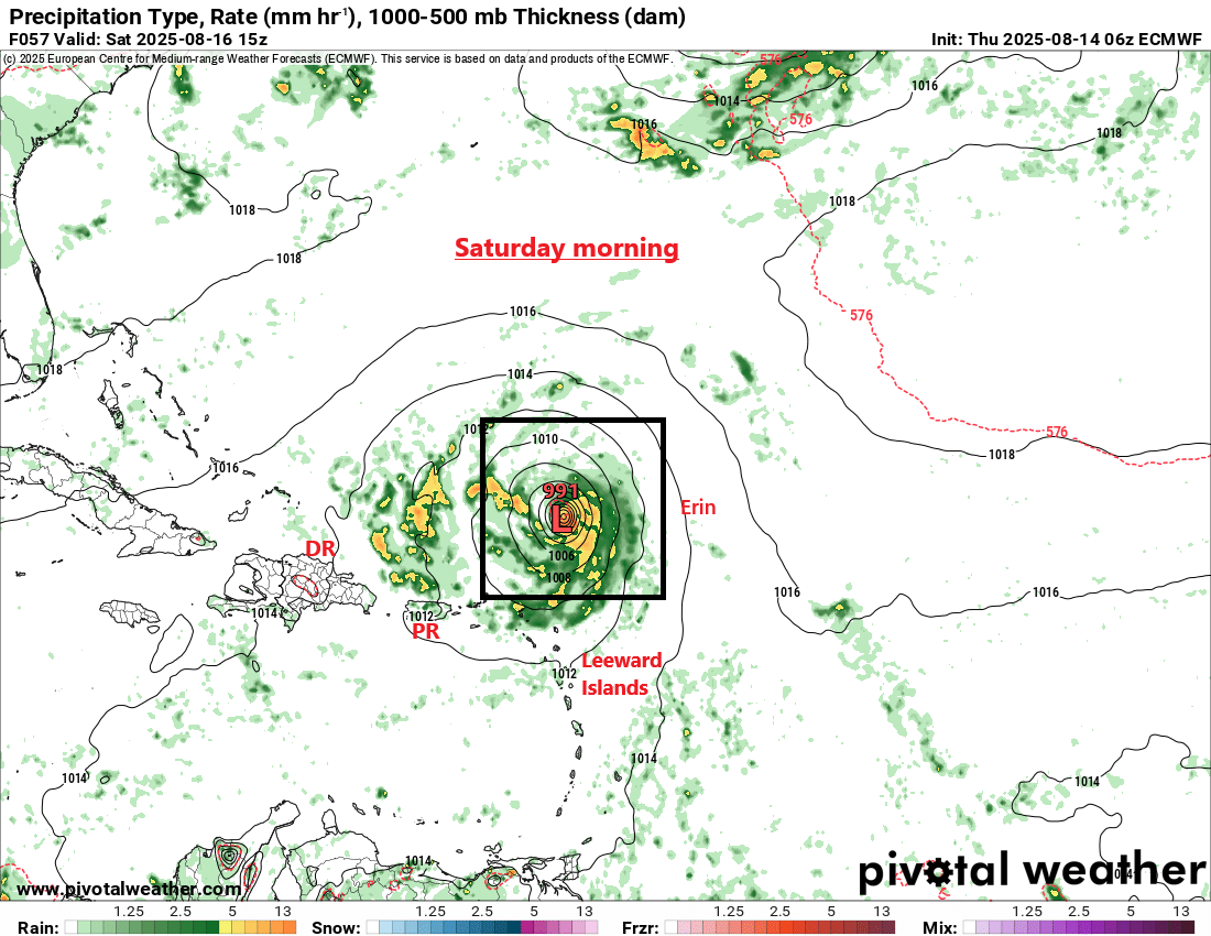
Track is becoming a little more important to potential outcomes for various locations. Starting in the near-term, the Bahamas and Turks and Caicos Islands are likely to experience tropical storm conditions today and tonight. Tropical Storm Warnings are posted for the Turks and Caicos, and a Watch is posted in the southeast Bahamas. That could get upgraded to a warning before too long. Heavy rain and gusty winds in those outer bands, much like we’ve seen in Puerto Rico since yesterday will be possible.
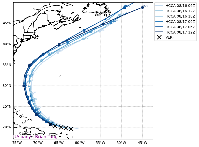
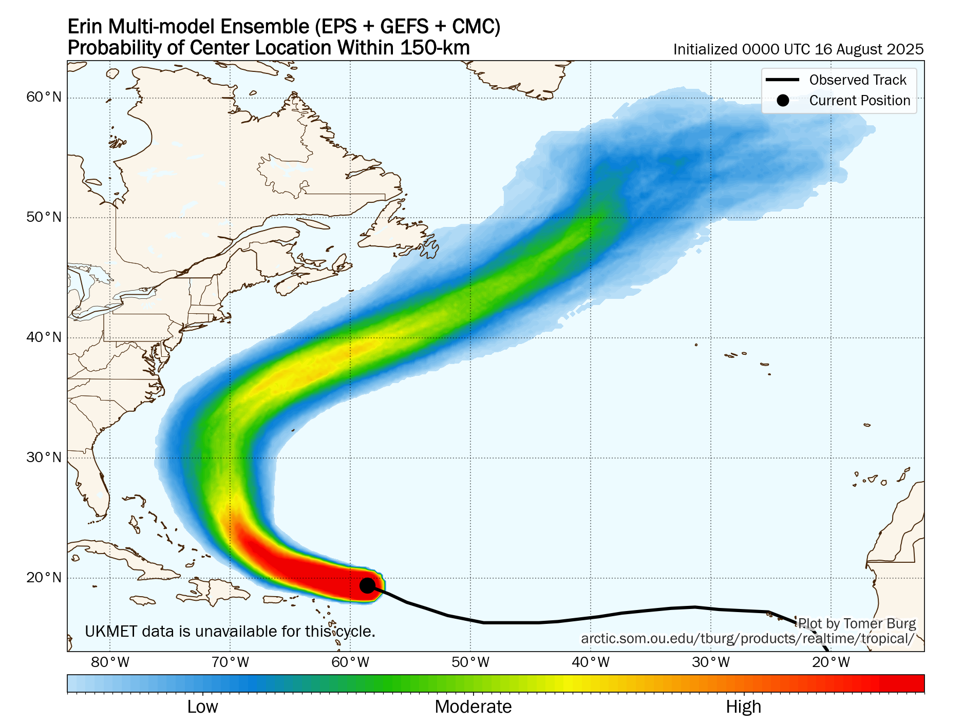
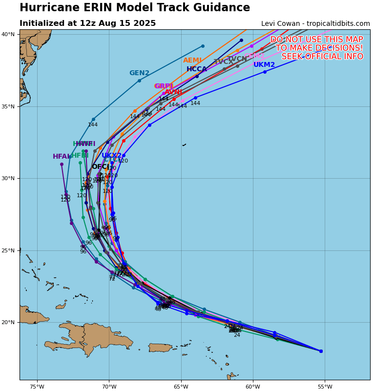
The consensus track from the top performing models has been correcting south and west really since Erin formed, but also over the last day and a half or so too. This adjustment is leading to some slightly increased concerns for the Outer Banks of North Carolina in particular but also perhaps Atlantic Canada, particularly Newfoundland. First off, you can see how the wave forecast will go this week. Large waves begin pounding the East Coast Tuesday, peaking on Wednesday and Thursday, and then diminishing next weekend.
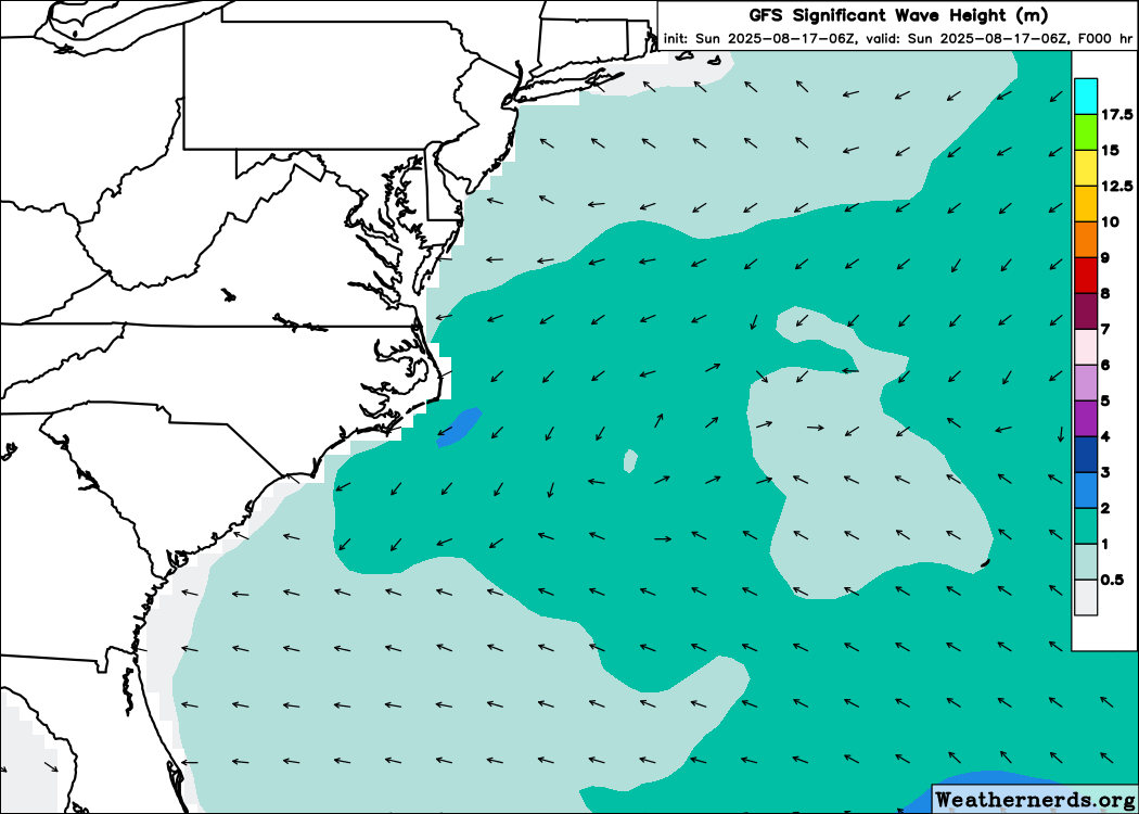
Suffice to say, this will make for very poor conditions at the beach. Anyone planning to visit the beach or go swimming this week from Florida into New England should give second thought to doing much in the ocean through at least Friday. If you do go swimming, please head all flags and posted signs and only swim where lifeguards are present. Between the rough surf and very dangerous rip currents, it will become straight up unsafe at times, even for stronger swimmers.
In terms of whether or not we see any direct impacts, or at least fringe bands make it to the Outer Banks, it’s very much a wait and see situation. If the current forecast holds unchanged, maybe not much more than gusty winds at times. If the trend west continues further, we will begin to say that gusty winds, possibly tropical storm force gusts, and locally squally conditions will become more likely. We’d encourage folks in eastern North Carolina, particularly on the Outer Banks to continue to watch Erin closely. This area is pretty used to hurricane impacts, but as always, keep an eye on things to be safe.
Down the road for Nantucket and Cape Cod, it seems likely that Erin will pass far enough offshore to avoid impacts. Probably still right to keep tabs on any changes. And then heading toward Newfoundland, if Erin impacts that area, it would not be until next weekend. Plenty of time to watch and still most likely just a brush by. For Bermuda, Erin may also cause a brush-by of impacts as it comes north.
Bottom line: The most serious impacts in Erin’s future will likely be rough surf and rip currents on the East Coast, but there is growing consensus that some fringe impacts will affect the Outer Banks, Bermuda, and possibly Newfoundland before all is said and done.
Behind Erin
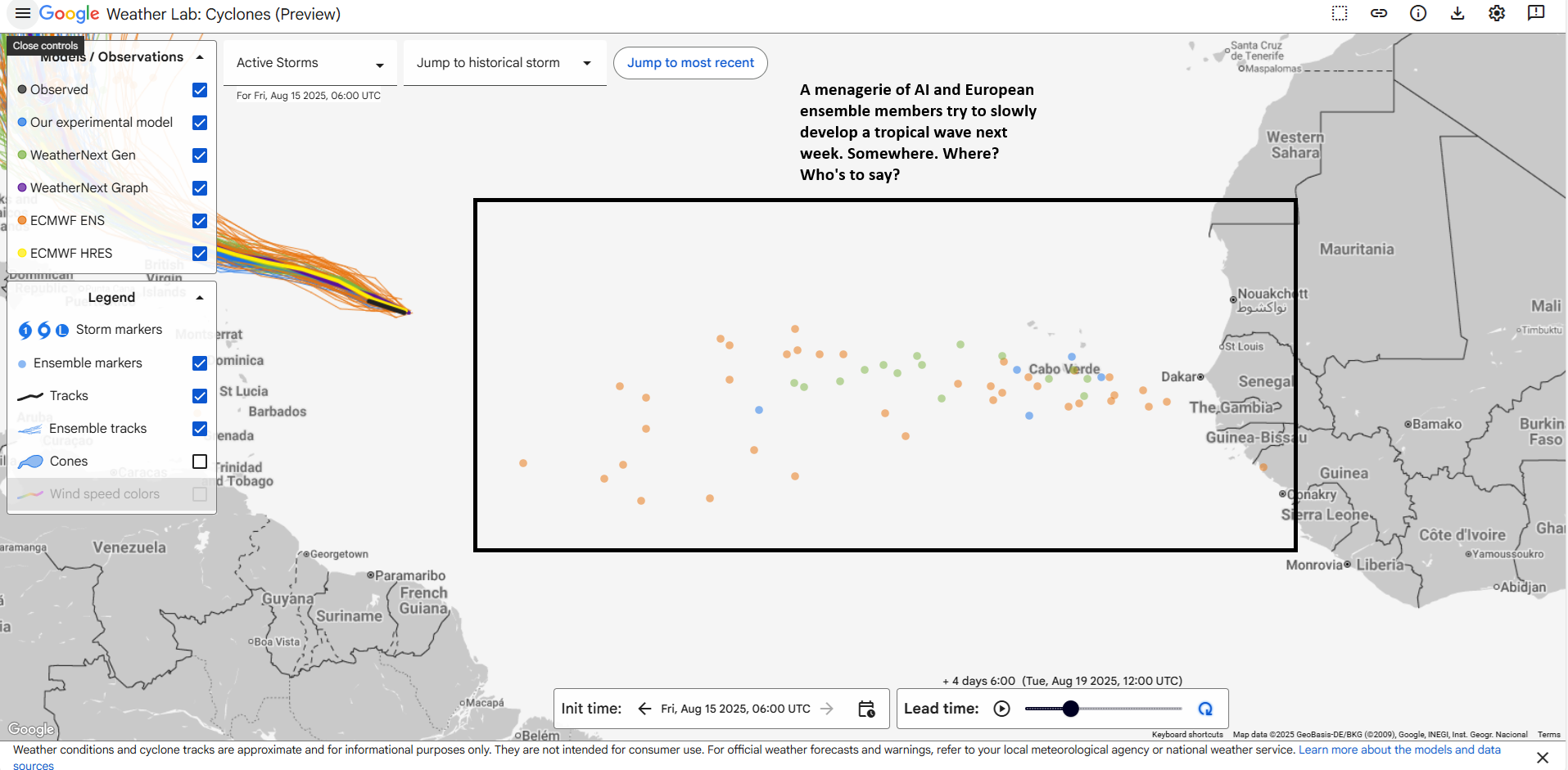
I’ve already seen the “usual suspects” on social media move on from Erin “fear porn” to the next system. The NHC has assigned this one a 20 percent chance of development over the next week in the eastern Atlantic.
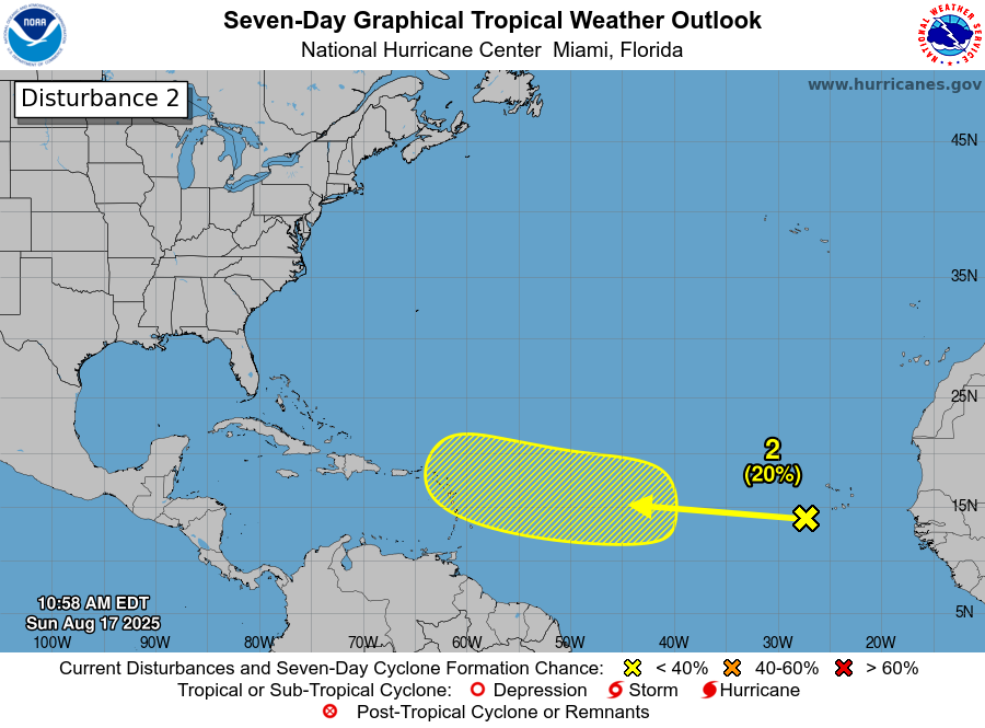
Admittedly, I think the odds of development are truthfully higher than this. I would expect we see an attempt at a tropical depression by Wednesday or Thursday. This system is likely to come west across the Atlantic at a slightly farther south latitude than Erin did. So in some ways, this should be a little sneakier. If we look at the upper map that this disturbance will be working around, we can see a couple key things. First, Erin is going to erode high pressure in the subtropical Atlantic. This will keep a pretty stout weakness in place there. If this next wave is quick to develop, it would almost certainly follow Erin to the north in the open Atlantic. However, there is another pretty strong trough of low pressure in the upper atmosphere expected to dive southeast into the Eastern U.S. after next weekend. If and when this occurs, it would also be likely to “capture” this next wave.
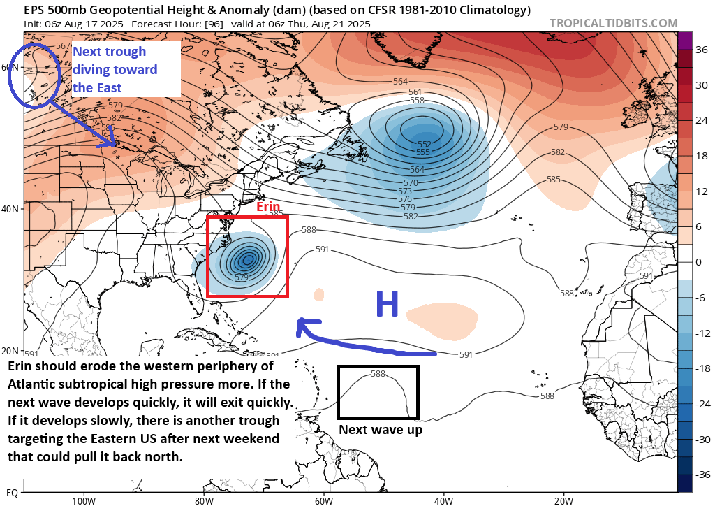
Of course, this all matters. But it’s too soon to speculate on how it matters. Generally speaking, the quicker this is to form, the quicker it would be to exit. The slower it is to develop, the higher chance it may become a disturbance of land impact eventually. But there remain questions on if this will be able to develop a whole lot at all. AI modeling strongly supports the “follow Erin out to sea” outcome. European modeling is less sure but also less bullish on development. The GFS is literally all over the map, ranging from the Gulf to east of Bermuda. So, we have a couple thoughts here, but we’ll need to watch things over the next few days before we can begin to say anything with any degree of confidence. Stay tuned.