In brief: Tropical Storm Dexter is sloppy this morning but continues to head out to sea. An area just off the Carolinas now has a 40 percent chance of developing, and it will likely be a heavy rain, rip current, and tidal flooding risk. Deeper in the Atlantic, nothing looks overly concerning, but we continue to see signs of life and development chances in the future.
Tour de Tropics
UnambiDexterous
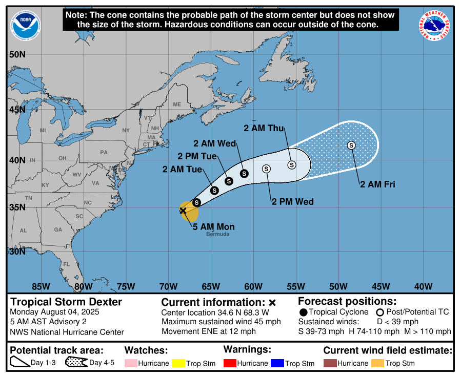
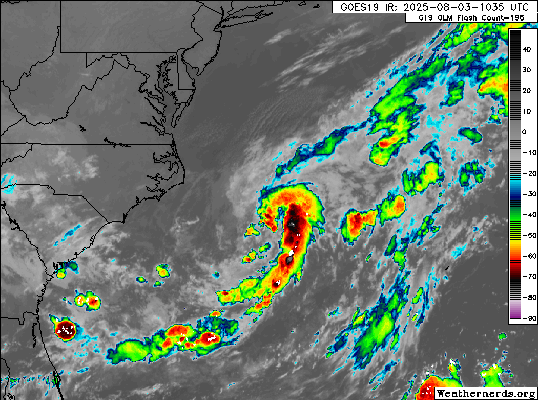
Dexter is only moving in one direction, and that’s out to sea.
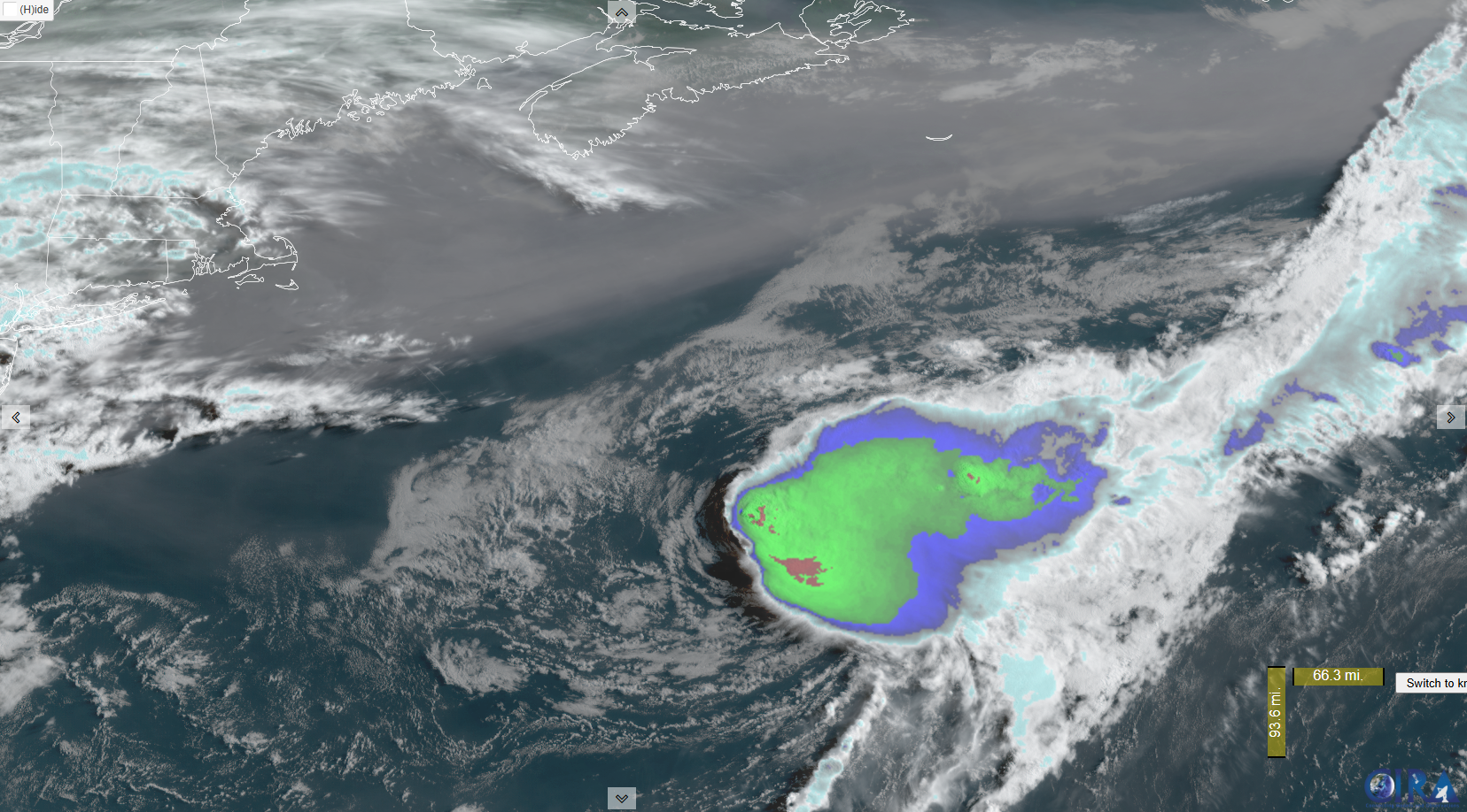
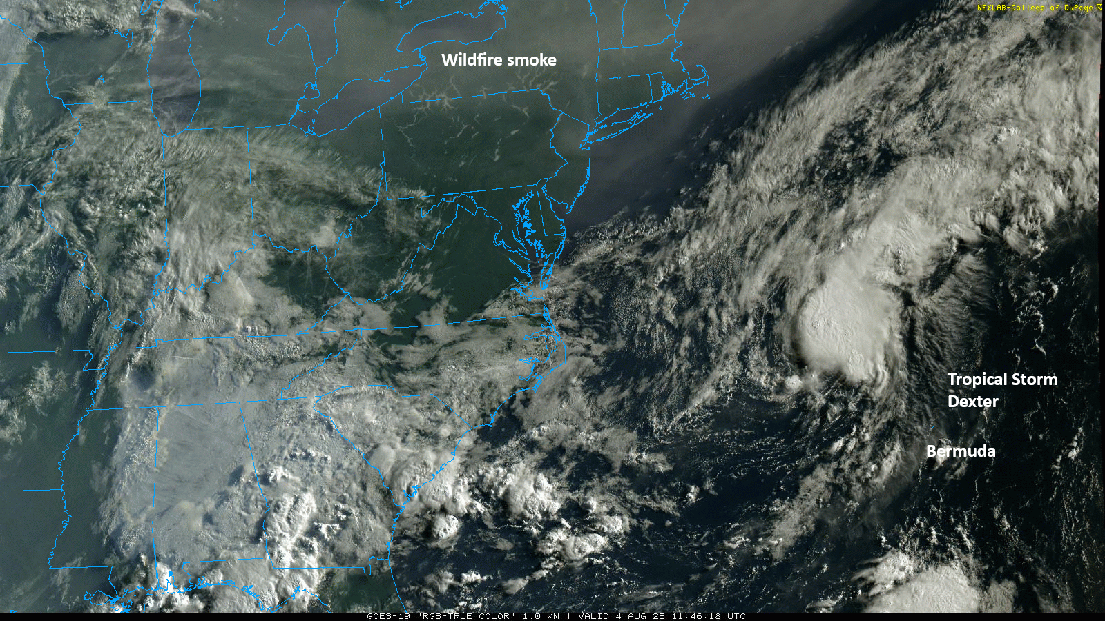
Dexter’s center was exposed some earlier this morning, but it appears that thunderstorms have blossomed back over it after sunrise. Still, this is trending downward overall, and it wouldn’t be a shock to see Dexter go post-tropical by tomorrow as it races out to sea.
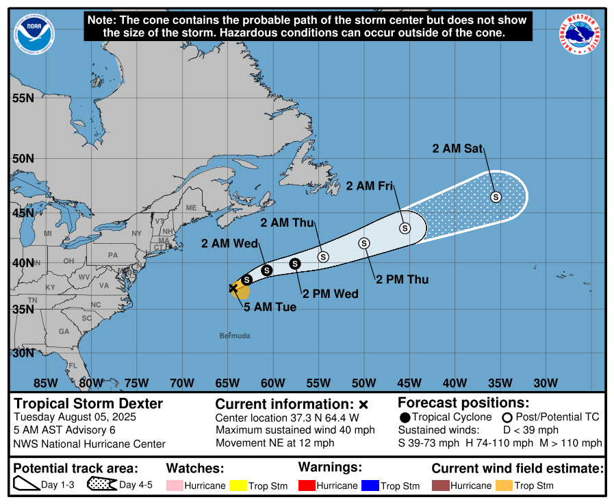
Dexter’s remnant circulation will probably be absorbed by a storm system moving into northwest Europe, most likely near or north of the British Isles by early next week.
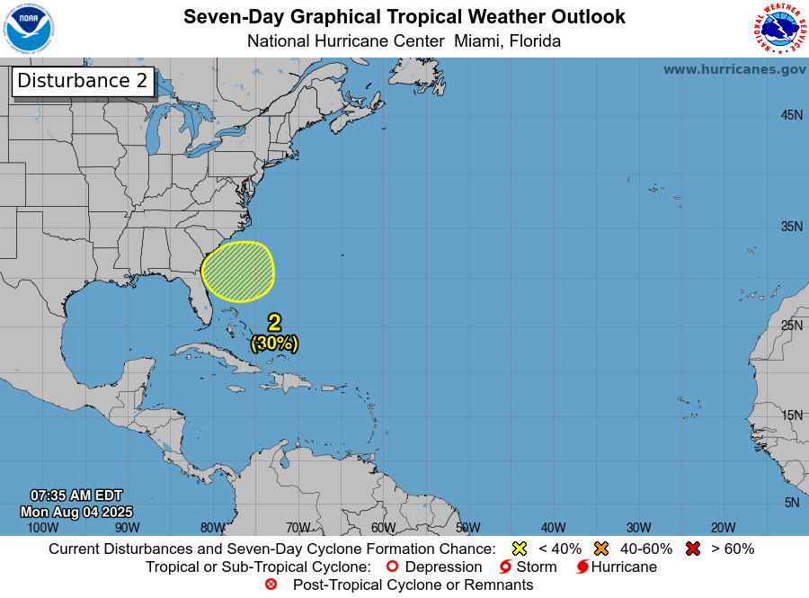
Southeast coast
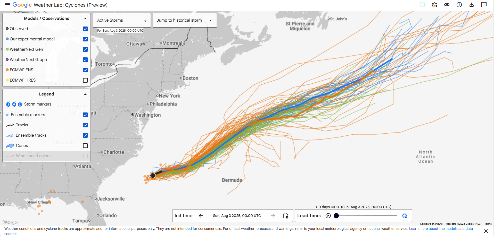
Next on our tour, we look close to home. There’s not much to see this morning with just some scattered clusters of thunderstorms off the coast of the Carolinas.
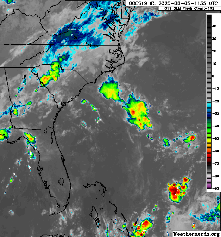
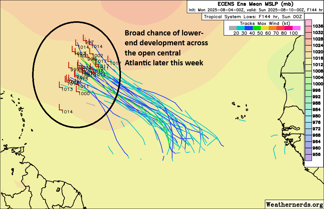
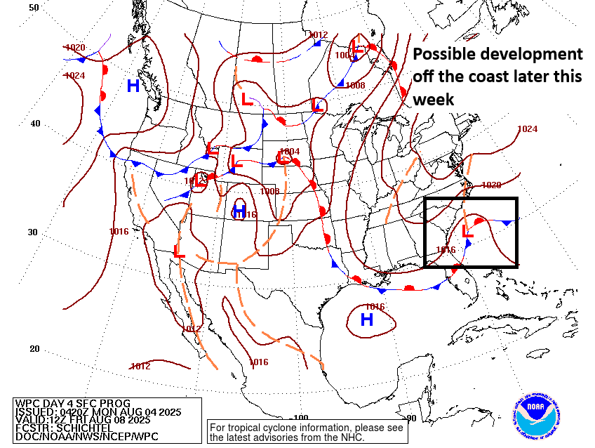
Over the next 36 hours or so, low pressure may develop in this area, however, and that’s when things may get a touch more interesting. This area was just bumped to 40 percent odds of developing over the next several days. At least today, it does not appear that whatever develops in this region will get terribly strong. But the overall environment is favorable for slow strengthening, as are water temperatures. One interesting thing about this is that steering currents don’t exactly look strong in this area. In other words, whatever this is will probably not move a ton, at least not in the first few days.
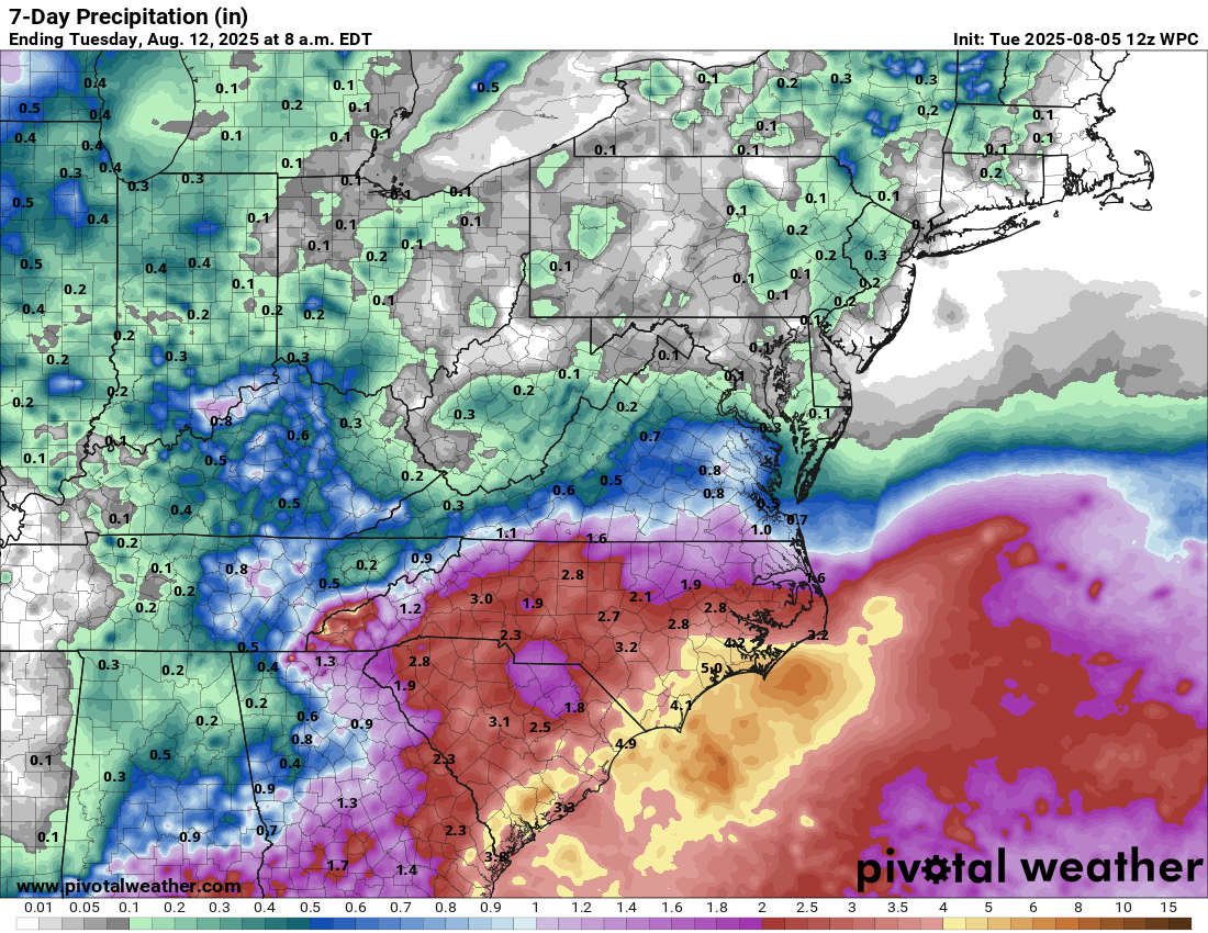
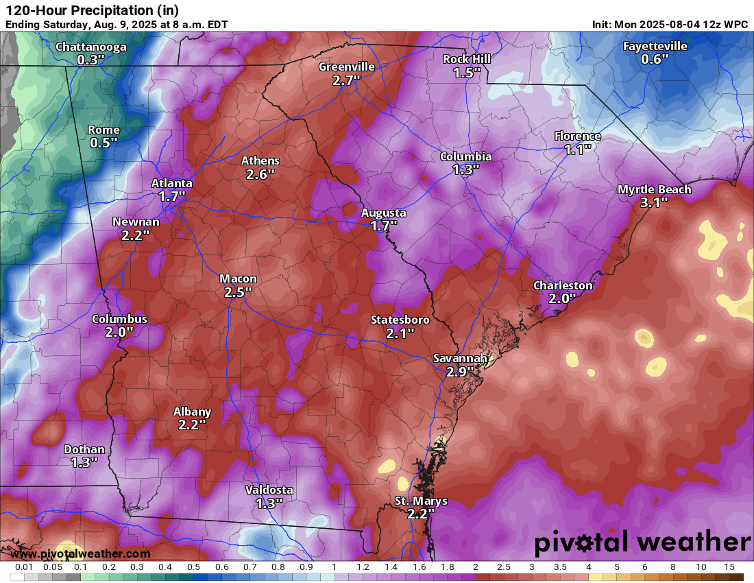
The initial concern on this will be rip currents on the coast of North and South Carolina, as well as heavy rainfall. Should a system develop and organize some offshore, obviously we’d watch that for the direct tropical risks. If it just sits and spins offshore, we’ll probably want to watch for coastal flooding risks from Virginia into South Carolina.
Bottom line at this point: We should continue to monitor this area over the next couple days, especially because of its proximity to land. At this time, it seems as though rain, rip currents, and perhaps tidal flooding will be the primary issues from this area.
Wild card? A handful of ensemble members develop the low pressure area farther south, closer to Florida. While that is a minimal minority of ensemble members, it’s at least something to perhaps keep a side eye on. It’s far less likely than something off the Carolinas though.
Deep Atlantic
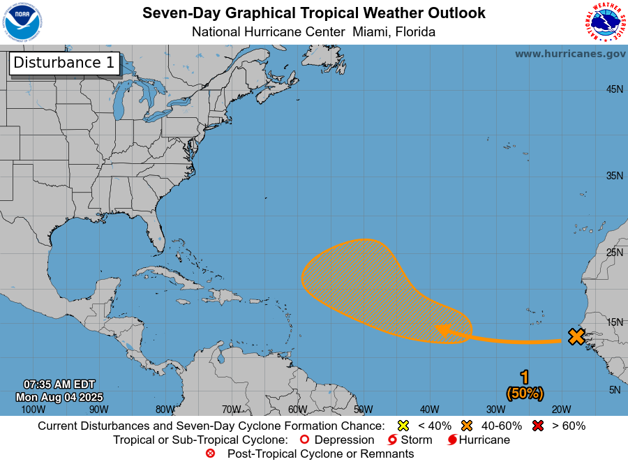
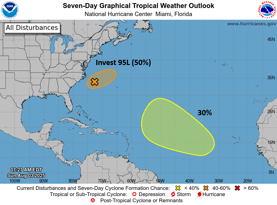
Last on our stop, the deep Atlantic, where the NHC continues to outline a broad 50 percent risk area.
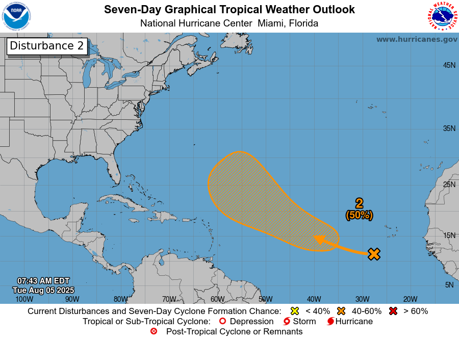
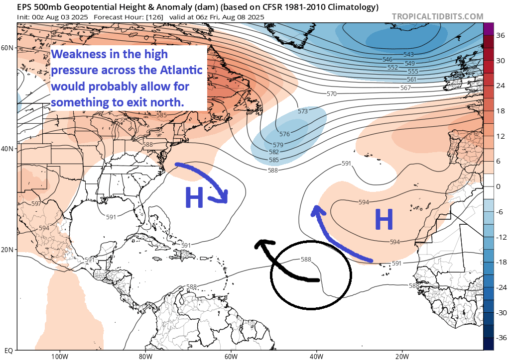
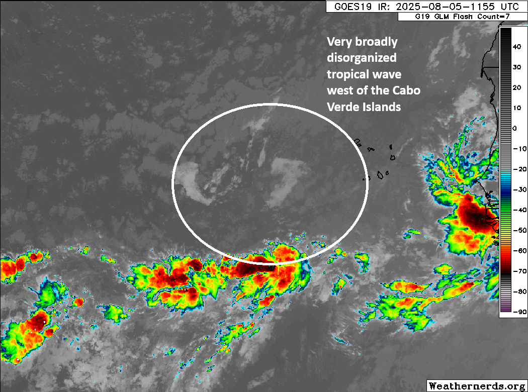
The tropical wave that is responsible for this area continues to produce little to no thunderstorm activity. There are storms to its south, but it’s spread so thin that there’s nothing to this at the moment. Over the next few days, we could see some gradual consolidation and organization occur.
This wave should move more to the west-northwest or northwest over the next few days as it makes an attempt to organize. The most likely scenario still takes this out to sea via a weakness in the subtropical ridge across the Atlantic.
More to come
Interestingly, the next wave or two that emerge off Africa may carry a slightly better chance of organizing. In fact, if you look at yesterday’s European model subseasonal forecast for the week of August 11th through the 18th, you’ll see somewhat bolstered odds of development closer to the Caribbean islands.
I will say, the models have been a little overzealous this year in developing risks in the Atlantic MDR in particular. Given that it’s now August and forecasts are pushing into mid-August, we should give those forecasts respect, but thus far it’s been tough sledding out there for any tropical systems. Could that continue? Certainly. So nothing is a guarantee here, but again, as you would expect heading into mid-August, the Atlantic is a little noisy. Stay tuned.