In brief: More flooding, this time in New Jersey in particular, as well as Florida. The next serious flooding event may unfold thanks to Invest 93L later this week in Louisiana.
Note: Most of the data in these posts originates from NOAA and NWS. Many of the taxpayer-funded forecasting tools described below come from NOAA-led research from research institutes that will have their funding eliminated in the current proposed 2026 budget. Access to these tools to inform and protect lives and property would not be possible without NOAA’s work and continuous research efforts.
Another round of flooding
First of all, if you think this year has been busy in terms of flooding, it has. Let’s just look at the Southeast as an example, since we’re going to focus a lot there today. So far, over 650 flash flood warnings have been issued in 2025 for the Southeastern U.S. If the year ended today, it would not be near last place for most flash flood warnings in a year.

In the South-Central part of the country, it’s not a whole lot different. We’re well over 1,000 warnings on the year for flooding.

2025 is off to a crazy start in terms of flooding around the country. (Editor’s note: I wrote this last night, but Michael Lowry has a very good synopsis on the flooding warnings in context here)
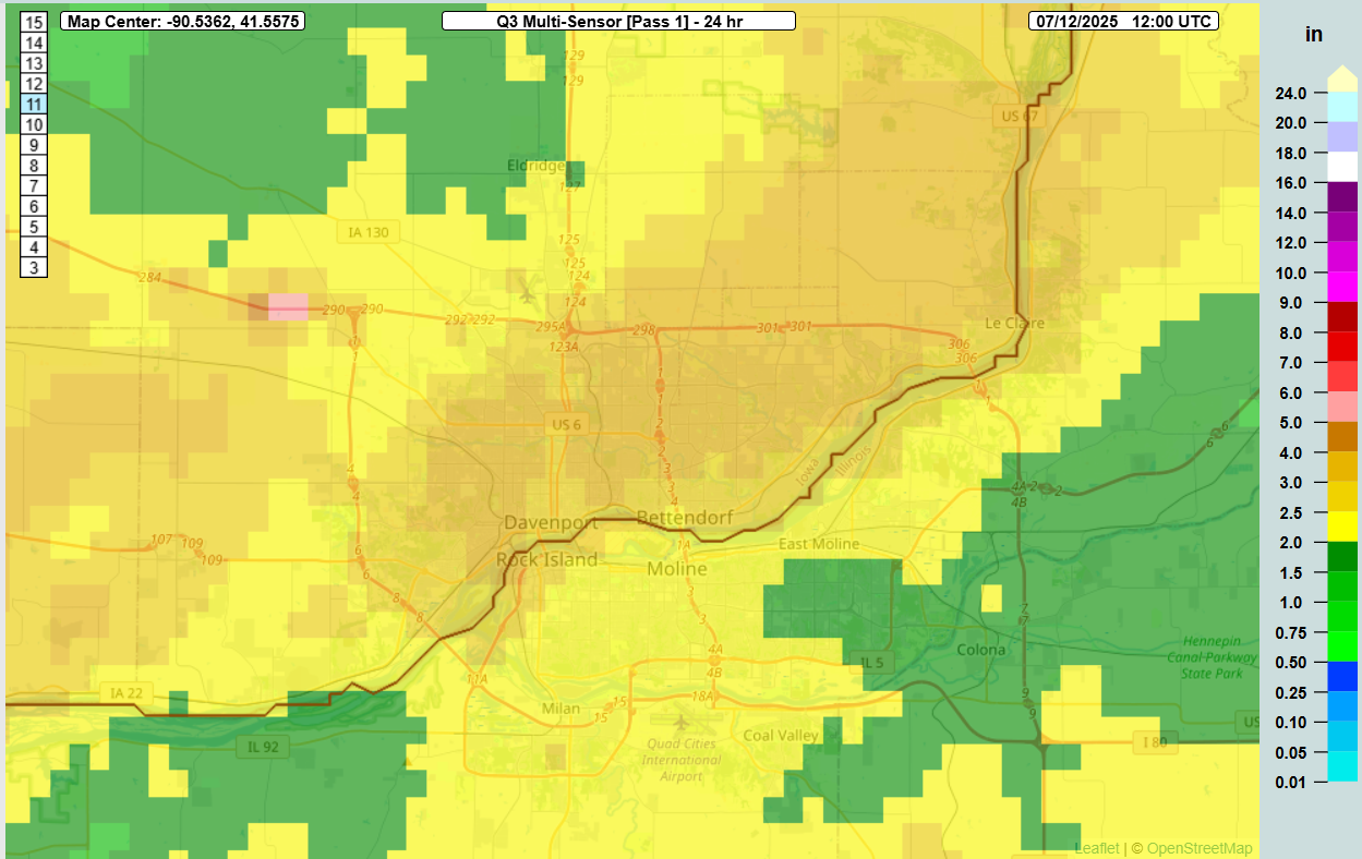
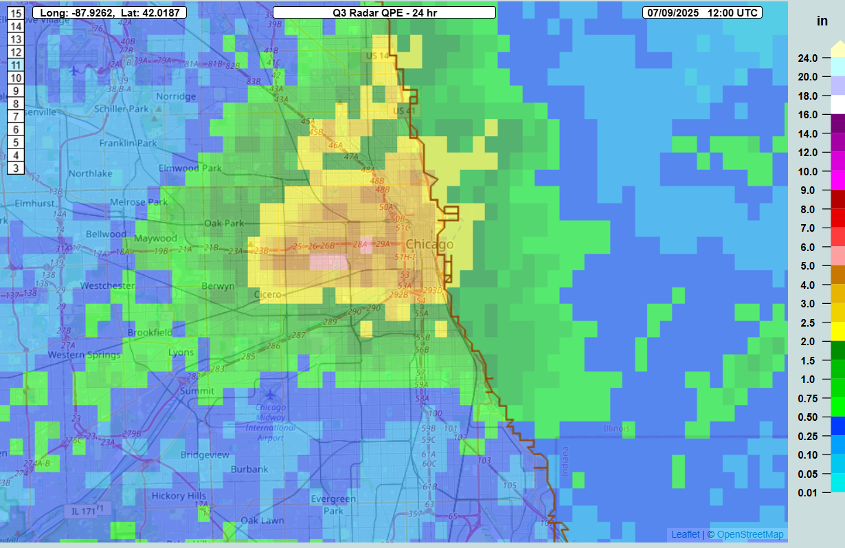
We saw more of it yesterday, this time in the New York City metro area and down in Florida.
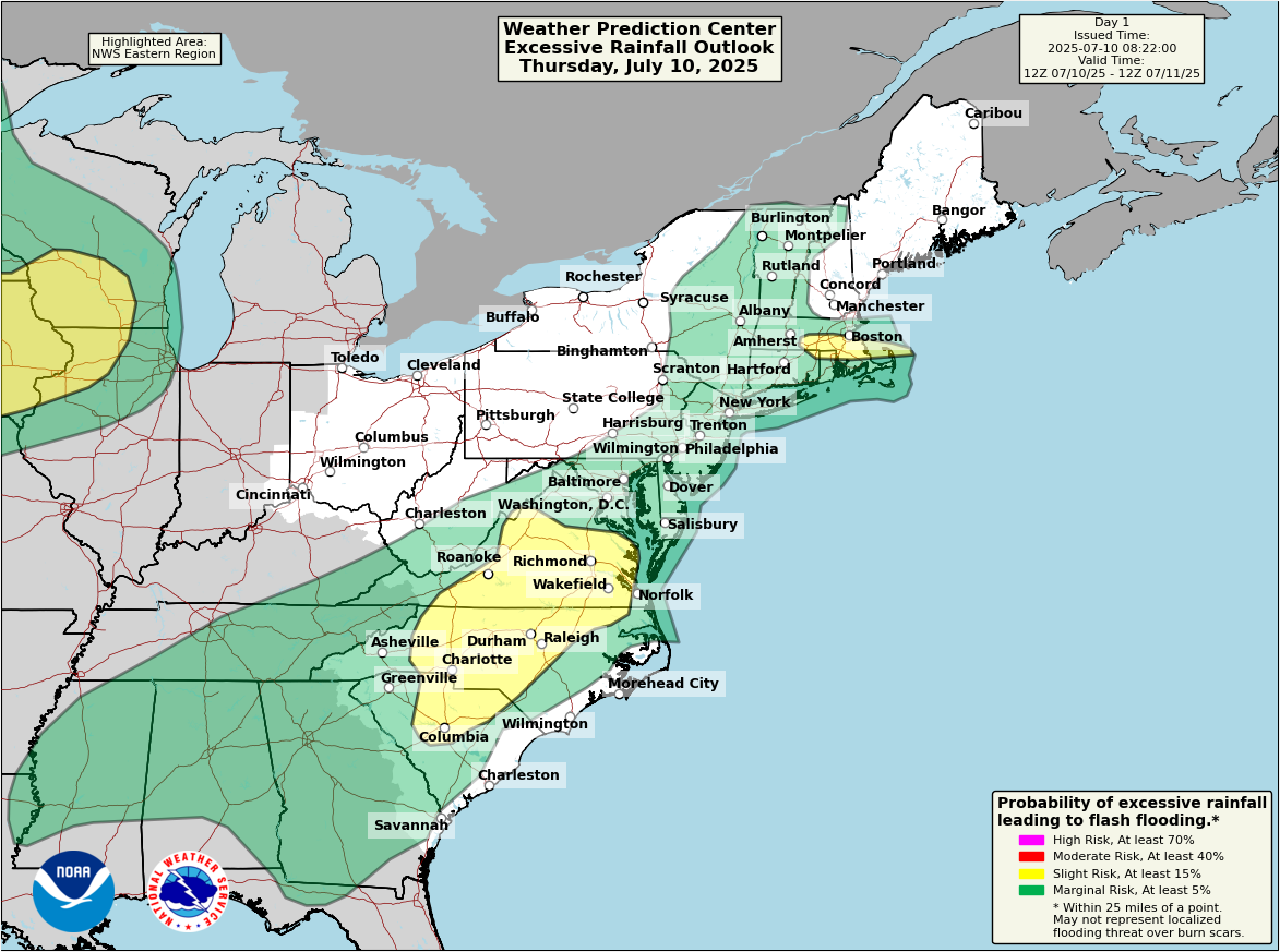
In northern New Jersey, rainfall totals probably came close to 7 inches in spots right near the Watchung Ridge up in western Union and northeast Somerset Counties.
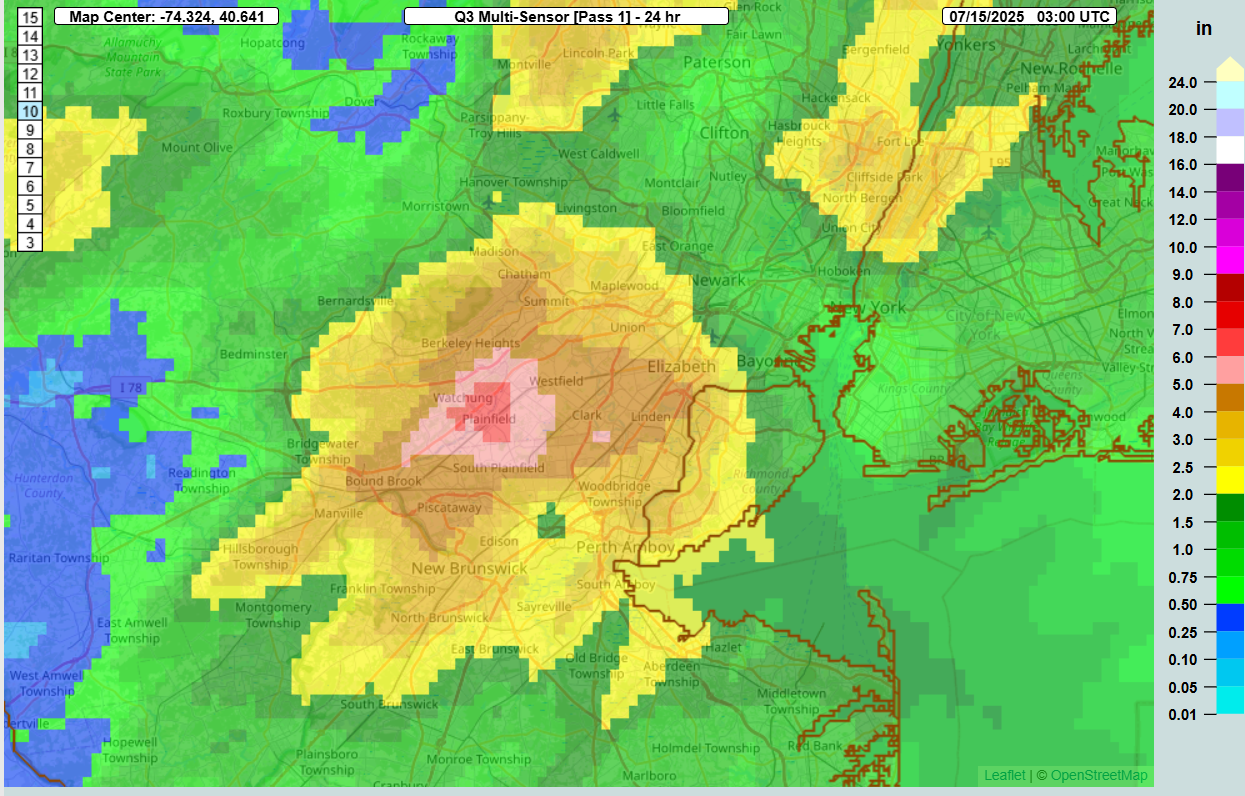
This type of rain has about a 2 to 3 percent chance of occurring in any given year in this location. Numerous reports of flooding were received in parts of New Jersey, as well as in New York City, as rainfall rates of around 2 inches or more per hour overwhelmed drainage systems. Heavy rain also fell west in Pennsylvania, west of Scranton-Wilkes Barre, with about 1 to 2 percent probabilities of those totals occurring in any given year. A secondary area occurred near Lancaster, PA as well.
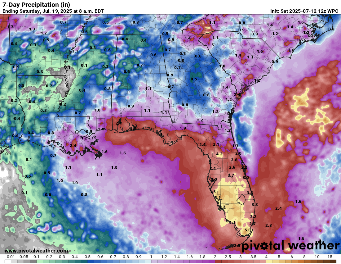
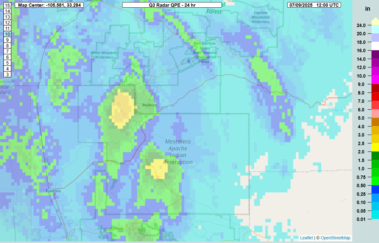
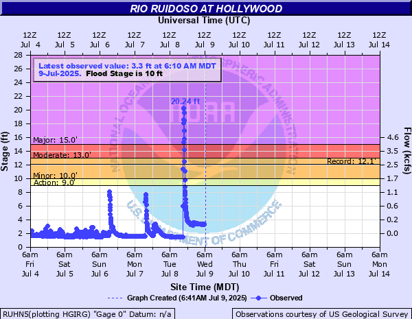
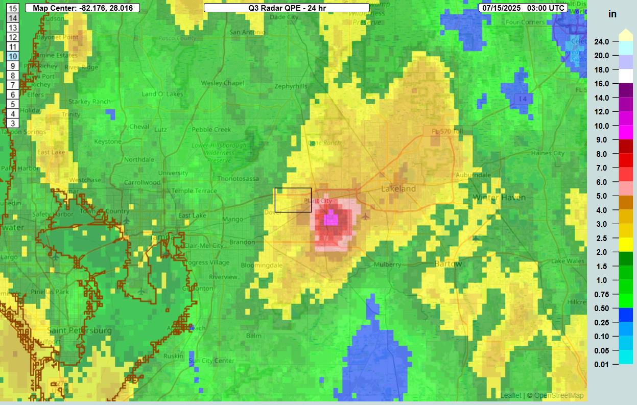
South into Florida, much of the state saw rain yesterday, but the Plant City and Lakeland areas were especially hard hit. Rain totals of as much as 6 to 10 inches occurred just southwest of Lakeland, with flooding reported there as well.
Just another day in this seemingly frenetic summer.
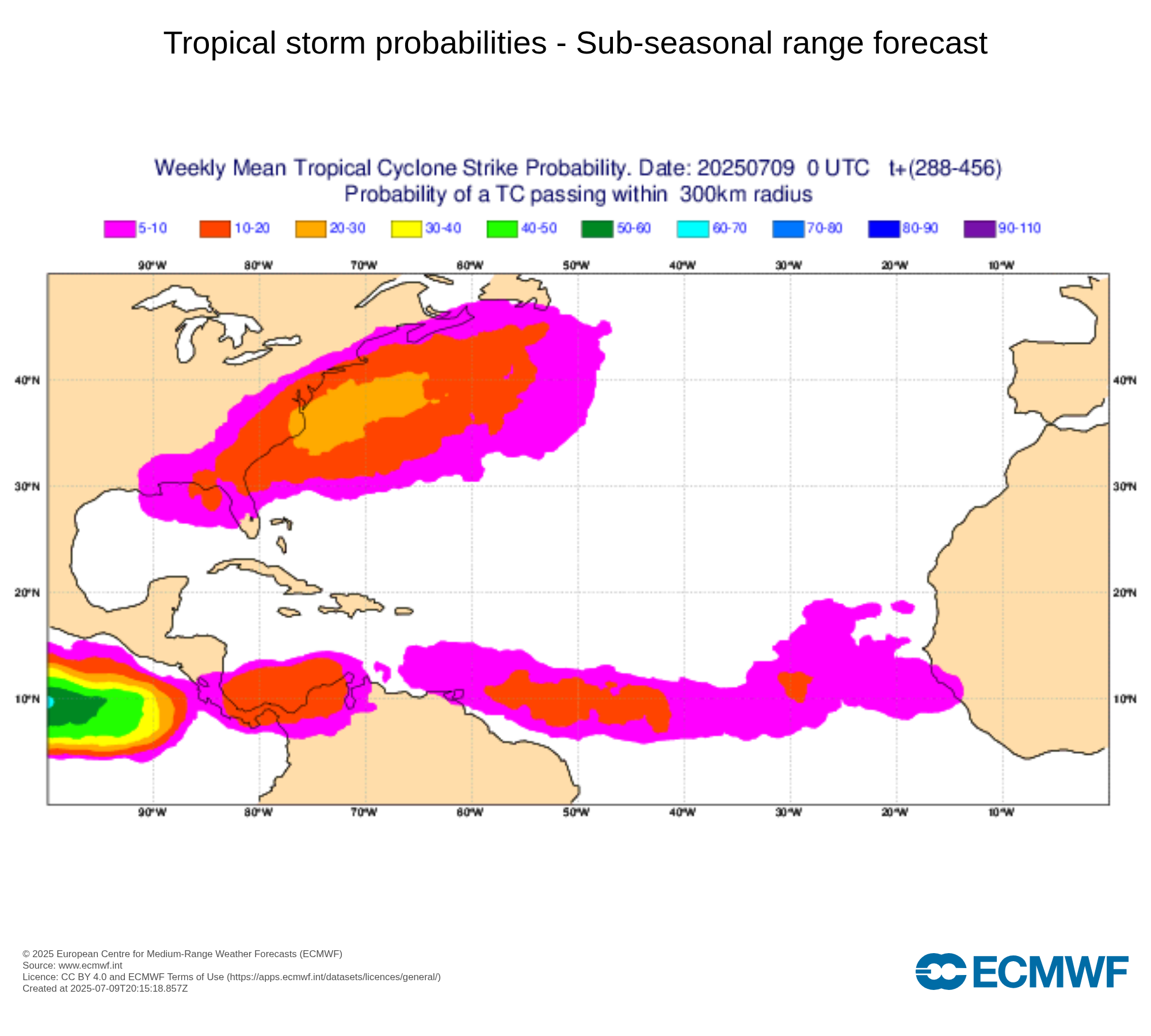
Tropical Disturbance: Invest 93L
There’s so much to talk about today in terms of all sorts of things, but we will focus first on the potential for a tropical system in the Gulf. Currently, Invest 93L is moving onto the Florida Peninsula. If we’re really being honest, it ain’t much to look at today.
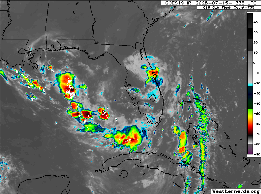
Once into the Gulf it will encounter both very warm sea-surface temperatures and slightly less wind shear. This will allow it to begin to get its bearings and make an effort to organize. Currently, the NHC is giving it about a 40 percent chance of development the next couple days as it moves west across the northern Gulf. Obviously, you see something in the northern Gulf, and it’s instinctive to get a little worked up. This will probably have limited time over water, and the proximity to land is likely going to work against it some. There’s also likely to be some drier air in play here. All this to say that it would seem that the ceiling on this system is fairly low in terms of intensity.
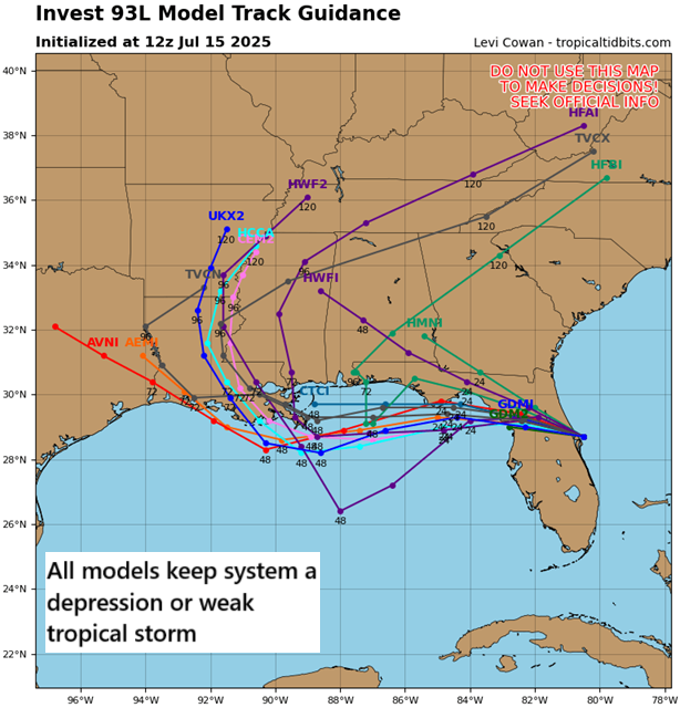
In terms of the track, it is likely to work west across the Gulf generally toward Louisiana. A weaker, more disorganized system would probably work inland west of New Orleans. A stronger system, for whatever reason, may come ashore farther east. The next name on the storm list is Dexter.
But given the low ceiling, I think it’s important to focus on the rainfall risk here.
Rainfall risk on Gulf Coast
Gulf systems this time of year typically have characteristics that make them very sloppy, very lopsided, and very wet. In other words, they’re often a flooding threat. And this appears to be the case here as well.
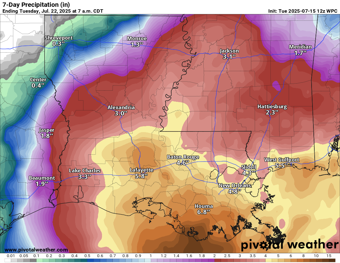
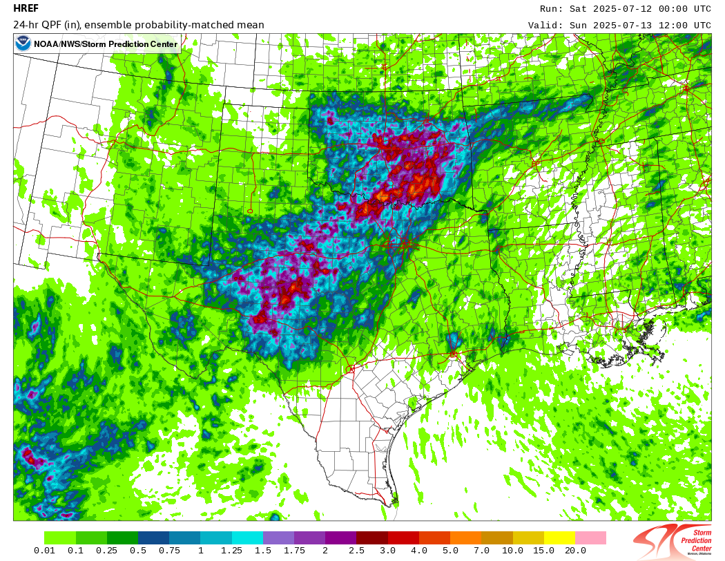
The current rain forecasts show upward of 4 to 8 inches of rain across much of Louisiana and coastal Mississippi. Heavy rain will also extend east into coastal Alabama and the Panhandle of Florida as well. In fact, there is already a moderate risk of flash flooding (3/4) for day 4 in Louisiana (Friday).
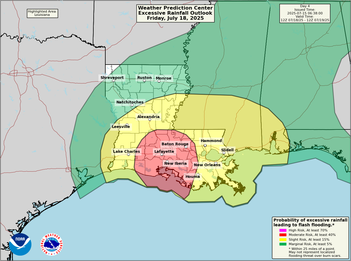
The focus of the flooding risk will be on Acadiana and the Atchafalaya Basin. This includes both Baton Rouge and Lafayette. It’s still a bit early to focus on high-end risks of how much rain could fall, but I would keep a very close eye on the forecast between Beaumont and Baton Rouge from the flooding and heavy rain risk point of view.
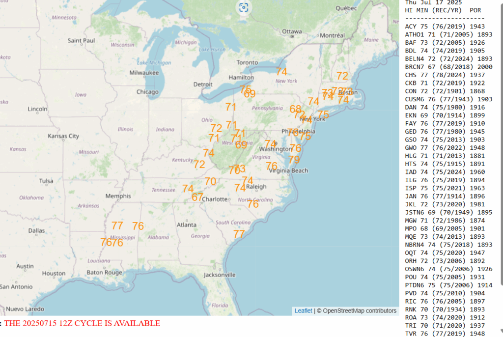
On the east side of 93L, a very warm and humid air mass will lead to hot and uncomfortable weather later this week up the East Coast. Numerous record warm low temperatures are at risk of being broken.
We’ll have more tomorrow morning or later today if anything significant changes.