In brief: The tropics remain calm, but we’re watching the Gulf next week — sort of. We have the latest on Texas flooding and some thoughts on mitigation. Also, flooding is possible in the Mid-Atlantic and New England today and/or tomorrow.
Note: Most of the data in these posts originates from NOAA and NWS. Many of the taxpayer-funded forecasting tools described below come from NOAA-led research from research institutes that will have their funding eliminated in the current proposed 2026 budget. Access to these tools to inform and protect lives and property would not be possible without NOAA’s work and continuous research efforts.
Tropical Atlantic
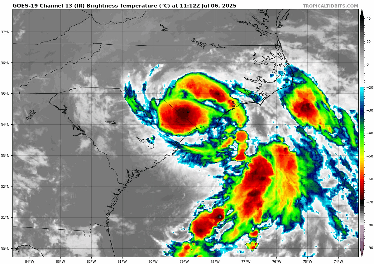
First off, there’s nothing at all to report in the tropical Atlantic today. We look quiet for the next week or so.
I think the next area to watch will probably be in the Gulf next week. A little piece of “energy” (or mid-level vorticity…spin in the atmosphere around 10,000 feet) may pinwheel from an area of weekend thunderstorms in the Mid-Atlantic, off the Southeast coast early next week, and into the northeast Gulf midweek.
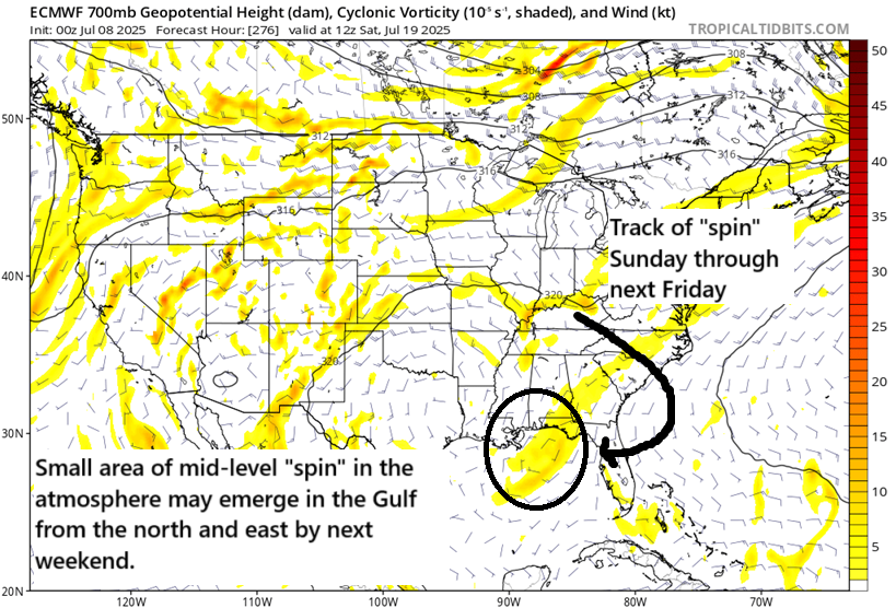
This would not be a highly likely pathway to development, but we have absolutely seen storms do this before, most notably in recent years probably Hurricane Barry back in 2019. The seeds for that storm were actually planted in Kansas with some thunderstorms that eventually arrived in the Gulf and spun into a storm that became 2019’s Barry. While Barry wasn’t a particularly strong storm it was loaded with moisture and ended up being the wettest on record for Arkansas and caused widespread flooding in Louisiana and over a half-billion in damage. So they can happen.
In this case, we will have to watch how this evolves in the coming days; it’s possible it ends up too close to land to develop, it ends up actually over land, it never emerges in the Gulf at all, or it ends up taking a farther south pathway to boost the odds of development. Current modeling suggests the “too close to land” scenario is most likely, but we’ll see. Either way, we have a long time to watch this, and it’s nothing to worry over today.
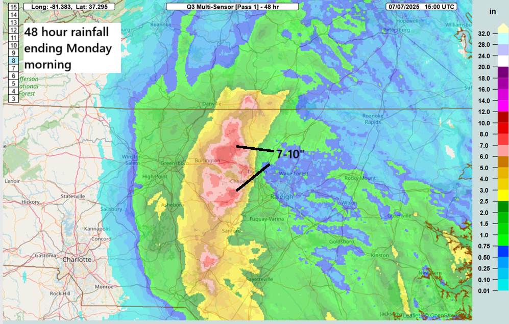
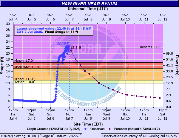
Texas flooding update
A lot of news coming out of Texas with respect to the impacts, response, and recovery to the Texas flooding catastrophe. I strongly recommend following The Texas Tribune’s coverage, as they know the state better than most and will have good quality information. I want to home in on one story about the Texas Senate declining to take up a bill that would have bolstered flood protection in the Hill Country and Flash Flood Alley. House Bill 13 would have provided about a half-billion dollars for numerous improvements to public safety communication, alerting, and sirens in places, similar to those that have tornado sirens. The bill was proposed by a GOP representative, Ken King from Canadian, TX, the area devastated by the Smokehouse Creek fire in 2024. There is one quote in particular that was made during the debate on this bill that I want to highlight.
Tony Tinderhort, an Arlington, TX Republican said this: “This shouldn’t be about anything other than the fact that it’s a half a billion dollars. This is probably one of the most simple votes we should be able to take today. It’s that this interoperability council is going to spend money to try and get these departments to be able to talk together.”
It’s easy to look at things in hindsight and become outraged, but importantly, I think this is a comment that speaks volumes about priorities among some legislators, not just in Texas but nationwide. First off, let’s be clear, this bill would not have prevented or mitigated this catastrophe in any way. It would not have been implemented until September. Secondly, even if the build out were completed, there is no way to know if it would have saved lives. Secondly, according to a January piece, Texas had a $28 billion surplus and $24 billion in the rainy day fund coming into this year. The proposed bill would have eaten up about 1.5 percent of the budget surplus.
When thinking of disasters, the easy thing to do is to throw up your hands and say “weather happens” and “bad things happen sometimes.” But time and time and time again it has been proven that preparedness and adequate ways to disseminate warnings save lives. Investing in preparedness is like investing in your health or home or whatever else you want to invest in. The phrase “an ounce of prevention is worth a pound of cure” originated from Benjamin Franklin, a relatively libertarian leaning individual that knew a thing or two about science and how the natural world works. That was almost 300 years ago. Much like Franklin’s legacy, it has stood the test of time. When we have leaders constantly badgering others about investing in preparedness because of sticker shock, the question has to be, what amount of damage or loss of life has to occur for them to get on board with improving societal preparedness? That’s an important question to ask representatives and ensure they’re looking out for their constituents and society and its best interest. This isn’t even a climate change conversation, it’s an every day one. It’s food for thought.
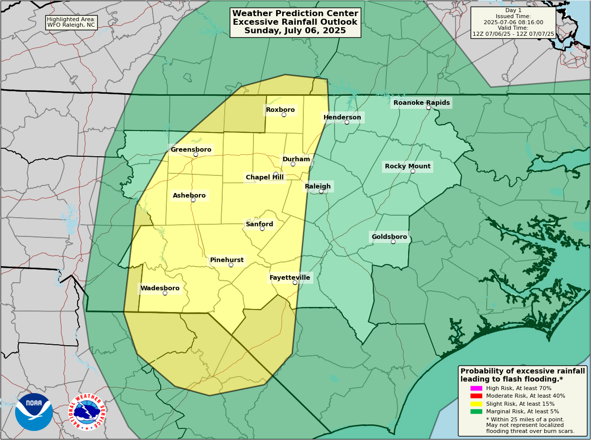
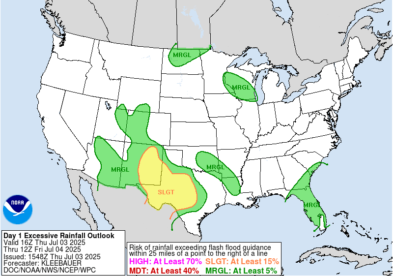
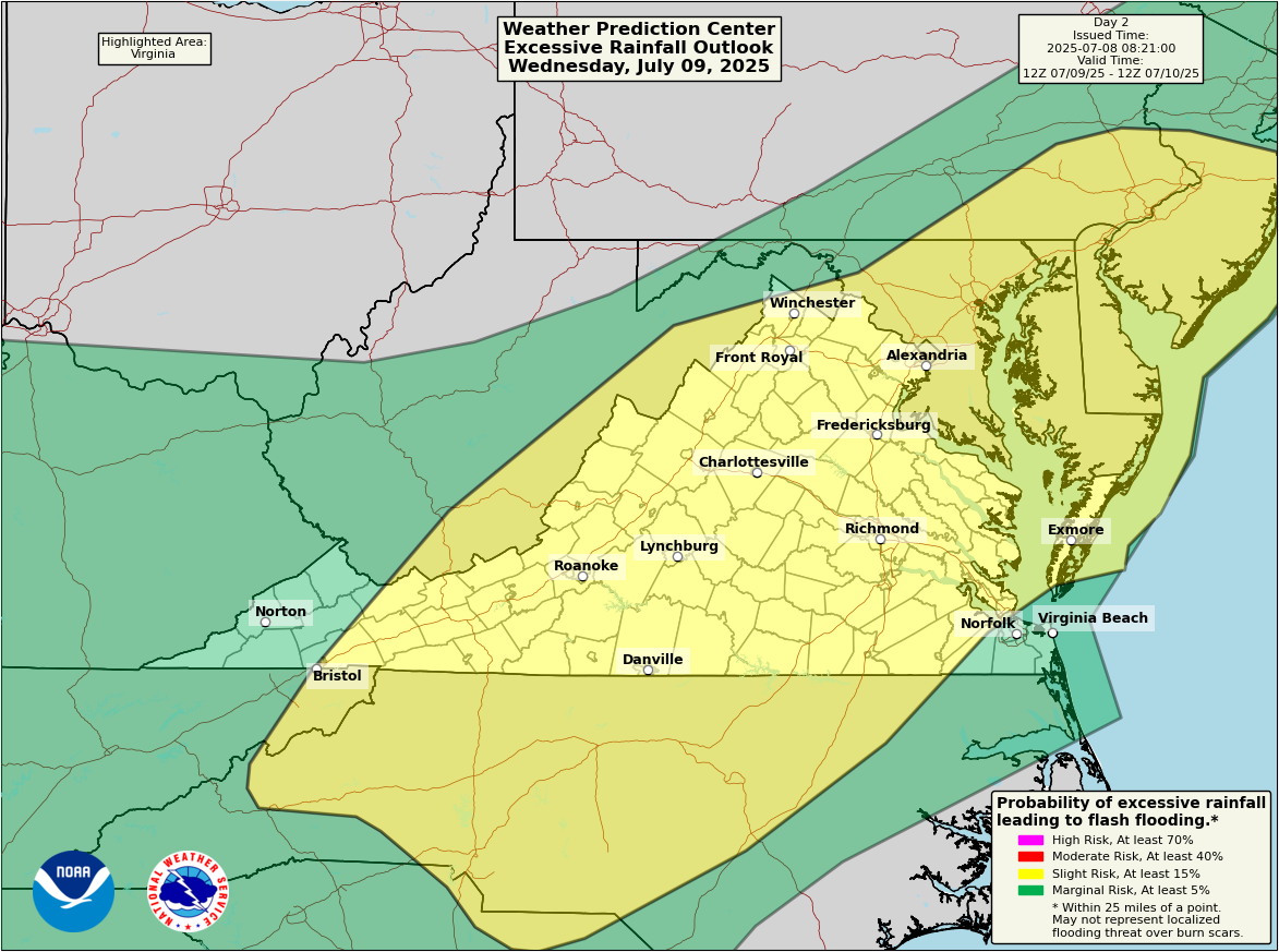
Flooding concerns this week
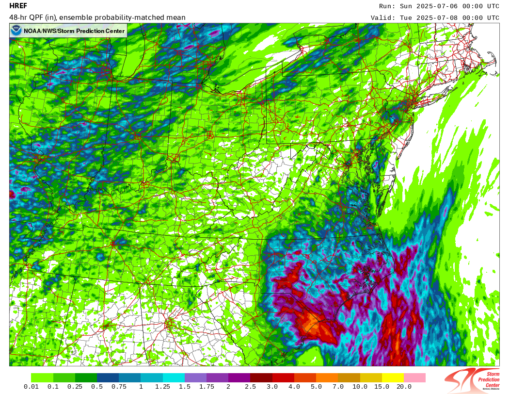
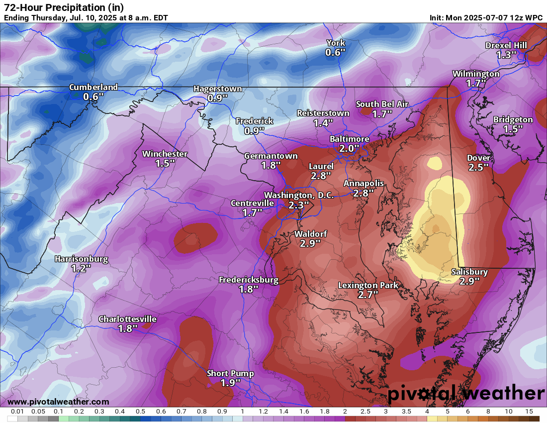
Much of the Mid-Atlantic is in a slight risk (2/4) for flash flooding today, with risks extending from Virginia into southern New England, including DC, Baltimore, Philly, and New York City.
We should expect to see heavy thunderstorms late this afternoon and evening across the area. The combination of storms and very high atmospheric moisture levels will lead to the potential for excessive rainfall rates of 2 inches an hour. Flood watches are in effect for most of the slight risk region.
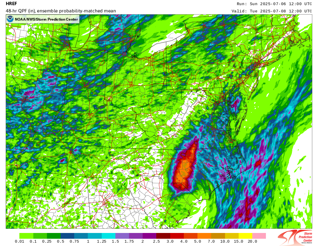
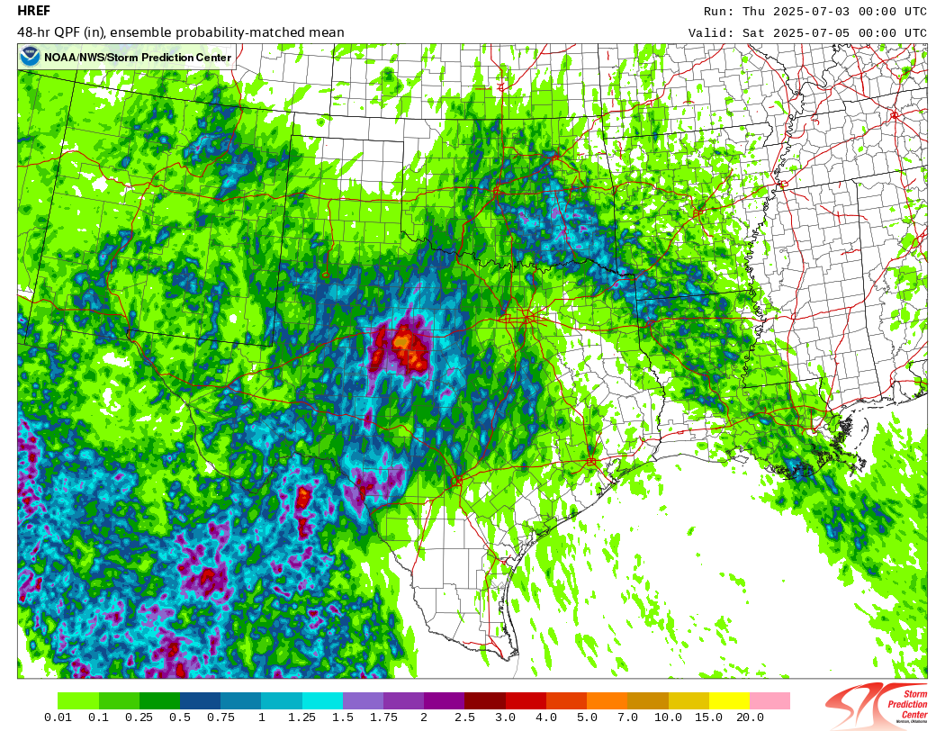
On Wednesday, the risk shifts to the south and east into mostly the Mid-Atlantic.
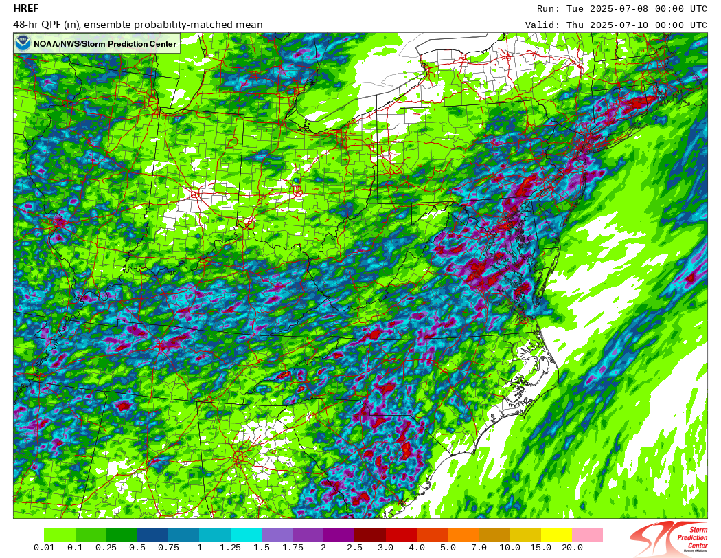
Rainfall forecast totals from the probability matched mean product of the HREF model from NOAA are on the order of 1-2 inches area-wide with isolated pockets up to 4 inches in this general region. It’s in those isolated areas that flash flooding could be an issue.
Additional flooding risk exists in Arkansas and Missouri today, where radar is active with showers and storms already.