Headlines
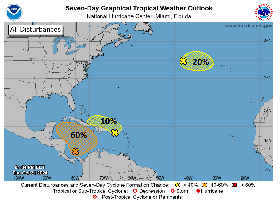
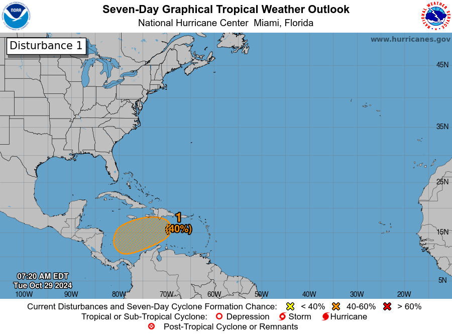
- The Caribbean disturbance now dubbed Invest 97L is likely to become a depression or tropical storm in the next 24 to 36 hours.
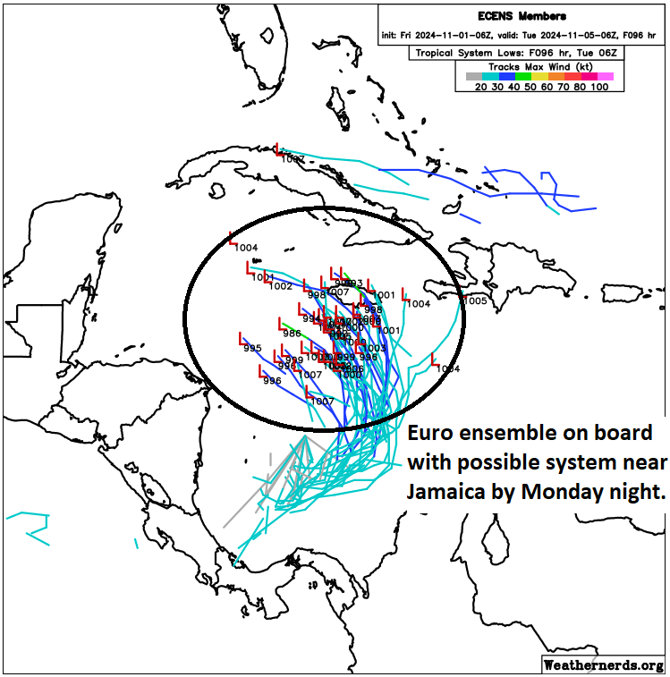
- It will reach Jamaica later tomorrow, then Cuba, then the Gulf on Wednesday.
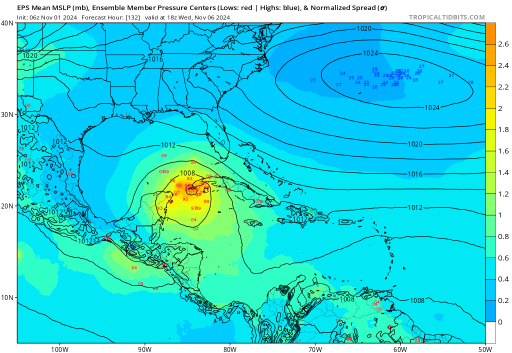
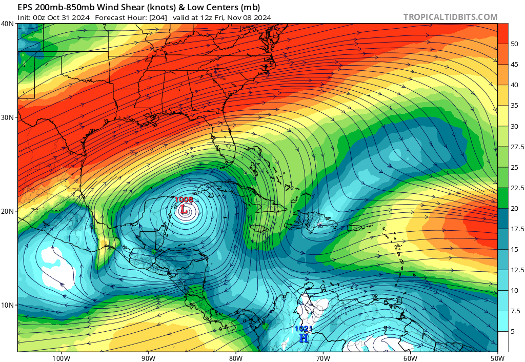
- From there, uncertainty is very high, with models spread out all across the Gulf of Mexico both in terms of track and intensity.
- While wind shear is still expected to generally protect the northern Gulf Coast, this system should probably still be watched over the next 5 days to see how forecasts evolve.
Rafael on the horizon in the Caribbean
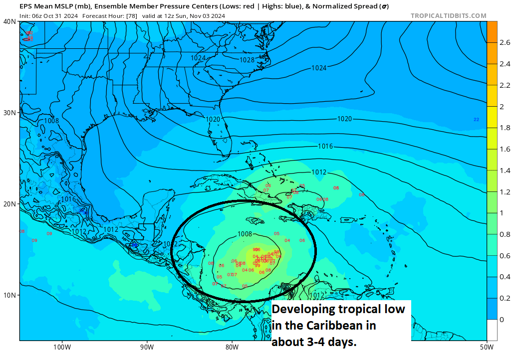
Last week we expected Patty to develop in the Caribbean by today or early this coming week. Patty front ran us all by forming way out in the northeast Atlantic. While that storm is not a land threat right now, what develops in the Caribbean likely will be.

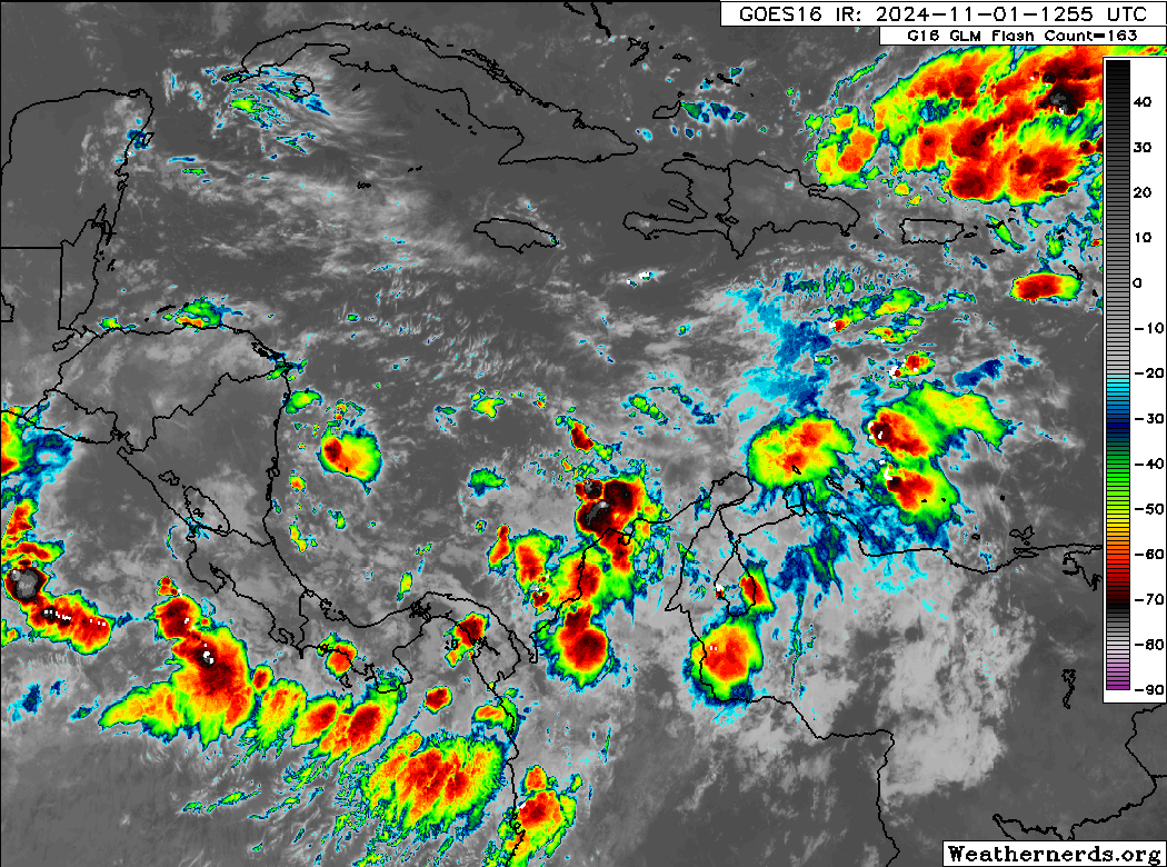
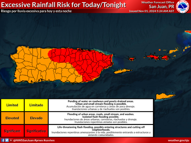
The disturbance has been dubbed Invest 97L for now, and it will likely become a tropical depression or tropical storm tonight or tomorrow. Its first stop on tour will be in Jamaica probably tomorrow afternoon. Tropical storm conditions and torrential rain are a good bet there.
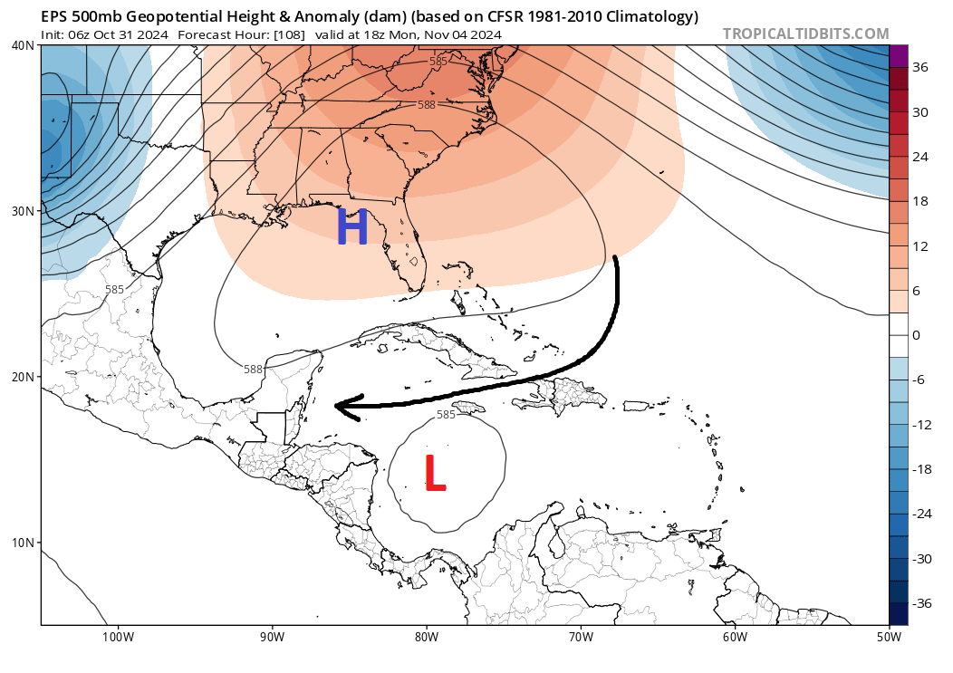
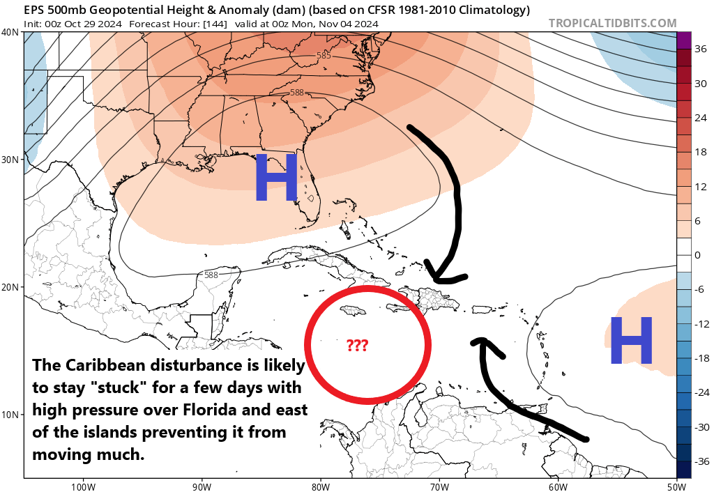
From there, 97L or Rafael will likely continue northwest across Cuba and into the Gulf of Mexico by Wednesday. Once in the Gulf, Rafael’s motion will be dictated by the upper pattern which features weakening high pressure near Florida. This will steer Rafael to the northwest into the open Gulf but as the high falls apart, it’s likely that the motion becomes slower and more erratic. This is why the forecast out 5 to 6 days with respect to likely Rafael’s track is very uncertain.

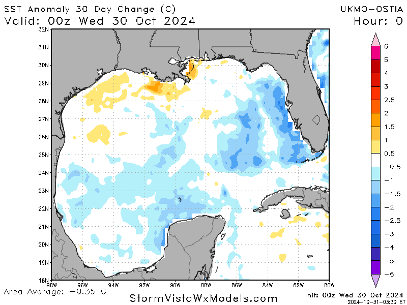
The good news is that wind shear in the northern and western Gulf is expected to be decent, which should allow for weakening before it does whatever it will do. However, there is a fair bit of uncertainty with all this admittedly. It is November, and you expect November things to happen here normally. But this is not a normal year. The Caribbean remains at near record warm levels, which is to say warmer than normal for any time of year, let alone November.
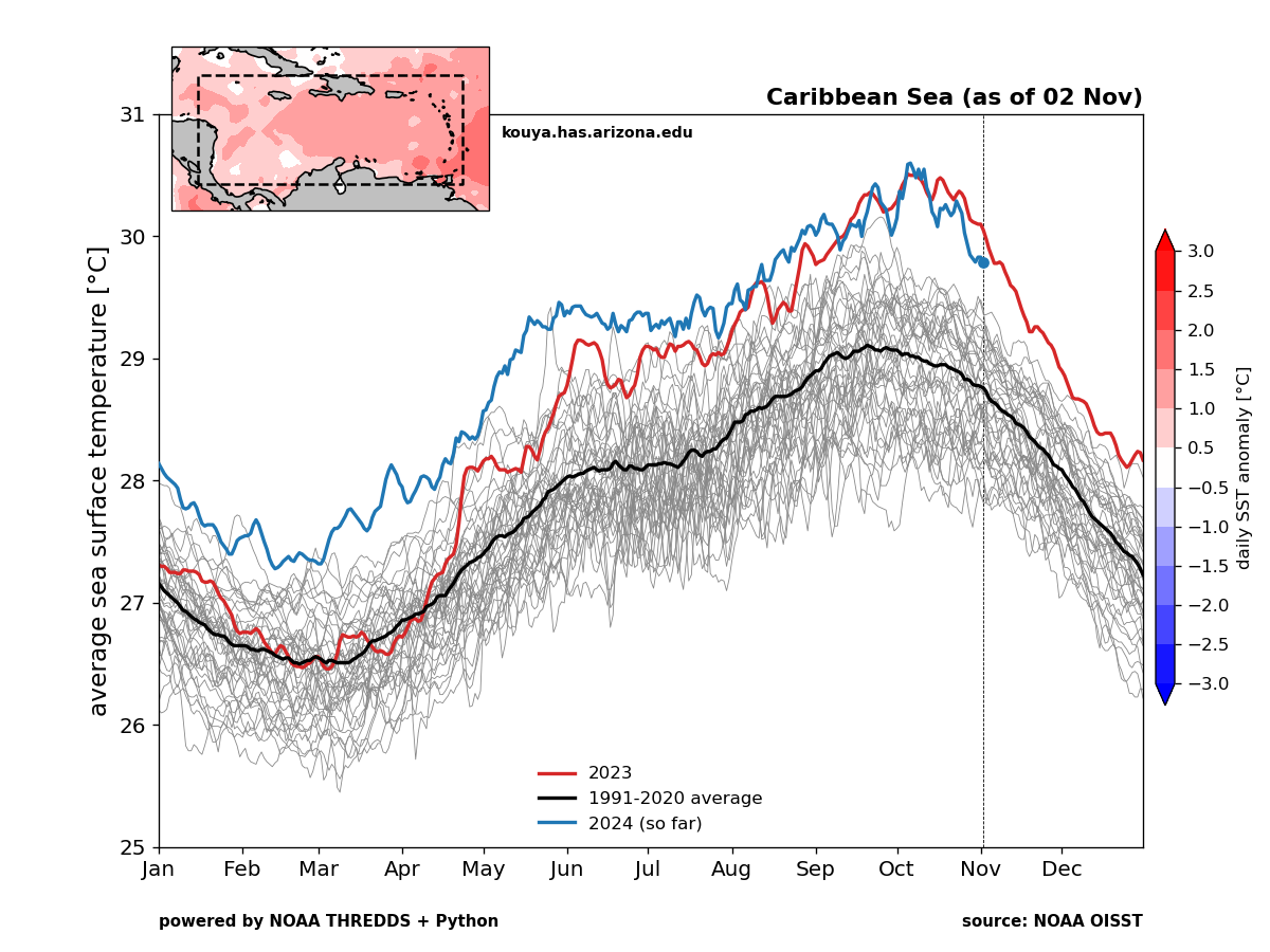
The Gulf is at near record warm levels for the date as well. So from an ocean support standpoint, this system will have a good bit going for it given the time of year. Could Rafael become a hurricane? Absolutely. Could it ultimately threaten the U.S. Gulf Coast? Certainly, though I would not call that “likely” at the moment, and the most aggressive modeling seems to be the GFS, which has historically had a bit of a tough track record in the autumn in the Gulf. But the bottom line is that this will be a system that merits attention, first in Jamaica, then Cuba, and then for the Gulf Coast. We’ll see where things point tomorrow.
Additional development is possible in the western Atlantic over the next 10 days, but nothing has the robust agreement we see with Invest 97L right now.