In brief: The tropical Atlantic has a number of items but only one really with a chance to develop much. No threats to land at this point either. Aside from that, there’s not a whole lot to say right now through about the 25th. Heavy rain and flooding chances visit South Florida and the southern Rockies today and tomorrow.
Atlantic tropics
The satellite picture over the Atlantic looks pretty noisy, but in reality only one item is truly a development candidate.
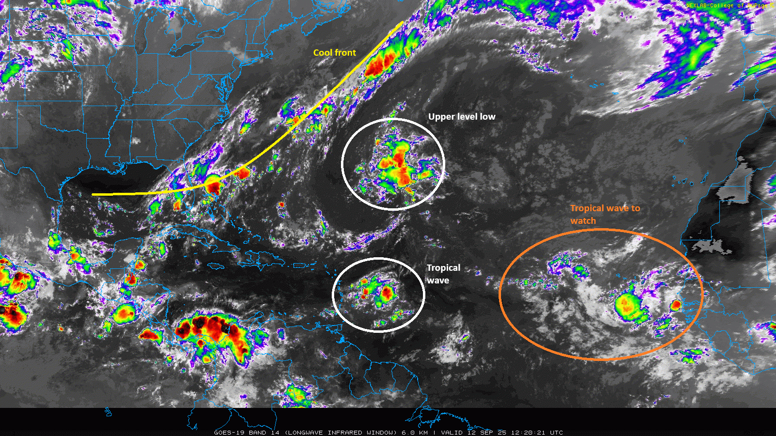
There is a cool front draped from near Florida into the Atlantic. You always watch these sorts of boundaries for any development, but there’s nothing imminent, and anything would likely track east or northeast out to sea. The big area of storms you see over the central Atlantic is an upper-level low pressure system, so that won’t develop. There’s an active tropical wave moving into the Lesser Antilles today, bringing some showers and storms but no development odds. And then there’s a broad tropical wave in the eastern Atlantic off Africa that’s now up to 40 percent odds of development as it moves into the open Atlantic this weekend and next week.
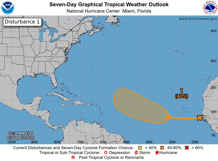
There is decent model support still for this to develop, and this wave will have a slightly more supportive background state in the Atlantic to work with as it moves west and west-northwest heading toward next week. This is probably a more legitimate candidate to develop than Invest 91L was a week or two ago. That said, it too will be fighting both dry air and wind shear in its neighborhood as it comes across. For now, I would not expect quick, strong development, but as has been the case with almost every system this year, a slow, uneven development pace. Not much has changed in terms of track, as Eric showed yesterday. We’ll keep watching, but at this point, this system is not a real serious concern.
Beyond that, who is next? Great question. We are seeing noise from the GFS model beginning to stir up the Central American Gyre (CAG) late in the period. That’s a climatological quirk of the model, where it tends to gravitate toward development in that region, whether realistic or not. In this case, there’s not a whole lot we can truly say. If you go by the Euro ensemble (like below), you see that surface pressure is currently forecast to be higher than normal, typically not a signal for development.
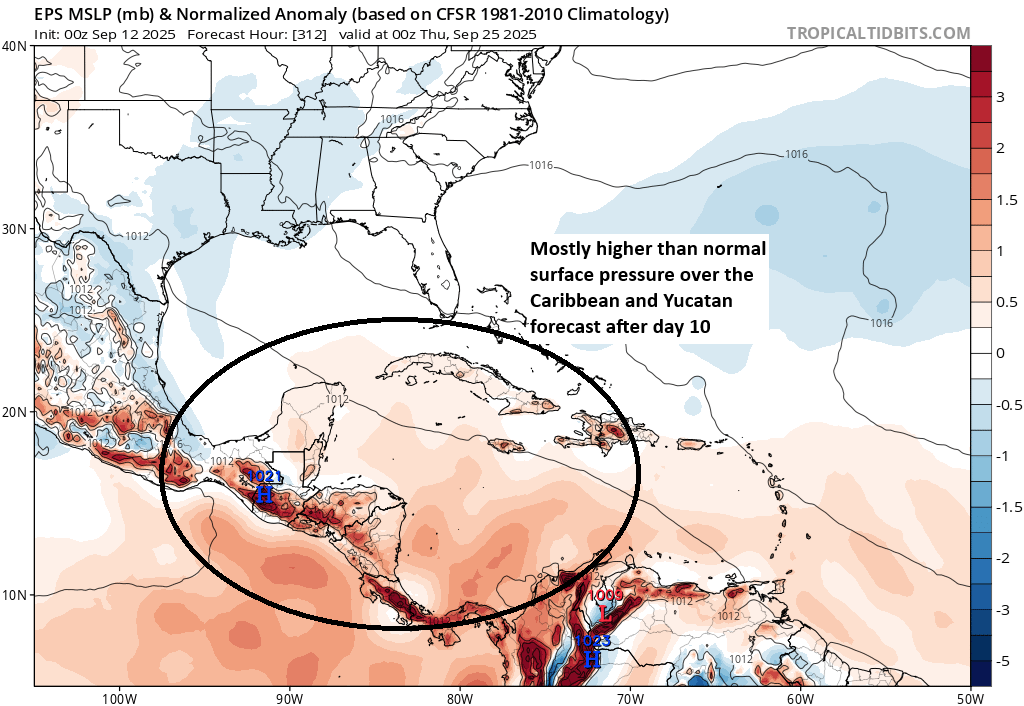
But that’s 12 to 13 days away, so a lot can change. The main takeaway for me as a forecaster right now? There’s not a particularly strong signal for anything else through September 25th. We’ll see if that continues.
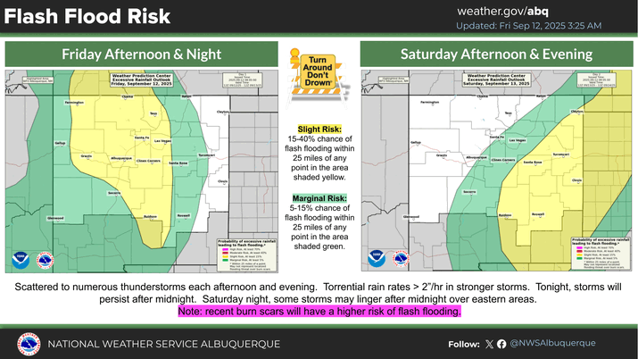
Flood chances
Elsewhere, not a whole lot to discuss weather-wise right now. There is some flash flood risk both in South Florida and in the Southern Rockies today.
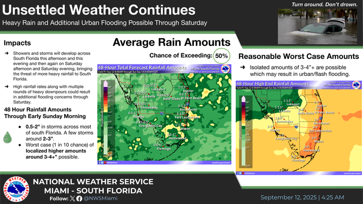
In Florida, showers and storms will move along slowly the next couple days, bringing a chance for as much as 3 to 4 inches of rain in spots in a worst-case scenario.
In the West, the risk is on burn scars in particular, with scattered showers and storms likely today and tomorrow across southern Colorado and New Mexico, where flood watches are posted.
The heavier rain risk shifts into the Plains this weekend.