In brief: The Atlantic should be calm over the next week, though there’s a low chance of something to watch next weekend off the East Coast. The Pacific gets active again this weekend. Heat winds down and by next week a less noteworthy pattern dominates the U.S.
Atlantic dust but a little something next weekend
On the Atlantic side of the coin, things continue quiet for the next 7 days. The entire central and eastern Atlantic is basically smothered in Saharan dust right now.
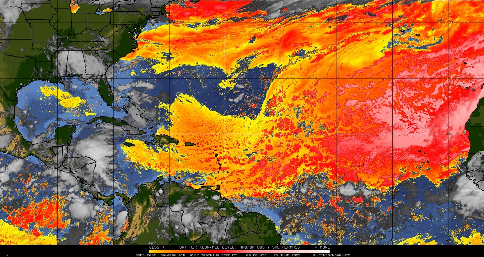
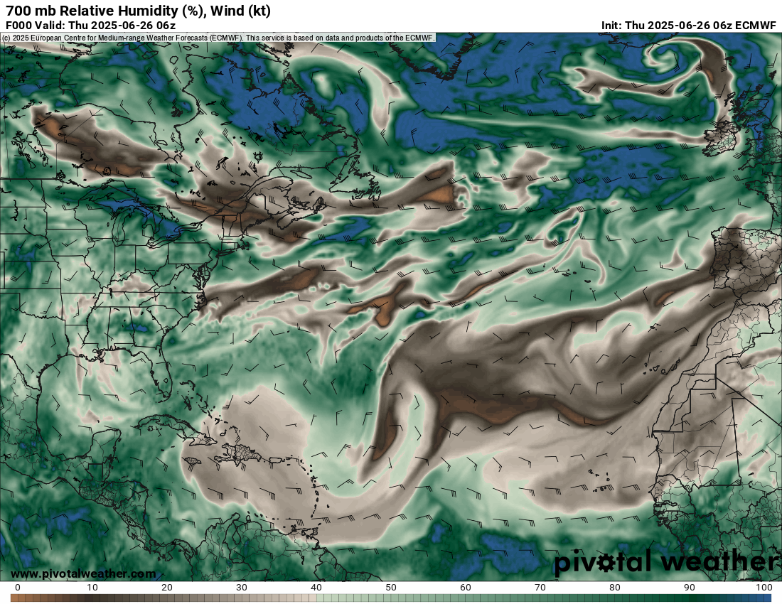
The dust indicates the presence of dry air, which is easily seen when you look up about 10,000 feet in the atmosphere at the relative humidity across the Atlantic.
The only hint of anything right now for the next 7 to 10 days will be off the Southeast coast late next week or weekend. Models have been fairly consistently showing the potential for a disturbance to emerge there and likely scoot out to sea. Model support for this is across the board from traditional to AI models. We’ll keep an eye on that, but at this time, there’s no support for anything of concern to the Florida, Georgia, or Carolina coasts.
Pacific back in action soon
Look for the Pacific to wake up from its short late June slumber soon. A disturbance off the coast of Mexico will have about an 80 percent chance of developing by this weekend.
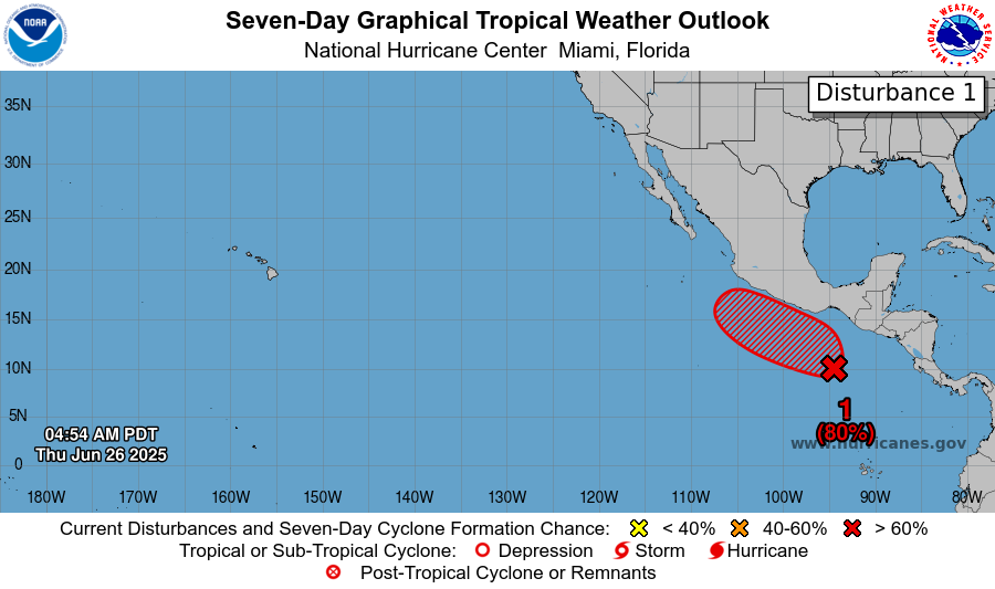
While the general model consensus currently keeps this system just off the coast of Mexico, some of the more reliable guidance does keep this thing awfully close to the coast, so it’s possible that impacts, at least indirectly, will be felt from about Oaxaca north to Baja as this lifts up the coast. It seems unlikely that this would be a major storm due to proximity to land, but something fairly well organized could emerge from this for a time. Worth continuing to monitor for those in Mexico.
Evolution of the heat wave from here
The Eastern U.S. heat wave is beginning to slow down now. However, it won’t completely disappear. Look for a gradual wind down in temperatures over the next several days, especially in the Midwest (though Friday looks quite cool in the East). Severe weather risks will continue around the periphery of things, including the northern Plains and Upper Midwest. But as you can see from the map below, it’s not until next week that we see some troughing begin to develop in the East, which should deliver some cooler weather.
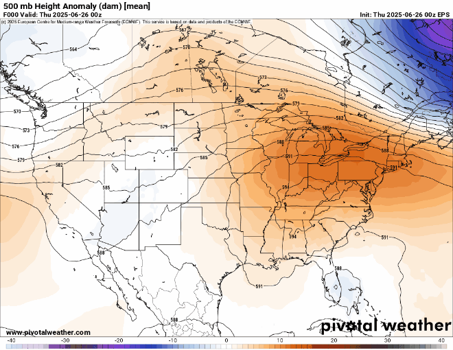
Meanwhile, you can see a big ridge pop up in the Pacific Northwest or western Canada. Next Tuesday looks especially hot with mid-90s in Spokane, 80s in Seattle, and near 100 in Boise. But at least for a moment, by the time we get to the middle of next week, the overall pattern across the country looks fairly standard with nothing too spicy.
I read that as of June 30th, the Special Sensor Microwave Imager Sounder (SSMIS) data run by NOAA & DOD satellites will no longer be sending the real-time microwave data needed for hurricane forecasting.
That this represents a reduction of 50% of data and now it will be difficult to detect activities such as rapid intensification and where the storms are going.
Can you talk about this? Does this mean that we can’t trust the hurricane forecasts at all?
It does not, but it’s a problem. I plan to address this news tomorrow.
Thank you
Thanks for keeping us updated on this concerning news.
We have Disturbance One in that Bay of Campeche… 20% for chance for 7 days.