Headlines
- Helene help continues to be desperately needed.
- Gulf development odds have stalled somewhat, but development of a sloppy system tracking east or northeast in the Gulf this weekend or next week seems plausible.
- The main concern we currently have is potential for heavy rain in Florida.
- Tropical Storm Kirk should become a hurricane in the next day, while Invest 91L may become a depression or Tropical Storm Leslie by tomorrow or Thursday. Neither are currently expected to impact land.
Helene latest
As communication slowly gets restored to affected areas from Hurricane Helene, we are beginning to get a sense of the scope of the disaster and the horrific details of loss and survival. The toll will likely get worse before it gets better. And we continue to encourage folks to contribute to organizations helping directly with the recovery efforts. Our list from yesterday:
Blue Ridge NPR has a good list. (many locally based resources on this list and other orgs, such as Samaritan’s Purse)
The East Tennessee Foundation is a resource as well.
A Houston-based organization that specifically helps food and beverage workers (of which many were impacted) called the Southern Smoke Foundation is another one I personally support and recommend.
World Central Kitchen is on the ground there also, serving up meals.
The Fuel Relief Fund specifically helps people with fuel.
Team Rubicon is on the ground as well.
Crowdsource Rescue is another org we’ve directly engaged with in the past that is doing incredible work right now.
The Cajun Navy is also doing rescue work in the region, and they’ve been a friend to us in Houston too.
Gulf development odds stall a bit
Now for some good news, I guess. Development odds over the next week or so in the Gulf have stalled a bit, or at least stagnated some. The NHC map is at 40 percent this morning, same as it was yesterday.
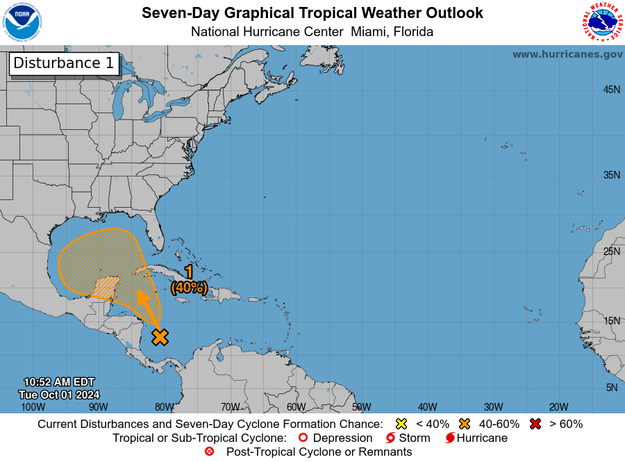
Keep in mind that the orange hatched area above indicates *where* development could occur, not where the system is expected to track. There’s not a whole lot to look at this morning, as any disturbance is very nascent and poorly organized. Over the next couple days, this will migrate northward and perhaps get slightly better organized. Various models depict various solutions, including the possibility that additional areas of disturbed weather enter the picture as well. Overall, the picture looks sloppy.
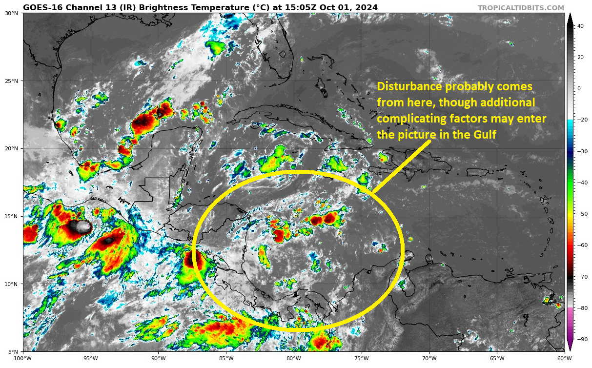
It’s worth noting for those extra concerned that this looks nothing at all like Helene did at this point in its life cycle. So this is why we continue to think that things are likely to be much sloppier and a bit lower end on the intensity scale as this gets moving.
The model solutions really do range from a more organized system to even 2 organized systems to just a “blob” of moisture that tracks northwest, then north, then northeast or even east-northeast across the Gulf, generally toward Florida. Some even sort of stall it out over the open Gulf, sort of like we saw last month off Texas where an undeveloped system sat and festered for a while before Francine emerged from the slop after a week or two. If you look at the GFS ensemble in particular, it shows a whole slew of options.

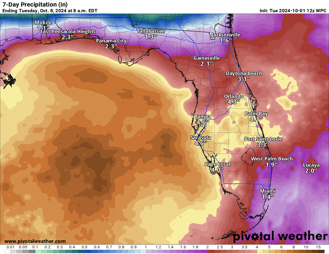
Again, this is much different than how things looked ahead of Helene. Given the idea of a sloppy system, a front in the vicinity early next week, and a somewhat disorganized initial disturbance, all this leads me to think that a messy rainmaker may be on tap for the eastern Gulf Coast and Florida this weekend and next week. Indeed, the rainfall forecast in Florida is solid. For now, serious flooding isn’t expected, but continue to watch this and monitor its progress in the coming days. I think it’s obvious that this one is going to be of lower predictability than Helene was. But also hopefully lower risk as well.
Kirk gaining momentum, and Invest 91L may develop behind it
Tropical Storm Kirk is on the precipice of hurricane intensity this afternoon, as it is a 70 mph tropical storm. Kirk is still expected to remain safely out at sea.
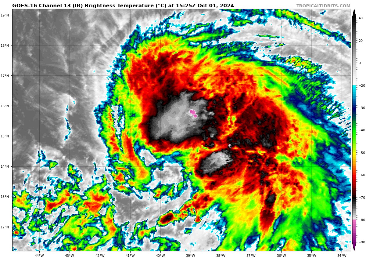
Kirk should intensify steadily over the coming days, peaking as at least a category 3 and possibly category 4 storm over the open Atlantic later this week. Expect to see some pretty stunning satellite imagery at some point. Again, thankfully, Kirk will avoid land.
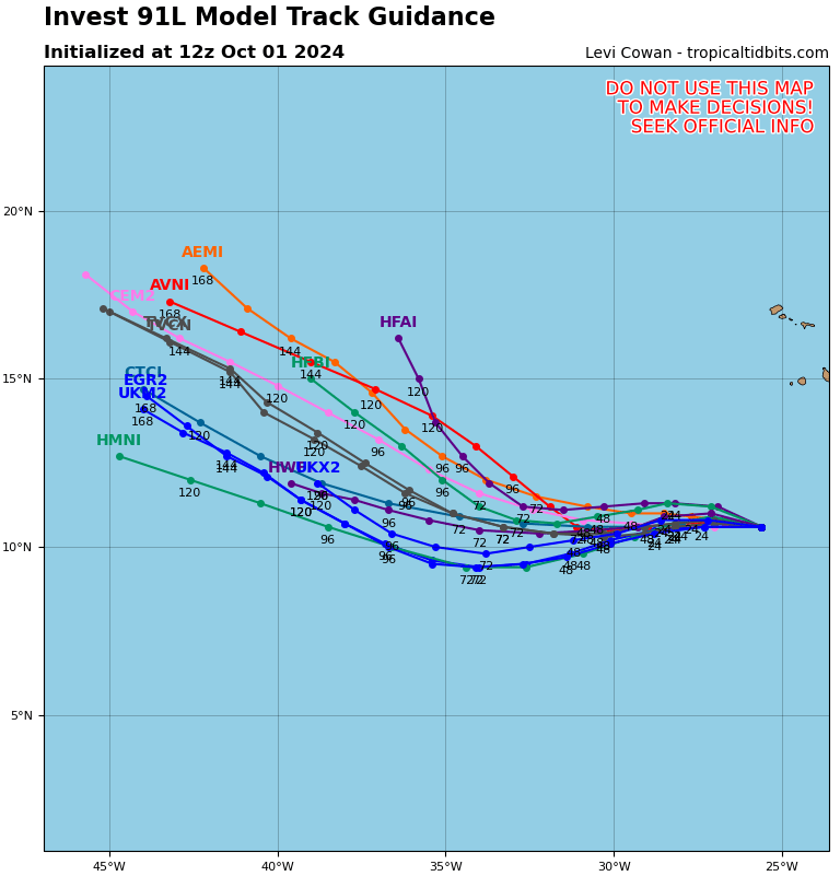
Behind Kirk, we do have a second area, Invest 91L. This one is close to developing as well. Over the coming days, this will take a track generally south and west of Kirk’s track. This should still keep it out at sea, but we’ll continue to watch this one closely in case it can manage to brush the islands eventually.
That’s all we’ve got for now. We will likely see some additional Pacific systems later this week as well. None at this point look to threaten land for now. More to come!
How do you see the weather in Galveston this weekend starting this Friday? The Weather Channel forecast has absolutely crappy weather the whole weekend. 😫
This isn’t SCW.
You know better.
I’ve never seen a more bowl of spaghetti looking spaghetti model before than what’s sitting in the Gulf
Every hurricane season, we see these “spaghetti” plots from many models. Is any one of these models consistently more accurate than the others?
Samaratan’s Purse is also a good place to give for hurricane recovery efforts.
Have the odds of Houston getting a wind storm or a flood gone up given how the Gulf/Caribbean system has evolved Tuesday?
You’re consistent, I’ll give you that.