Headlines
- Tropical development in the Gulf remains possible but not entirely likely over the next 5 days or so.
- Regardless, the combination of a couple disturbances and the remnants of Pacific TD 11 will combine to produce significant moisture tracking toward the Florida Peninsula.
- Heavy rain and some flooding are possible there, especially at the coast and south of I-4 next week.
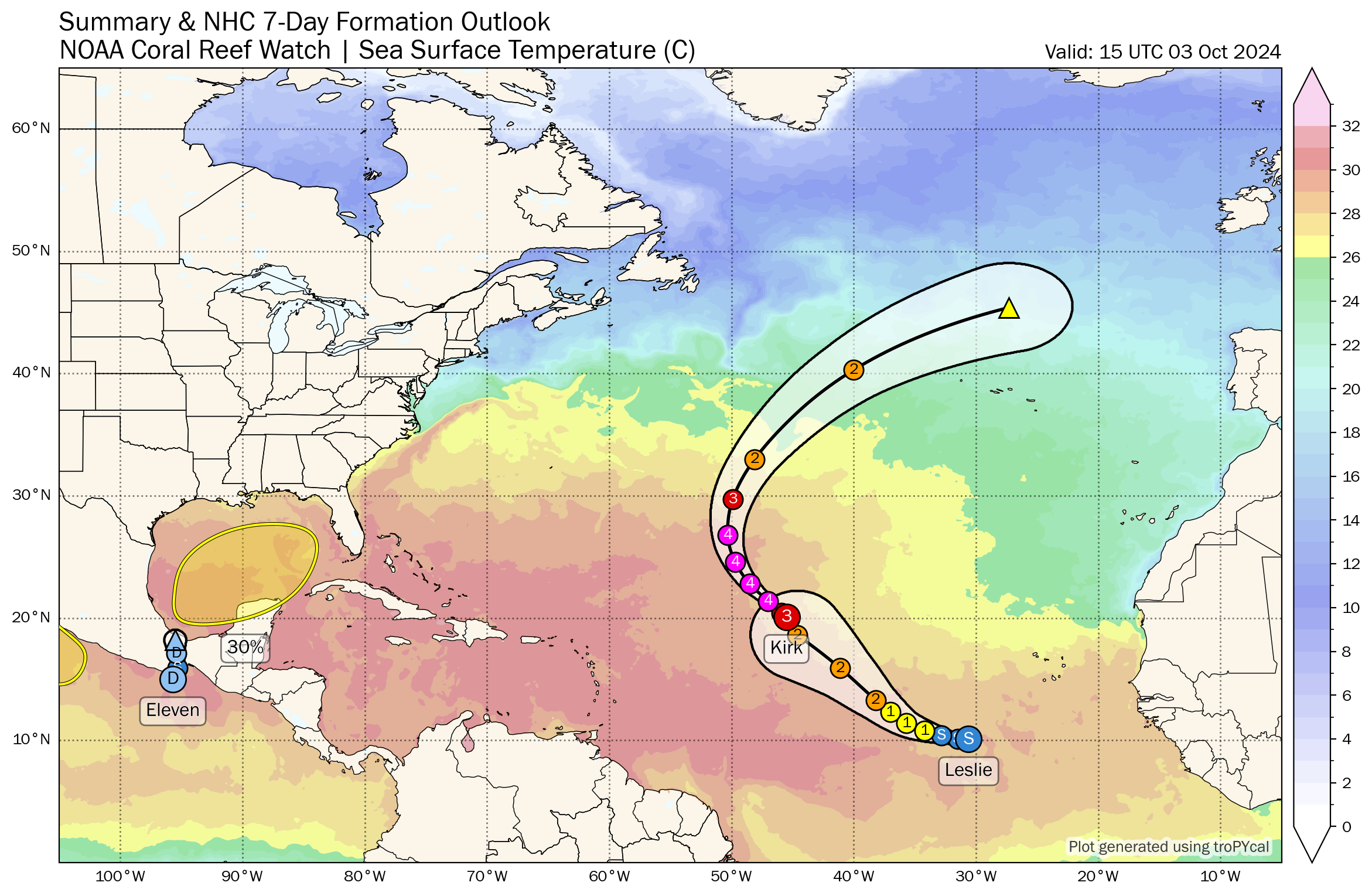
- Hurricane Kirk is nearing category 4 intensity in the open Atlantic, no threat to land.
- Tropical Storm Leslie will slowly organize and may track a bit farther south and west than Kirk but most likely not threaten land.
Gulf development risks slowly backsliding, but heavy rain chances in Florida increasing
We are down to a 30 percent chance of tropical development in the Gulf today, as we continue to watch for disorganized thunderstorms in the area over the next few days. I still think this area will have a chance to develop next week, and many models show development of low pressure into something akin to a depression by early next week.

Today, there’s nothing at all today. We have a cluster of storms south of Cuba and another one in the Bay of Campeche and western Gulf of Mexico. No imminent development is likely from this. Wind shear looks to be a bit much right now, and that may be the biggest limiting factor in any development out of this area. I would say odds of a named storm are quite low from all this, but odds of an invest or depression are moderate still.
What this will do, however, is deliver rain to the Florida Peninsula. Sunday, Monday, and Tuesday look quite wet. Atmospheric moisture is going to load up over Florida, with precipitable water values (or how much available moisture there is) up around the 90th percentile for early October, or around 175 percent of normal. Between the two disturbances noted above, the remnants of Tropical Depression 11 in the Pacific will enter the fray as well.
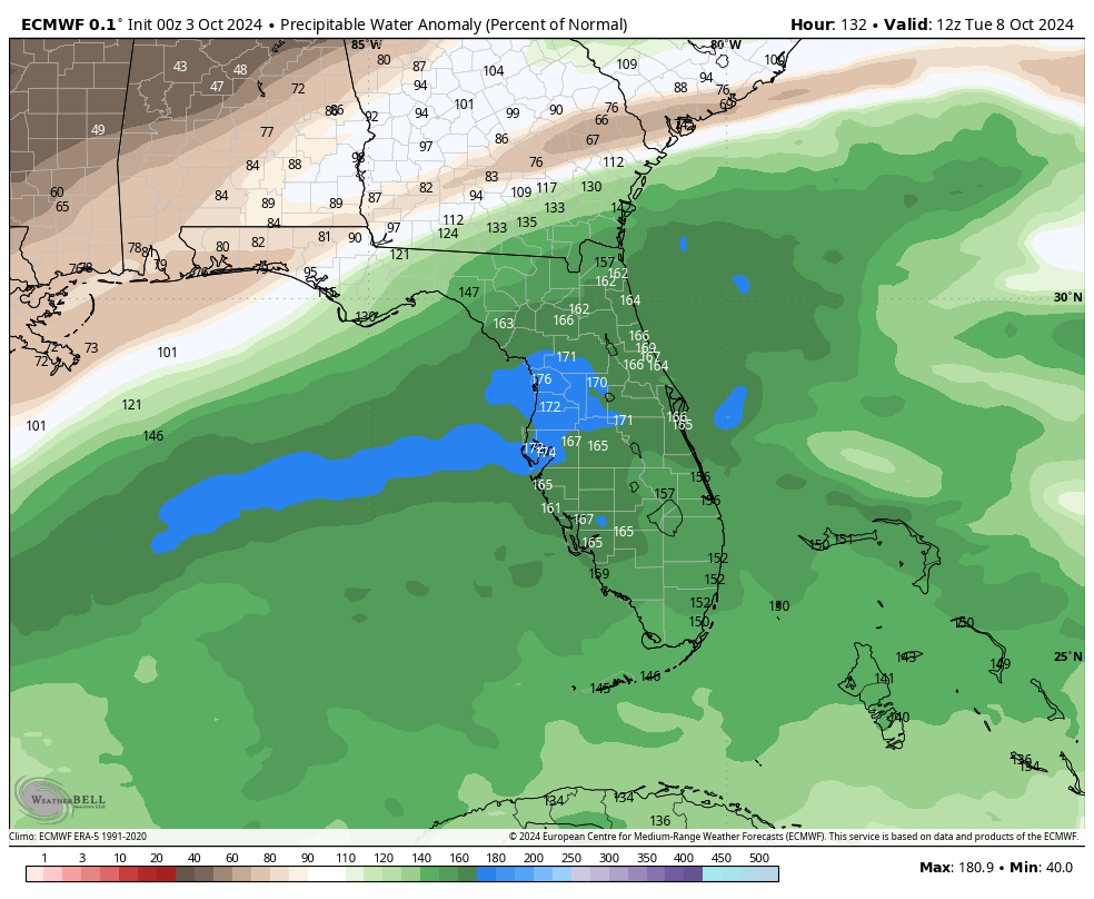
This translates to a lot of moisture available for heavy rainfall. Not everywhere in Florida will get dumped on. But there will be heavy rain around and if you have vacation plans, all I can say is to keep tabs on the forecast early next week and consider some indoor activities. Current rain totals look to be on the order of 4 to 8 inches through next week, with the highest amounts on the immediate coast and south of I-4. North of there through Jacksonville or Gainesville looks to be a bit less impacted.
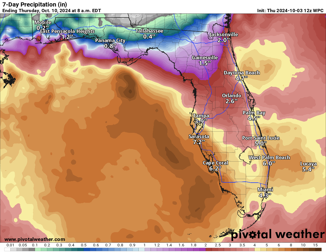
We’ll keep tabs on this for potential flooding. At this point, we remain fairly unconcerned with any other tropical impacts, other than rip currents which are always a consideration with a disturbance in the Gulf.
Atlantic racking up cyclone intensity
Meanwhile, the open Atlantic is bustling with Hurricane Kirk and Tropical Storm Leslie. Neither storm is a threat to land.
Kirk is about as classic looking as it gets, albeit with a relatively large eye.
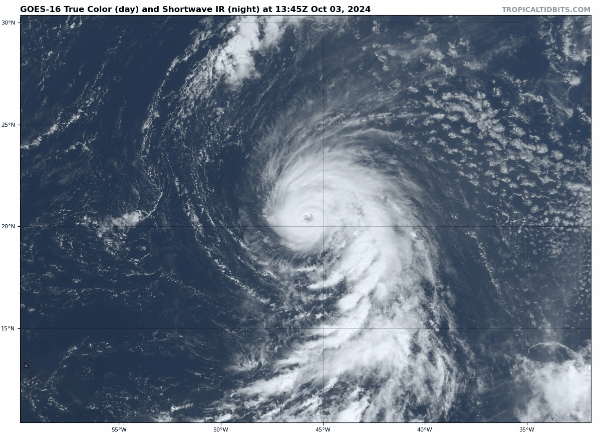
Hurricane Kirk should peak in intensity tomorrow before slowly weakening as it goes north and northeast out to sea. Modeling is in decent agreement that this will avoid the Azores on its way out right now.
Leslie is a little sloppier right now, but it too should intensify into a hurricane eventually this weekend. It will trail Kirk a little farther to the south and west. There is a very, very, very slight chance that Leslie could gain enough longitude to perhaps deliver some fringe impacts to the islands at some point, but that’s unlikely and a long way off. We’ll keep an eye on things.
The good news is that once Kirk and Leslie exit and the Gulf system is out of the picture later next week, I don’t quite know what would be next. There are no model signals of any real strong sort that point to the next system to watch. So perhaps we get a little break. Could it be the final break and the season is over? Maybe, maybe not. But with such warm water still out there, a November storm somewhere would be unsurprising this year.
I’ll tell you what’s next, silly! Halloween and Ren Fest!! Yay!!!!!!!
🍂🍂🧡🍂🍂
I was going to say Milton, but I like your suggestions better.
If we do get to Milton, I expect stapler jokes.
Lol
Weelll…this “Milton” is hoping for no “Milton”…