One-sentence summary
While we’ve had worse travel outlooks for Christmases in the past, this year doesn’t look spectacular, with a few areas likely to experience weather impacts through next week.
Christmas weekend outlook: Rough in spots; not bad in others
After a rollicking couple of days on the Eastern Seaboard with record flooding in Charleston, nasty weather in Florida, and powerful winds knocking out electricity to hundreds of thousands in the Northeast, we will mercifully get a couple days of a break in the East. Meanwhile, the West is just getting started with another storm aiming to bring rain to California today and tomorrow.
As all of that mess starts to exit the West later this week, it promises to setup some impacts on travel days heading right through early next week. It doesn’t look horrific on any given day right now, but a series of systems will probably keep some travel headaches going into next week. Let’s walk you through what and where to watch as it stands right now across the country.
Wednesday: Focus on California
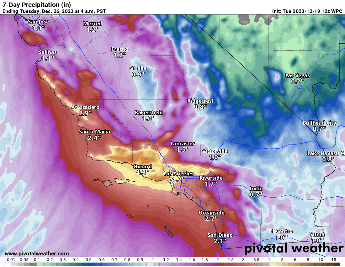
The main headaches on Wednesday are likely to be in California, with heavy rain expected as a cold front pushes down the West Coast tied to a storm system offshore. The highest risk for any flooding will probably be in the LA Basin and Ventura County into Santa Barbara in SoCal. About 1 to 3 inches of rain is expected from this storm on Wednesday which may be enough to cause some flooding and certainly impede travel a bit between LA and San Francisco.
Thursday: More rain, flooding in California
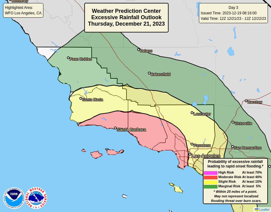
That storm system is expected to kind of slow down offshore of California, keeping a wet forecast going, especially in SoCal on Thursday. Another inch or two will be possible there, with flooding a definite concern. The Weather Prediction Center has placed the western portion of the LA Basin into Ventura and Santa Barbara under a level 3 of 4 moderate risk for excessive rainfall.
Farther to the east, showers will begin to become a possibility in the Plains, but no real serious travel headaches are expected in the eastern half of the country.
Friday: Weather shifts east
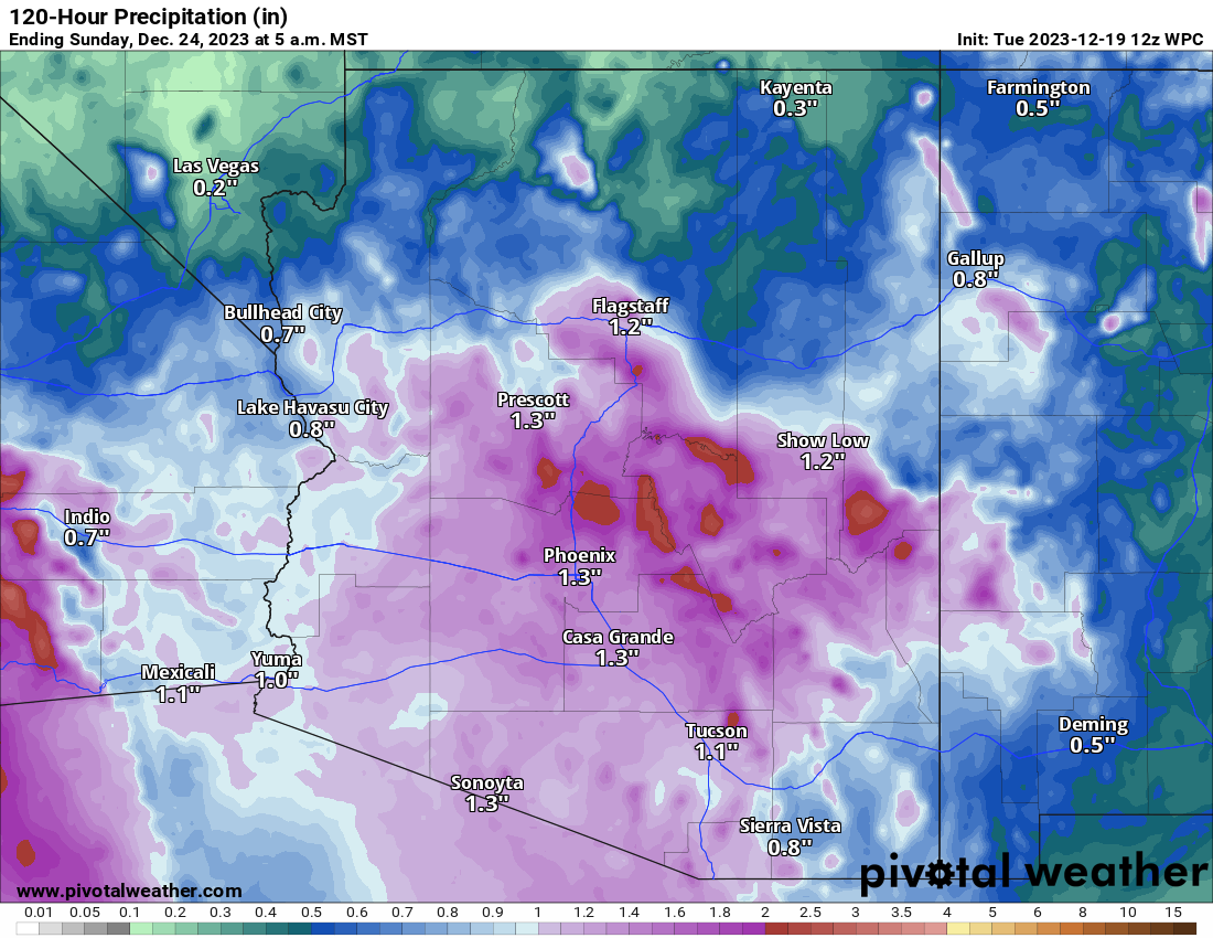
I don’t foresee any real serious issues on Friday, but there will be a couple areas to watch. Rain in California will finally start to push east, more into Arizona, where heavy rain may fall in parts of the state, including Phoenix.
Meanwhile, rain and/or thunderstorms may push across Texas into Louisiana Friday afternoon, perhaps causing a few modest delays in the Houston area.
Saturday: Calm before the storm
Nationally, Saturday may be the best travel day overall with only some minor issues in parts of the Rockies, Southern Plains, or Southeast. No major problems are currently foreseen.
Christmas Eve: Rockies, Plains, and Mississippi Valley see stormy weather
As everything slides east, we’ll get low pressure developing in the lee of the Rockies, probably between the Texas Panhandle and Kansas. This will lead to rain and thunderstorms in the Plains through Texas, expanding east to the Mississippi Valley as the day wears on. Some of these storms could be on the stronger side.
Meanwhile, snow should break out in the Rockies, with Colorado and Wyoming the most likely areas to see accumulation and potential travel headaches.
Christmas Day: Wet Southeast
The forecast confidence begins to fade rather aggressively here, as we end up with a storm system over the Midwest and a wet Southeast and perhaps Mid-Atlantic. Travel doesn’t look particularly awful here, but there will probably be some wet roads for the East in spots. Snow or a mix should continue on the backside of the storm from Wyoming into perhaps parts of Nebraska and South Dakota.
Beyond Christmas Day: East Coast Storm? Still wet in the West
Uncertainty plunges later next week. If you look at this map showing the forecast interquartile range for next Wednesday afternoon from the European ensemble, you can see ample uncertainty.
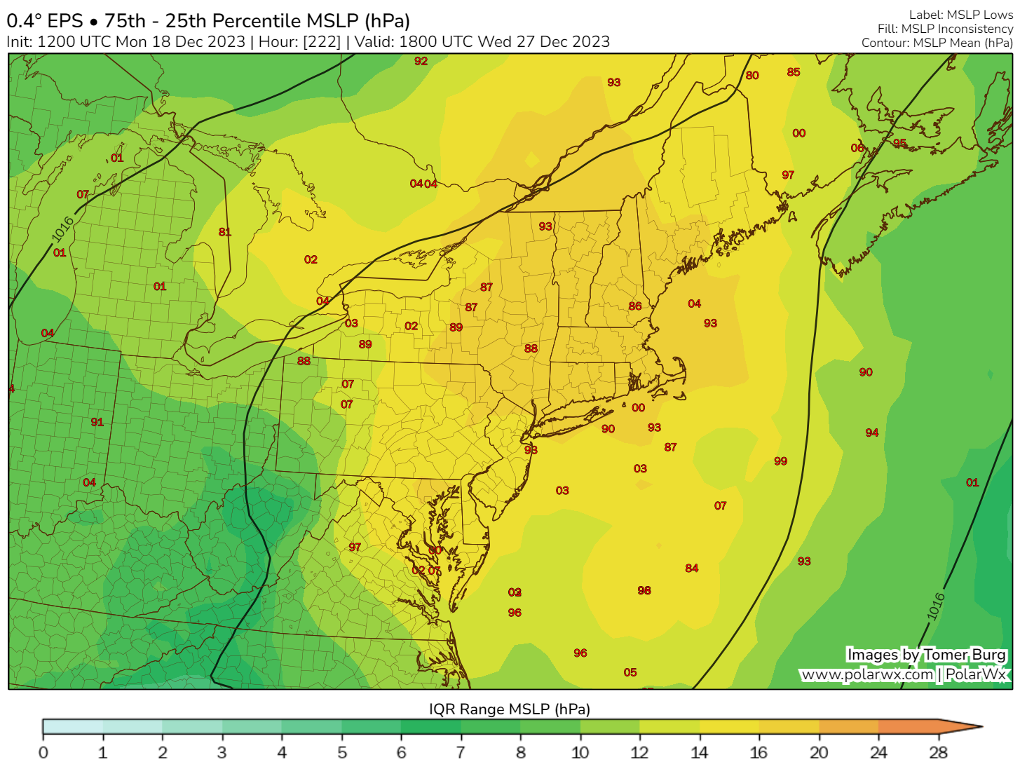
The IQR shows the difference between the 75th minus the 25th percentile of ensemble sea level pressure. The higher the values, the greater the potential uncertainty with placement and intensity of low pressure (or high pressure). In this case, we see a strong signal for a storm in the Eastern U.S. What we do not see is any confidence within the ensemble members regarding location or intensity. So we know something is probably going to happen that could be a travel headache in the Eastern U.S. after Christmas, but we aren’t exactly sure what, when, or where.
Temperatures next week are likely to be warmer than normal in the Northeast, so this probably precludes snow risk for the major cities, but interior areas could be prone to some snow in the right (wrong?) scenario.
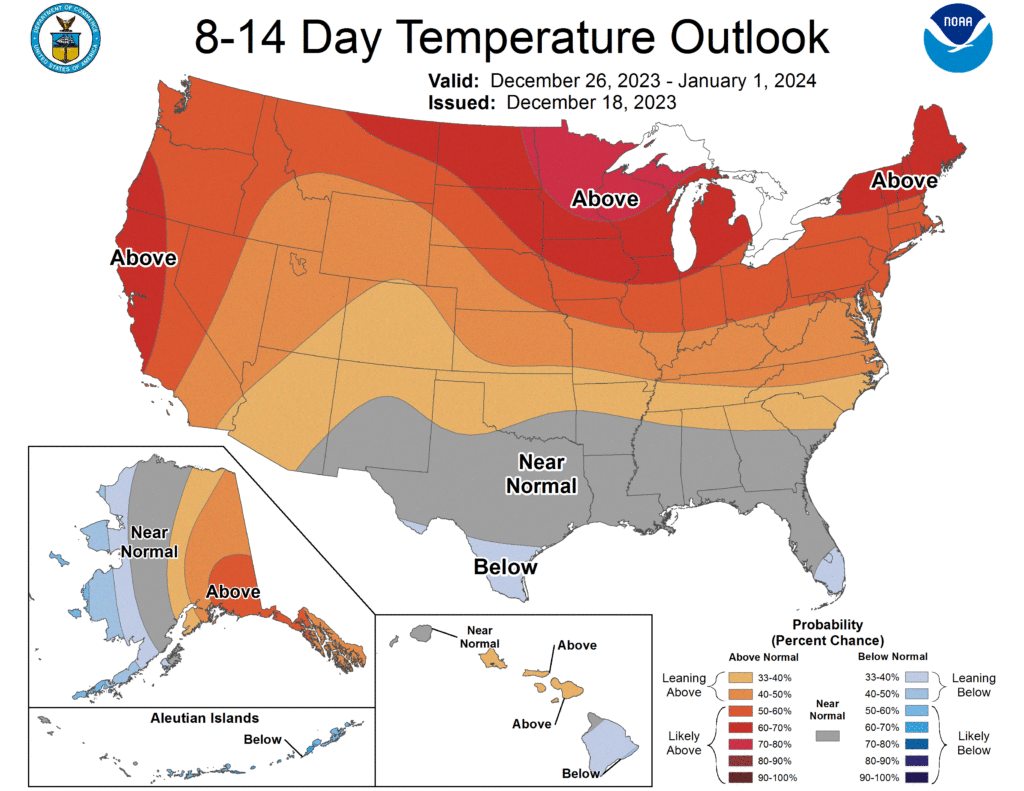
Meanwhile, the West looks mild too, with continued rain and mountain snow lashing the West Coast. This is pretty clearly an El Niño flavored pattern across the U.S. to close out 2023.
So glad to see the Eyewall! 😉
What was that thing that developed in the Gulf, whacked FL and caused misery as it moved north?