Headlines
- No high confidence signals for tropical development in the Atlantic over the next 2 weeks.
- It seems likely that we’ll make it to June 1st without an Atlantic storm.
- Eastern Pacific may get its first system by next week, but it likely heads out to sea.
A May Atlantic basin storm seems unlikely this year
Over the next seven days, it looks like a relatively quiet stretch in the tropical Atlantic. The area where GFS modeling has been hinting at some kind of potential development, the Caribbean, looks drier than normal through next week.
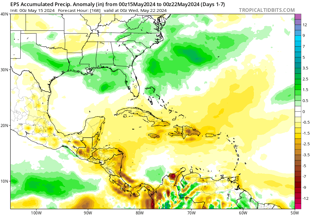
Any kind of development should be held off through the 25th or so. Heading into weeks 2 and perhaps week 3, it continues to look unlikely that we see development in the Atlantic. The Climate Prediction Center’s global tropical hazards outlook shows above average rainfall developing in the Caribbean and western Atlantic in that timeframe, but as of now, there’s nothing to really latch onto as a development candidate.

At this point, I feel relatively comfortable saying that unless something drastically changes soon, we’ll make it to the June 1st start of hurricane season with no preseason storms in the Atlantic.
Hurricane season underway in the Eastern Pacific
Today is the first day of hurricane season in the Eastern Pacific, and the National Hurricane Center has a 30 percent area outlined off the coast of Mexico.
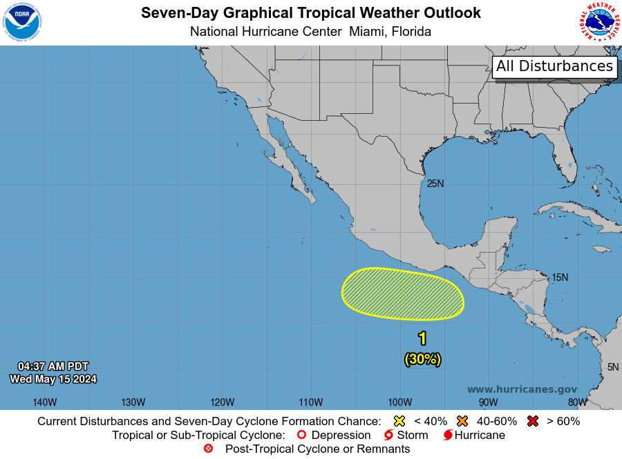
Slow development of this area is possible as it moves west. A building ridge of high pressure in the upper atmosphere, reloading extreme, historic heat over Mexico will keep this one likely moving west out over the Eastern Pacific. If it were to develop, Aletta is the first name on the list this year.