In brief: Hurricane Imelda will impact Bermuda today as a raucous hurricane, but it is moving quickly so it exits tomorrow. Hurricane conditions will arrive later today and through tonight, though there is some chance that the worst will end up south of Bermuda. Either way, a quick hitting strong storm. Meanwhile, we talk more about the complex situation between Humberto and Imelda that has occurred, and where it all goes next.
Hurricane Imelda
Imelda is a strong category 1 storm, headed for category 2 eventually later today. Obviously, a hurricane warning is in effect for Bermuda, and conditions are expected to deteriorate later today.
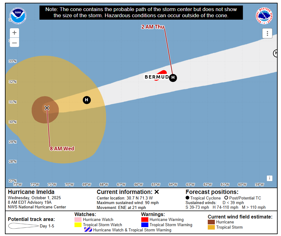
Imelda’s exact track maybe nudged a hair south overnight, which could push the center south of Bermuda. Either way, and no matter how I write this, it’s going to sound inappropriate, Imelda has a robust backside.
So hurricane impacts are almost a certainty on Bermuda. But whether or not we can avoid the potent winds on the southwest side that have been discussed this week as part of a “sting jet” scenario remains to be seen. A track just south of Bermuda probably avoids the worst-case scenario for Imelda specifically, but it still provides plenty of problems.
The good news is that Imelda is moving swiftly, and Bermuda should see calmer conditions and clearing as early as tomorrow morning. From here, Imelda will head further out to sea, not a land threat for now, though the exact trajectory becomes more uncertain in 3 or 4 days.
Imelda & Humberto
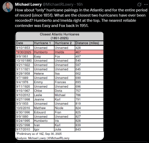
Michael Lowry dug up a great statistic yesterday that showed Humberto and Imelda were the two closest hurricanes in the Atlantic basin in the satellite era.
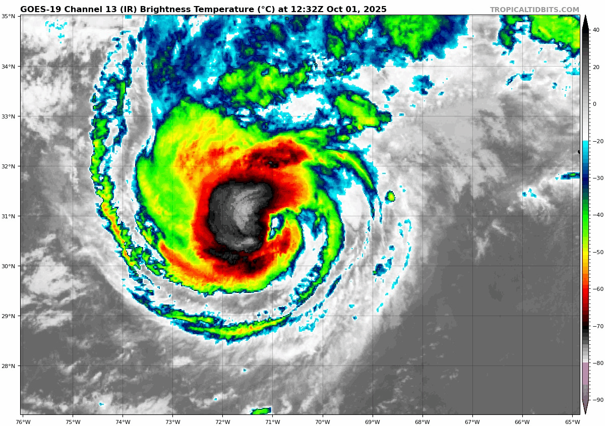
And, frankly, it’s not even close. We did see them both interact with one another yesterday in a somewhat interesting way, via a bit of a Fujiwhara effect. You can see that on this satellite loop from the College of DuPage. If you look closely, you see Humberto get pulled back north and west a smidge on Tuesday, as Imelda begins to undercut the storm.
From here, Humberto essentially disintegrates, while Imelda becomes dominant and gobbles up some of what’s left of Humberto on the way out to sea. The rest of Humberto’s remnants get stretched out into the overall weather pattern across the Atlantic, and that may help also give a boost to Storm Amy, which is expected in the British Isles Friday and Saturday.
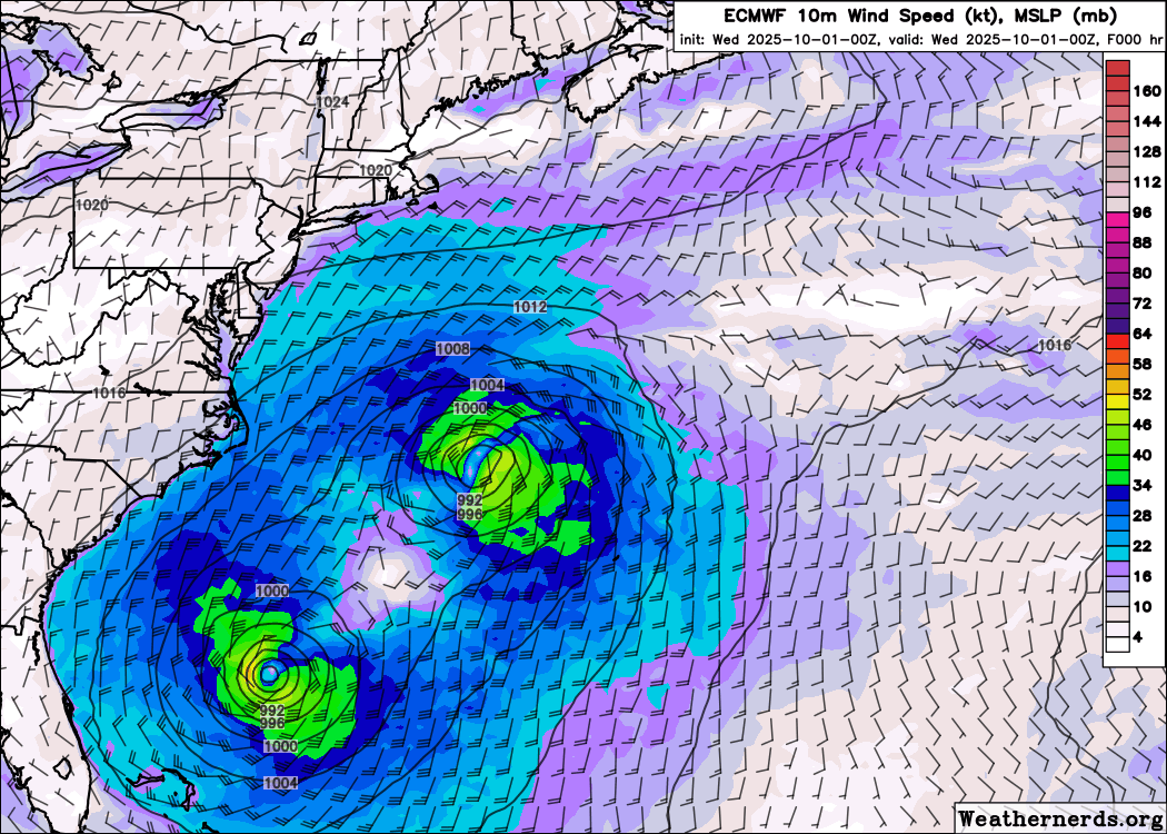
But is interesting to see the model data showing Humberto and Imelda basically in a little cocoon together last night into today before Humberto just gets wrecked. A fascinating meteorology unfolding in the Atlantic that may make someone’s dissertation one day.
Last note: Remember Gabrielle? Well, it brought flooding to Ibiza in the Mediterranean. Nothing to rave about there.