One-sentence summary
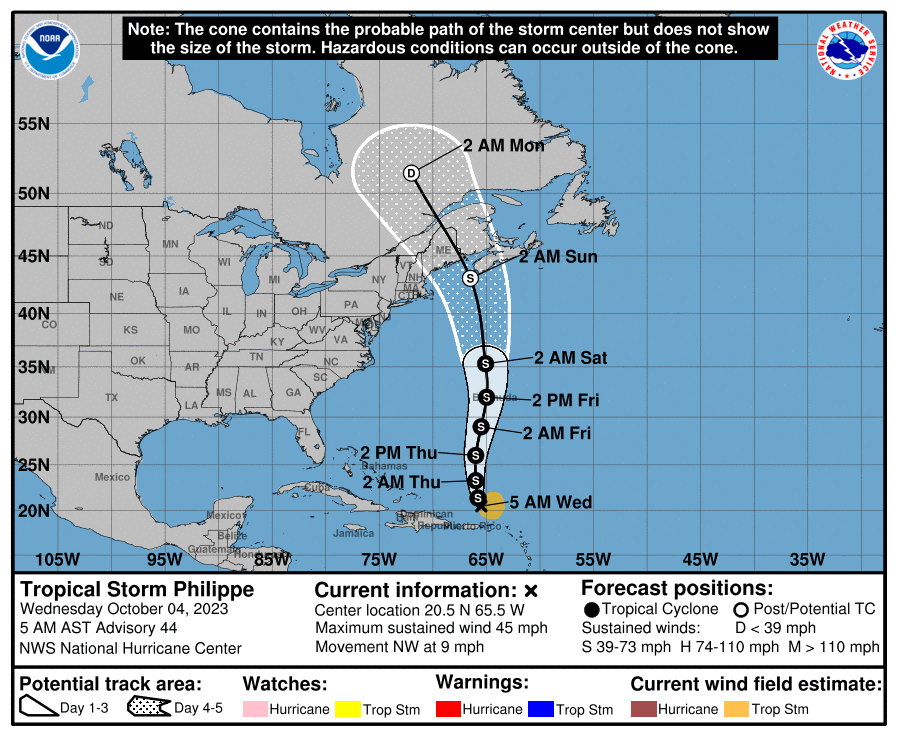
Philippe is finally lifting north after lashing the Leeward Islands earlier this week, and it may move toward Bermuda as a tropical storm by Friday or so.
Philippe is disheveled, but not dead
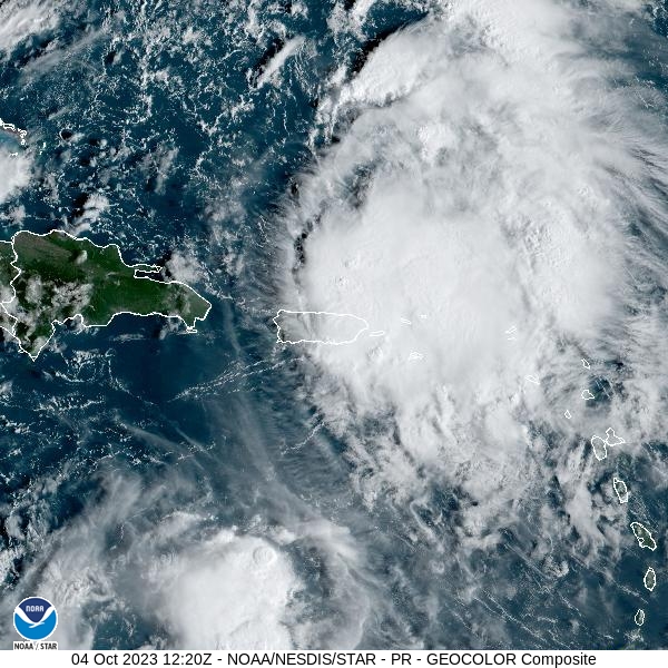
Tropical Storm Philippe has a rather ragged appearance this morning, and it continues to struggle with wind shear. After proving to be a rainmaker for islands such as Barbuda and Dominica, as well as the Virgin Islands, the storm should finally find a passage north as a high pressure system gets out of its way. It has open water for a couple of days before it reaches the vicinity of Bermuda. So what will happen to the storm’s organization over the next two days?

There is a ton of uncertainty, as Philippe could use this brief window of opportunity to strengthen into a Category 1 hurricane, or it could essentially be wiped out. Given its initial disheveled state, it’s difficult to parse whether the storm will, in fact, get its act together. The official forecast from the National Hurricane Center splits the difference, calling for a strong tropical storm with 60 mph tropical storm winds as Philippe nears Bermuda. This seems like a reasonable best guess.
After interacting with Bermuda, Philippe should begin transitioning into an extratropical cyclone as it heads toward the Canadian Maritimes and northern New England. The primary threat there will be some additional heavy rainfall this weekend before the system dies out completely over Canada. Areas including Maine and Nova Scotia should continue to track the storm’s progress for a few more days until we can say au revoir to Philippe.

Beyond Philippe: Some Pacific mischief?
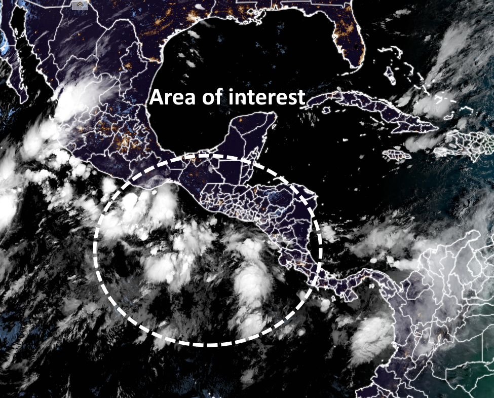
After Philippe’s exit, the Atlantic looks quiet for a little while. The one feature we probably need to watch is a disturbance in the Pacific Ocean south of Guatemala that is likely to become a tropical storm over the next five days or so. Much of our model guidance indicates this will move across Mexico and into the Gulf of Mexico next week.

This could bring some heavy rainfall to coastal areas of Mexico, as well as the Gulf coasts of Texas and Louisiana later next week. But we’re at the point where there is just the threat of this happening, rather than any certainty. We’ll continue to watch it for you.
Grateful for the dedication and effort Mr. Berger. Cheers
A friend of mine told me about Chem trails. After a Google search I didn’t know who’s information to trust and you came to mind as a trusted source. So, what do you think about Chem trails?
https://www.texasstandard.org/stories/as-drought-threat-increases-scientists-hope-to-make-it-rain-by-seeding-the-clouds/
“Chem trails’ are a derisive term that some folks use to describe “contrails,” which are cirrus clouds that form in the wake of jet planes. The science is pretty basic: Jet engines create a lot of heat. When you heat up the water vapor, it condenses around the jet engine exhaust particles and becomes visible as a cloud. If the atmosphere is very dry, contrails will either dissipate quickly or not form at all. They call them “chem trails” because they believe there’s something nefarious about them. There’s not. You are visualizing basic science when you see contrails…the heating of water vapor in the sky.
Thanks, that what I thought as well but I wanted to hear it from you!