One-sentence summary
Philippe is dumping rain in the northern Lesser Anilles today before it heads out of town, leaving behind a quieter picture in the tropics.
Philippe impacting Anguilla, Antigua, and Barbuda with heavy rain & wind
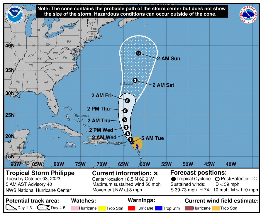
Tropical Storm Philippe is moving north of the Leeward Islands this morning, but the worst of the weather really just arrived there overnight.

Philippe is terribly organized, with its center displaced well north of all the thunderstorms. This is what will continue depositing several inches of rain on the Leeward Islands through tonight. Philippe will lift northwest and eventually north, albeit slowly over the next two days, before conditions begin to improve in the islands. Anywhere from 3 to 8 inches of rain will be possible when all is said and done particularly between Barbuda and Dominica. Flash flooding is certainly possible. The Virgin Islands should see closer to 1 to 3 inches of rain, with even a bit less in Puerto Rico.
From here, Philippe should head out to sea, passing close but east of Bermuda, where it has a puncher’s chance to become the season’s seventh hurricane. There is a slight chance it could bring some modest impacts to portions of Atlantic Canada next week, but that’s still a bit of a ways out to get too specific. It’s probably worth monitoring at least.
Beyond Philippe: Pacific action & low-level noise in the Atlantic
Outside of Philippe, the Atlantic looks quiet for the next 5 to 7 days before perhaps we’ll watch the southern Gulf or northwest Caribbean for signs of life. There’s nothing specific to focus in on right now, just a general low-level hum of static within the models. Often that’s a precursor to something, but not always. We’ll keep tuning in to see if we can decipher things.
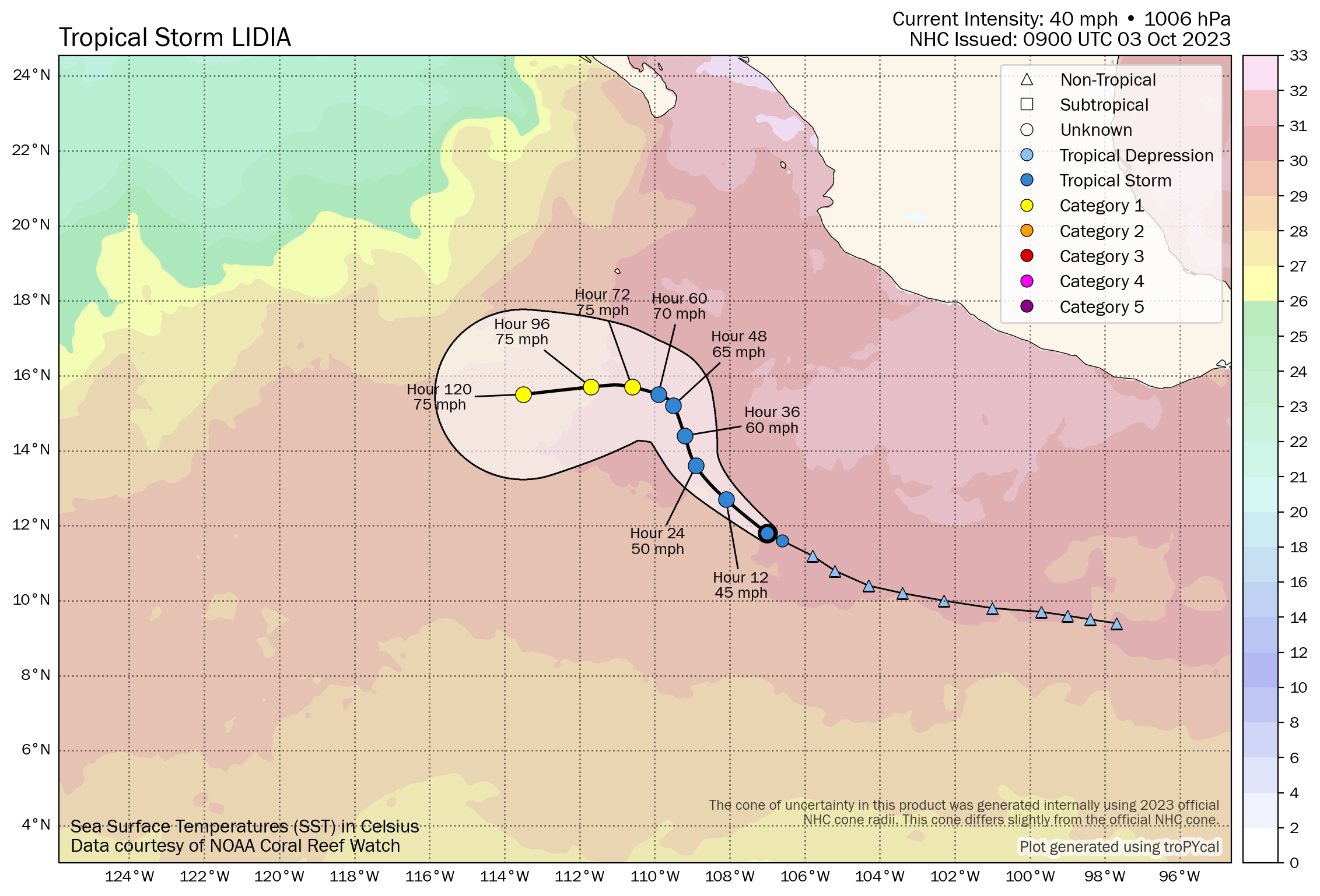
In the Pacific, Tropical Storm Lidia has formed. The track forecast has gotten a little better together since yesterday (when it was Invest 98E). It now appears that Lidia is most likely to turn west into the open Pacific rather than impact land.
Another system may develop closer to Mexico later this week or weekend as it gradually tracks west as well.
U.S Weather Notes: Texas rain & severe storms in the Plains; chilly weekend!
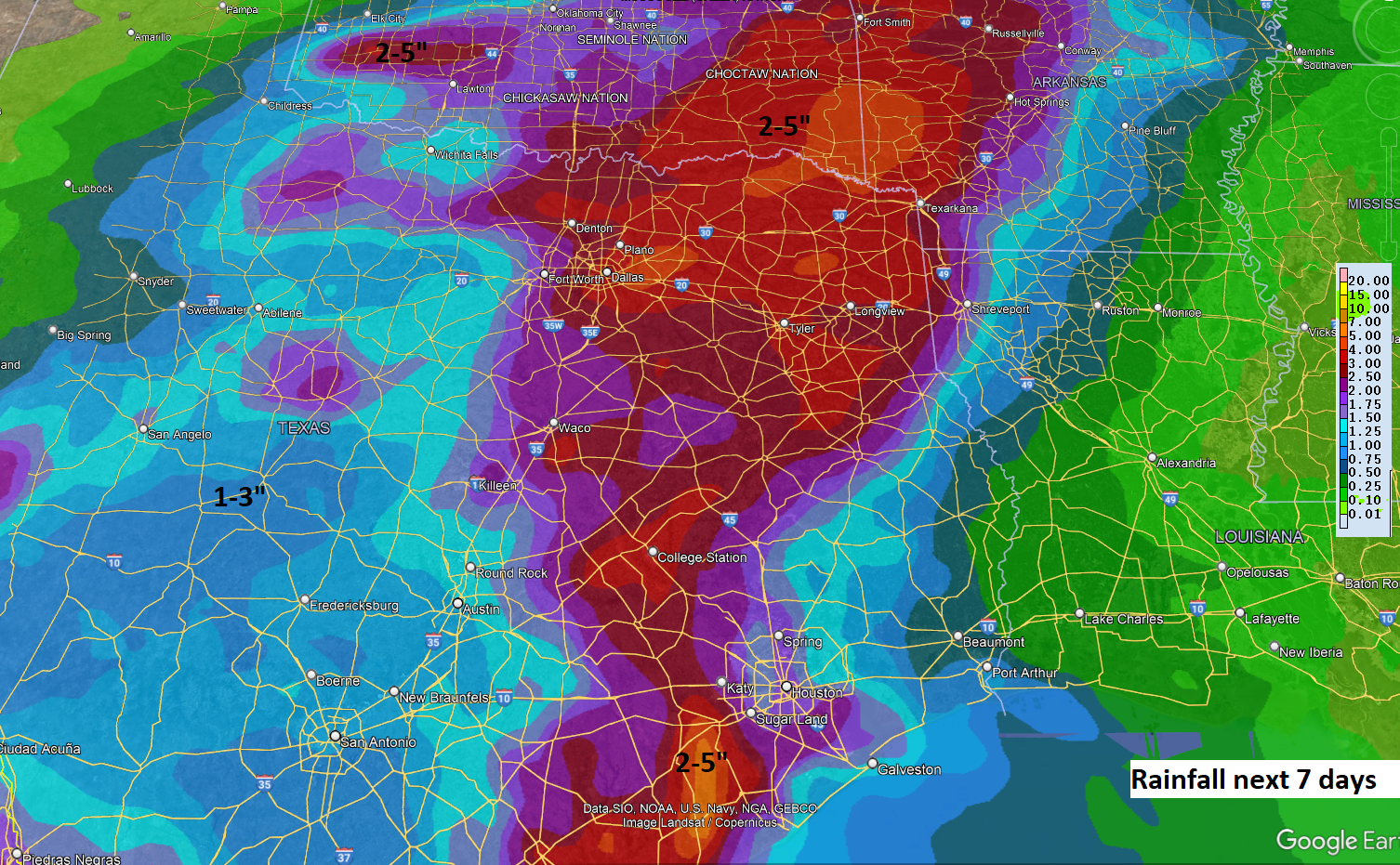
We went in depth on things yesterday, and today looks generally a bit quieter, although storms will spread across more of Texas. There is also a chance of locally heavy rain in the Houston area, which we have covered for you at Space City Weather.
The severe weather risk today is highest in the central Plains today. The Storm Prediction Center bumped up today’s risk to enhanced (level 3 of 5) in portions of Oklahoma, Kansas, and Nebraska.
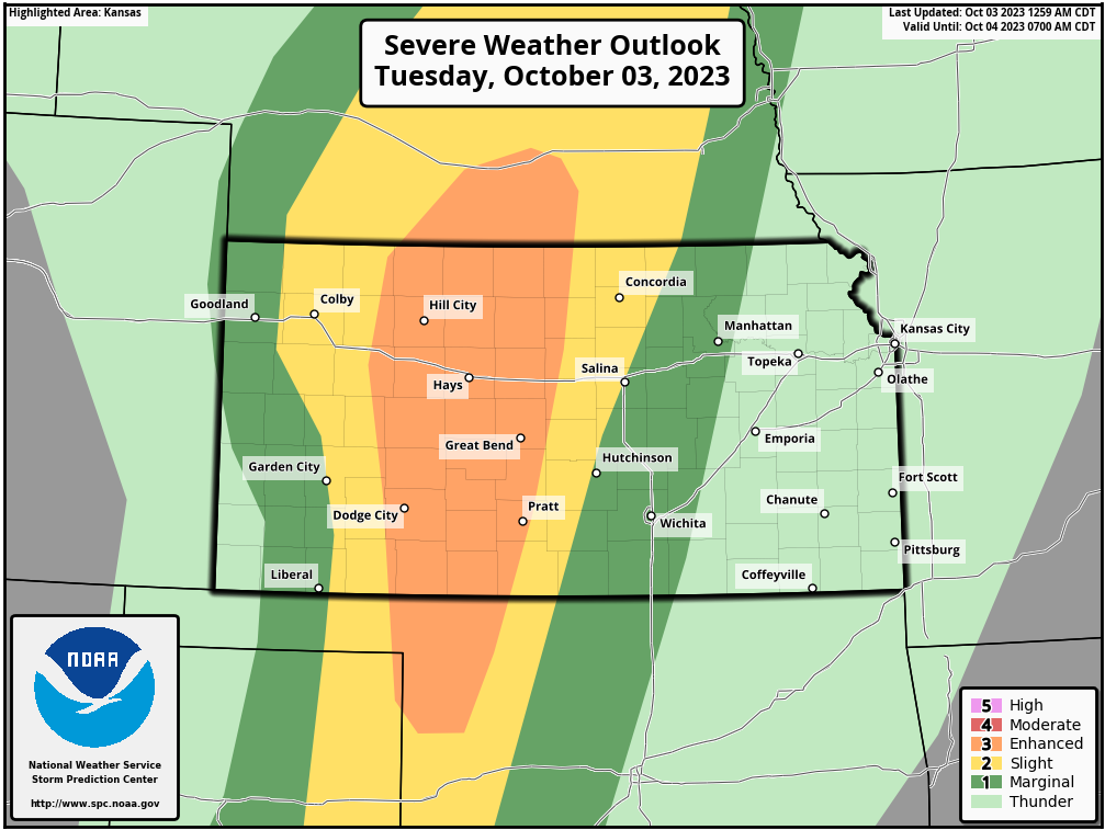
Hail seems to be the biggest risk today, with some golf ball to hen egg size hail possible in the strongest storms. Tornadoes are possible with a few storms, and there should also be a fairly broad damaging wind threat.
We’ll continue to see pockets of heavy rain in Texas over the next few days which keeps the risk of localized flooding in play. That said, the dryness of the last few months will certainly mitigate any real serious flooding concerns in most of the state. We mentioned the heavy rain chances near Houston today. The Dallas area will probably get involved in some of this heavier rain tomorrow and tomorrow night.
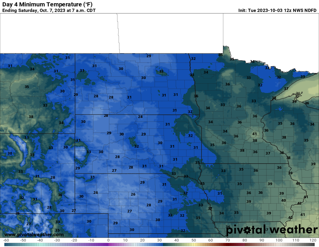
The first real cool air mass of the season continues to look likely for late this week and weekend, bringing at least a slight chance of frost or a freeze to parts of the northern Plains Friday or Saturday.
Low pressure will spin up along the front somewhere between Lake Erie and Quebec which will enhance rain over portions of Upstate New York or New England this weekend. As much as 3 or 4 inches of rain is possible for portions of Maine and New Hampshire, particularly in the White Mountains. We’ll have to keep an eye on this area for localized flooding this weekend.
We’ll leave you with a scene from Brighton Resort in Utah yesterday. A taste of winter.
More tomorrow!
Brighton in UT. 🙂 I grew up in the East Millcreek Canyon area of SLC, in Olympus Cove. My view out of the house was Mt. Olympus, a 10,000’+ tall mountain. Our house sat at about 5100′; front side looking at Mt Olympus, the back side looking out over the Salt Lake Valley. Brighton and Alta are where I learned to ski way back in 1959. I was three…… I have been down here for 22+ of the last 26 years. I still miss the seasons, and especially the first snowfalls of the season.
Sigh………