One-sentence summary
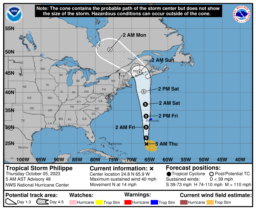
Philippe will bring tropical storm conditions to Bermuda tonight and tomorrow before transitioning to a nor’easter-type system and moving into Nova Scotia, New Brunswick, or Maine later this weekend.
Tropical Storm Philippe: Another one for Bermuda & Atlantic Canada/Maine
Tropical seasons tend to have “flavors” to them. And this year’s flavor seems to be that the corridor between Bermuda and Nova Scotia is the highway for quite a few systems. Philippe should join that list.

Over the next few days, Philippe will track northward, probably passing just west of Bermuda tomorrow, which will lead to yet another round of tropical storm conditions on the island. Philippe is not necessarily a strong tropical storm, with winds of 40 mph this morning. But it is expected to gradually become a bit of a broad, more wind-laden system as it tracks past Bermuda and toward Nova Scotia, New Brunswick, or Maine. Ironically, this will be as a result of the storm transitioning (much like Lee did) to an extratropical entity (more like a nor’easter than a tropical storm).

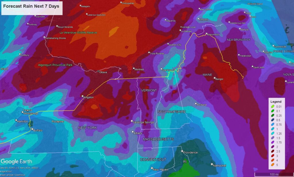
The main issue from Philippe as it comes north will be gusty winds, rough waves and erosion, and heavy rain as it transitions into a robust non-tropical low over Maine and Quebec. Rain totals are currently expected to be on the order of 1 to 4 inches for portions of New England and Quebec, highest north of Ottawa and Montreal. Localized flooding will definitely be a possibility, and the Weather Prediction Center has northern New England highlighted in their excessive rainfall outlooks for Saturday through Monday.
The specifics on waves and winds will get sorted out in a day or two. But I would expect conditions generally less severe than Lee for Nova Scotia, New Brunswick, and Maine.
What else is out there?
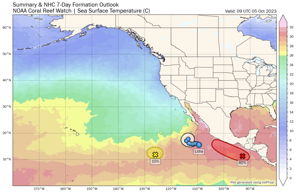
The NHC is highlighting another area in the deep Atlantic that may be able to try to develop next week. Probably nothing, and certainly nothing to worry about at this point.
Closer to land, as Eric noted yesterday, we continue to see some noise in modeling with respect to some moisture off the coast of Mexico. Tropical Storm Lidia will go out to sea in the Pacific, but the next system, closer to the coast of Mexico when it comes west-northwest has a little more complexity.

This one has a chance to drift into Mexico and perhaps into the western Gulf. Should that happen, we could see heavy rain over Mexico or tracking across the Gulf from southwest to northeast. But there’s a long way to go to sort this all out.
Other than that and some strong storms in Texas this morning, we’ll have quieter weather across the U.S. the next few days.
Y’all have mentioned the distinction between a tropical storm and a nor’easter a few times now. What IS the difference? (And sorry if you explained and I missed it…if you could point me to the relevant post, that would be great!)
In a nutshell, it’s what helps them to strengthen. So a tropical system (storm or hurricane) feeds off heat. In other words, it’s a warmer process, the warm water and moisture helps it organize and grow. With nor’easters, the process by which they grow and strengthen differs. Those types of non-tropical storms grow and strengthen off of jet stream dynamics and tend to have clashes of air masses involved (so they usually have cold fronts or warm fronts attached). Basically, they’re fed by the atmosphere, whereas tropical systems are most often fed by the water. If that makes some sense!
Can someone pipe all that rain from Nova Scotia this year down to Texas/Louisiana?