In brief: Erin is chugging out to sea now, but not before possibly delivering an enhancement to already extreme wildfire risk in Nova Scotia, New Brunswick, and Prince Edward Island. Rough surf and rip currents will linger on the East Coast and in Atlantic Canada through Sunday. Invest 90L remains worth monitoring for Bermuda. Invest 99L is worth monitoring for the Windward Islands. And flooding chances mix with beneficial rainfall heading into next week in the southern Rockies and Plains.
Hurricane Erin
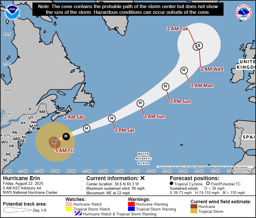
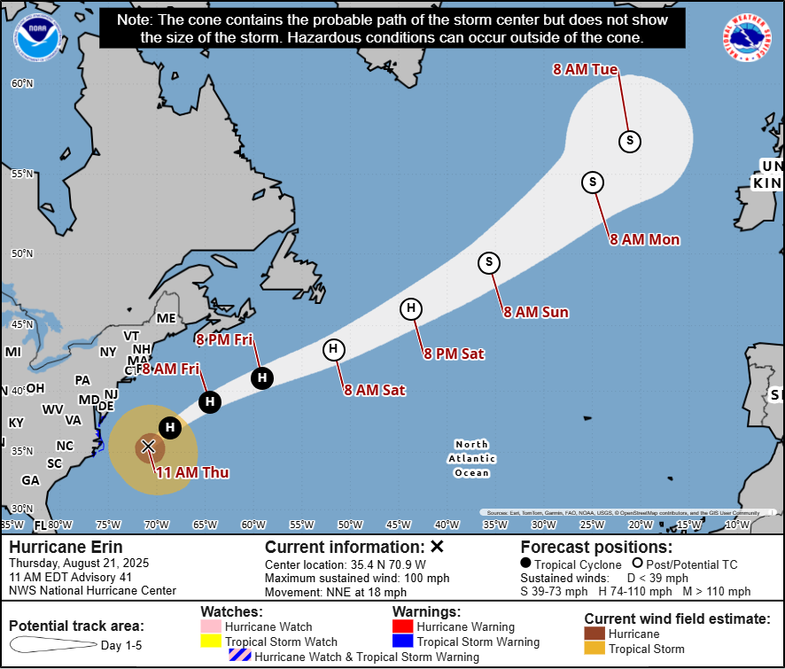
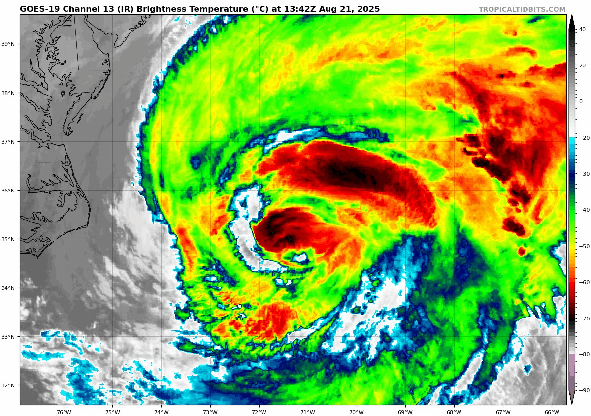
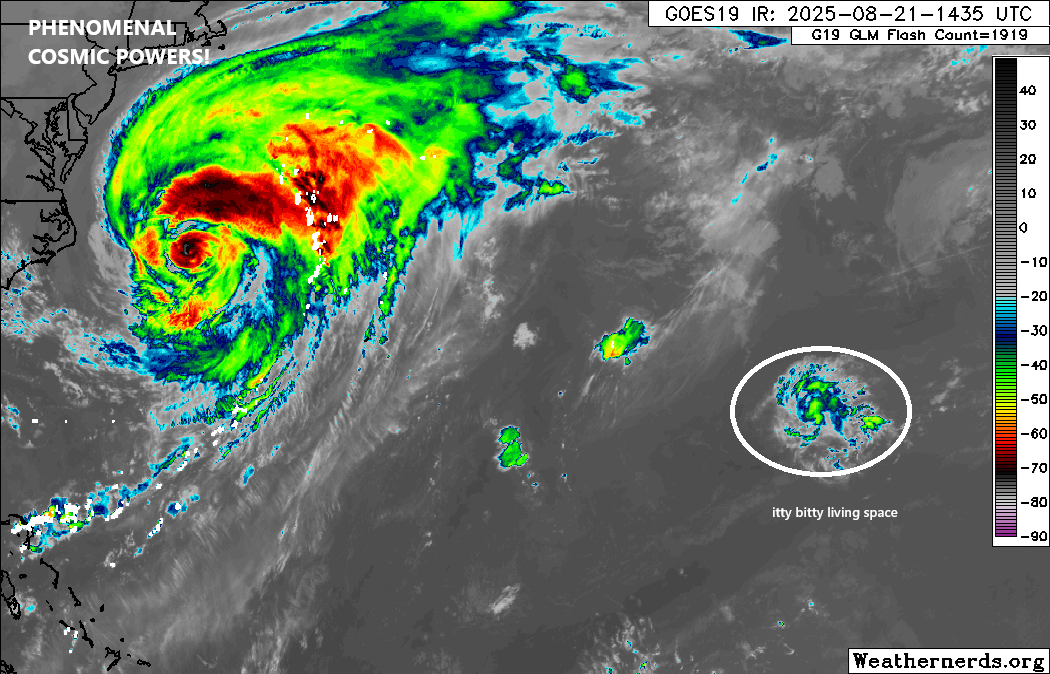
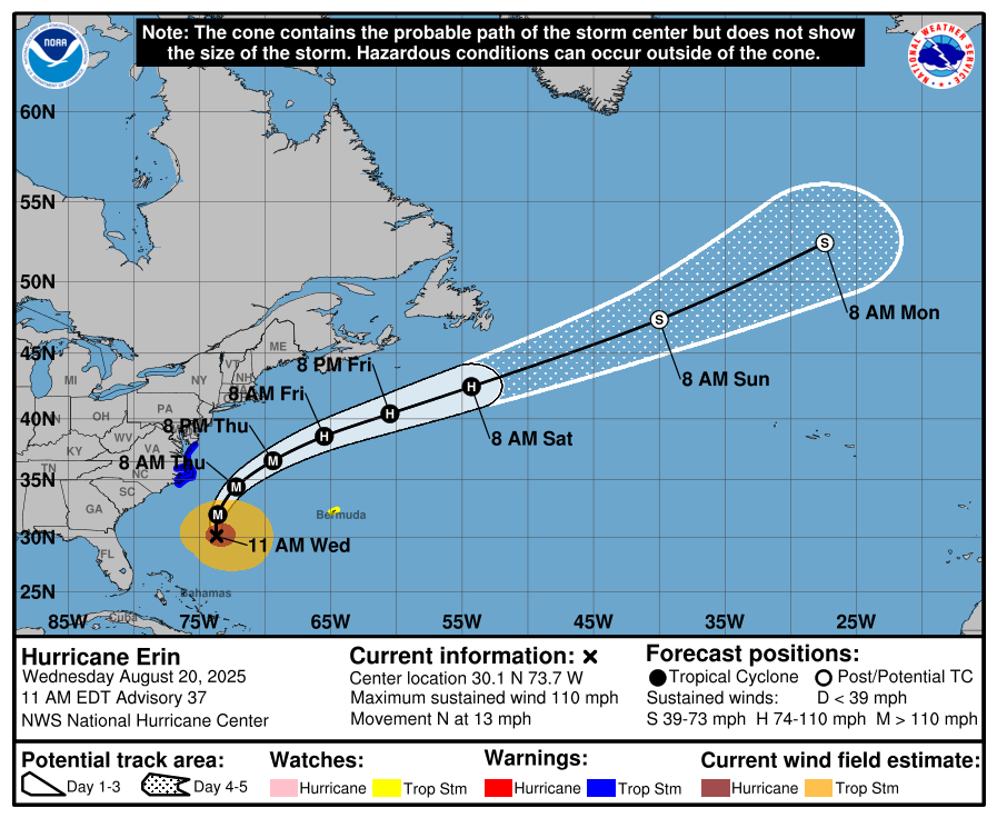
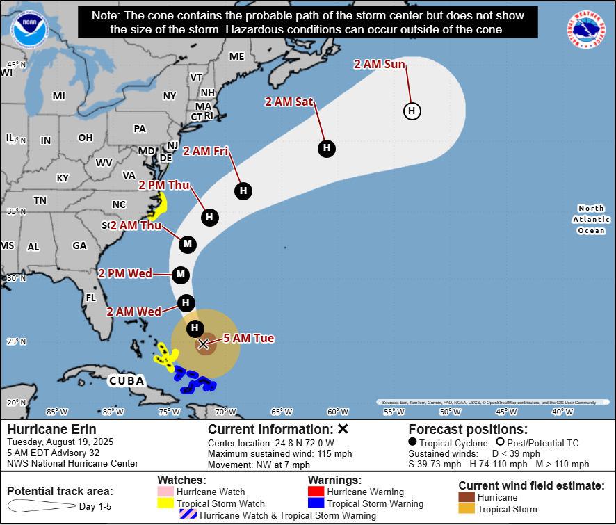
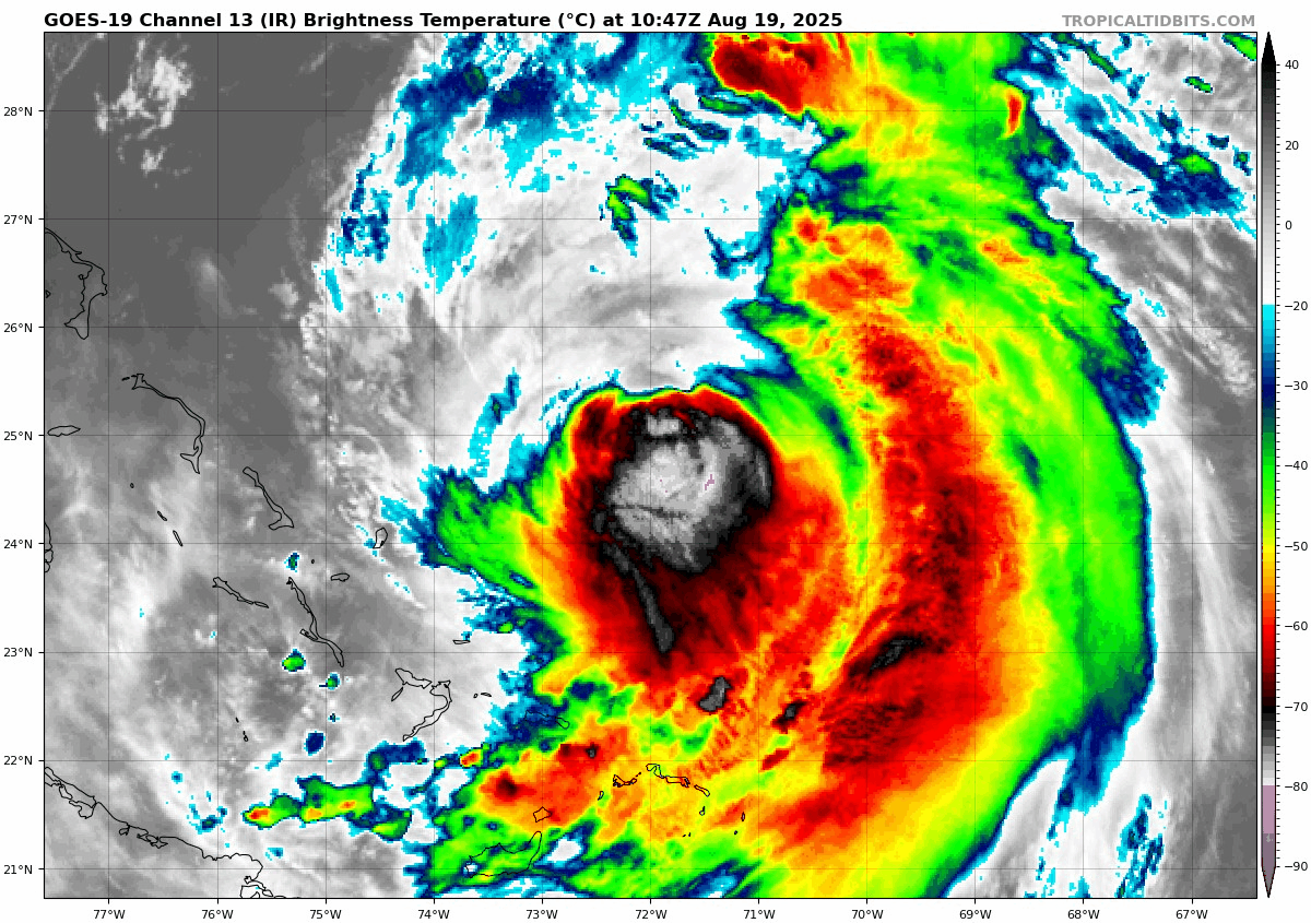
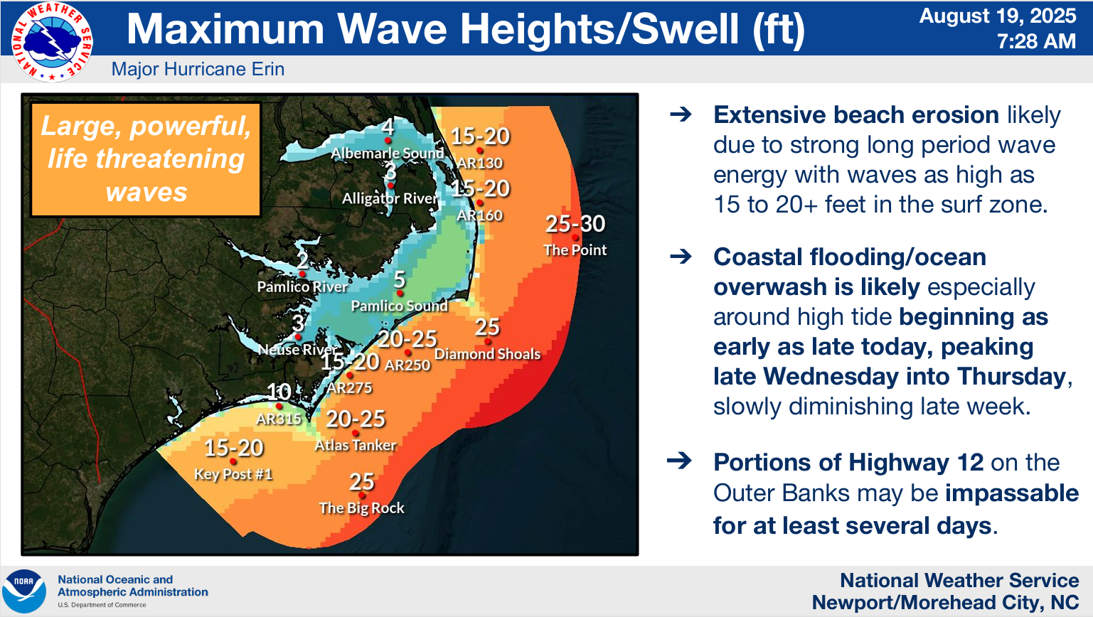
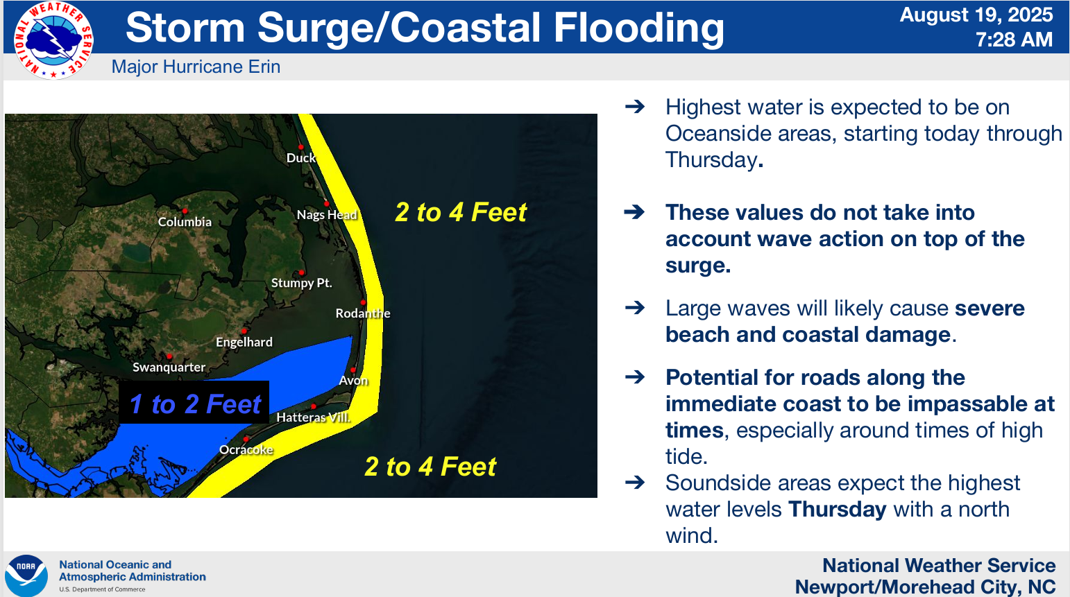
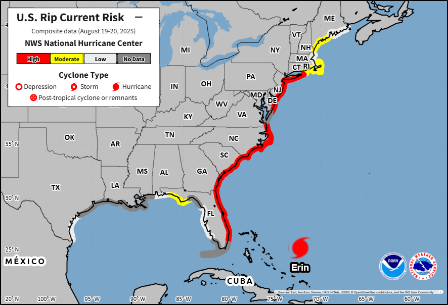
Erin is booking it this morning. The strong, sprawling category one hurricane is moving northeast at over 20 mph. The good news this morning is that all watches and warnings for land have been discontinued. Rough surf and rip currents will continue to impact the East Coast, Bermuda, and Atlantic Canada, but the worst of Erin’s impacts to land seem to be over now.
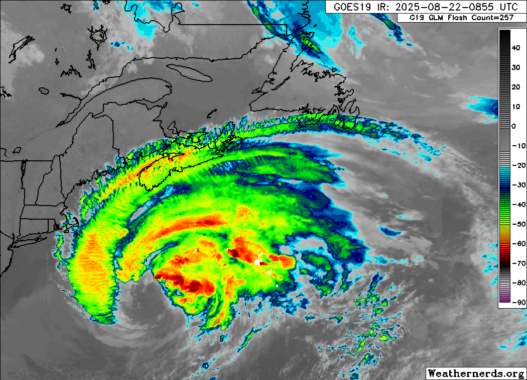
What’s next for Erin? Well it remains a large storm, with a wind field of tropical storm-force over 350 miles now. It should pass well south of land, but gale-force winds are likely in southeast Massachusetts, Nova Scotia, and the Avalon Peninsula in Newfoundland as this passes. Rough surf with waves of 3 to 6 meters may break on the coast of Nova Scotia today and in the Avalon & Burin Peninsulas of Newfoundland later and tomorrow. Even as Erin weakens and turns extratropical in the cooler North Atlantic waters, the size of the gale-force wind field may grow further, keeping Erin a powerful feature on the weather map through the weekend.
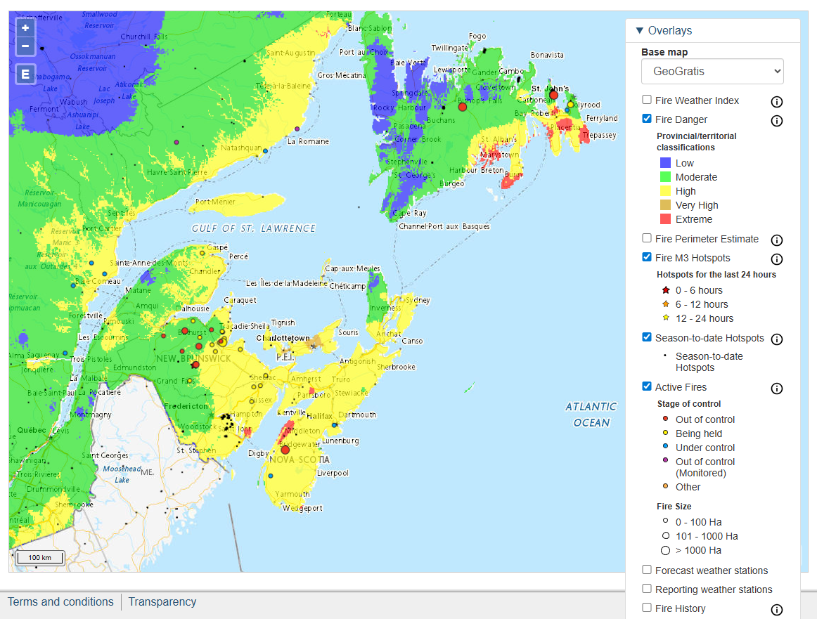
Yesterday I noted the wildfire potential with gusty Erin winds blanketing a very dry Atlantic Canada. Well, the fire risk today at least seems pretty noteworthy in Nova Scotia, PEI, and parts of New Brunswick, with “extreme risk” drawn in those areas.
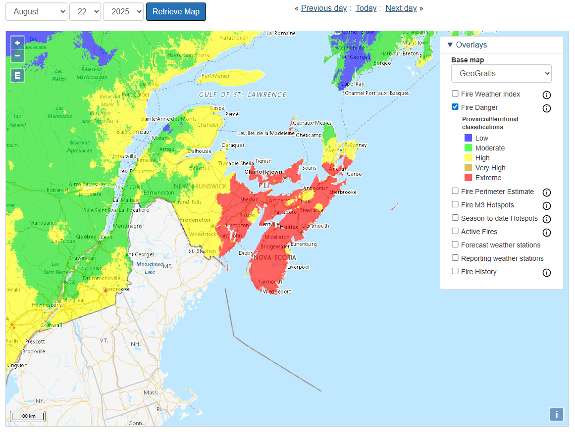
That risk should remain and expand into Newfoundland tomorrow. For some areas, the risk may diminish as Erin passes, particularly for Newfoundland. In Nova Scotia, New Brunswick, and PEI, however, the risk may stay at extreme levels through the entire weekend. A rare situation for this part of the world.
Erin’s remnants will park themselves south of Iceland for a time before probably moving into Europe as a (much weaker) storm next week.
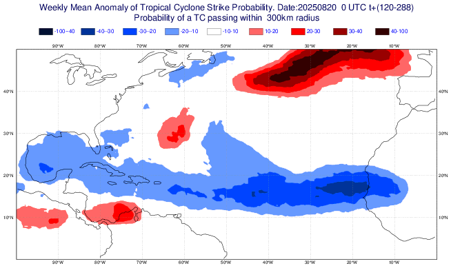
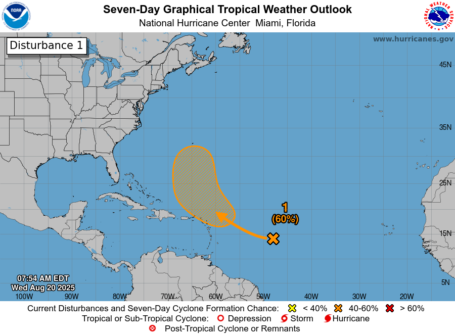
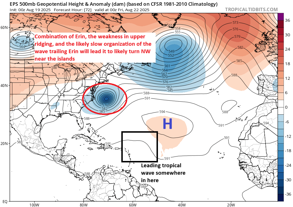
Invest 90L
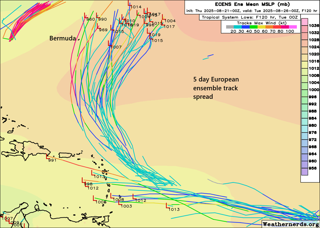
Let’s work our way back south now to Invest 90L. This one continues to lack much organization today, but models continue to insist it will eventually get its act together.
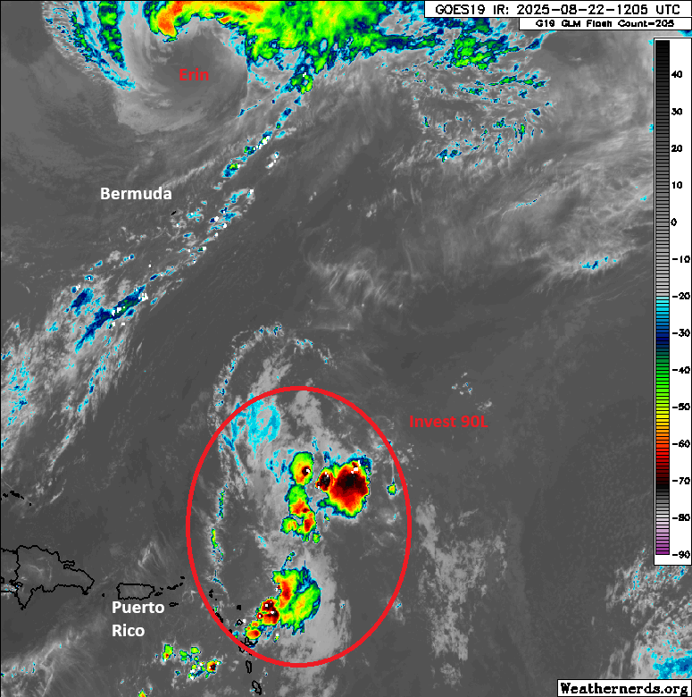
Over the next few days, this broader area may try to consolidate some, and we should see gradual development into a tropical depression or tropical storm. Invest 90L will track around the western edge of high pressure just west of the Azores, meaning it will continue on a north-northwest or northward trajectory. Model guidance at this point seems to suggest it will stay east of Bermuda on its way north, but we’ll continue to watch this, particularly once we (presumably) get some development out of this area.
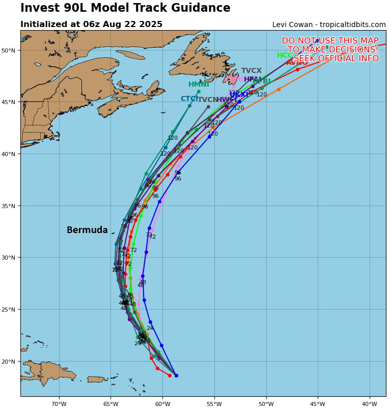
Interests in Bermuda should continue to monitor 90L over the next couple days. We do not expect this one to explode and rapidly intensify to a high-end storm like Erin did. But we could see it quickly come together as a tropical storm.
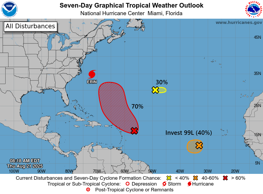
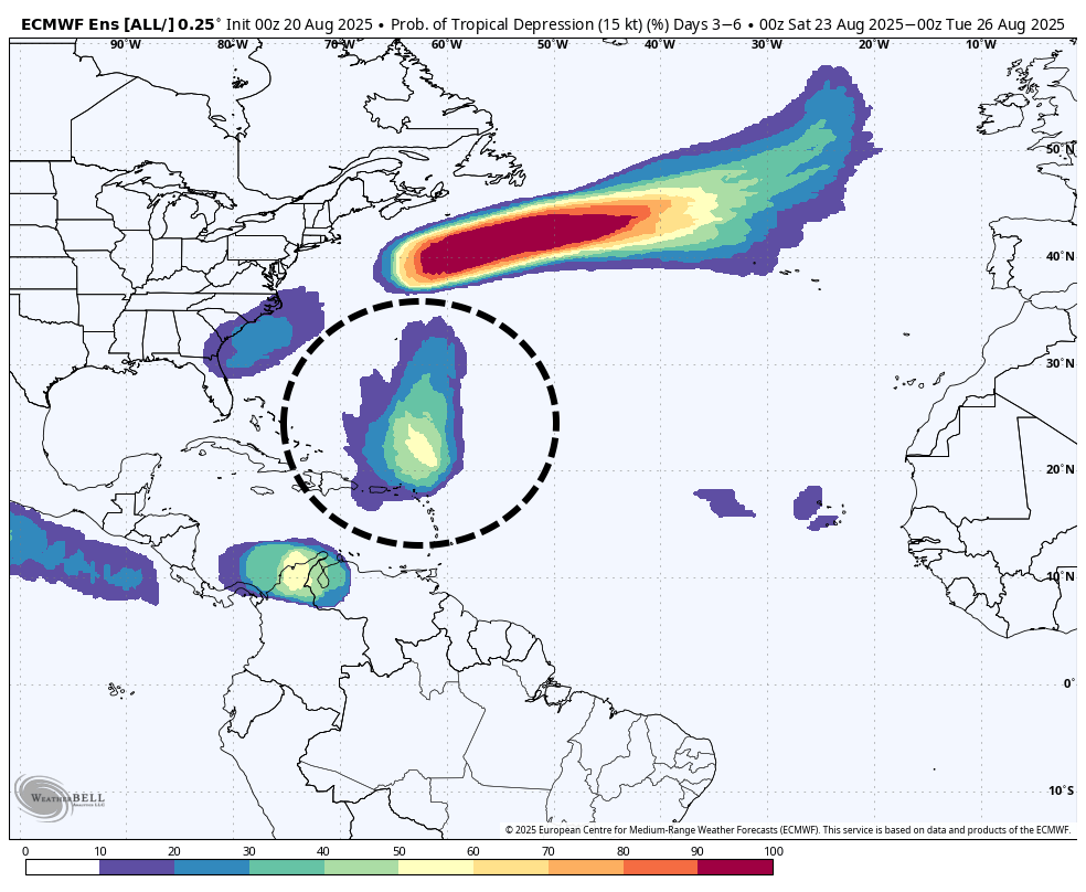
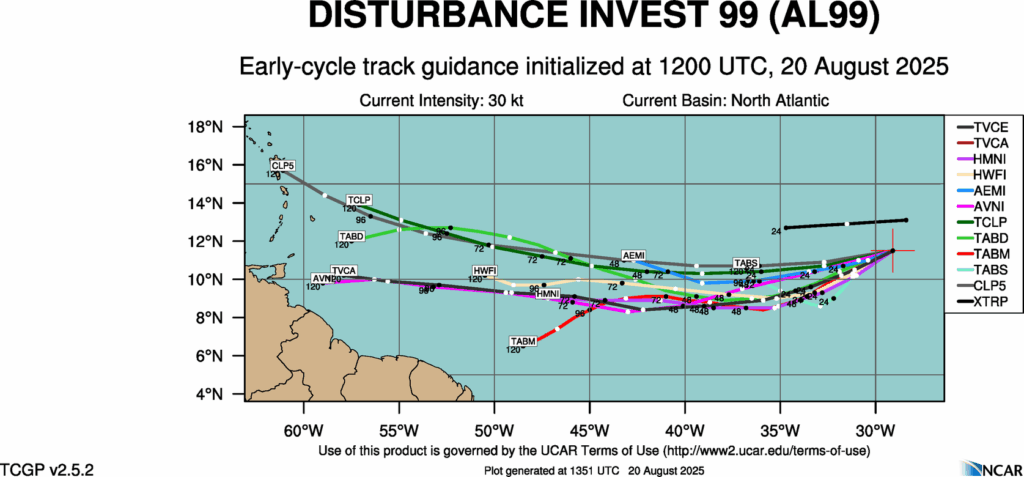
Invest 99L
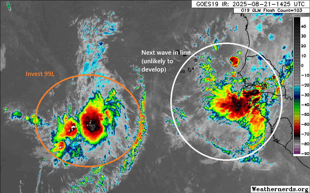
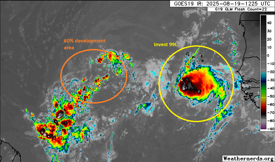
Backing off to the south and east now, we look at Invest 99L. This one has had the opposite problem of 90L. Models have insisted it would eventually succumb to shear and dry air, and it’s been as resilient a wave as we’ve seen all season. Well, Invest 99L’s luck may be running out.
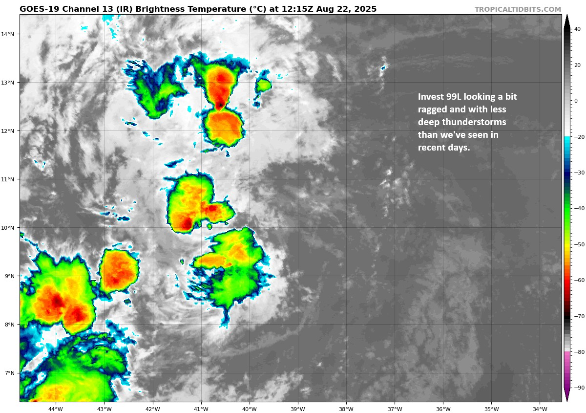
Over the next 3 to 4 days, Invest 99L will continue to have a puncher’s chance at perhaps sneaking into tropical depression status before likely getting ripped up again in the Caribbean. Interests in the islands should at least keep an eye on this, particularly for the Windward Islands. But this seems like mostly just a scattered heavy rainmaker right now. Beyond the islands, it seems likely that this will remain buried in the Caribbean or end up moving ashore in Central America eventually as a remnant disturbance. But we’ll continue to watch in case something should change.
Flooding risks
Yesterday saw a flash flood emergency, our first in quite some time, this one in Roanoke, Virginia. Read Kevin Myatt’s always excellent coverage in the Cardinal News for more on that event. But 3.38 inches of rain in an hour is more like Gulf Coast style than Appalachia. Very impressive stuff.
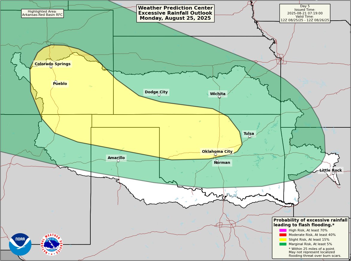
Flash flooding risk today will be mainly in Georgia and South Carolina back across the Gulf Coast, as a stationary front is draped across the region. But as we go into next week, we continue to see a pretty strong signal for heavy rain in the Plains. A slight risk (2/4) for excessive rainfall and flooding remains painted on the maps for Monday between the Front Range and Kansas & Oklahoma.
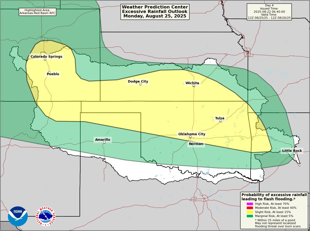
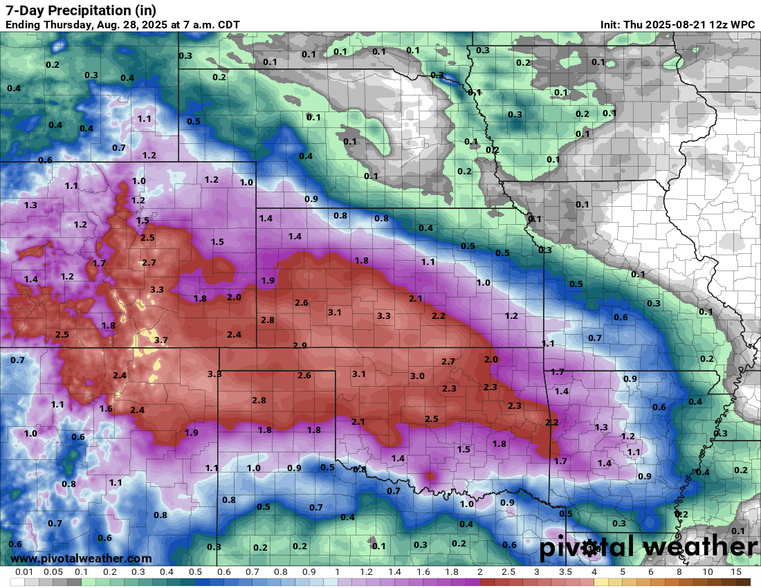
Colorado Springs, Wichita, Tulsa, and Oklahoma City are all included here. For Tuesday, that risk shifts mostly back into Colorado and New Mexico. Rain totals over the next week continue to look quite healthy in these areas, with perhaps 1 to 4 inches in Colorado and parts of New Mexico and 3 to 6 inches in Kansas and Oklahoma.
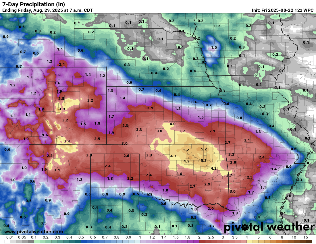
Considering the Rio Grande has dried up to a trickle or worse, any amount of rain that could find its way into the system would be beneficial.