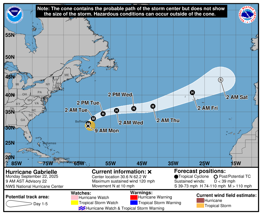
In brief: Invest 93L was upgraded to Tropical Storm Humberto this afternoon, and it is not currently expected to threaten land. Invest 94L’s forecast remains directly related to Humberto and has a very high degree of uncertainty. This will continue to be a low-predictability situation for another couple days at least.
I think this is the first time all hurricane season we’ve done two posts in a day? We’ll call that a win. Anyway, this will be brief, but I want to catch you up on some changes today.
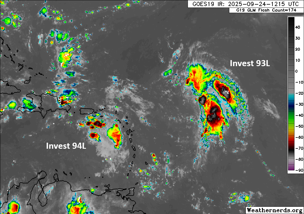
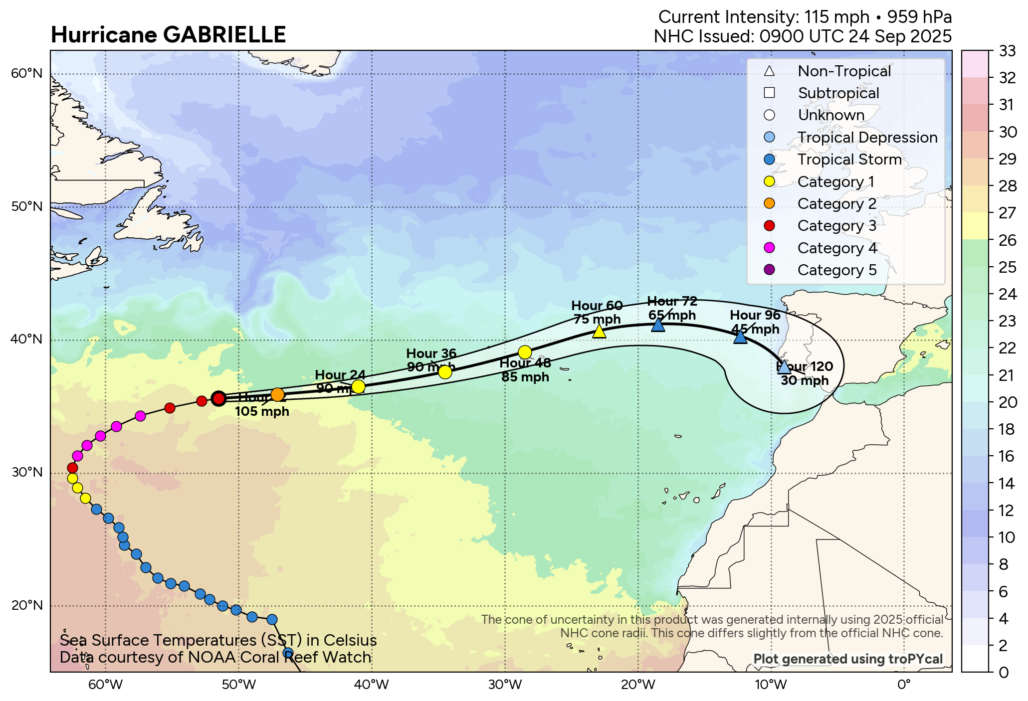
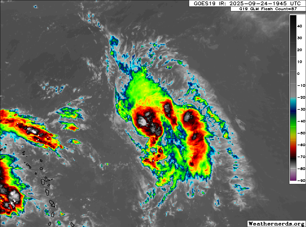
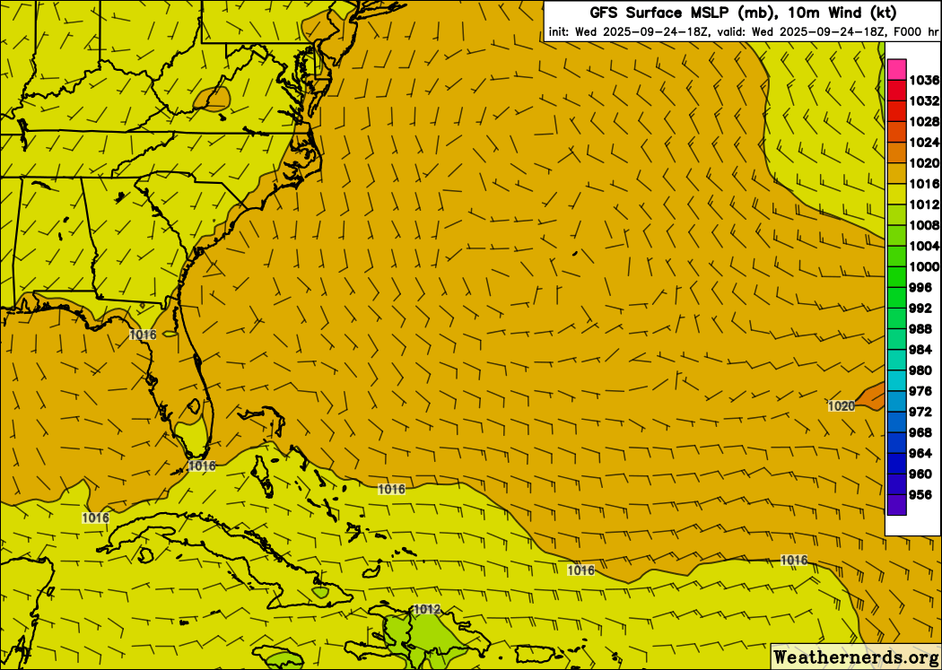
93L is now Humberto
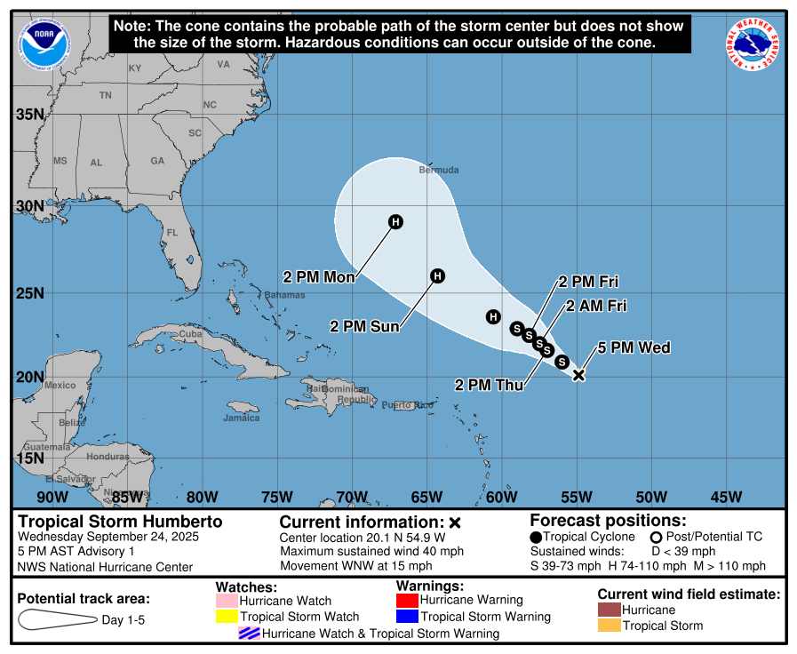
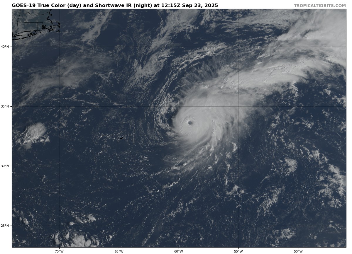
In a case of again dispensing with formalities, we took Invest 93L and skipped the tropical depression status and jumped right to tropical storm classification. Tropical Storm Humberto has winds of 40 mph. It’s certainly not the worst looking tropical storm we’ve ever seen.
Thankfully most land will not likely need to worry about Humberto. However, interests in Bermuda should continue to monitor this storm’s progress. Various tropical models and most ensemble guidance curves Humberto on a trajectory similar to Erin earlier this summer, which would keep it west of Bermuda. However, depending on how well organized the system is, it could produce some meaningful impacts by early next week in Bermuda. Stay tuned.
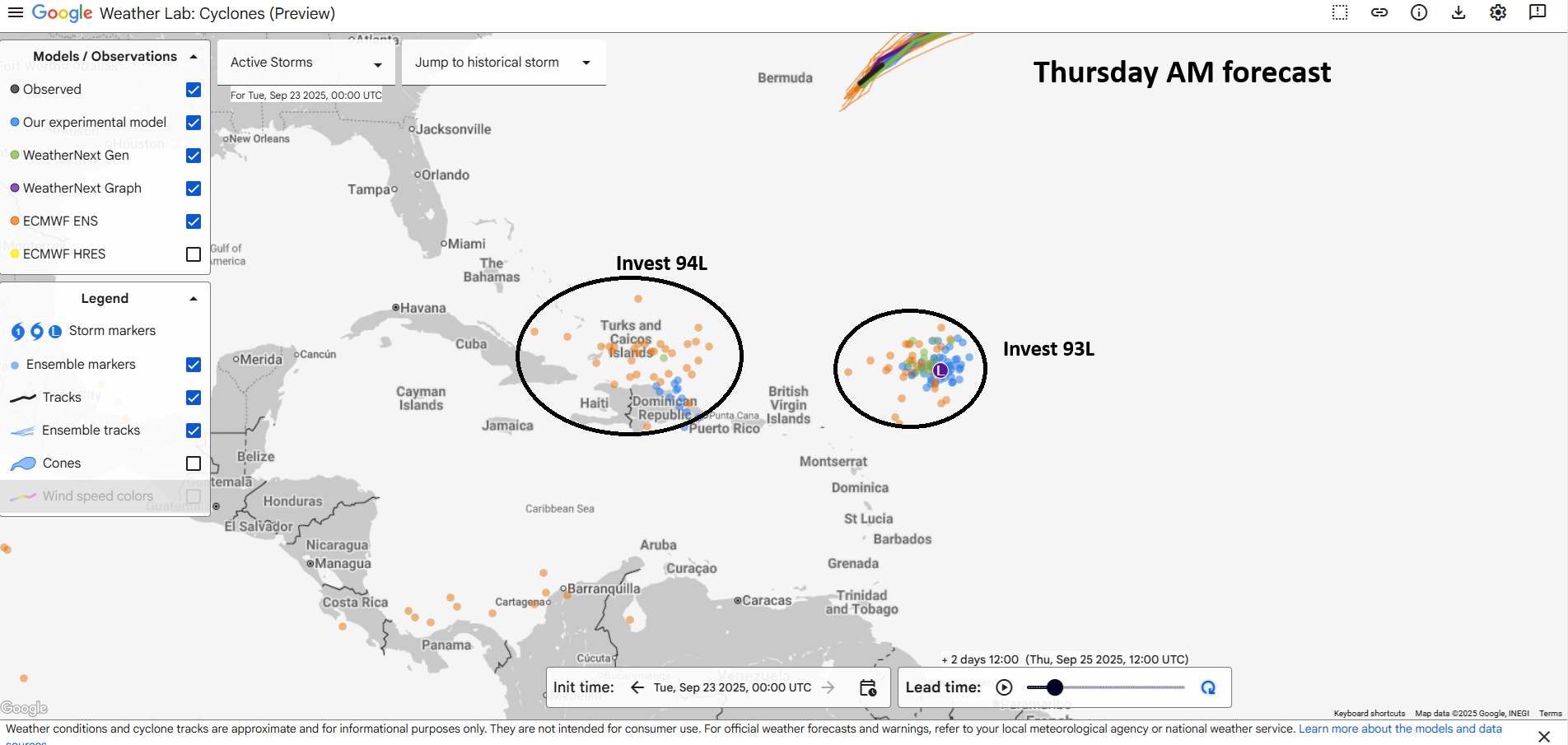
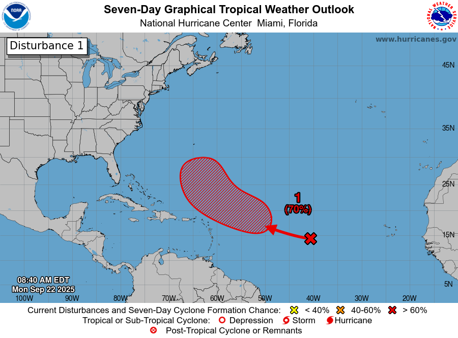
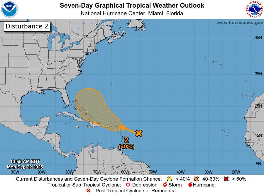
Invest 94L
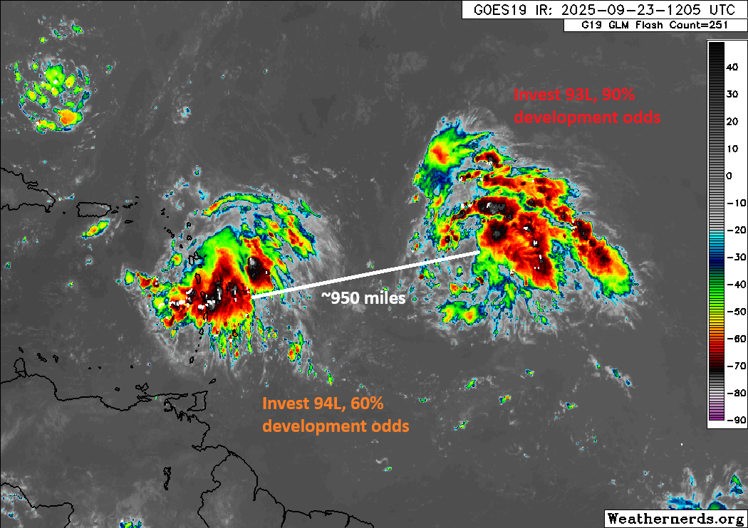
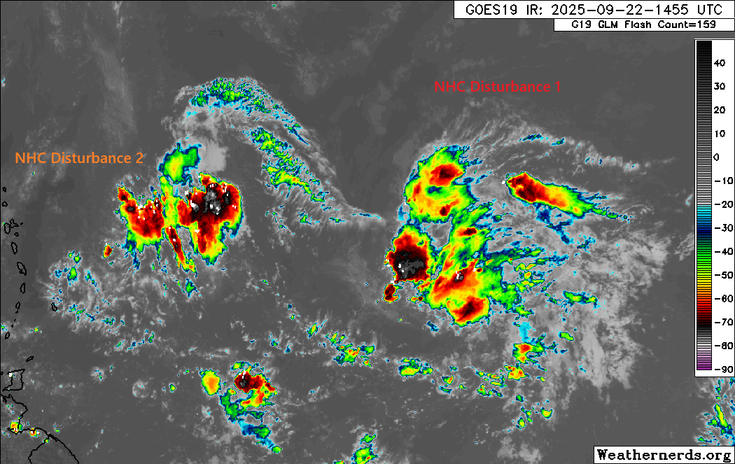
Meanwhile, the one we’re watching a little more closely, Invest 94L remains in the Caribbean. It was initialized this afternoon very near the southwest tip of Puerto Rico.

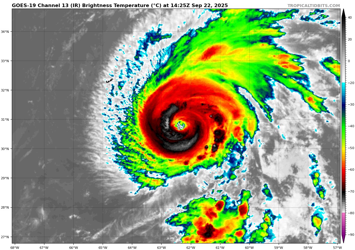
But you can see that there are clusters of thunderstorms both north and south of the island. The system is quite strung out at the moment. While the surface reflection may be near Puerto Rico, there is clearly some sort of mid-level and upper-level reflection elsewhere. You’d like to see a system better vertically stacked before it can organize, but at this moment in time, 94L is anything but that. So, don’t expect this to pull a Humberto we wouldn’t think.
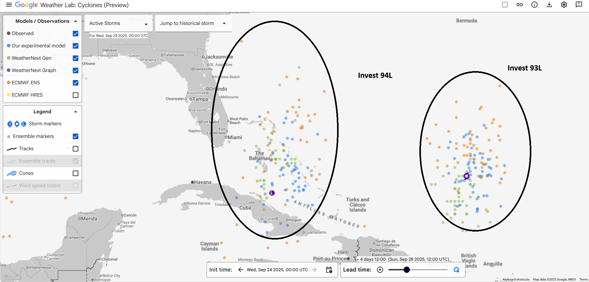
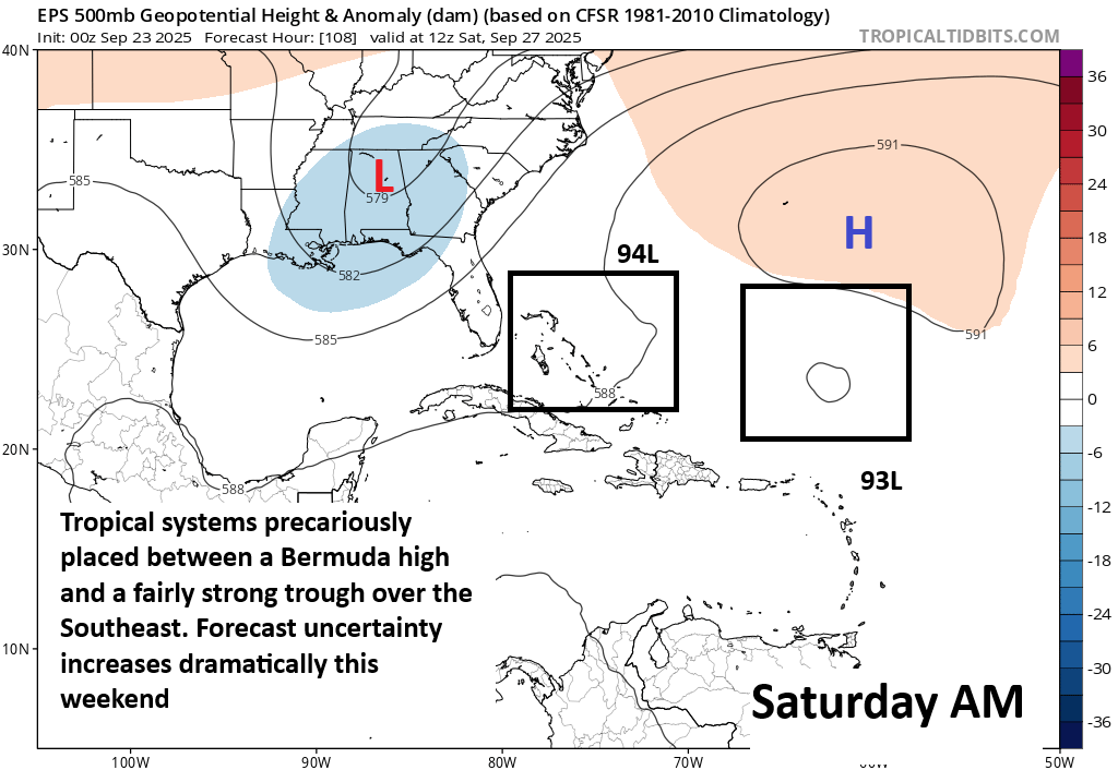
We have a good 2 to 3 days before this clears Hispaniola and makes it into the Bahamas. At that point, assuming it is not shredded by the mountains of Hispaniola, we would likely begin to see an environment more conducive to organization. Much like this morning, the frustrating reality is that we have no real clue what happens next. The operational model guidance is definitely dropping options though.
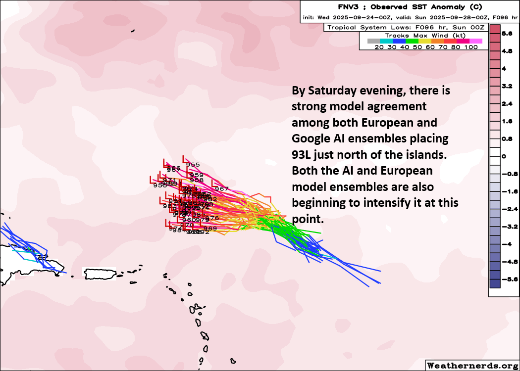
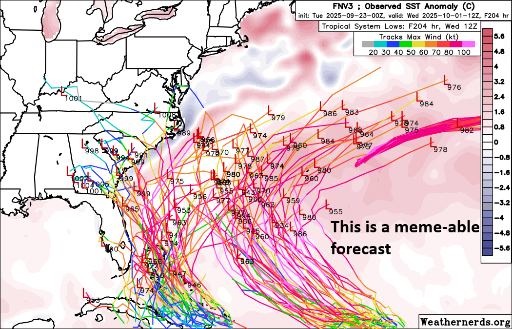
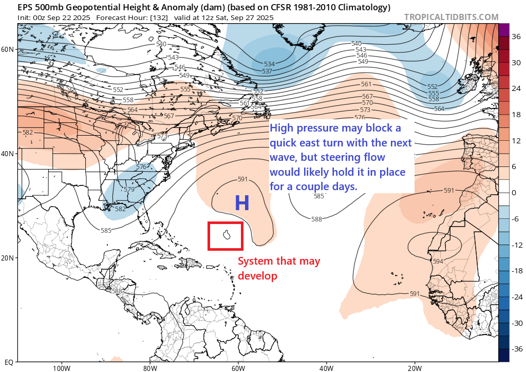
The GFS seems to favor a Fujiwhara interaction between 94L and Humberto, which would potentially pull 94L toward Humberto and pull Humberto a little farther west (offshore of the East Coast) before it all heads out to sea.
This scenario is a realistic one for sure, but I’m not sure it’s any more likely than other possible scenarios. The European model basically leaves 94L behind once Humberto heads out to sea and does weird things with it, which again is plausible but not necessarily likely. Other options include literally nothing, a storm going up the East Coast, or just a storm that follows Humberto out to sea. Put all that together, and we’re still very much in “choose your own adventure” mode with regard to 94L’s future. Stay tuned, but I don’t expect much clarity on this for at least another day or two.
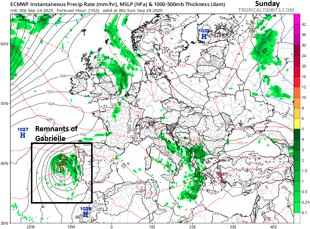
Notably, regardless of what transpires here, there will begin to be some heavy rain risk in the Carolinas and Virginia in about 3 or 4 days. After Helene last year, I know this won’t give people warm and fuzzies, but just bear in mind that this is a much different scenario than Helene from an entirely different direction. Certainly, keep tuned to the forecast, particularly near the coast, but we just want to offer a little reassurance that anything remotely like that is not currently in the cards on any model guidance.
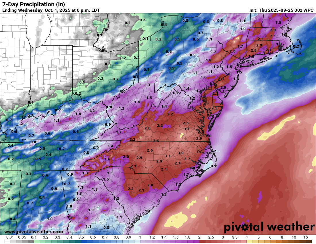
Rain totals of 1 to 4 inches are broadly forecast across Virginia and North Carolina down to about Columbia, SC over the next week. Notably, this is east of the mountains.
More tomorrow.