In brief: We take a look at how models did, as well as some of the totals and causes of the extremely heavy rain that hit the Northeast this week. We also check in on the tropics, which look relatively benign on the Atlantic side for the time being.
Northeast recap
Back on Monday, we took a look at forecast rainfall for the upcoming days, noting that there were some decent risks for 5 inches or more of rainfall. Tuesday’s rainfall forecast through Thursday evening highlighted the Hudson Valley, western Connecticut, and northeast New Jersey for the highest rainfall totals.
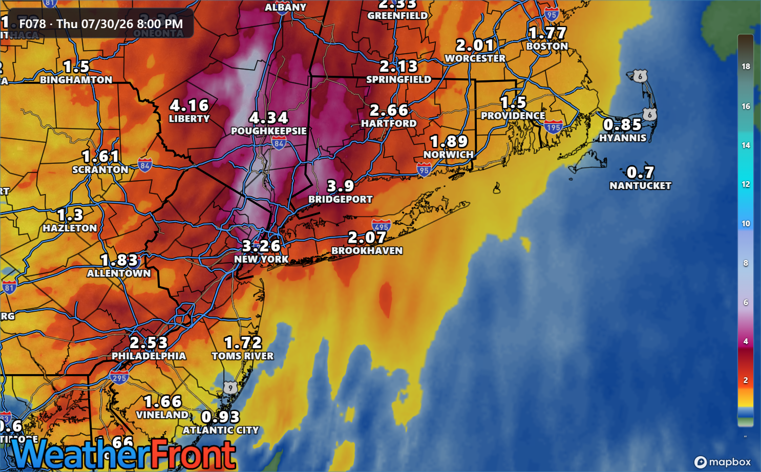
So how have we done?
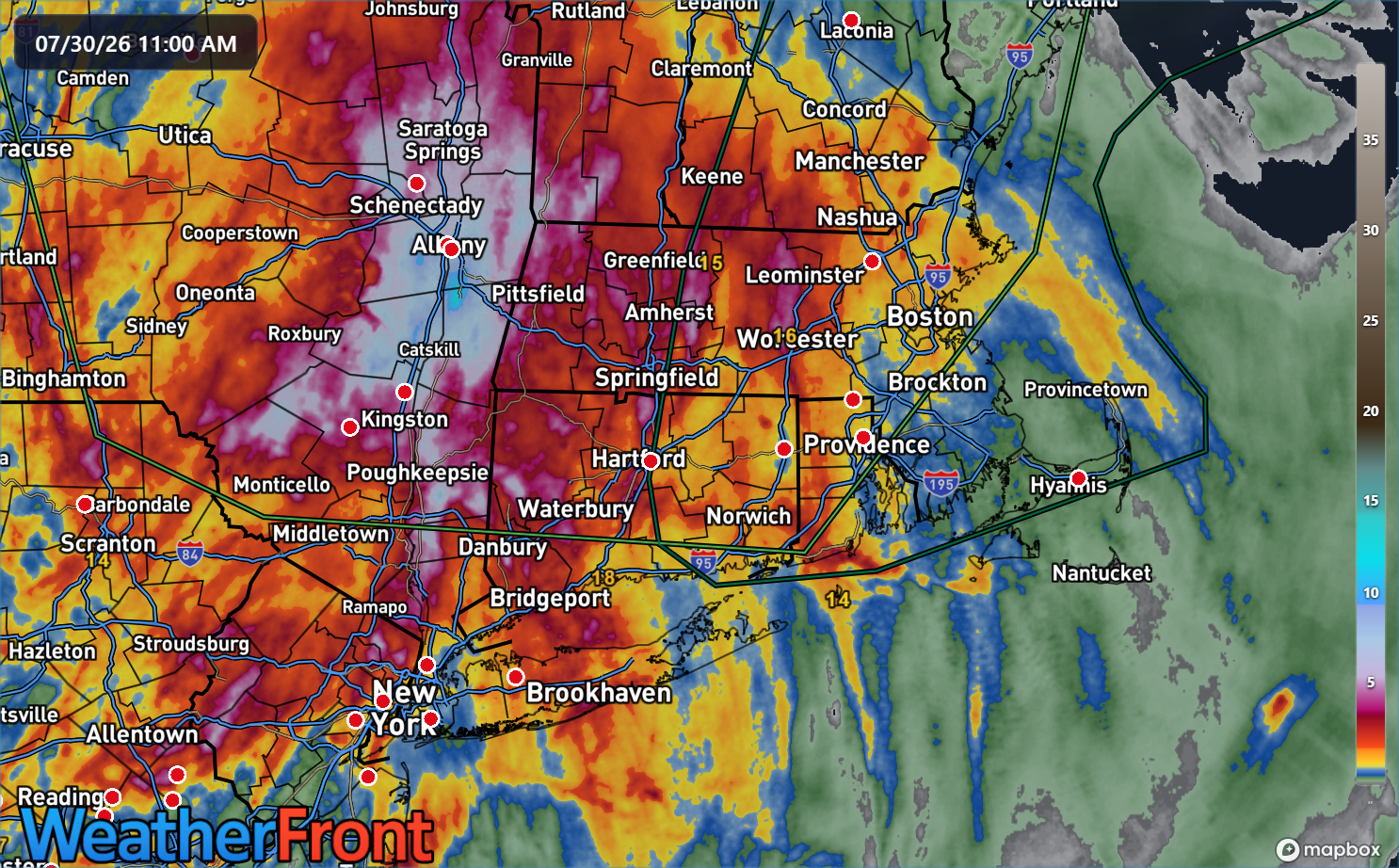
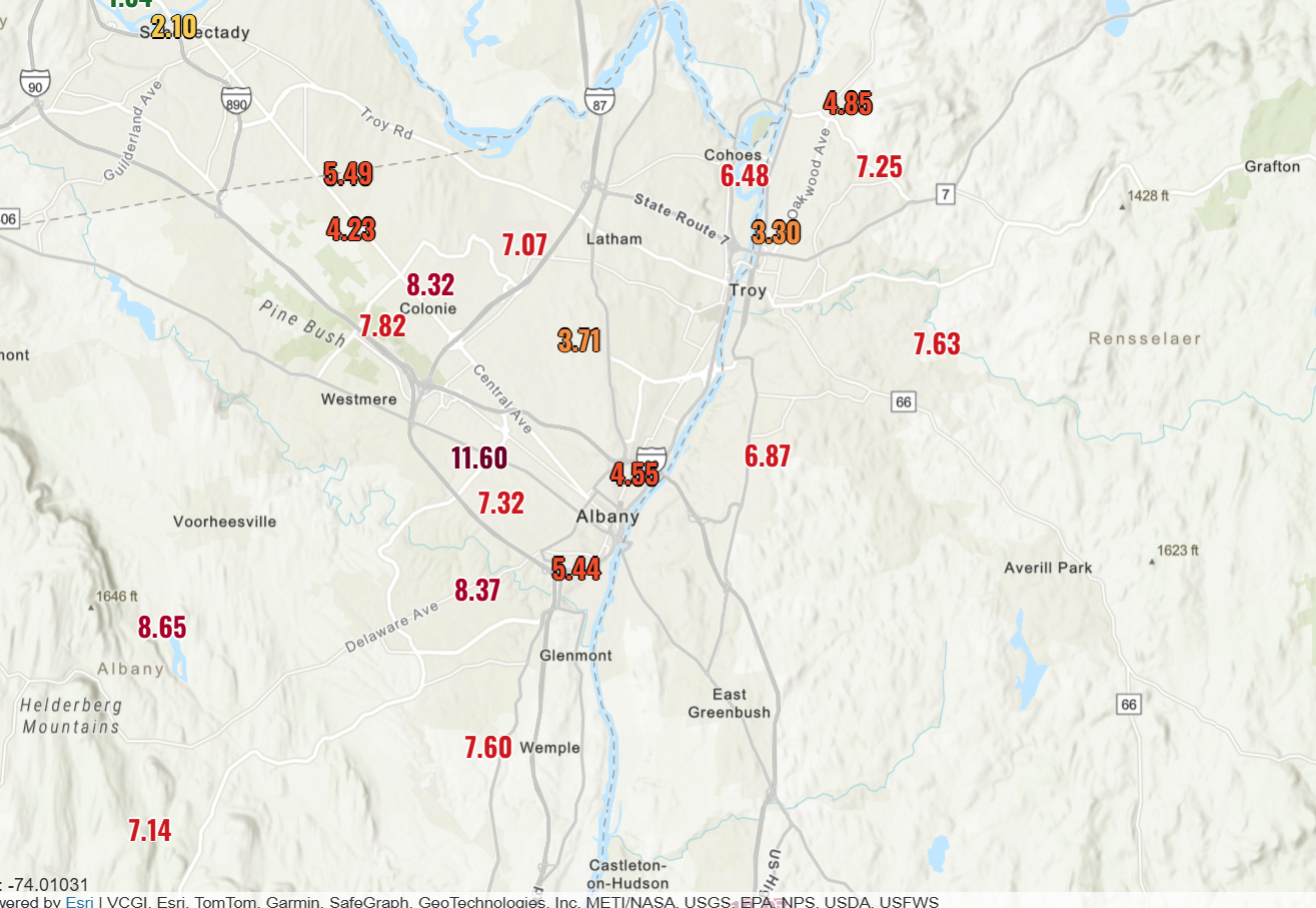
A couple things. The overall forecast was decent. However, rain totals were underestimated in New York State and slightly overestimated in Connecticut. But overall, this was a decent forecast. The totals in the Hudson Valley up through the Capital Region of New York State were incredible.
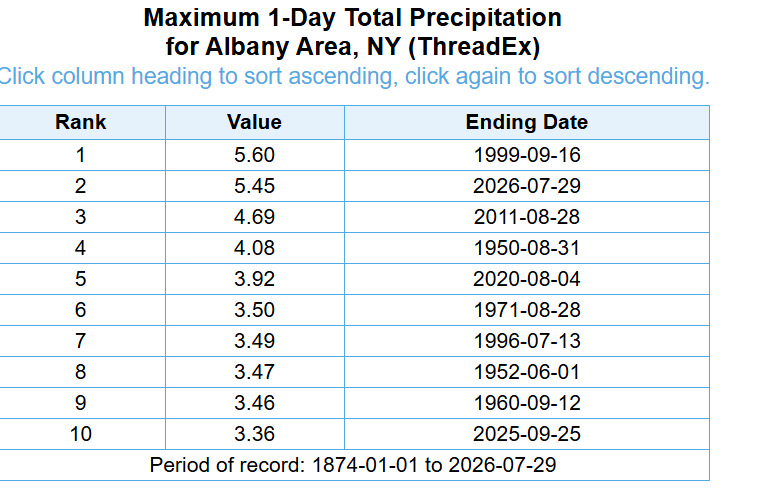
For Albany, Wednesday was the second wettest day on record (going back to 1874). Of the 10 wettest days on record in Albany, six have been produced via direct impacts from tropical systems, a seventh may have been related (8/31/1950) to interior landfalling storms in the Central U.S., and three were not directly affiliated with tropical systems, including yesterday.
So it’s unusual for Albany to receive this much rainfall from a non-tropical storm. Atmospheric moisture levels were in the 90th percentile in Albany Tuesday night into Wednesday and closer to the 95th percentile on Long Island. In other words, it was a deeply moisture-rich environment. If you look at the total precipitable water from 2 AM Wednesday, you can see almost like a miniature atmospheric river pointed right at the Hudson Valley.
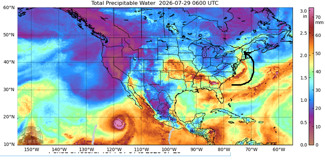
All this moisture, coupled with a slow-moving upper low oriented just right to allow bands of moisture to burst into the Capital Region continuously helped lead to some of those ridiculous rainfall totals. According to the most recent Public Information Statements from the NWS, the highest totals came from Schodack, NY (11.79″), Kinderhook, NY (11.47″), and Valatie, NY (10.31″).
All in all, this was a rather impressive rain event, especially considering the lack of a deep tropical moisture connection or direct tropical system impacts.
Tropics? Not here
The tropics are busy in the Pacific with the second category 5 storm of the week (Genevieve in the Eastern Pacific earlier this week was the other), this time in the West Pac. Super Typhoon Dolphin is back to category 4 intensity now, but it had peaked earlier today as a cat 5 storm.
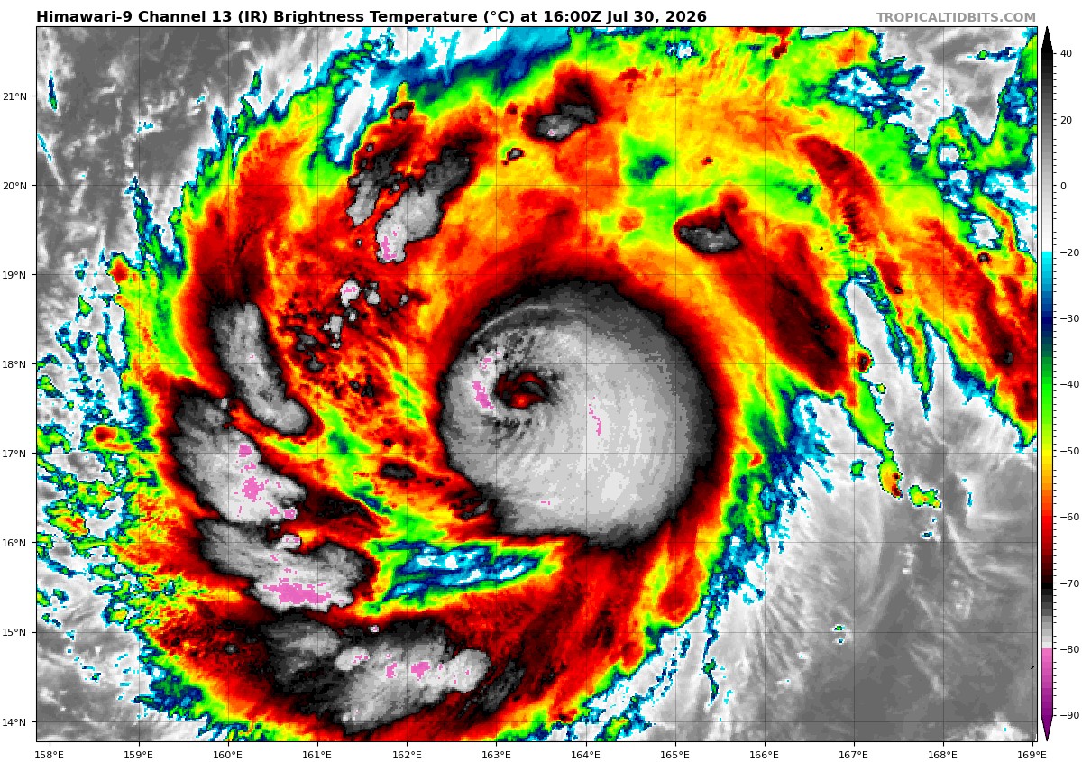
Dolphin is likely to head toward China or South Korea over the next week to 10 days.
Meanwhile, in the Atlantic, we got nuttin. Some of the AI modeling is trying to latch onto a weaker system in the deep Atlantic in about 10 days or so, but nothing suggests a likely storm, let alone a strong one. Something we’ll watch, but nothing we’re concerned with.