In brief: The Mid-Atlantic coast is likely to see multiple rounds of minor to moderate tidal flooding with a slow moving coastal low this week. The West is likely to see another round of heavy rain, something that is still very needed in that region.
Before we begin today, a quick personal-ish note. For those unaware, I (Matt) moved to Connecticut over the summer to be closer to family, experience autumn again, and for of course for work. But while I was still in Houston in 2025 I was asked to help out with a documentary being developed, centered around friend and colleague, Chris Gloninger. Chris’s story became newsworthy for leaving broadcast meteorology after receiving actual death threats for discussing climate change in Iowa.
Whatever your thoughts on climate change, I think most of us can agree that discussion and differences around how to approach climate change solutions are reasonable, but taking it to the “death threat” level is overboard and reprehensible. Chris has since devoted his career toward advancing the public’s understanding of climate science and impacts. The documentary will not just focus on Chris but also on how communities respond when extreme weather strikes, with a deeper look at the horrific Texas Hill Country flood of 2025 and the 2025 budget and staffing cuts to the National Weather Service.
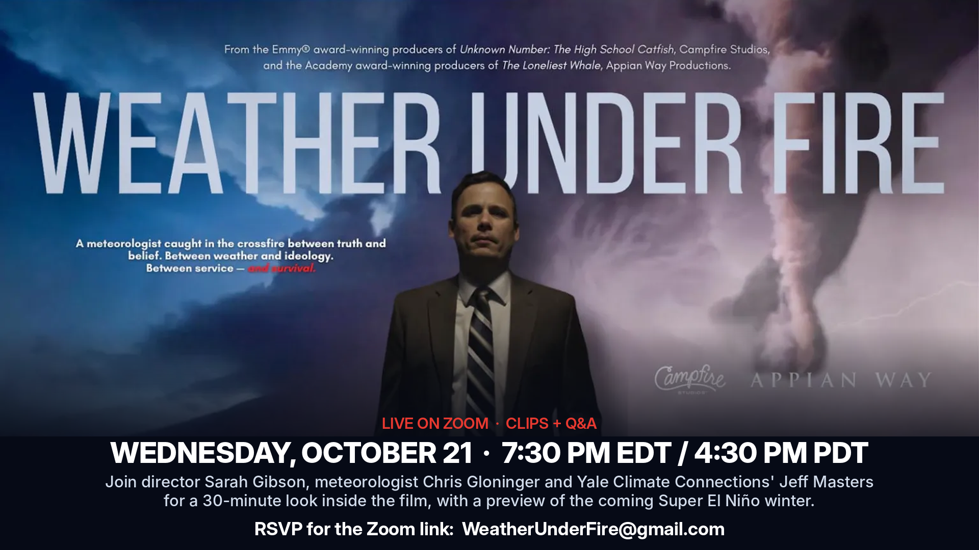
To get the movie to the finish line, the film needs some crowdsourcing to finish things up. It’s a 501(c)(3) for those curious. Some of you may be all-in on helping, some of you may not want to touch anything climate related, and some of you may not know what’s up here. For that latter group, there will be a Zoom event this Wednesday with Sarah Gibson, who was delightful to talk to and work with, Chris Gloninger himself, and Jeff Masters, who was the original hurricane weather blogger and who The Eyewall draws a good deal of inspiration from. (You should also read Jeff’s current work over at Yale’s Climate Connections blog, along with another inspiration for The Eyewall, Bob Henson).
Even if you aren’t interested or able to financially contribute, it may be an event you’re curious to attend. Dr. Masters will also be giving an update on the upcoming El Niño winter. Here is the link for the Zoom meeting on Wednesday, October 21, at 7:30 p.m. EDT / 6:30 p.m. CDT. To receive an invite, please RSVP at [email protected].
East Coast storm
As we noted last week, our biggest issue heading into this week will be yet another slow moving nor’easter-type storm off the East Coast. This one remains sort of floating between a nor’easter or a tropical system. I’m going to just refer to it as a “coastal low,” because the difference in impacts, be it a nor’easter or a tropical storm will be minimal. These things matter from a scientific perspective but not from a public preparedness perspective.
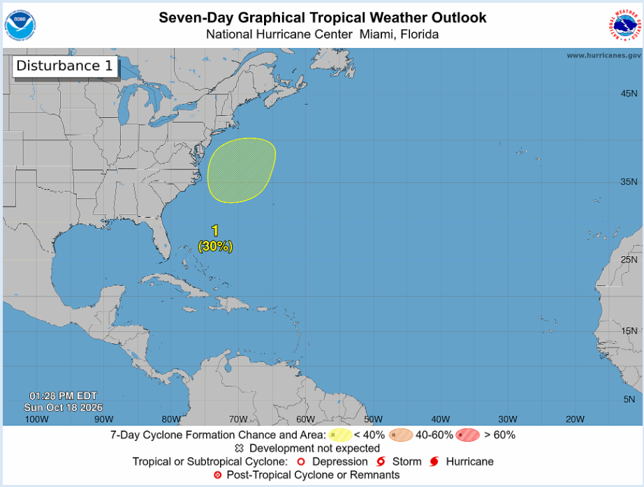
That said, there is a 30% chance this will take up a name this week, per the NHC. Google’s Deep Mind shows about a 60% chance of development this week. To be honest, I don’t know enough about how Google’s model will discern between tropical and non-tropical in its algorithm, so this could be high, low, or something in between. Either way, it stands to reason that a nominally strong coastal low is going to take up residency this week off the North Carolina coast.
Here’s what the European model showed this morning in terms of surface pressure and precipitation.
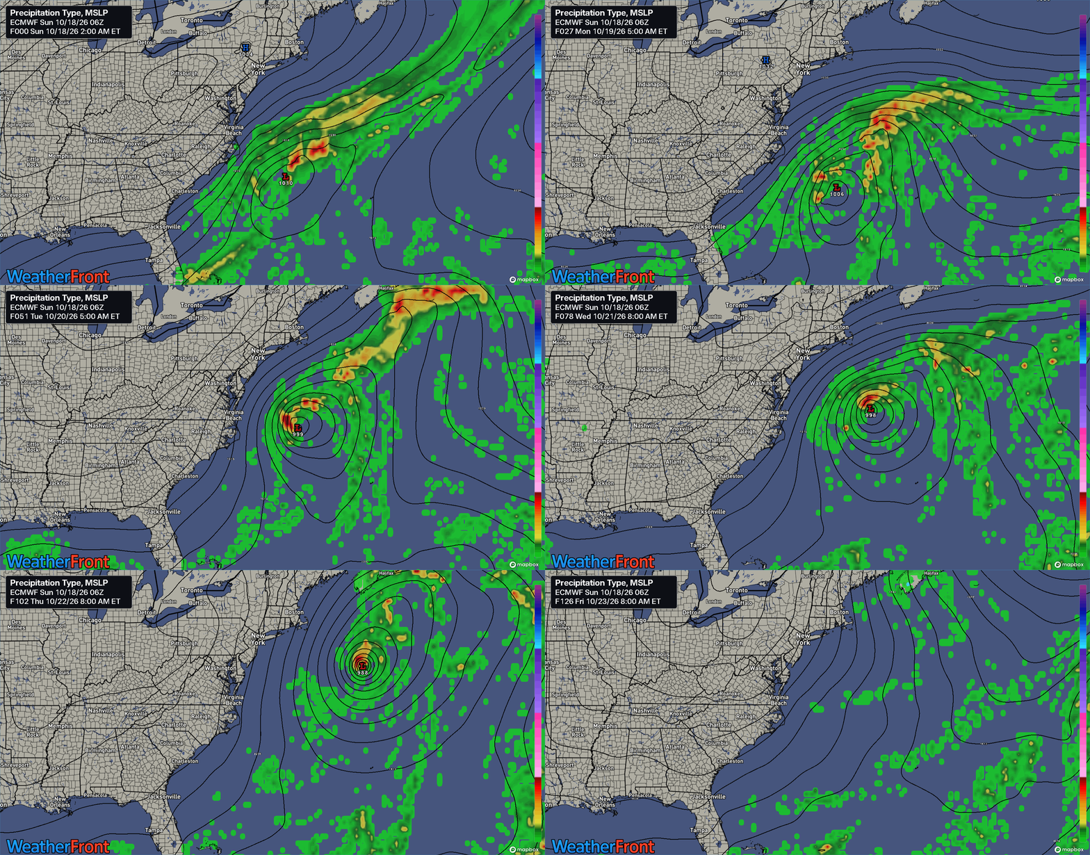
So, good news/bad news here compared to what we discussed the other day. First, the good news is that the residency time near the coast and frankly the proximity to the coast looks a little more manageable today compared to Thursday. The bad news is that this will still produce multiple days of rough surf and tidal flooding that will likely contribute to another round of coastal erosion.
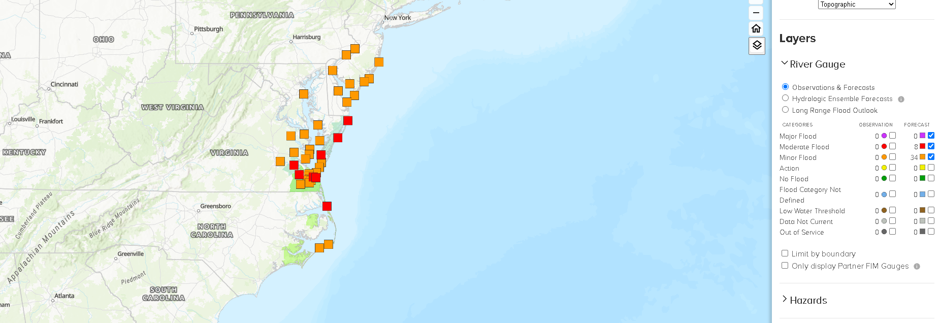
At this point, it looks like the most significant tidal impacts through midweek will be on Delmarva and in the Virginia Tidewater.
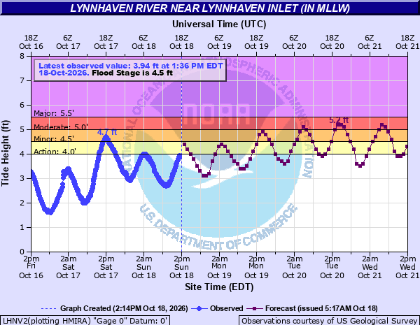
We may squeeze out another tide cycle or two of flooding beyond the end of this forecast, but it looks like late Tuesday through Wednesday will be worst right now for that issue. There is at least some risk that a tide cycle could verify with major coastal flooding at a location or two between Delmarva and the Outer Banks. This is implied on the coastal flooding risk map for the Tidewater through Thursday.
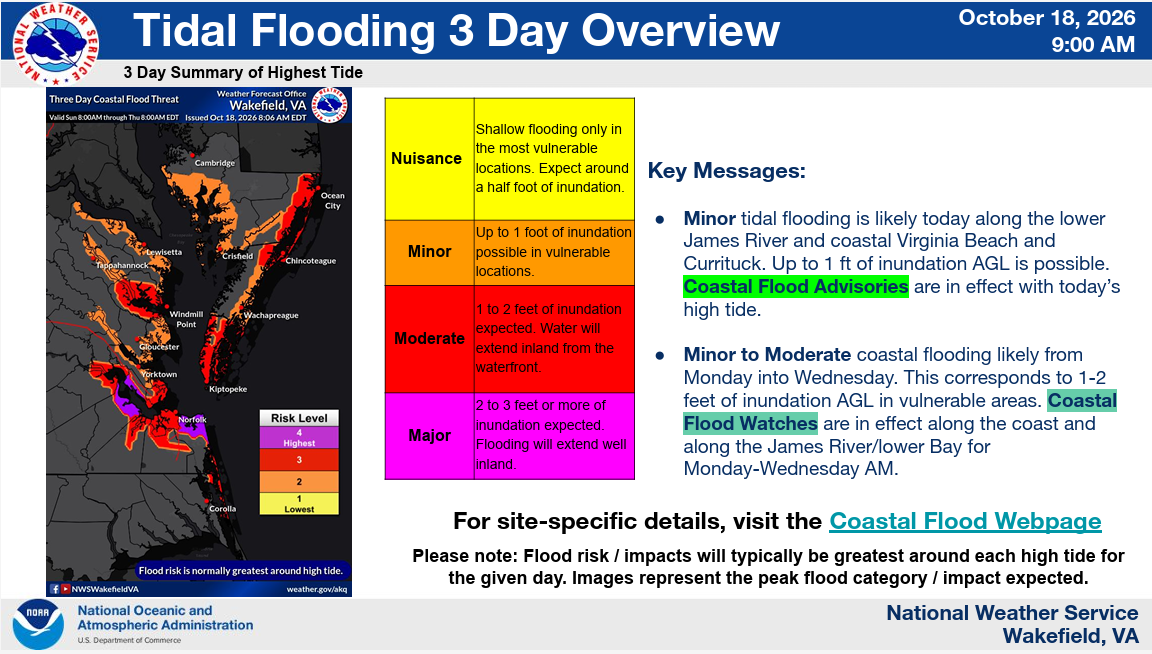
Bottom line: If you live on the coast from Delaware through the Outer Banks, you’ll probably be impacted by either erosion, coastal flooding, or rough surf over multiple days this week.
While the storm system will sit offshore, it will still be breezy at times this week as well. Wind gusts into tomorrow could be around 35 to 45 mph on the Mid-Atlantic coast. Some gusts in the Outer Banks could approach 50 mph. Here’s a map for tomorrow afternoon.
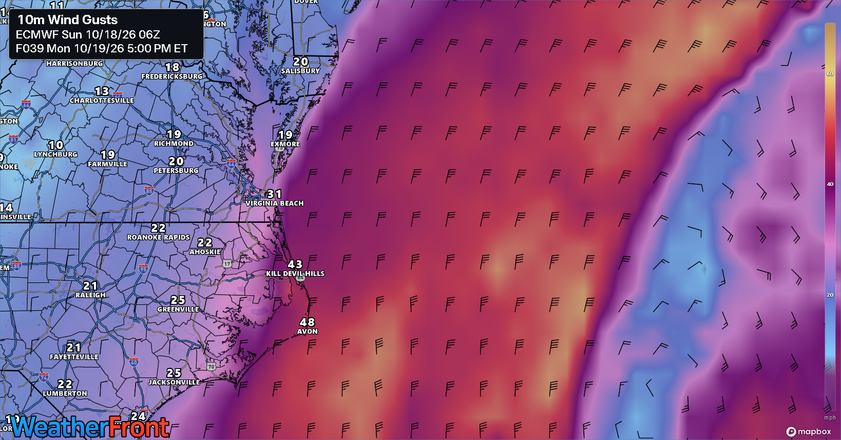
Slightly less intense wind gusts will persist into Tuesday and Wednesday. The system should pull far enough east to lower impacts by later Thursday and Friday.
Peek at the Pacific
Hurricane Trudy off the coast of Mexico is the latest in an endless string of hurricanes in the Eastern Pacific. Over the next few days it will begin to weaken. However, a surge of tropical moisture from that area is once again going to lift northward into the Desert Southwest, an area that has been absolutely soaked over the last month or so. After a relatively weak monsoon season, this was needed. And some places are seeing rainfall departures of 3 to 6 inches above normal, and even more in spots.
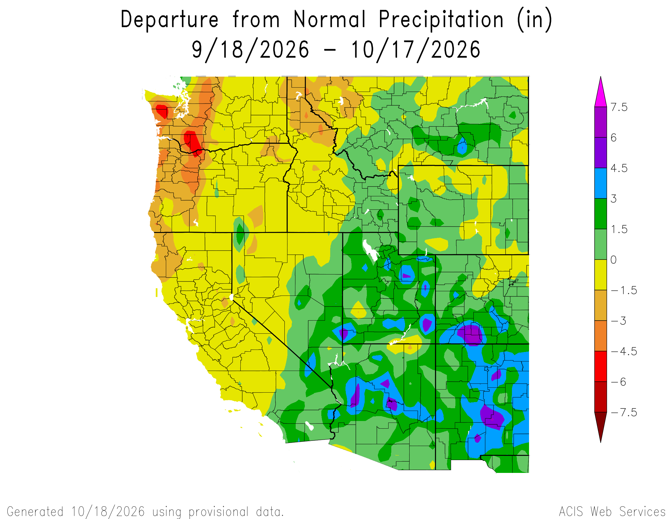
Lake Powell’s water level has jumped about 2 feet over the last week or so, which is a literal drop in the bucket of what’s needed out there, but it’s a start.
Well, as Trudy’s moisture is pulled north, yet another round of locally heavy rainfall seems likely in the West. California should participate in this as well, as a well timed cold front and low pressure system will approach off the Pacific (somewhat tied to the remnants of western Pacific Typhoon Koguma). This should help spread rain out over the entire region, with the heaviest probably associated with Trudy’s remnants in southwest Colorado.
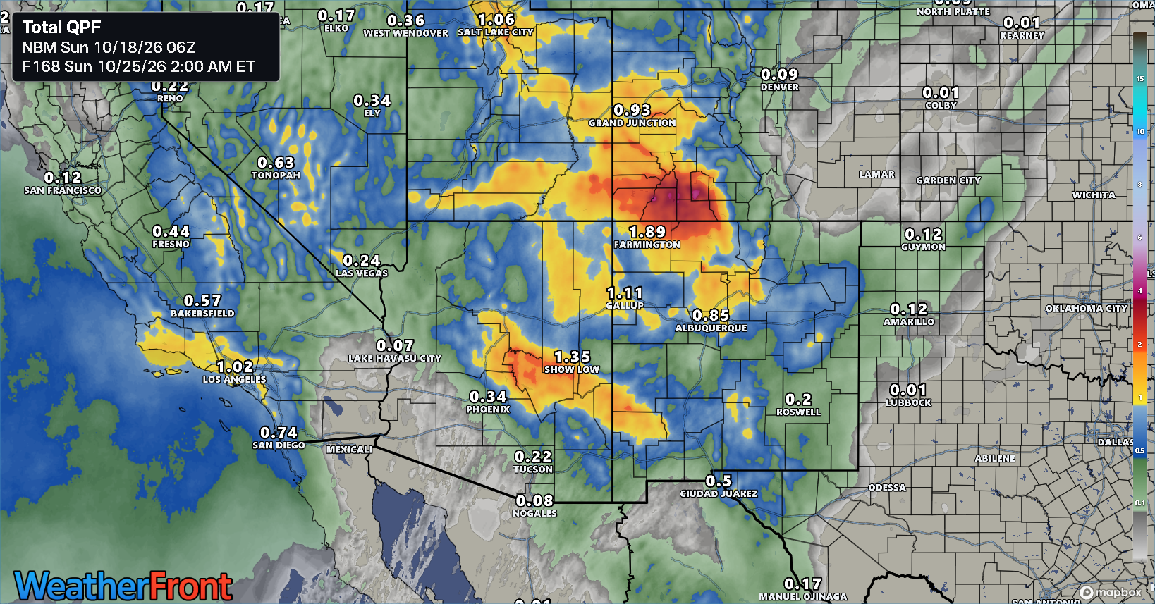
Obviously the rainfall amounts are subject to change, but this looks like another decent rain event for the Southwest.