In brief: A coastal storm off the Carolina coast will continue to produce gusty winds, tidal flooding, rough surf, and beach erosion. It should exit Thursday or Friday. The West will prepare for another bout of heavy rain and some mountain snow, with significant rainfall and flash flooding possible between Phoenix and Durango on Wednesday and Thursday.
The East Coast storm we’ve been discussing is winding up as we start the week, and it’s producing some decent wind gusts on the Mid-Atlantic coast today. The Outer Banks have gusted to 40 mph at Hatteras, 41 mph at Nags Head, 43 mph at Duck, and 45 mph at the U.S. Coast Guard Station near Cape Hatteras.
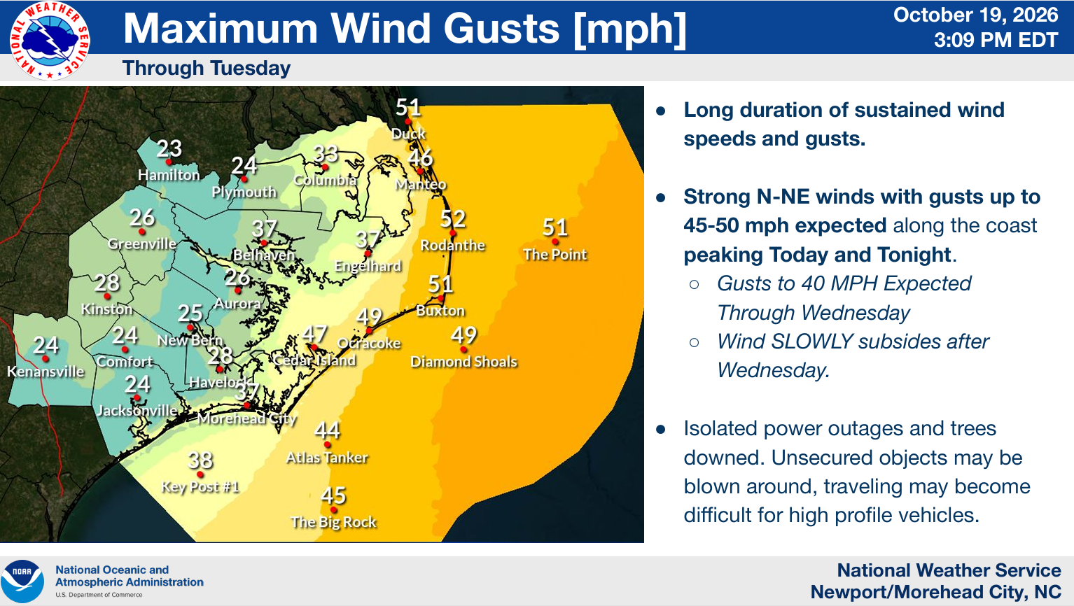
Wind gusts of 40 to 50 mph or so will continue into tomorrow and slowly subside into Wednesday and Thursday. As this happens, tidal flooding will continue to be an issue on the East Coast. Numerous gauges are expected to peak near minor flood all the way up through New Jersey now. Moderate flooding is expected from Delmarva into the Outer Banks. And locally major tidal flooding is expected along the Pagan River in Virginia.
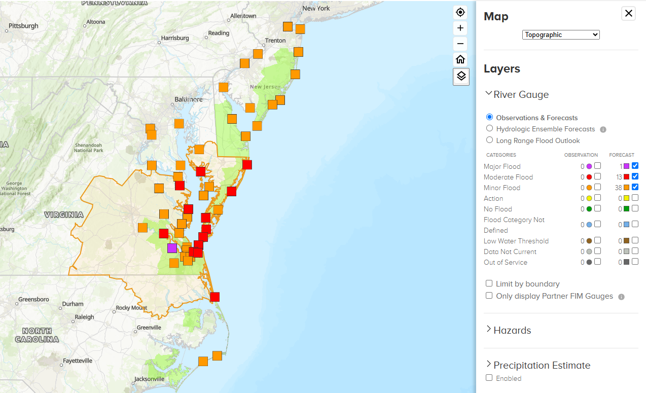
The particular gauge that’s expected to reach major flooding is a younger gauge, so we don’t have a lot of history here, but the forecast does push it up to 4.5 feet, which is just under the recent record set last October for that site, the Pagan River at Smithfield Station. These levels will cause inconvenient flooding for those areas.

Notice that this will also be a “build up” event. In many of these locations, since the storm will be longer duration, tides won’t have the ability to lower fully, and you just add a little bit of water on top of each tide cycle til the storm clears. Tide levels should peak later Wednesday or early Thursday before beginning to subside as the storm exits. Rough surf and beach erosion remain serious concerns from the Outer Banks into the Jersey Shore.
On satellite, the coastal low looks standard right now; nothing too special or unordinary.
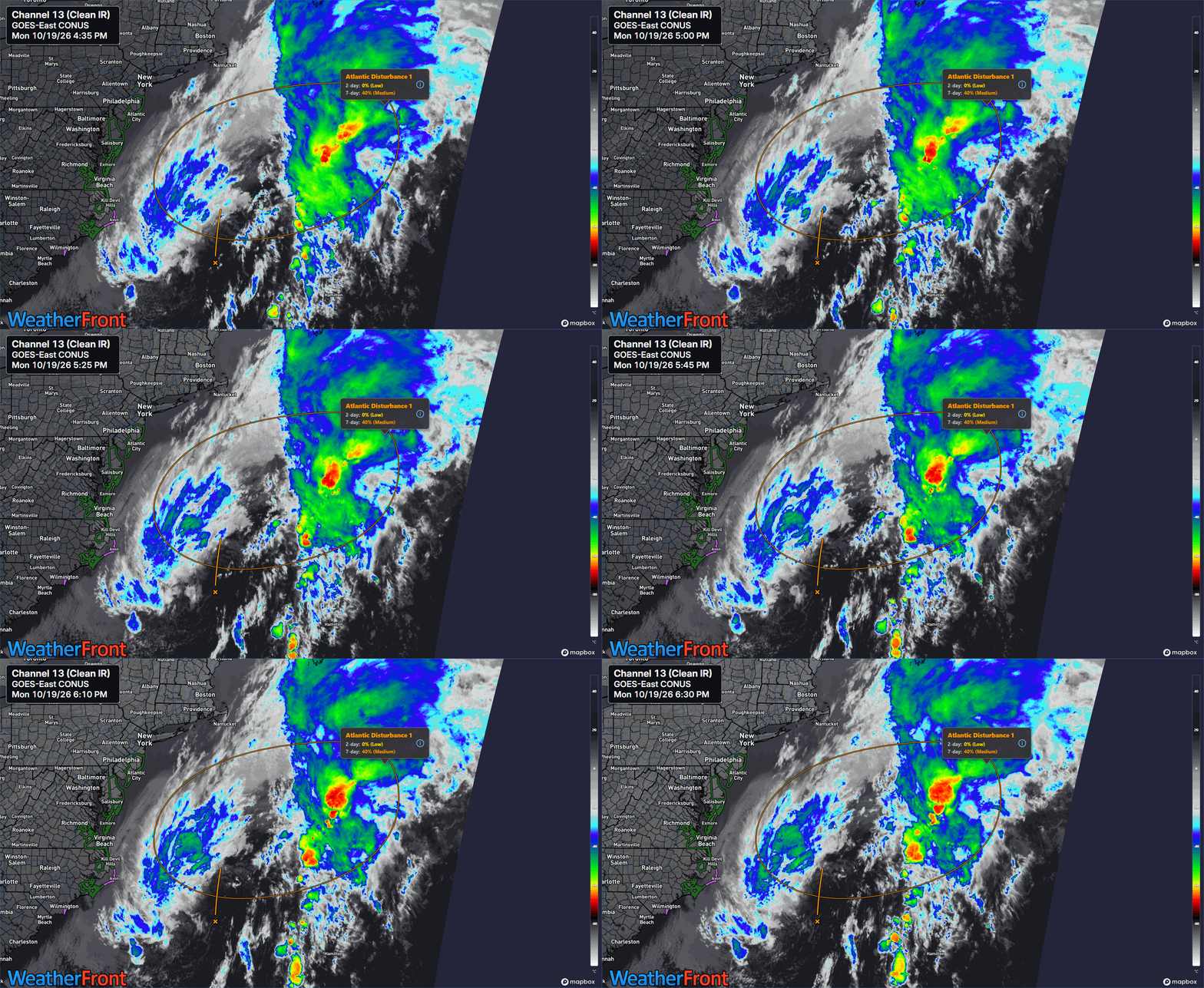
It looks like it just recently got tagged as Invest 93L, however, and the National Hurricane Center forecasts a 40 percent chance of development, right in line with what Google’s 1,000 member ensemble shows. Just to again be clear about this, while there is a chance that this storm will develop into a depression or named storm it is not a direct threat to land in the U.S., and it will not really change the anticipated impacts for the East Coast.
For those wonkier than the primary target audience here, the system looks to a rather shallow warm core low, so it will have about 48 hours or so to develop over the warm waters of the Gulf Stream before it likely starts to lose tropical characteristics and just remains a big ole’ low pressure system tracking north. Folks in Nova Scotia and Newfoundland probably want to keep tabs on the future of this system, as it may be a decent rain and wind producer up there if it can track close enough to land.
Otherwise, that’s the story on Invest 93L, our coastal storm.
The tropics look generally quiet in the Atlantic beyond this. There may be something in the western Caribbean or southwest Atlantic that tracks north or northeastward toward month’s end, but at this time support for that is relatively muted, mostly just 1 to 5 ensemble members in various model runs.
Looking West
As noted last evening, the remnants of Pacific Hurricane Trudy, a western Pacific typhoon, and a cool front look to bring a bout of locally heavy rain to California and the Southwest later this week. In fact, the Weather Prediction Center has pushed up a slight risk for excessive rainfall on days 3 and (shown below) 4 for the Southwest.
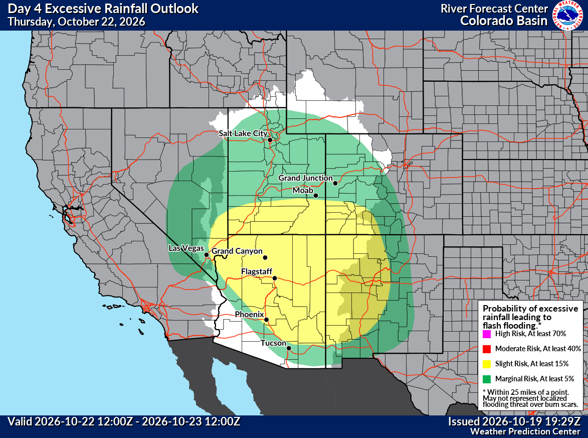
Wednesday and Thursday look to be the target days, with locally heavy precipitation in Southern California, as well as more coverage of heavier rain and some mountain snow in the Southwest.
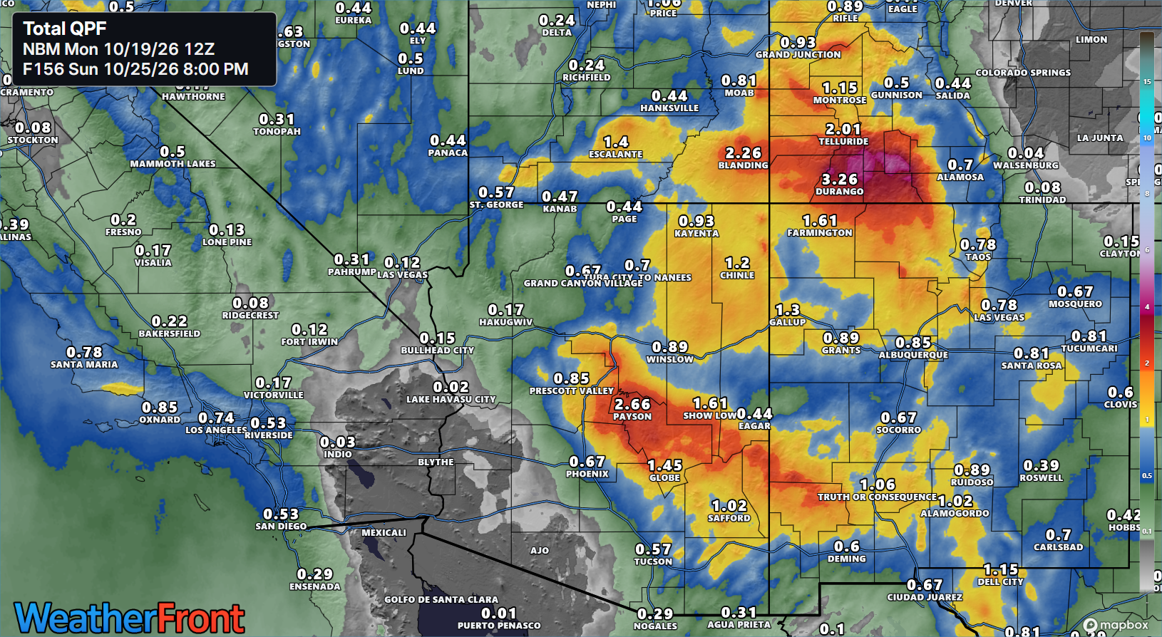
We’re looking at around an inch of liquid in the mountains of the LA Basin and perhaps on the coast near Santa Barbara. Arizona should get whacked with 1 to 3 inches in the mountains northeast of Phoenix and even more than that in Colorado outside of Durango in the San Juan Mountains. Snow levels will vary from west to east, around 8,000 in the Sierra, 10,000 feet in northern Arizona and Nevada, and 12,000 feet in Colorado. As you go north, snow levels could drop down to 7,000 feet or so in Utah, but the total precipitation will be lower.
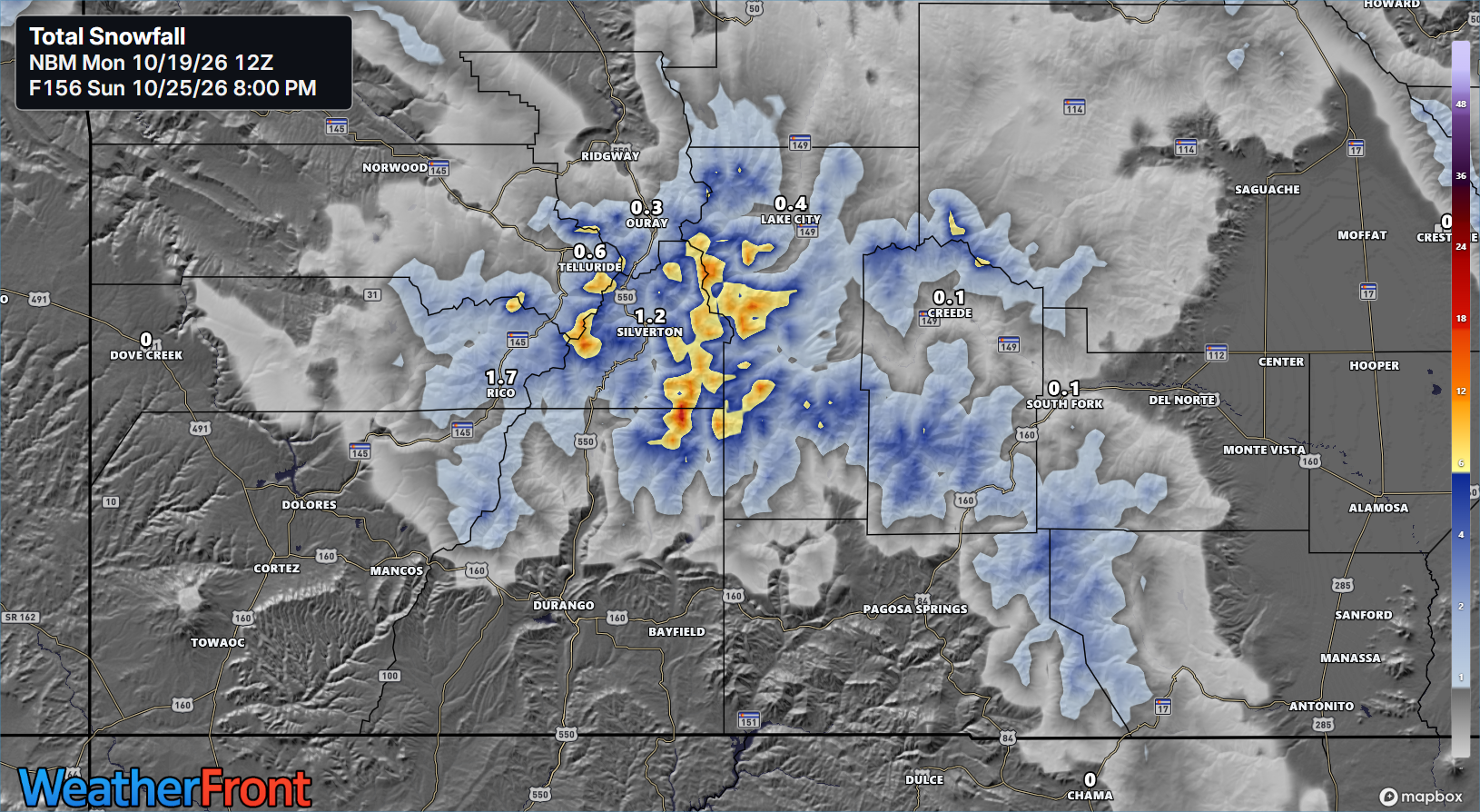
So perhaps skiers can get a little excited about seeing this. Arapahoe (north of this map view) plans to open Saturday, so this surely won’t hurt. Congrats to those who celebrate.