In brief: A potential storm off the East Coast may move slowly next week, kicking up surf and tides along the Eastern Seaboard. There is some chance it could become a tropical system. This may be a long winter of coastal flood producing storms on the East Coast too.
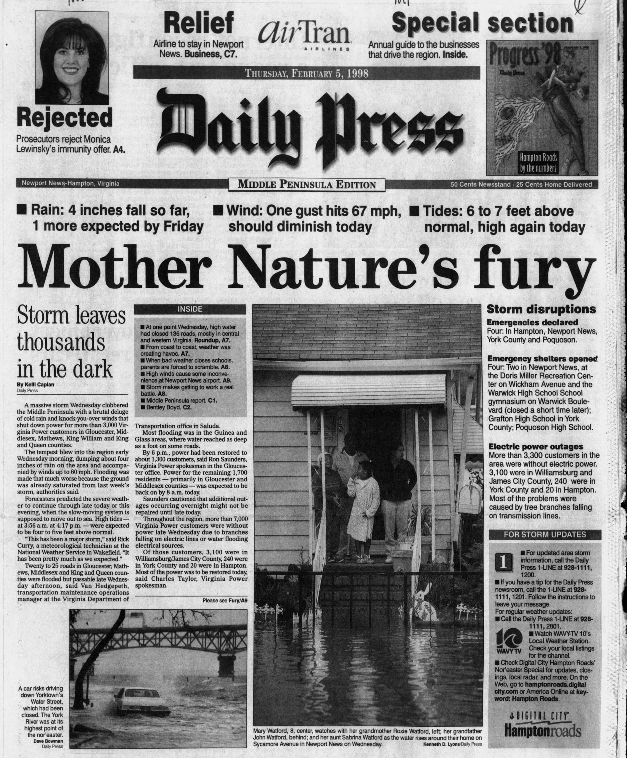
Back in early February 1998, your author was a mere budding weather weenie in his teenage years, his future already destined by his weather obsession. I even had this newspaper cutout in my locker.

But I recall distinctly a nor’easter from that winter that wreaked havoc on the Jersey Shore. It happened on February 4th and 5th in the super El Niño winter of 1998.
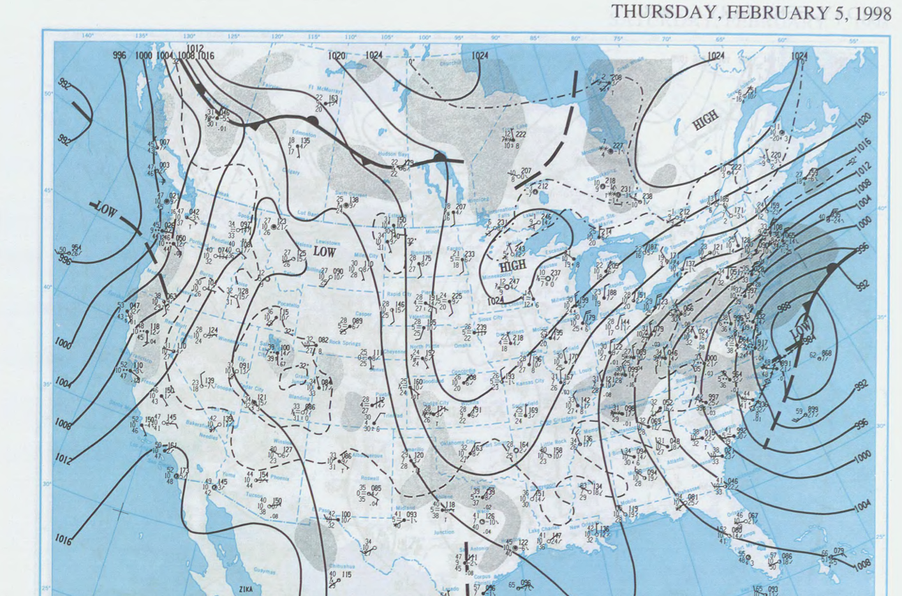
That storm in particular was responsible for over $145 million in damage (in 1998 dollars; $300 million today), about half of which occurred in Virginia. It remains the tide of record in Ocean City, MD and ranks 6th in Lewes, DE.
The storm itself was exceptionally strong, very early. In fact, the surface low pressure values across much of the coastal Southeast and offshore are still February records, according to NOAA’s David Roth. In other words, the storm intensified far south before strengthening further offshore. By the time it was off the Mid-Atlantic coast it was not setting records, but it was still potent and slow moving. The only other semi-recent storms I see with the kind of duration of winds in Jersey as strong as they were in February 1998 were during Hurricane Isabel in 2003, a November 2009 nor’easter (“Nor’Ida”), Boxing Day 2010, and the storm that occurred last February 7-8.
Regardless of those superlatives, it was the coastal erosion that was the really big problem. In both the 1982-83 and 1997-98 “Super” El Niño events, coastal storms caused significant damage not just to California but to the East Coast as well. It was newsworthy in 1983 too, with one coastal expert somewhat presciently just expounding on a theory of the greenhouse effect, which leads to climate change and subsequent sea level rise as a problem. He was prescient for a number of reasons if you read that linked piece.
The lesson from this is that while El Niño is going to make headlines on the West Coast and in California, events of this magnitude are also likely to produce strong impacts on the East Coast too, which is something residents and emergency managers/decisionmakers should be keen to over the coming months. Which brings us to…
Another coastal storm?
For the last couple days, models have been keying in on the potential for slow moving low pressure off the Mid-Atlantic coast. This has happened already this fall, seems to be a calling card of El Niño, and is likely to continue and possibly intensify as we go deeper into the cold season, as noted above. But this feature has shown up in multiple models, across multiple ensembles, and with little agreement spatially (geographically) or temporally (time) on track or intensity.
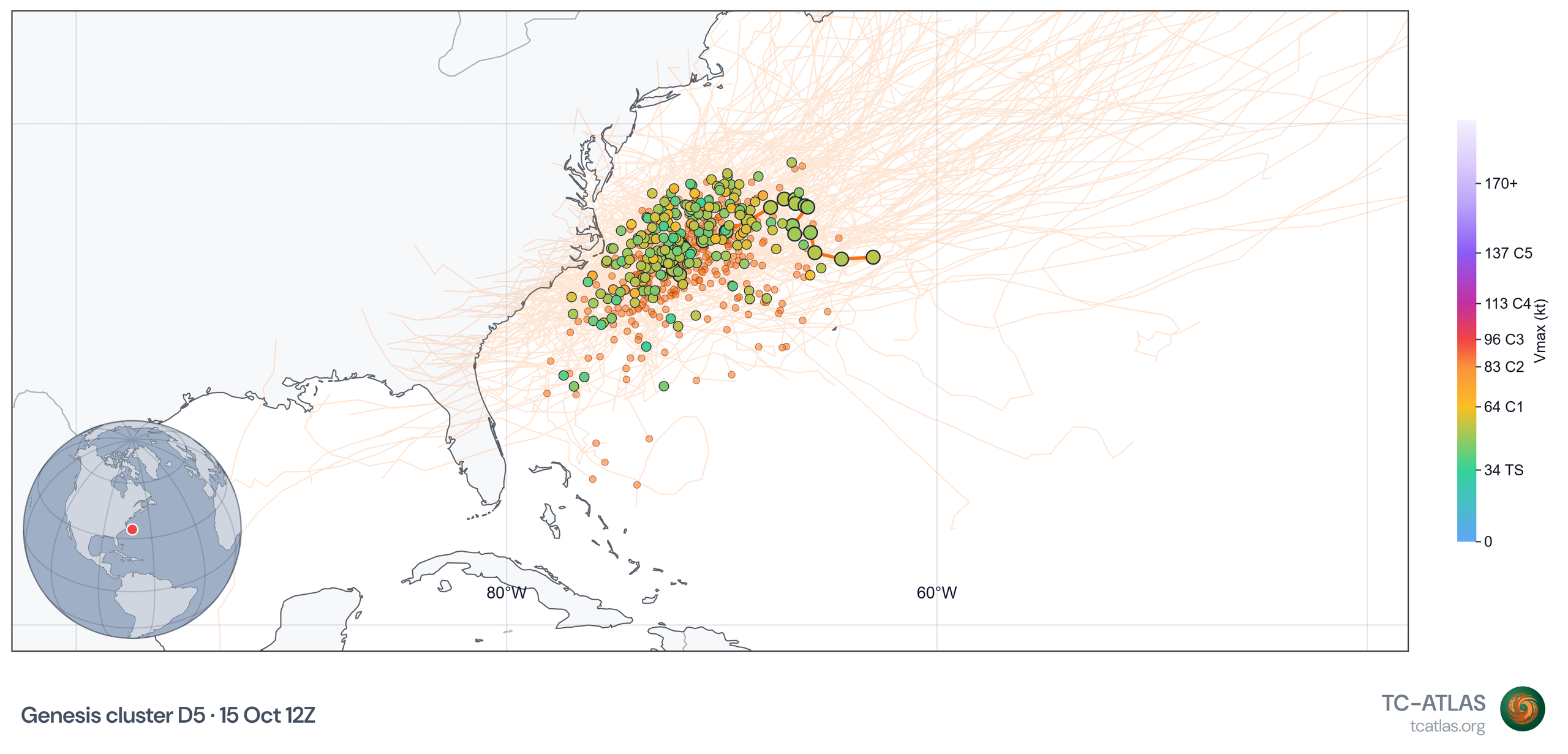
In looking at recent model guidance, despite the erratic development spread and potential, it seems as though this system has a couple notable elements to it. First, it looks to be slow moving. It develops offshore early in the week and doesn’t really disengage until late week. Obviously if it tracks inland or shifts farther out at sea, that may make a difference in how long the impacts last, but the takeaway here is that it’s in no hurry. The reason seems to be that the upper air pattern as forecast next week (Tuesday shown here) is supportive of high pressure just east of Bermuda, and a ridge of high pressure over Mexico basically “trapping” or blocking in the low pressure area, be it on the coast, offshore, or wherever.
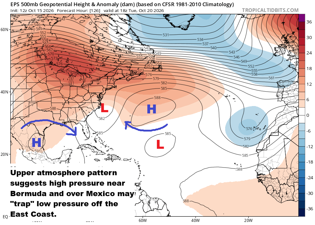
In other words, you’re placing this system between a rock and a hard place. The pattern may not loosen up until Friday or Saturday.
Another notable element is that with these forecast positions of low pressure, sitting over generally warm water off the East Coast, you’re lobbing the potential for a “warm core” or tropical system to develop. Indeed, from last night’s European operational model, we saw a deep warm core system show up in the guidance. Unlike the nor’easter from a couple weekends ago, this one has a slightly higher potential to go tropical.
That said whether it does or does not is sort of immaterial right now. Something we’ll watch, but not anything we can really go overboard on speculation right now. Just for, well, we’ll call it illustrative purposes, here is today’s 12z European operational model. This is merely one of a myriad of possible outcomes.
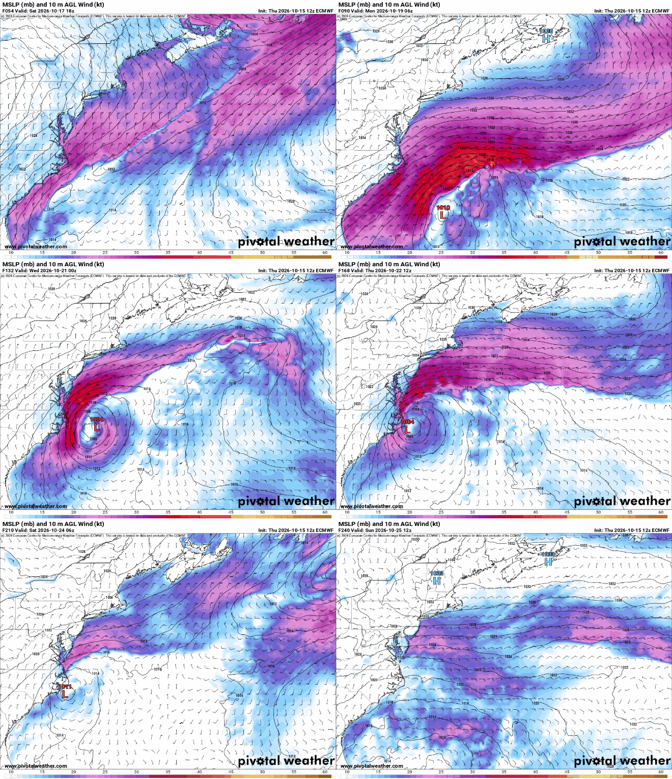
From an impacts perspective, this would likely feature multiple consecutive high tide cycles with elevated tides and winds at the coast from Long Island through North Carolina. This scenario probably would lead to higher impacts from Delmarva into North Carolina than elsewhere, but this is still rather speculative.
The takeaway here is that we are probably heading for another episode of prolonged higher tides and gusty winds on the Mid-Atlantic coast. It’s too soon to really say whether this will lead to a multi-day coastal flooding event and/or how severe that would be, but after the nor’easter from a couple weekends ago, some of the coastline remains vulnerable to higher tides and erosion risk. And this will almost certainly only be the next of several times we discuss these kinds of storms on the East Coast heading into winter.