In brief: We have the latest on Isaias, which will make landfall this evening near Destin, FL as a borderline major hurricane. We also talk more in depth about flooding concerns and wind concerns inland from Isaias. Also, the San Diego area is under a Tropical Storm Watch for Rachel. We explain how that scenario should unfold on Sunday.
Hurricane Isaias
The storm remains a major hurricane this evening as it’s rapidly approaching the Gulf Coast.
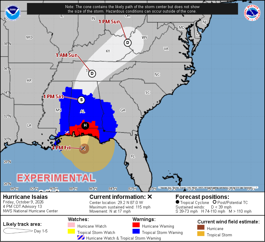
Maximum sustained winds are reported to be 115 mph, and the core of Isaias is resilient as anything I’ve seen. It’s currently estimated to be fending off 30 to 40 knots of wind shear. The center is currently about 90 miles south of the Panhandle, and it’s moving north at over 15 mph. A little back of the napkin math suggests landfall is roughly 4 to 5 hours away, so about 9 PM ET/8 PM CT, give or take.
On the current trajectory, Isaias will make landfall very near Destin or Fort Walton Beach. Surge and wind impacts will likely be worst there and just east of there. Indeed, conditions are deteriorating already.
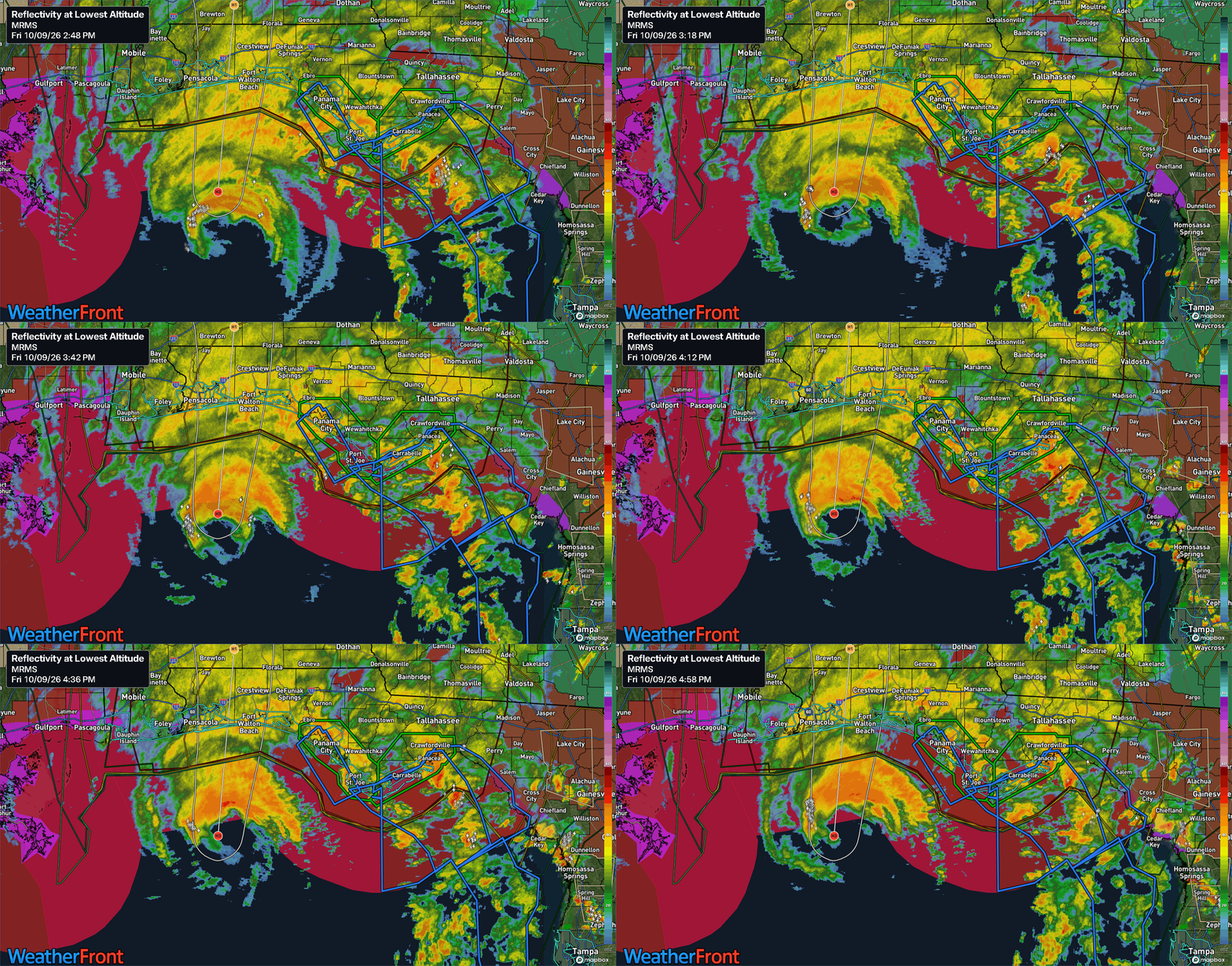
Wind gusts have been as high as 56 mph at Pensacola Naval Air Station so far, along with a 63 mph gust west of the center, about 50 miles south of Gulf Shores. So even on the west side of the storm, we’re likely to see some decently strong winds.
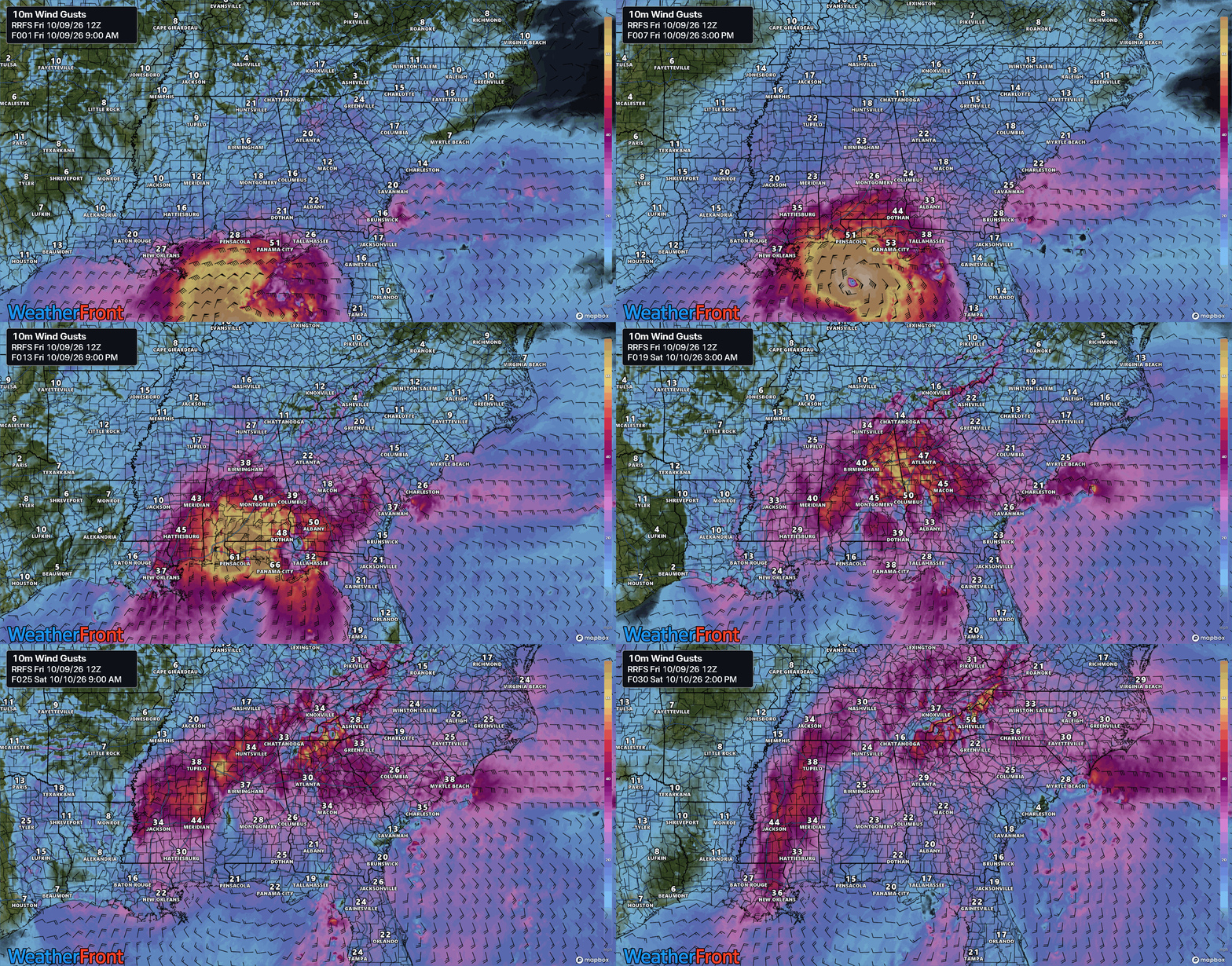
The surge forecast and general wind forecast remains mostly unchanged. As the storm progresses inland, the wind field is going to expand and spread out across the region. This will likely cause power outages and the like, perhaps as far inland as Birmingham or Atlanta. Charge your phones tonight.
The tornado threat continues to be elevated on the eastern flank of the storm, and we’ve already discussed that in more detail in our most recent post.
Bottom line: Hurricane Isaias will make landfall before midnight near major hurricane intensity, with significant impacts on the Florida Panhandle, spreading inland overnight.
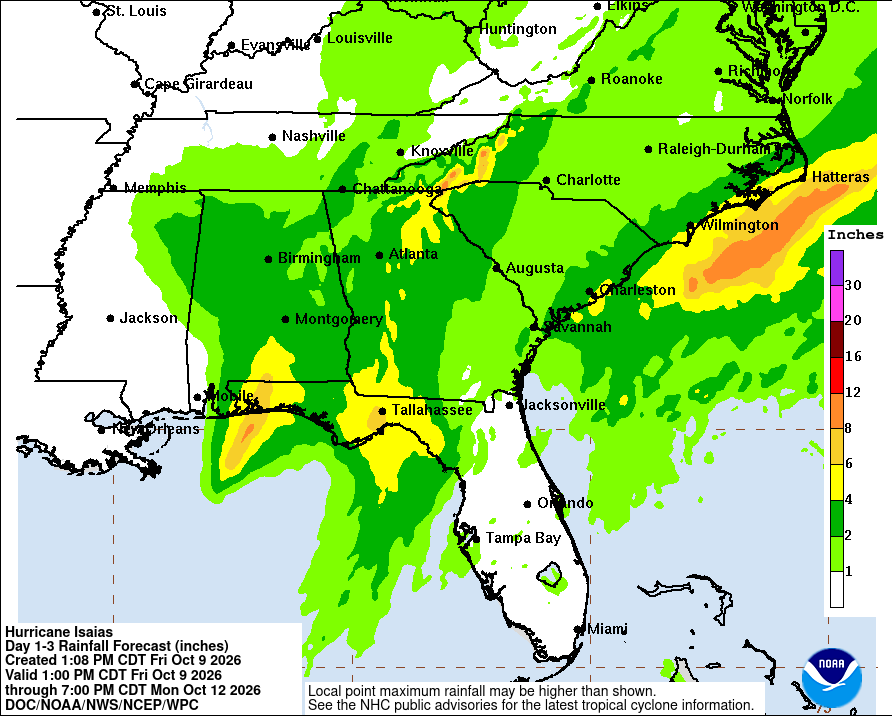
One last thing, the rainfall forecast. Watch for localized instances of more significant flash flooding potentially in the mountains of North Carolina Upstate South Carolina. We aren’t talking Helene type stuff here, but still a meaningful impact. A moderate risk (3/4) is in effect for flash flooding tomorrow in those areas south into Georgia.
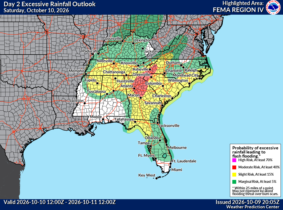
The mountains north and east of Atlanta will also be under this moderate risk.
Tropical Storm Rachel
Watches have been issued for the San Diego area for tropical storm conditions possible this Sunday as Tropical Storm Rachel pushes that way. This last occurred in 2023 with Hilary. Most forecasts are currently keeping that intensity of wind out of San Diego, but with landfall not terribly far to the south, it’s not out of the question that we if the track shifts at all between today and Sunday we see those winds lift north.
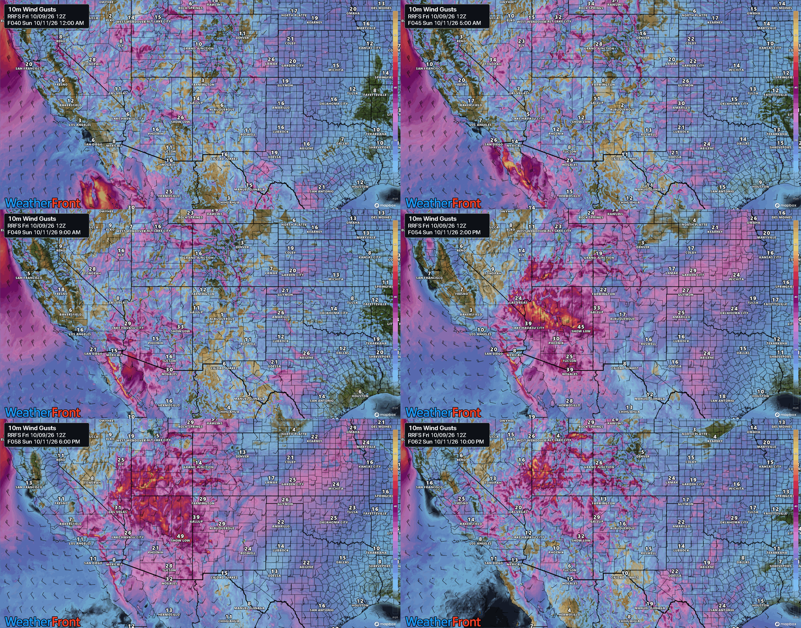
Rachel is expected to make landfall between Ensenada and Lázaro Cárdenas in Baja California, Mexico. Tropical storm force winds will spread north as it also moves north, and this could bring those conditions into the mountains of San Diego County or southeast California, as well as into Arizona. Either way, Sunday looks like a windy day across the desert, with gusts of 35 to 55 mph across Arizona, southeast Nevada, and southern Utah.
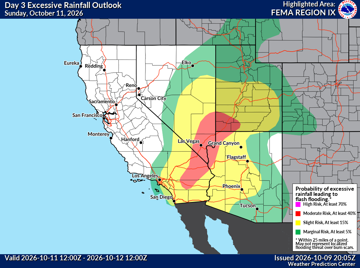
In addition to the wind, we’ll see rain as well impacting the region, with areas of flash flooding possible. A large area is under a moderate risk of excessive rainfall and flash flooding Sunday in Arizona, California, Utah, and Nevada.
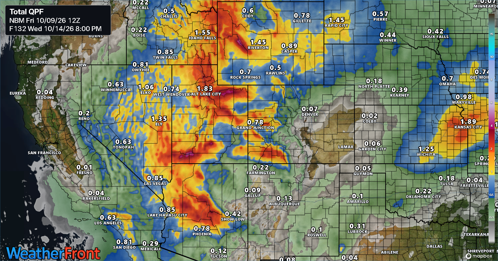
Worth noting that enhanced moisture will spread north and linger in Utah into Monday and Tuesday as well, which could trigger additional issues.
There’s a lot going on out there folks. Stay safe.