Isaias is one of those storms that is classic autumn hurricane. While working through the various pieces of this forecast this week, I kept coming back to Hurricane Delta back in 2020. And this is partially why I never really thought to downplay this storm as hype.
Much like Isaias, Delta, six years ago to this day, was a storm that had been a major hurricane, turning north, and beginning to weaken in the face of considerable wind shear.
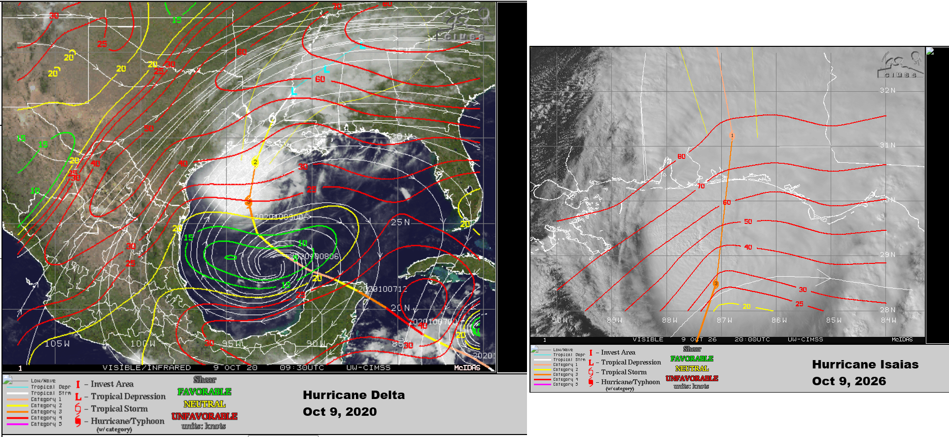
The shear facing Delta was less intense than that of Isaias, but the end result seems to be similar. A look at the radar images of the two storms just past landfall tells that story fairly well.
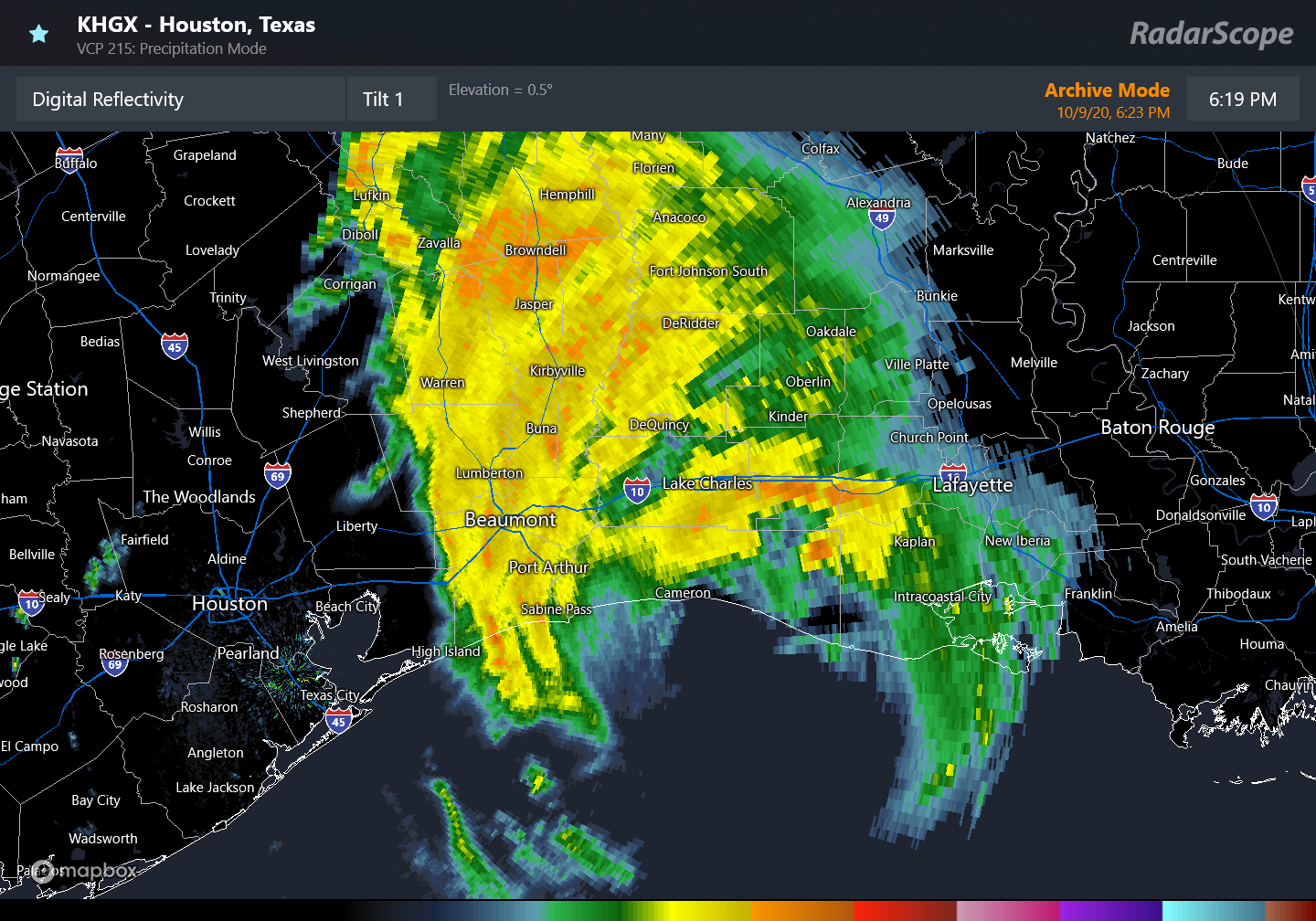
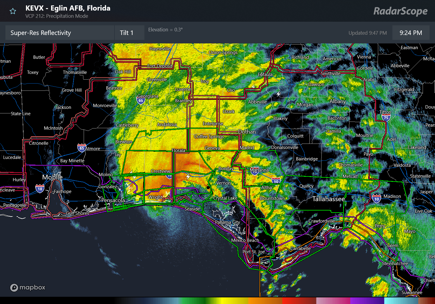
Both storms lacked much action south of the center. Both storms saw the wind field expand at landfall and shift to the west side of the storm. And both storms produced impressive wind gusts over a broad area.
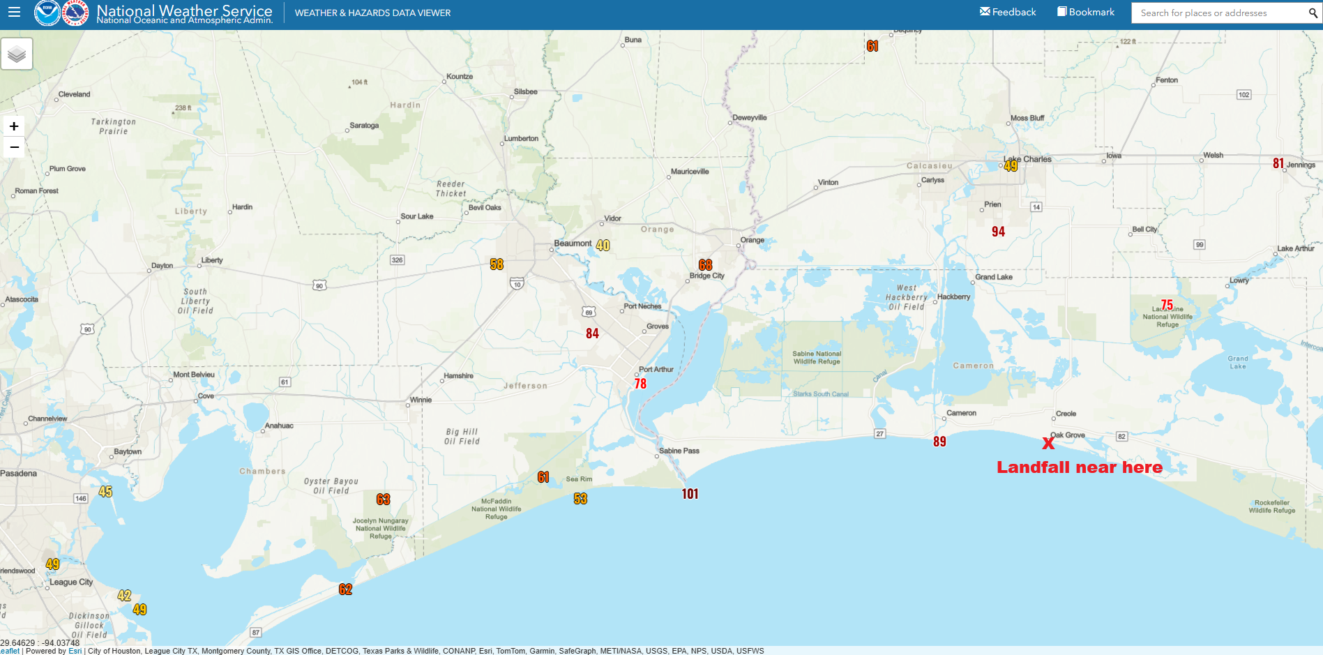
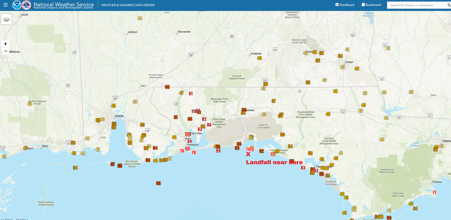
Why does this happen? One possible explanation of this is the dry air we talked about in the run up to the storm’s development. We did note that Isaias could wrap in drier air off the western Gulf Coast, causing it to weaken. This can also help enhance wind gusts (through stronger downdrafts) simultaneous to weakening the storm overall.
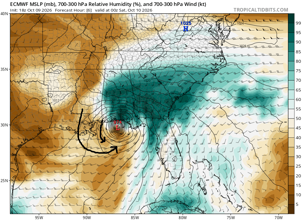
A similar thing happened during Hurricane Delta in 2020 as well:
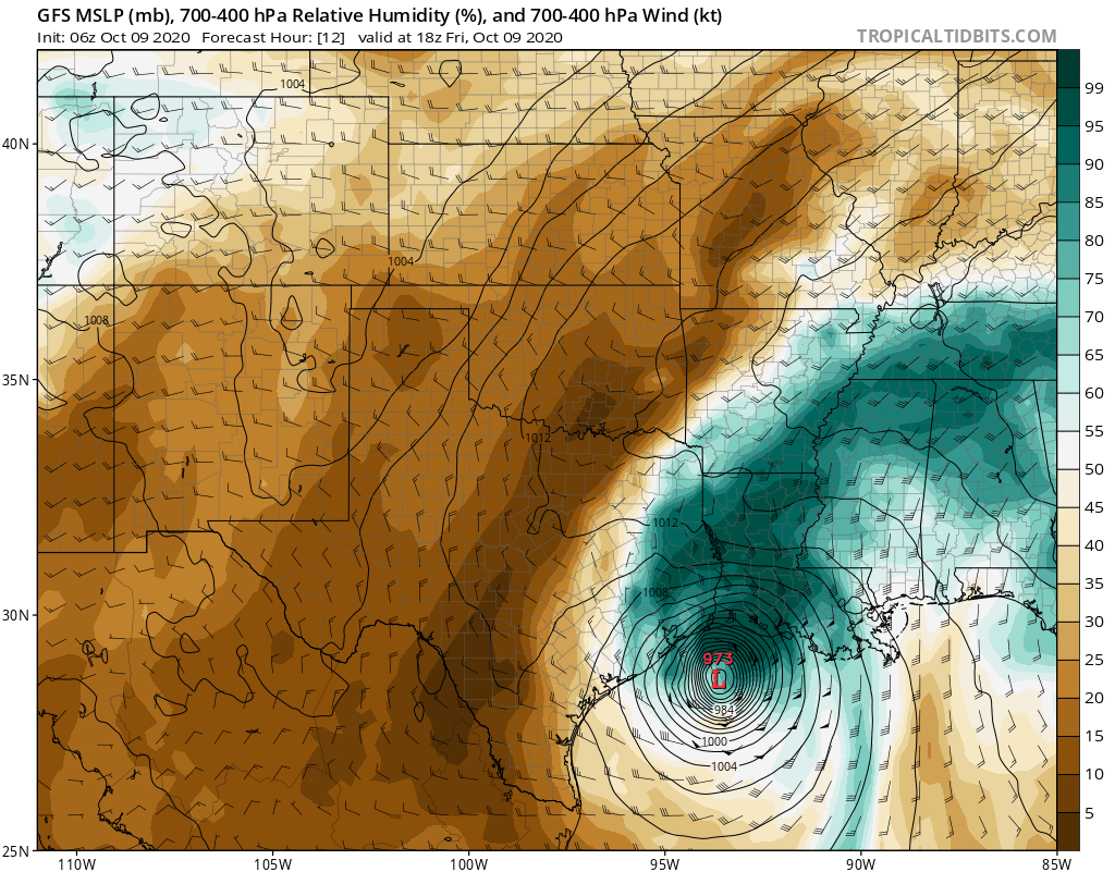
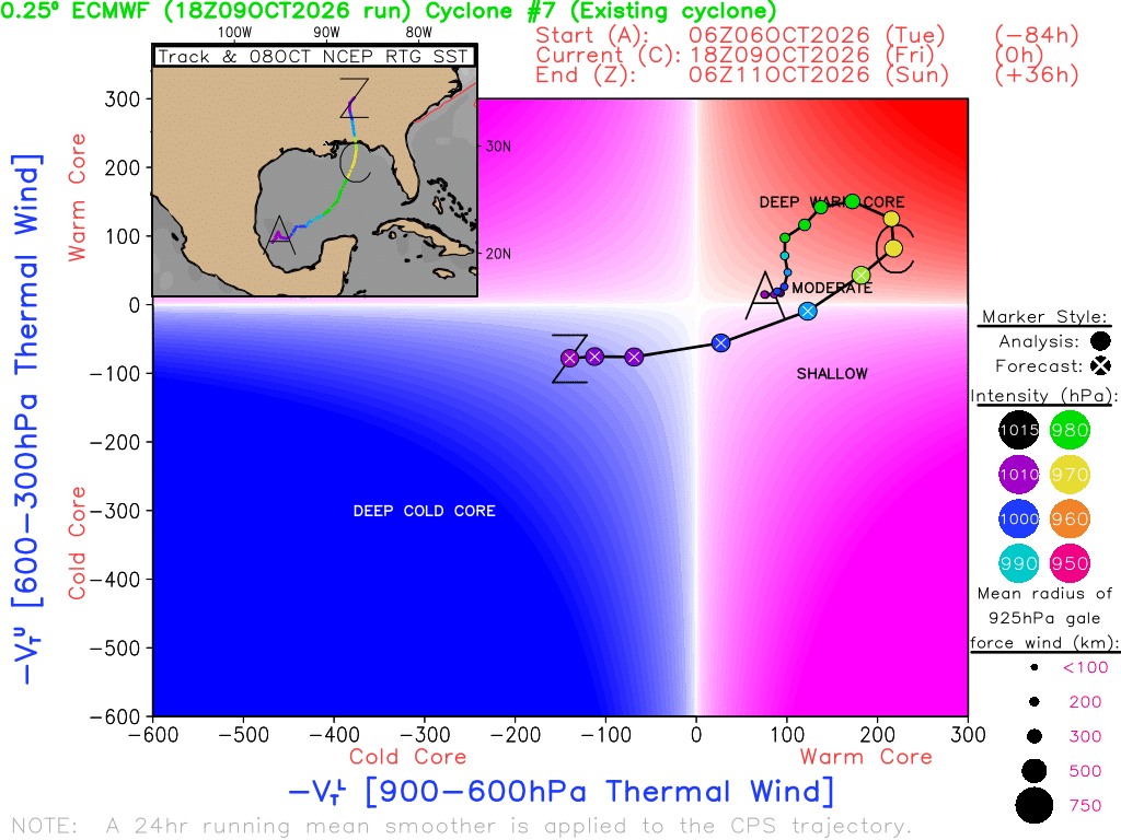
We also typically see this type of expanding wind effect on all sides of a storm as it begins to lose tropical characteristics. We are passing the threshold of deep warm core (tropical) and more into moderate warm core now, eventually transitioning to cold core (extratropical) by tomorrow afternoon.
So that is a simplistic explanation of what’s happening here, and it’s similar to what happened six years ago today in Texas and Louisiana. The combination of a robust inner core of a storm that held intensity, wind shear both hurting it and helping it, dry air both hurting it and helping it, and a transition to an extratropical storm has led Isaias to come ashore swinging away unlike some other past storms that have made landfall in a weakening state.
In the meantime, the poweroutage.us page says that over a half-million customers are without power nationally, most of them in Florida and Alabama. As the night wears on, the winds will continue to expand north, and this will lead to another escalation in power outages overnight toward Birmingham, Huntsville, and Atlanta. We also continue to expect a decent side helping of tornado warnings tomorrow, so folks in Georgia and the Carolinas should have ways to receive warnings tomorrow.