In brief: A potentially significant flash flooding event may unfold between the Hudson Valley and Philadelphia on Tuesday, with some uncertainty remaining on exactly who will see the most rain. Flood watches are posted.
Keeping the focus on the Northeast this evening, we are setting the stage for a potentially impactful day of flooding risk Tuesday from North Jersey, across New York City, and into southwest New England and southeast New York. The table was set today with some slow-moving torrential downpours in Rockland County, NY and Passaic and Bergen Counties in New Jersey.
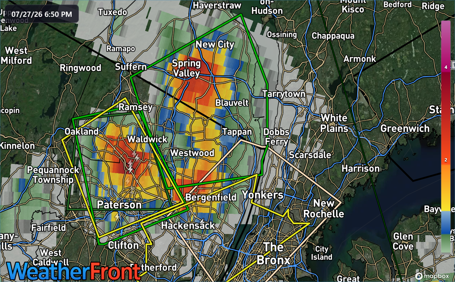
Spring Valley, NY, just near the intersection of the Garden State Parkway and New York Thruway and Ridgewood in Bergen County, NJ seem to have seen the most rain with radar estimates around 3.5 inches.
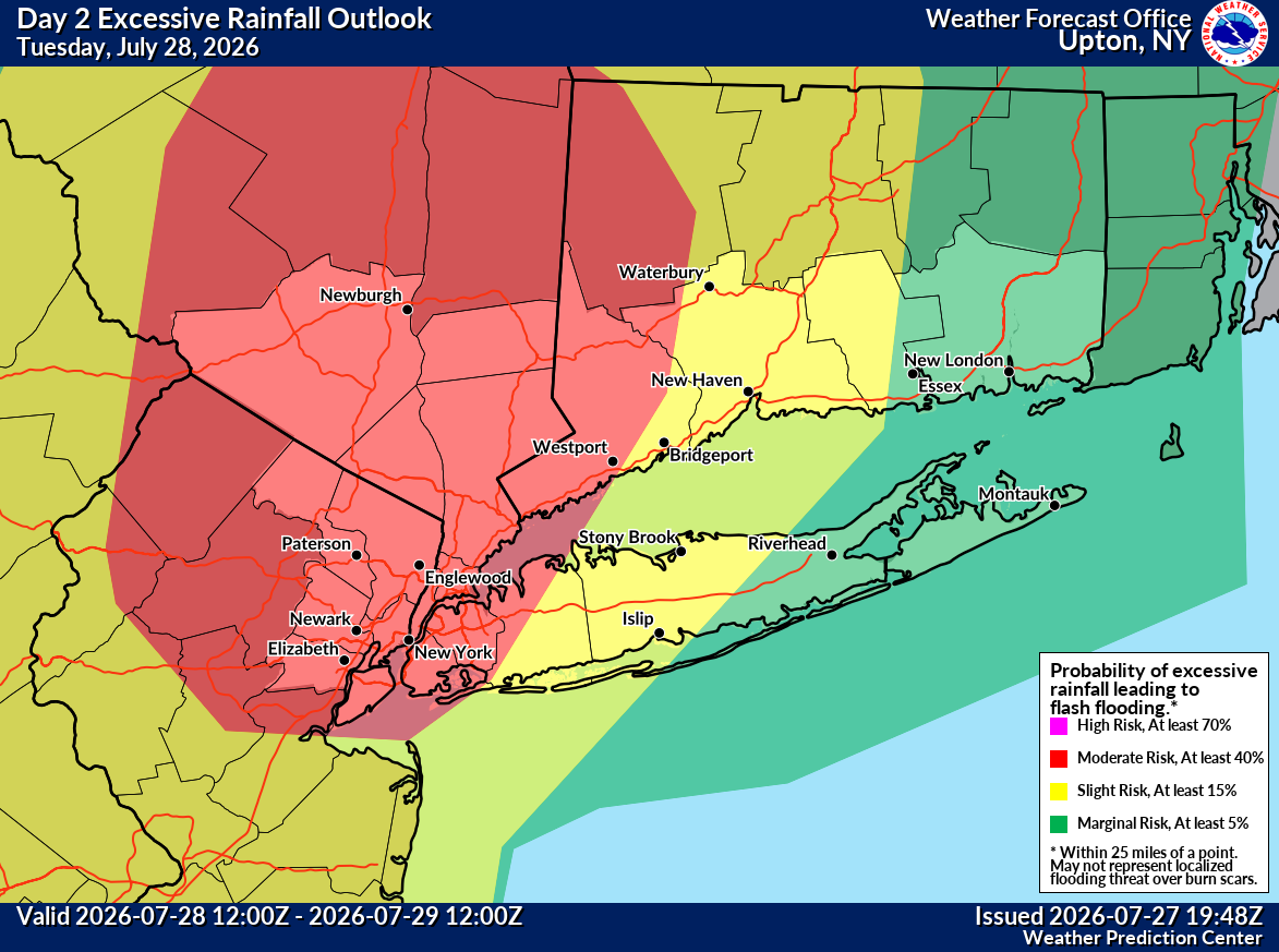
We go through again this tomorrow but on a larger scale. The area was upgraded to a moderate risk of excessive rainfall (level 3/4) on Tuesday from northeast Jersey to just south of Albany.
Storms will move across the Poconos and Catskills in the late morning, spreading east through the afternoon. There’s some debate right now if storms will get going around early to mid afternoon or mid to late afternoon across the NYC Metro area. Some of the more recent high resolution model guidance seems to have slowed things down a bit in terms of the onset. But there is still some modeling that favors storms increasing pretty quickly tomorrow.
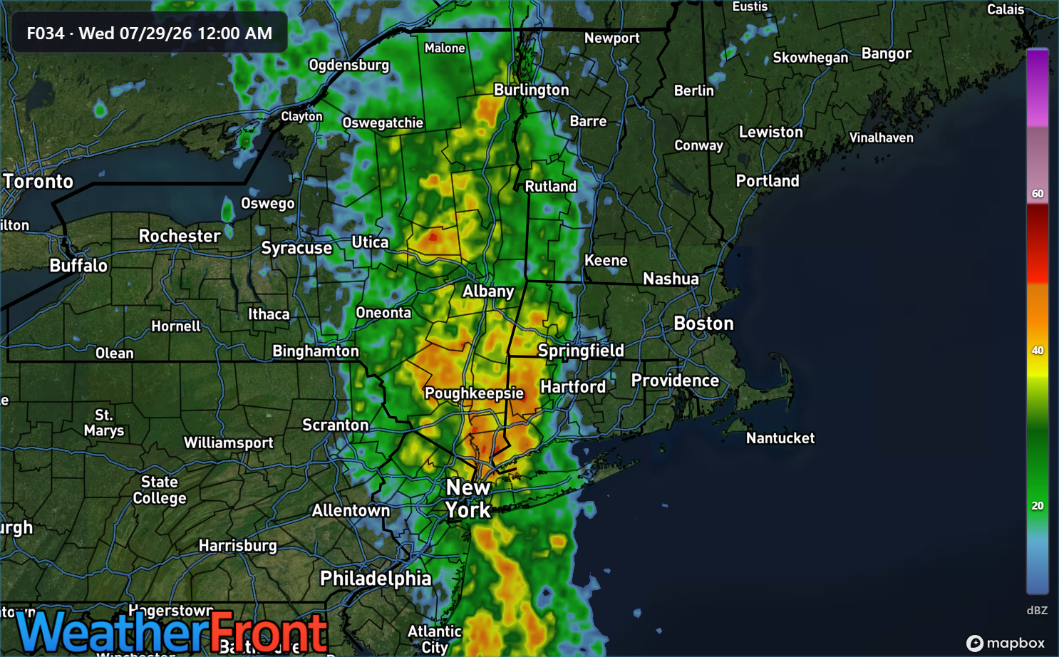
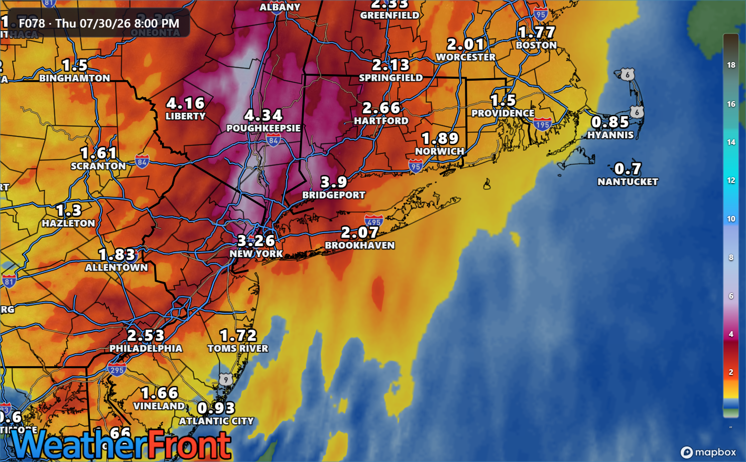
Either way, as the upper disturbance responsible for this mess closes off, the forward progress of rain will slow and more widespread rain will develop on the northern side of things. That’s why we could be talking about a radar image that looks similar to this tomorrow evening.
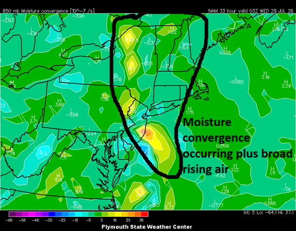
In addition to this broad upper support for rain, there’s going to be an influx of moisture converging over New Jersey, New York, and New England.
Whatever happens, there will likely be very heavy rain somewhere between Philly and Albany tomorrow afternoon and/or evening. There’s a pretty curiously high probability of risk of 5 inches or more of rainfall over 24 hours from the HREF model, which ensembles multiple high-resolution models.
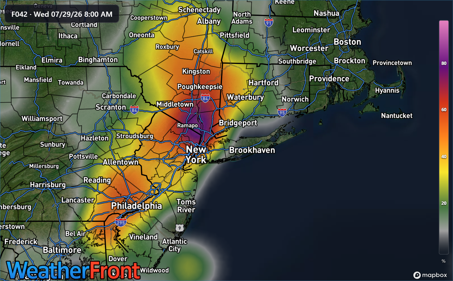
The Lower Hudson Valley seems to have the highest odds, but there are not so insignificant probabilities south of there toward Philadelphia or northern Delaware also. Extreme western Connecticut is also on the edge of these higher probabilities too.
While many parts of New Jersey have been dry, the area around New York City through southwest Connecticut has seen a lot of rain in the last 7 to 10 days and the onset of flash flooding may occur a bit faster than usual given these totals. Flood Watches are posted around this region, and folks should be prepared for a bit of a rough go of it tomorrow afternoon and evening.
Be safe, and don’t drive through flooded roads!