In brief: The tropics look quiet over the course of the next week or two. Meanwhile, a stubborn, slow-moving storm is likely to bring heavy rain and some flash flooding back into the Northeast this week, perhaps into Upstate New York and southern New England.
Just a quick editor’s note for you to let you know that I am now officially a Nutmegger, or a resident of Connecticut in the Westport area. We discussed this at Space City Weather last spring as to why I was relocating from Houston, but in the interest of transparency, if there is an East Coast bias in some of the writing here, this is why. I will try not to do that, and obviously with hurricanes and tropical systems, those will remain the primary focus here.
Tropics on pause for a bit
The good news to start this Sunday is that the tropics are taking a breather after Bertha last week.

The next couple weeks look mostly quiet. There is some chance that this week’s nonsense off the East Coast could congeal into something briefly that heads out to sea, but overall we expect the Atlantic, Caribbean, and the Gulf to behave through the early days of August. We’re approaching the seasonal ramp in historic activity now, so the stakes get a little higher by about mid-August. For now, we’re good.
Northeast flooding risk
A disturbance is going to track on the downstream side of a major Plains ridge this week, across the Great Lakes and into the Northeast. As it does so, the upper level disturbance will basically close off over Western New York and work across Southern New England, eventually pulling out by the end of the week or weekend. Slow moving, closed off upper level low pressure systems are always a headache, and this one should be no different.
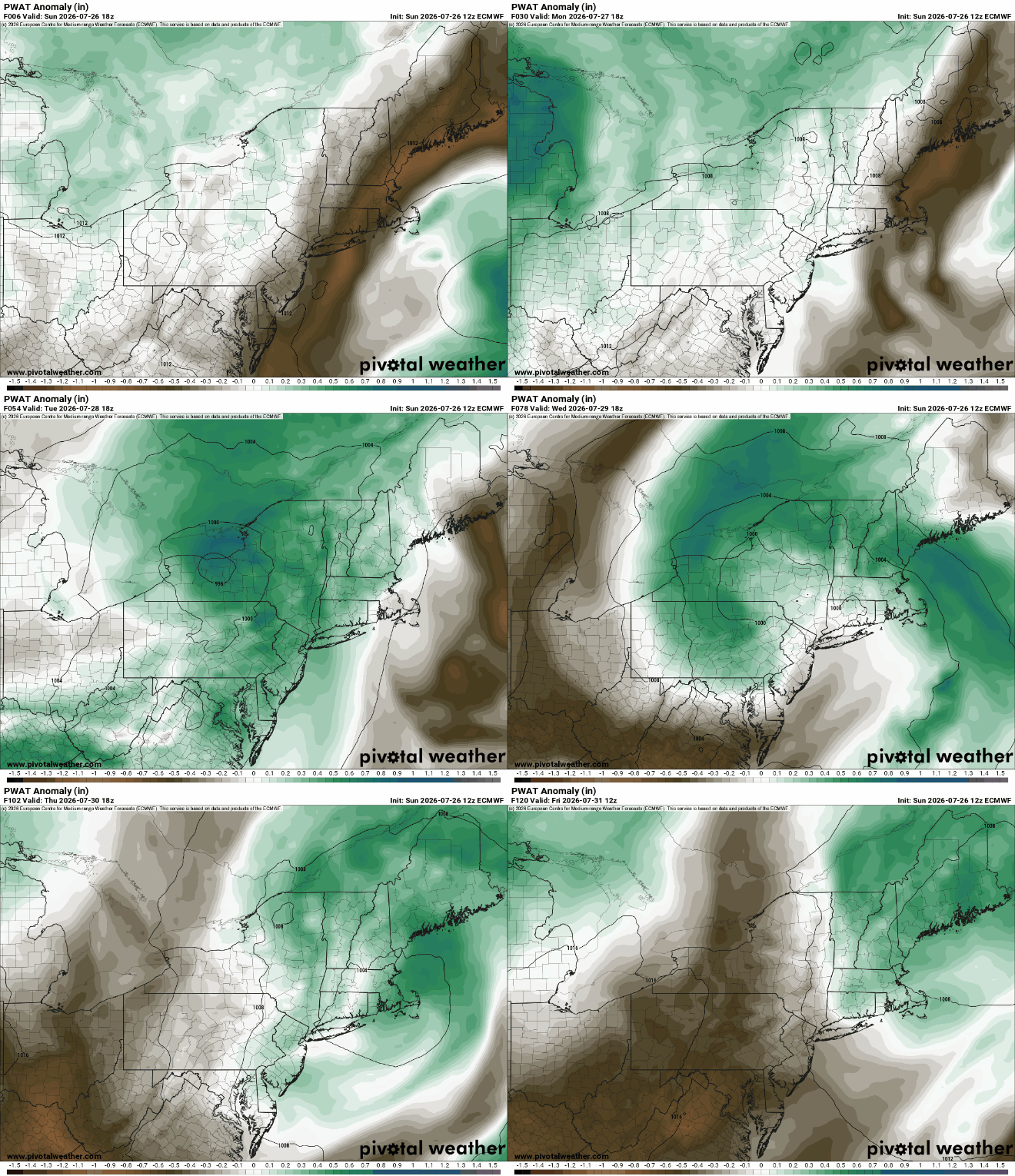
Areas from the Mid-Atlantic into New England and New York should see abundant atmospheric moisture, especially on Tuesday and into Wednesday which should translate to heavy rainfall potential with showers and storms pretty widespread. The slow moving nature of the front and upper level storm system, as well as the potential for a coastal low will likely prolong the rainfall chances perhaps into Thursday and Friday as well.
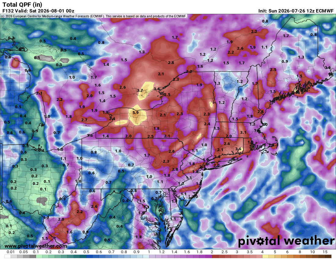
As of right now, it looks like Tuesday may be the worst day in Upstate and Western/Central New York and the Mid-Atlantic. Tuesday night into Wednesday may be the worst in New England. When all is said and done by Friday, rain totals should be anywhere from 1 to 5 inches, with a few locally higher amounts possible. Spread out over a few days, this will cause some minor flooding, but if a lot of this hits Tuesday into Wednesday, we could be talking about locally more serious flash flooding concerns, depending on exactly where that heaviest rain falls. Much of the region is in a slight risk (level 2/4) for flooding on Tuesday and Wednesday.
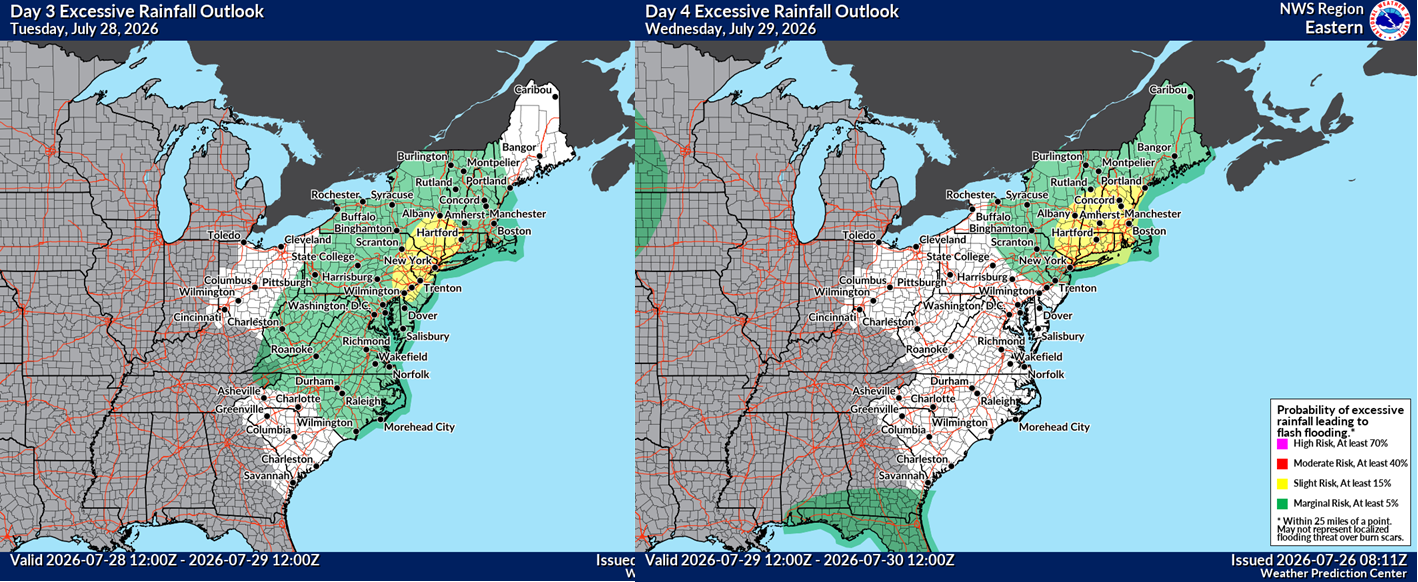
So, just something to be aware of. I imagine we will see a handful of flood watches get issued tomorrow in more flood-prone areas from recent rainfall. At this time, severe storms are not likely. More to come as I’m able!