In brief: Bertha is skipping along the western Gulf Coast as it heads toward a Texas finish. Impacts will be modest with some welcome rains in South Texas and a few gusty downpours north of there.
To Bertha’s credit, it has managed to hold on and cling to life, albeit barely it seems. This is more like a glorified blob or what we might call an MCS (thunderstorm complex) than a tropical storm, but even maligned tropical systems deserve love too.
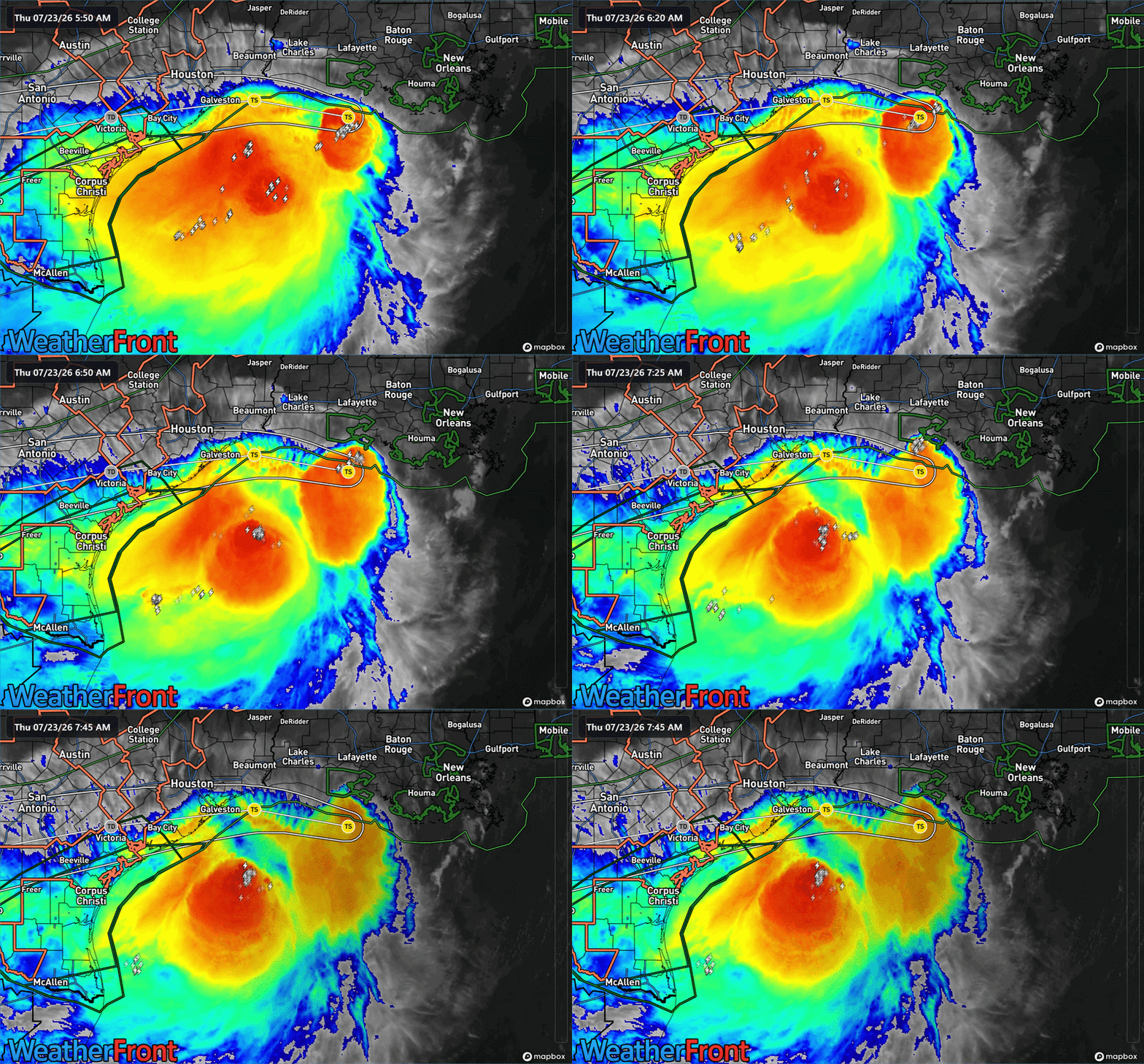
Bertha’s center is displaced far from the bulk of its storms, which are currently in the southwestern most blob off the middle Texas coast. Shear continues to pester Bertha, keeping it totally off-kilter, as does drier air over land, hence this “halficane” type look. While some of the elevated oil platfoms offshore have seen gusts of 60 to 80 mph since midnight, the bulk of the action is not quite making it to the surface and current maximum wind gusts are 15 to 25 mph from Galveston through New Orleans.
The bulk of Bertha’s rain is falling over the open Gulf, with a cluster of rather nasty looking storms hugging the northern fringe of the rain shield.
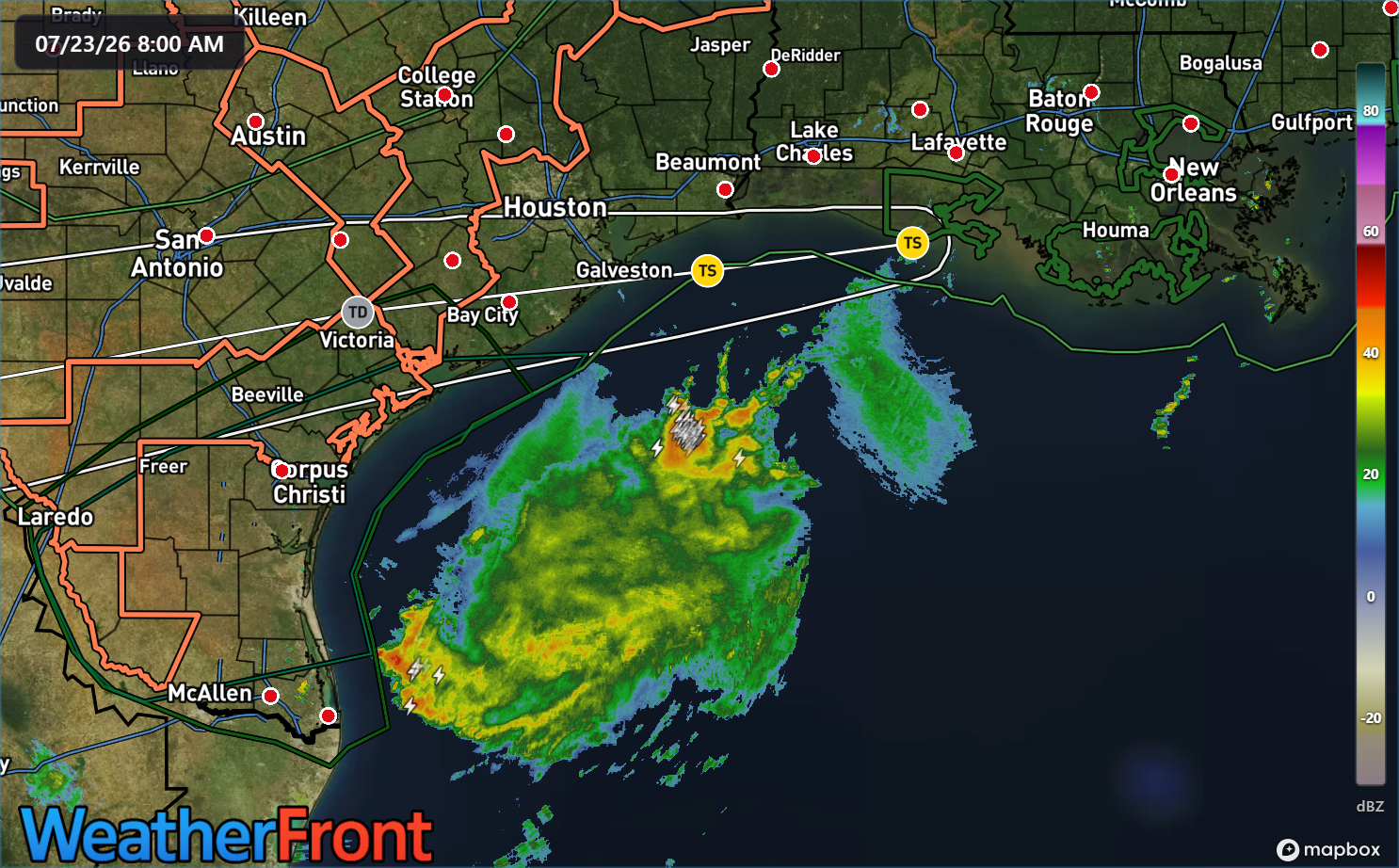
The bulk of this rain is going to push into the Middle and Lower Texas coasts, with the majority of it likely evaporating once it gets well inland. Hill Country does not need to worry about this, and South Texas is the one part of the state that could really use some rain.
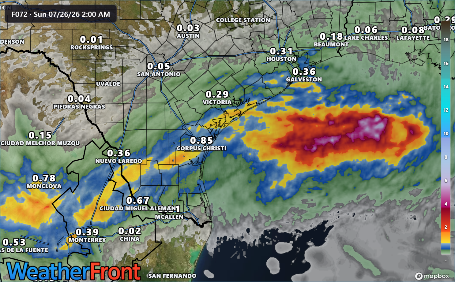
The yellow on the map above shows about 1 inch rainfall totals extending from near Matagorda Bay through Corpus Christi to just south of Laredo and some higher totals once it interacts with the mountains in Mexico. For the Houston area, I wrote about impacts earlier at Space City Weather but they’ll be mostly minor.
But, for the Texas and southwest Louisiana coasts, we’ll likely see some gusty downpours over the area this afternoon as Bertha’s close approach interacts with daytime heating. The steadier rains will increase today south of Matagorda Bay and into the Corpus area. Wind gusts could top off in the 40s mph in spots on the immediate coast but more than likely lower than that, especially as you work inland from the beachfront.
And we can then tie a ribbon on Bertha.
Beyond Bertha we’ve got nothing really in the Atlantic to discuss. A few models are showing risk of a developing system off the Southeast that would quickly scoot out to sea next week. I wouldn’t worry a ton about that one. More tomorrow.