In brief: Bertha is beginning to slowly weaken as it drifts toward Louisiana. Some rain (not a whole lot) is likely in South Texas as Bertha or its remnants approach tomorrow and tomorrow night. Bertha’s remnants are expected to keep moving west to the Pacific side of Mexico by the weekend.
I am short on time today unfortunately, so we’ll keep this brief.
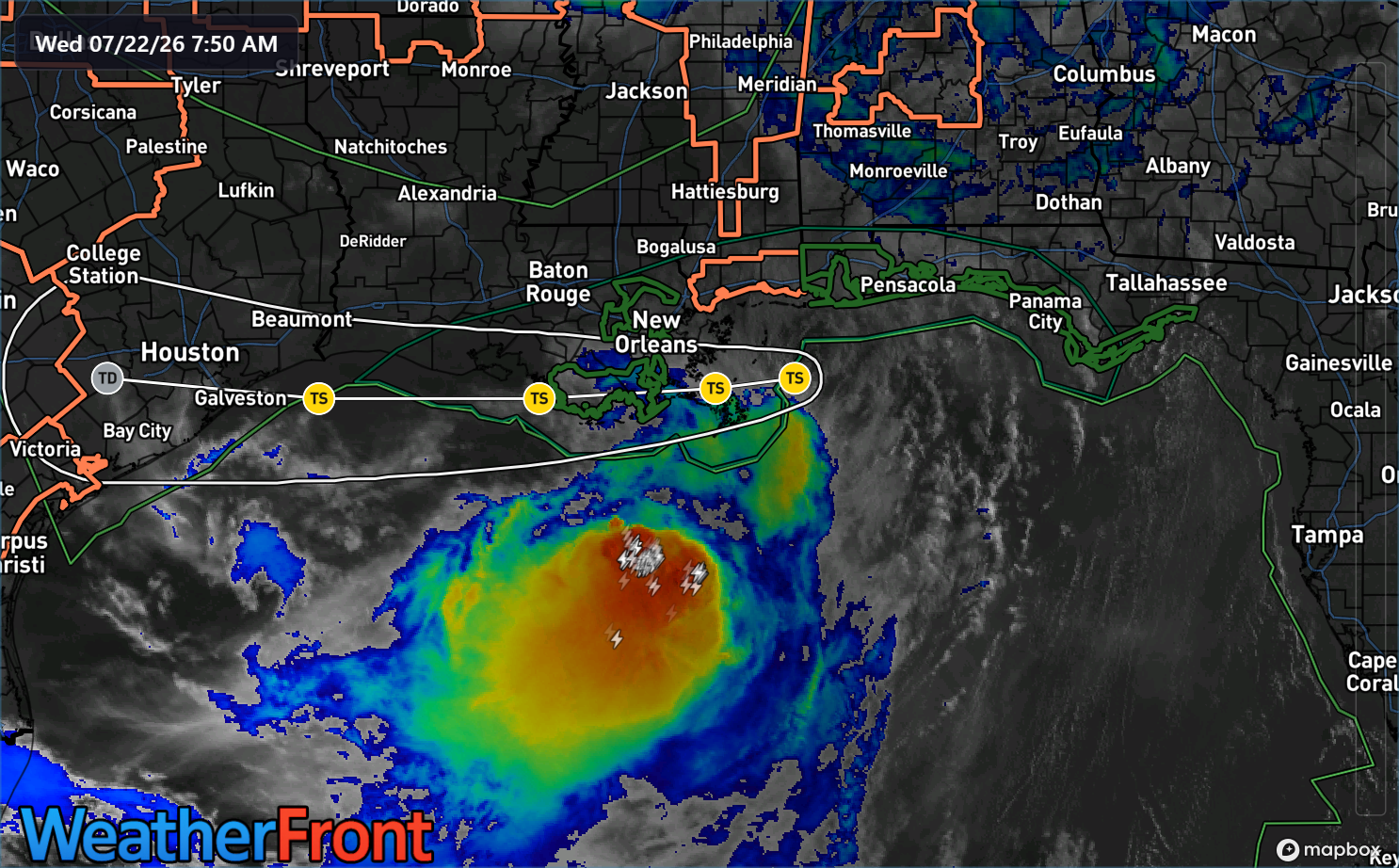
Bertha is struggling this morning. The thunderstorms are displaced far, far from the center.
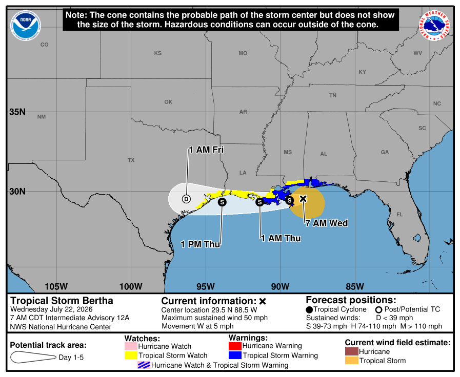
Northeasterly shear seems to be hitting Bertha pretty hard this morning, and winds have dropped from a maximum of 60 mph to 50 mph. Bertha’s future track is relatively unchanged today, with most ensemble members tracking Bertha either along the coast or a little bit offshore.
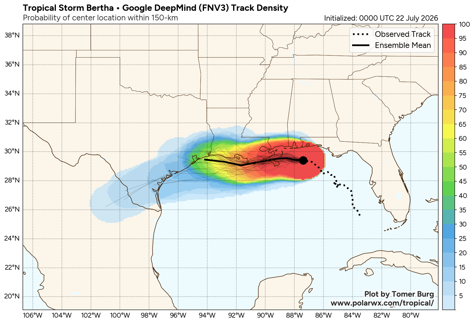
The majority kill off Bertha entirely before it gets to the Texas coast, while a handful keep it going as a depression into South Texas. Either way, Bertha is unlikely to strengthen any further, even if it tracks offshore more. Bertha is also expected to keep moving, with the remnants arriving on the Pacific side of Mexico by later in the weekend. In other words, we do not expect hell to be unleashed on Texas in terms of heavy rainfall, thankfully.
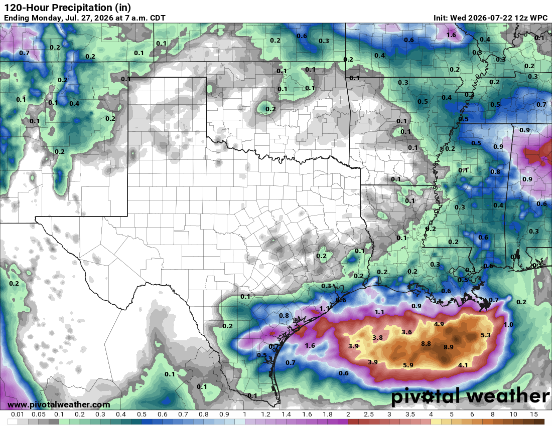
Also, with Bertha’s thunderstorms displaced to the south, this means that as it comes into Texas, it’ll send those rains down to the Middle Texas Coast and hopefully the Corpus Christi area. Far south Texas has not seen a whole heck of a lot of rain this month, so this would be mostly welcome. Hill Country is not expected to be impacted by Bertha. Houston and eastern Texas into western Louisiana will see some indirectly related storms tonight. I wrote about that over at Space City Weather this morning.
But for the most part, as expected, Bertha’s impacts will be primarily nuisance and mostly minor over the next few days. We’ll update later should anything else change.