In brief: The nor’easter off New Jersey and New England is mostly doing what we thought had been expected, with gusts as high as 70 mph in spots and some major tidal flooding. More wind, rain, and high tides to come into tomorrow. Meanwhile, we also check in on Gonzalo and Fay, Polo’s flooding risk, and the latest in Hawaii.
Here in my backyard in Connecticut, I think it’s safe to say this nor’easter has flopped. It’s not terribly far off what I expected here, but it also really has not been a big deal. The same cannot be said everywhere, however. A classic case of your mileage may vary.
Wind
Maximum wind gusts have been notable in some areas.
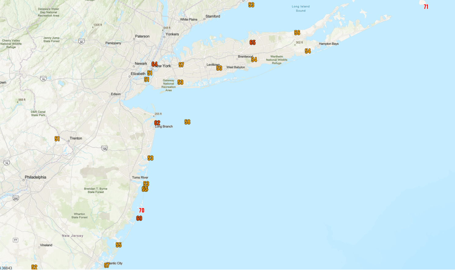
The leader in the clubhouse appears to be Block Island which registered a 71 mph gust. Next to that we have Barnegat Light on the north end of LBI in Jersey that hit 70 mph. Harvey Cedars peaked at 69 mph just south of there. Off the map, Wellfleet on the Cape in Massachusetts hit 70 mph also. And there was a 68 mph gust at Brandywine Shoal in Delaware Bay. For NYC Metro, the peak gust appears to have been Oakland Gardens in Queens that hit 57 mph and JFK Airport which did 53 mph. There was also apparently a 64 mph gust in Midtown Manhattan, but I suspect that was on a high rise.
So I mean, the wind basically did what we expected it to do. I do think we’re past peak wind now for today at least. There could be another round of gusty winds tonight on Long Island or the Jersey Shore as the storm center passes nearby. I would expect mostly 50-60 mph gusts from that at peak, but don’t be surprised if the storm escalates again overnight in those coastal areas.
Tidal flooding
In terms of tidal flooding, there was a good deal of moderate to locally major flooding reported this morning around New York City and Long Island tidal gauges.
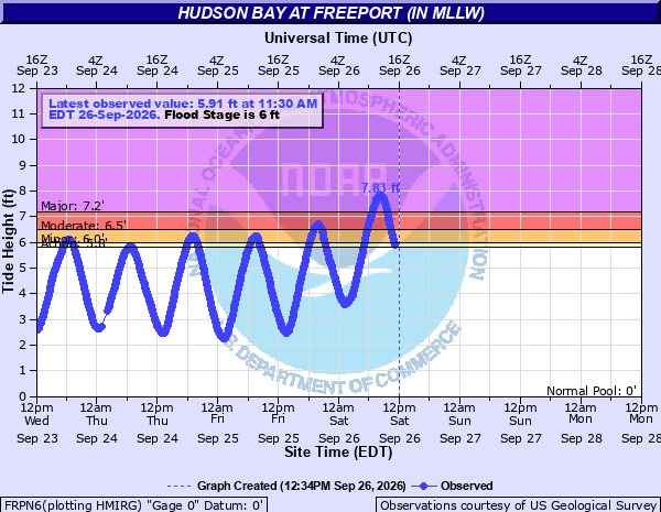
Same story on the Jersey Shore and in Delaware. In fact Lewes, DE on Delaware Bay fell just 1 foot short of their record tide.
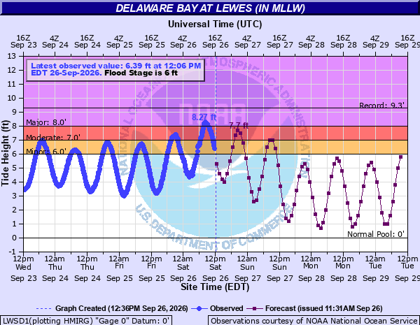
This will rank as the 7th highest tide on record in Lewes.
Subsequent tidal flooding may again be moderate to major in many spots tonight and perhaps again on Sunday morning before the storm weakens and exits.
You can view tide tables for the various monitoring sites up and down the coast.
Rhode Island and Massachusetts
Rainfall
The dispersion of rain has been very convective today across southern New England and areas to the south. Radar currently shows some thunderstorms near Storrs, CT as well as just south of Newport, RI. In general, this has been a bit more sporadic in terms of rain than I think we had expected. Most nor’easters have more of a steady rain shield. I think we’re seeing a combination of the time of year and the very, very loose warm core nature of this storm. Not a hybrid tropical/extratropical storm per se, but it’s taking on some of those convective characteristics.
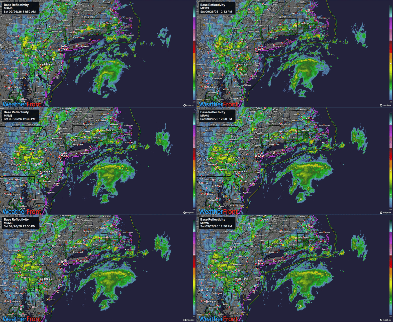
Thus far, we have seen about 1 to 2 inches of rain on the Jersey Shore north of Atlantic City and on Long Island. Inland from there, it has been a bit less, with a half-inch to 1.5 inches or so from the Trenton area through New London and southern Rhode Island. How much more rain should we expect? Well, rain should pick up in intensity over a broader area tonight as the storm lifts north and west, pushing heavier rain into southeast Massachusetts and Rhode Island and probably Long Island and New Jersey again.
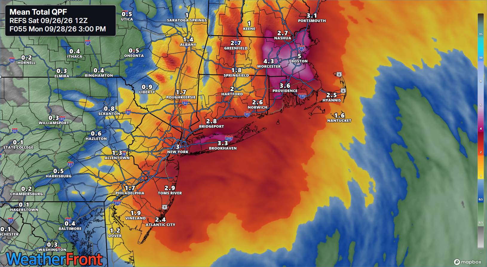
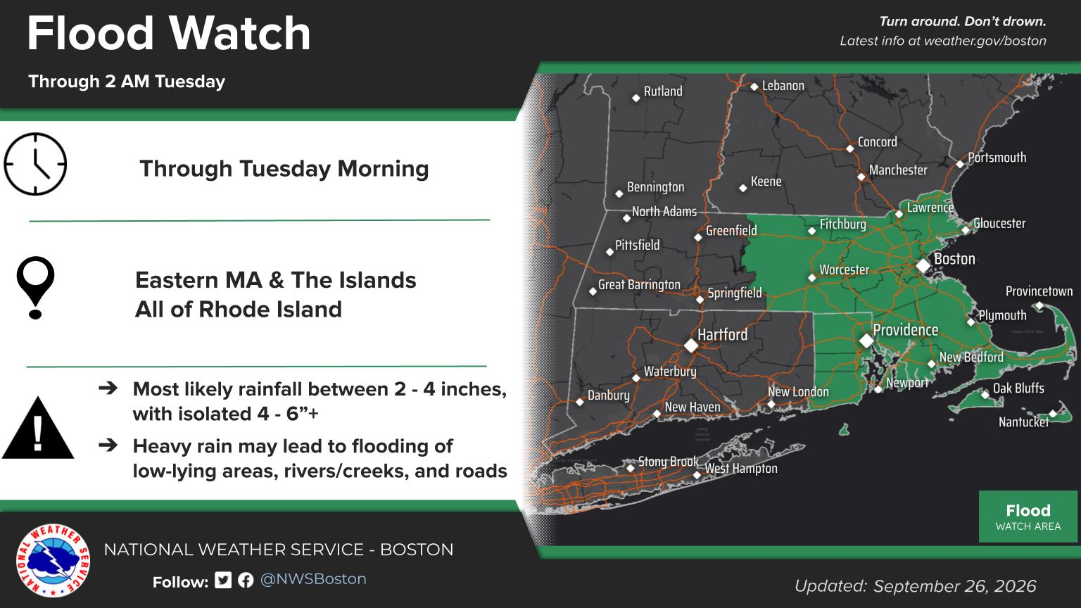
Note the 5 inch total near Boston. There has been a rather consistent model signal for excessive rainfall between Boston and Providence and in southeast Massachusetts tonight and tomorrow since earlier this week. So I continue to say that area may be at highest risk for legitimate flash flooding, especially with high tides at the coast. Odds of 5 inches of rain in 24 hours at some point between now and Monday are 30 to 50 percent in various modeling. Those are some beefy odds, so again, watch the flooding risk in those areas. A Flood Watch is posted for the region.
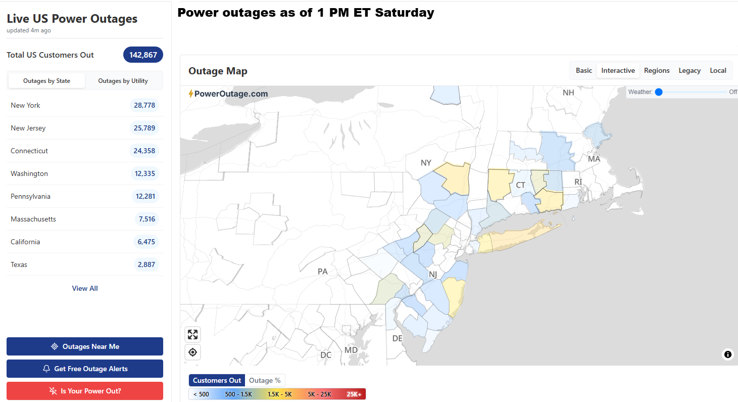
Overall, the themes of this storm are mostly what we expected, a mostly coastal flooding driven event. Power outages have not been awful, with currently only about 100,000 to 120,000 customers without power as of 1 PM today.
We’ll see how tonight goes.
Around the horn
Let’s check out the rest of the newsy bits in the tropics.
Atlantic Basin
Tropical Storm Fay is back down to depression status, but it’s expected to linger like a Cranberries song for a few more days. Meanwhile, Gonzalo is…I don’t even know how to describe Gonzalo other than it’s a metaphor for this hurricane season. I guess it’s still a tropical storm, but all of its thunderstorms are displaced east of the center, and not just east, like 150 miles east.
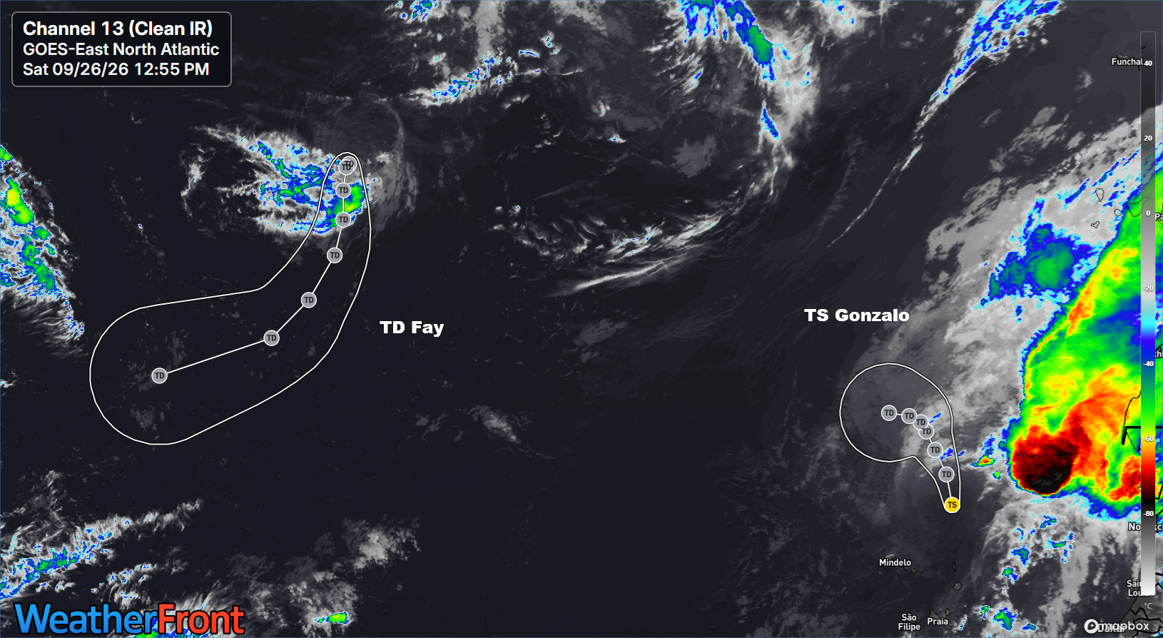
Both of these systems will be kaput before long.
Over the next 2 weeks, the odds of another fishy system are probably a little elevated, and we continue to see generic noise in the Gulf of Mexico that we can’t particularly get specific on right now. But we’ll keep tabs on things for the next couple weeks and see where this goes, if anywhere.
Polo pains
Hurricane Polo has weakened since yesterday, sort of. It’s now a high-end category 4 storm, but it’s beginning to wear down a little. That said, it’s still expected to maintain category 1 or 2 intensity as it hooks north into Baja by Monday night.
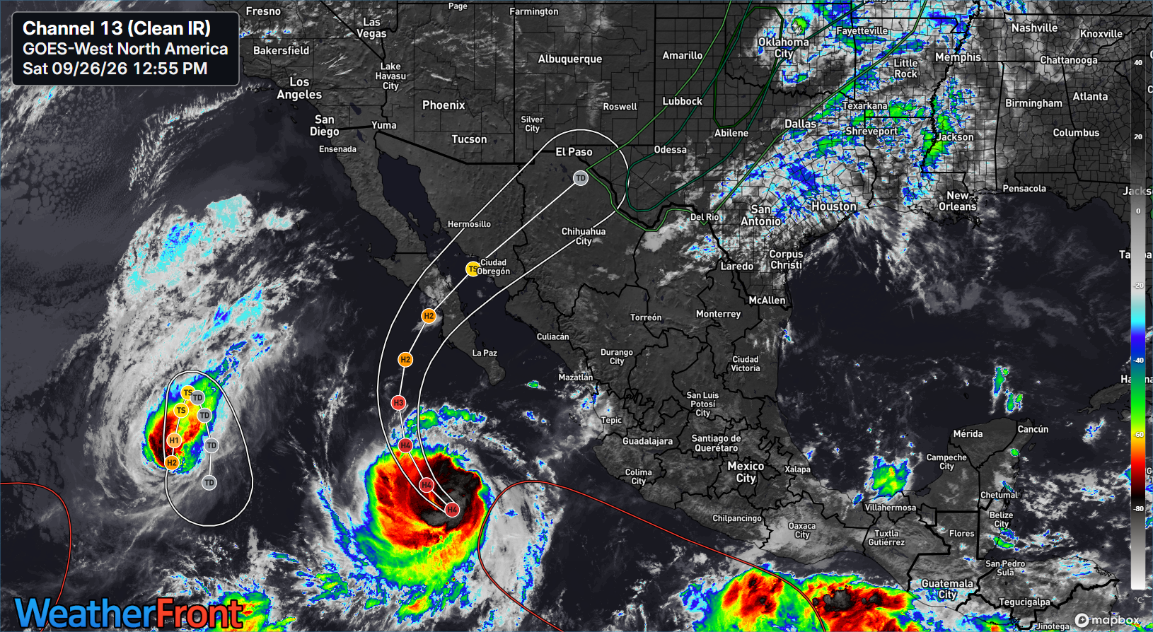
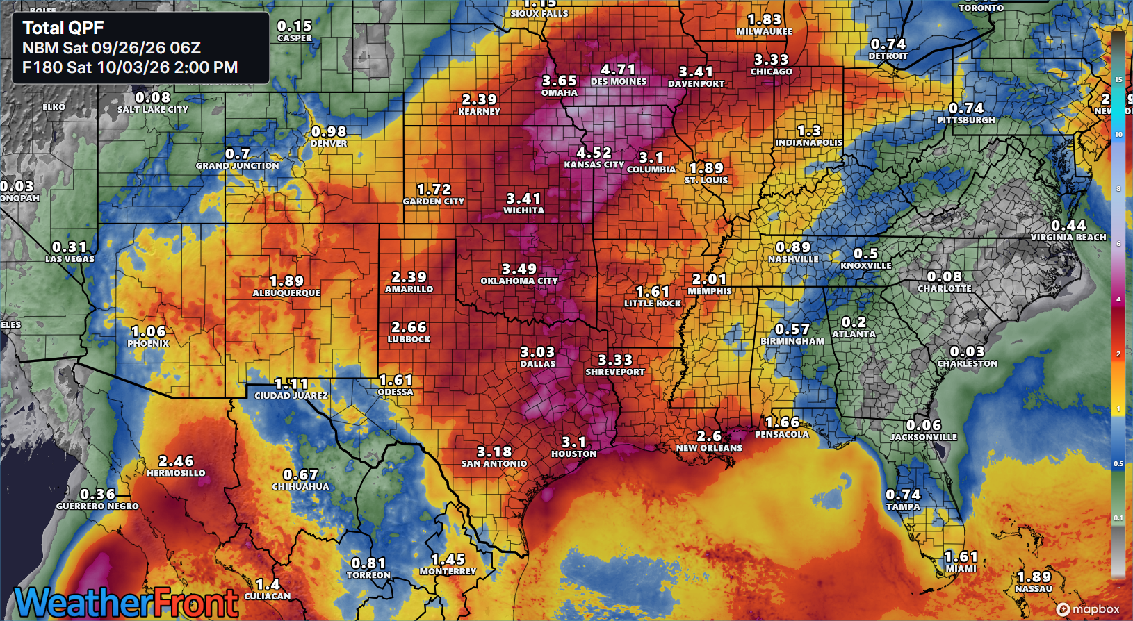
Polo’s biggest threat may be its rainfall however. We still continue to expect significant rain in the Desert Southwest, as well as Texas and the Plains. This will likely lead to increased flooding risk, especially in New Mexico (which has been hit very hard lately) and north and east from there next week. More to come on this.
Hawaii
Hurricane Nolo continues to drench portions of Hawaii, especially the Big Island, where as much as 15 inches or more has fallen already in some spots and another 10 inches or more could still fall.
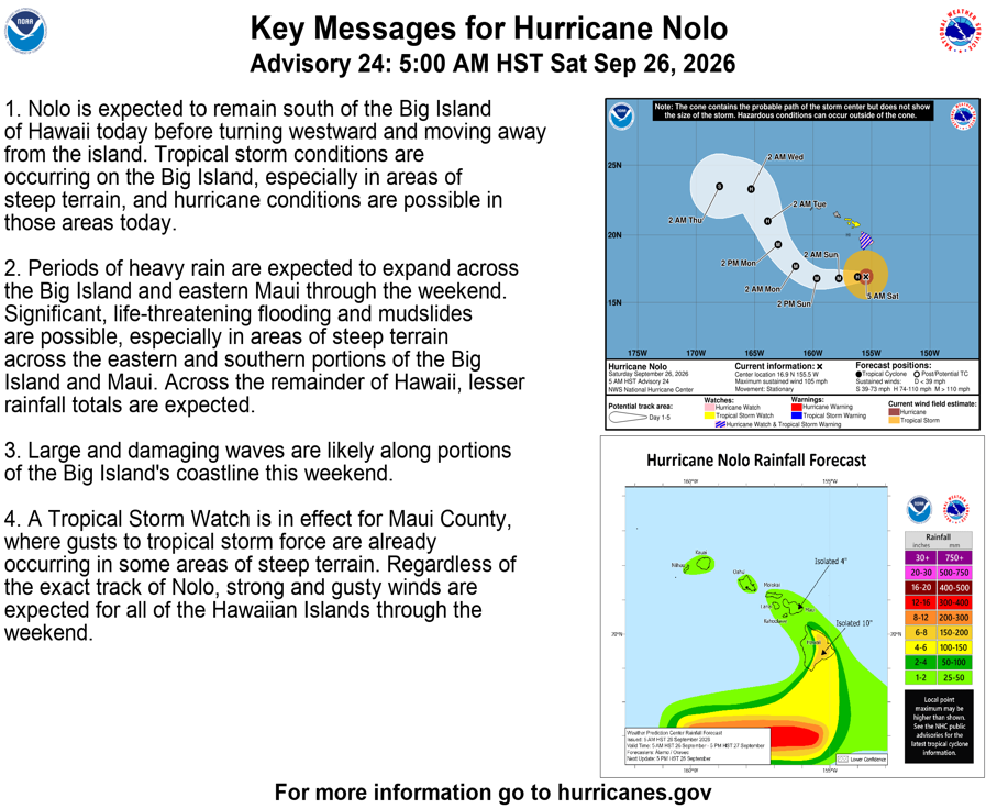
Nolo should have minimal impacts as it stands right now on the western Hawaiian Islands.