In brief: A significant nor’easter will impact New Jersey, Long Island, New York City, and New England this weekend with the threats becoming clearer today. We breakdown the specifics below. Plus, we have the latest on our newest Atlantic storm, Hurricane Polo back to cat 5 intensity, and Hurricane Nolo’s impacts in Hawaii.
Let’s start with the coastal storm we’ve been discussing all week. We’ll get the high notes out of the way first.
What has changed? A storm track slightly farther south but also farther west, bringing the center closer to the Jersey Shore and perhaps western Long Island, increasing potential wind risks and tidal flooding risks there.
What do these changes mean? Slightly higher risk of scattered power outages on the Jersey Shore or Long Island, as well as slightly higher high tide cycles.
On satellite, things are beginning to get going here, though the whole thing is still somewhat ill-defined.
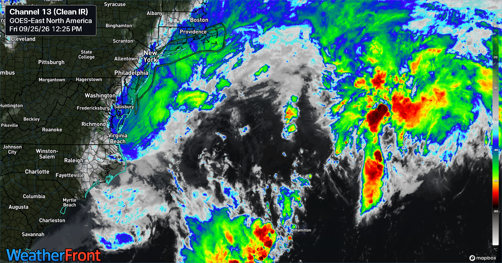
A shield of rain sits off the Jersey Shore and extends up through Nantucket and Martha’s Vineyard.
Over the next 24 to 30 hours, this low pressure system will congeal and lift north, parking about 100 miles south of Long Island before making a left turn toward New Jersey. The storm may come ashore in Jersey, somewhere in Ocean County probably or just north of Atlantic City on Sunday. From there, the storm will weaken and eventually pull back east and northeast out to sea on Monday.
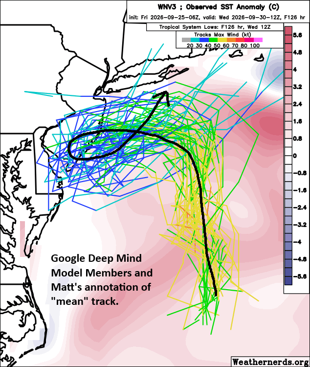
We are beginning to see some decent model agreement on this now across the board. Both higher resolution and more global resolution modeling is pretty much on board with this outcome.
So from a “what’s it mean” perspective, here’s a look.
Winds
For the most part, coastal areas between Long Beach Island, NJ and Nantucket will see 40 to 60 mph wind gusts. There is the possibility that some stronger gusts could impact Block Island, RI, Montauk and eastern Long Island, as well as Monmouth and Ocean Counties in New Jersey. If that happens, it would probably be either Saturday morning or sometime on Sunday morning. But the overall peak of wind with this storm will probably occur tomorrow morning.
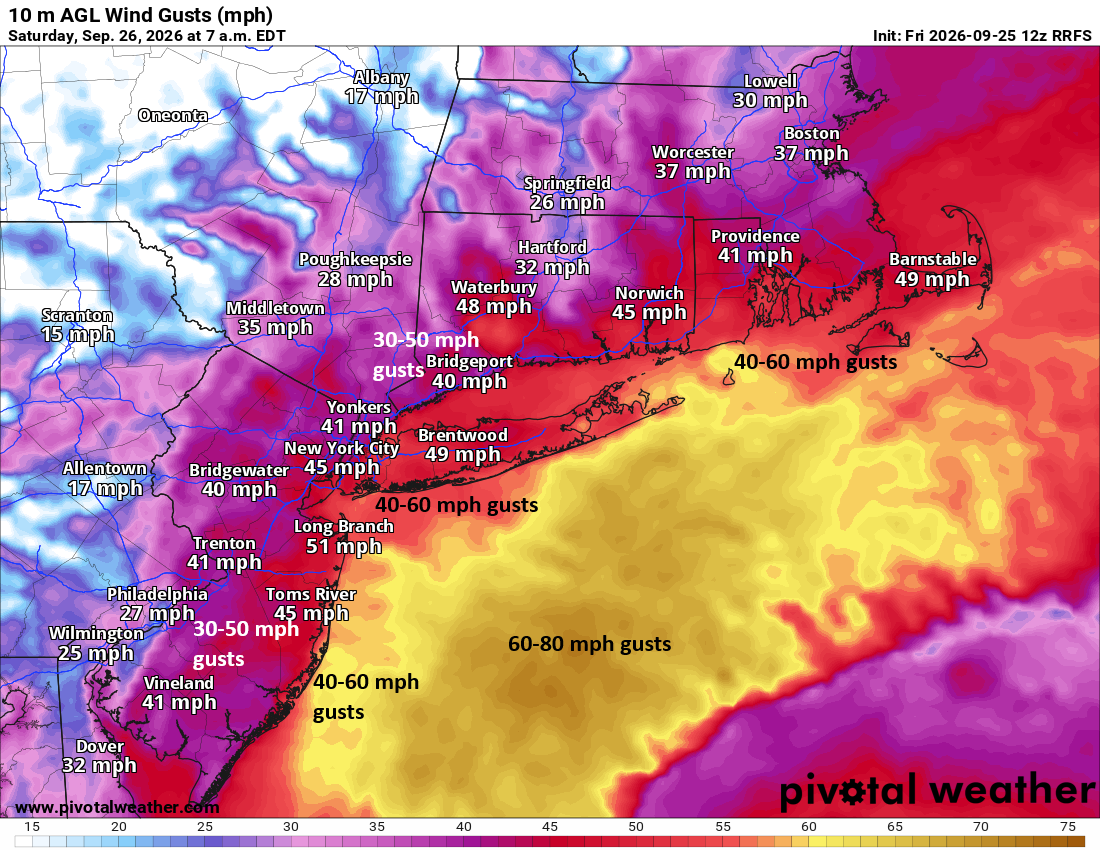
These types of wind gusts are pretty typical in stronger wintertime nor’easters. It just happens to be September 25th. Still, scattered power outages seem to be a safe bet, so if you live in an hour that tends to lose power with a nor’easter charge your phone this evening. That’s probably good advice for most people anyway, just in case, for whatever reason, the wind ends up overperforming.
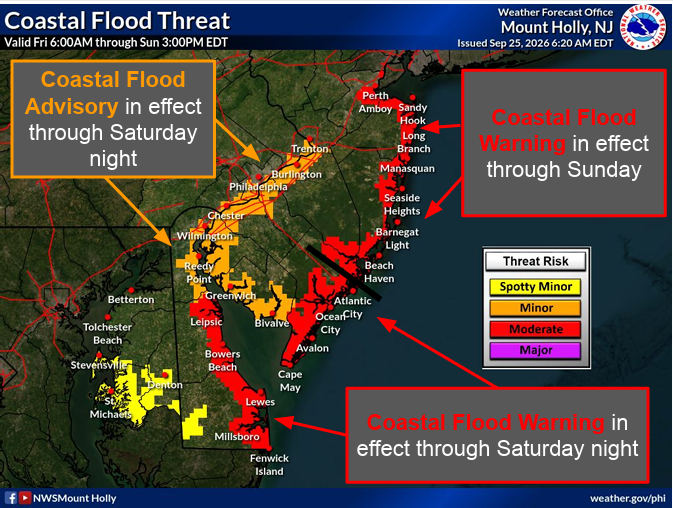
Tidal flooding
The National Weather Service has good briefing slides worth checking out.
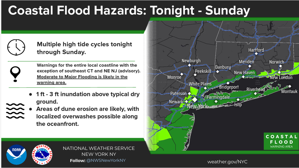
You can also view tide tables for the various monitoring sites up and down the coast.
Rhode Island and Massachusetts
In general, this looks to be a minor to moderate coastal flooding event, except perhaps in Nassau County, Staten Island, and the LI Sound side of New York City, where tidal flooding could be locally classified as “major.”
Rainfall
Total rainfall is expected to be 1 to 3 inches over about 36 to 48 hours. Again, for folks in Connecticut as an example, this is a different style of flooding risk than we saw a couple times this summer. This is more puddling than flooding.
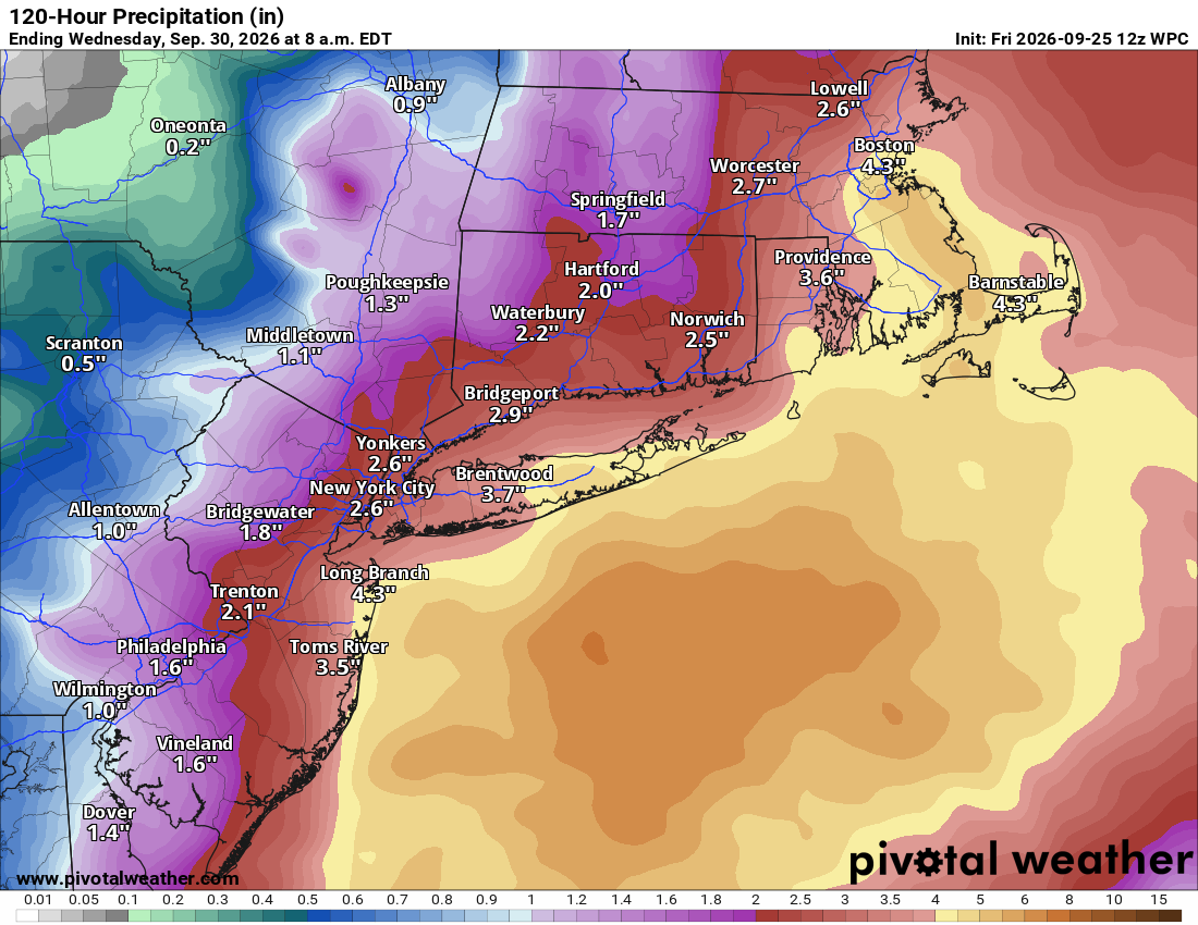
However, I would keep an eye on a couple places for potentially more significant rainfall and potential for localized flash flooding.
1.) Jersey Shore: Some areas could see as much as 4 to 5 inches of rain depending on how close the center of the coastal low gets to the coastline.
2.) Eastern Long Island: Locally 5 inches or so of rain may fall, depending on exactly how close the low gets to the coastline.
3.) Southeast Massachusetts: This area may still have the highest risk of more excessive rainfall, as models have been consistently placing 4 to 6 inches or more in this general area. Odds of 5″+ over 24 hours are 30-40 percent near Cape Cod Bay. While this probably wouldn’t cause severe flash flooding, it could cause localized issues.
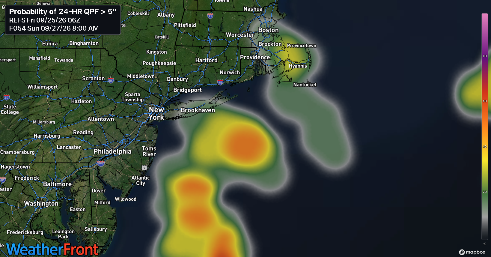
Outside of those areas and the immediate coast dealing with tidal flooding, this storm will be a big old nuisance above anything else.
More later if anything changes or tomorrow.
Around the horn
Enter: Gonzalo
The 7th named storm of the Atlantic hurricane season formed today, as Tropical Storm Gonzalo developed from thunderstorms around the Cabo Verde Islands.
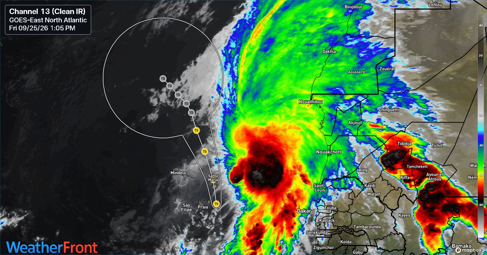
Gonzalo should peak in intensity soon before diminishing as it lifts north away from the warmest water. Maximum sustained winds are around 50 mph. Elsewhere, Tropical Storm Fay is officially the biggest ACE contributor of the season, bringing our accumulated cyclone energy to 7.2 on the season (Fay accounts for 46 percent of that). Seasonal activity is now running at 8.3 percent of normal in terms of ACE. Remarkably low. Thank you, El Niño.
Polo is a monster
Maximum sustained winds reached 180 mph in Polo this morning, and this is validated from hurricane hunter aircraft in the storm, which probably arrived just past peak and recorded about 911 mb and 175 mph winds.
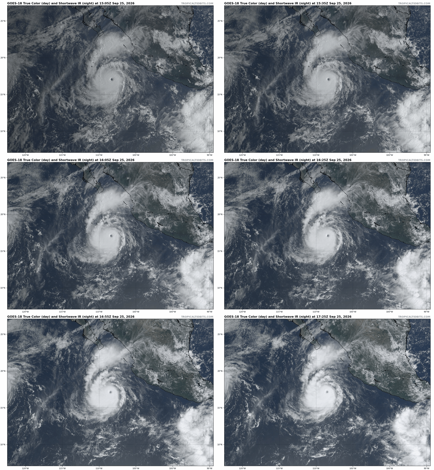
Whatever the case, Polo will move into Baja this weekend as a weakening (but formidable) hurricane. Its moisture will get funneled into the Southwest, Texas, and Plains, and that will lead to flooding risk in the Desert Southwest, especially New Mexico and eastern Arizona on Monday and into the Plains on Tuesday as the remnants interact with a front.
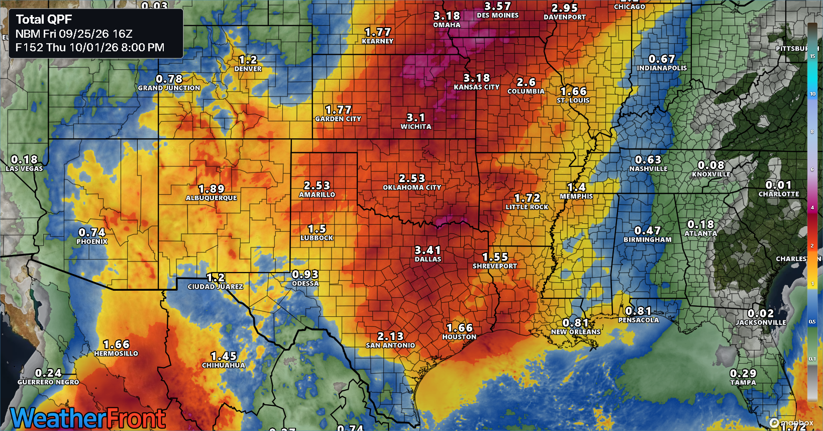
1 to 3 inches with higher amounts seems to be likely over a very broad area of the Plains and Southwest as this happens. More details on the flooding risk will become apparent as we get closer.
Hawaii still expecting terrible rain
A Hurricane Watch and Tropical Storm Warning are in effect for the Big Island of Hawaii as Hurricane Nolo tracks around the islands. Torrential rains on the order of an additional 20 to 25 inches remain possible in the mountains of the Big Island.
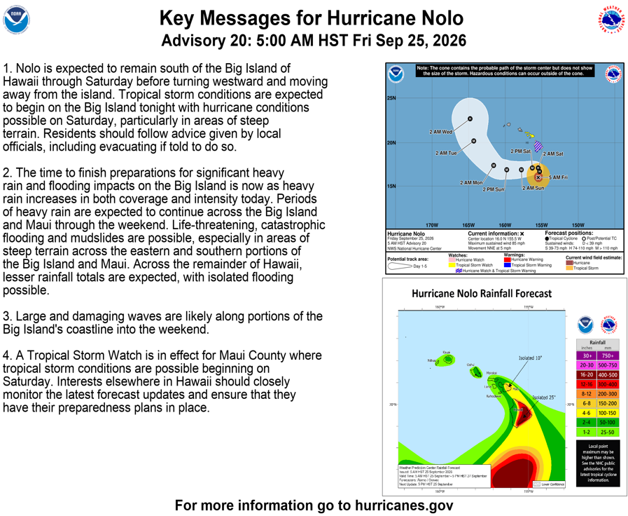
Nolo is expected to track far enough west of the westernmost Hawaiian islands right now to avoid serious impacts, but it’s worth keeping an eye on.