In brief: The nor’easter this weekend continues to slowly, very slowly come into better focus. We explain the tidal flooding, wind, and heavy rainfall risks for New England and the Mid-Atlantic. We also rundown Hurricane Polo’s latest and potential flooding threat to the Southwest, as well as Nolo’s threat to Hawaii.
Let’s roll through the latest and greatest on the upcoming nor’easter and all the many things floating around out there that are worth monitoring.
Nor’easter nuisance
For folks in the Northeast, we know a little more today about the upcoming coastal storm/nor’easter this weekend. but there is still a surprising amount of model disagreement on the exact track. Let’s get that last part out of the way first. Here’s the latest Google Deep Mind WeatherNext 3 run. About half of the model members are capturing this. Others may be too weak or ill-defined. But whatever the case, it gives you an idea.
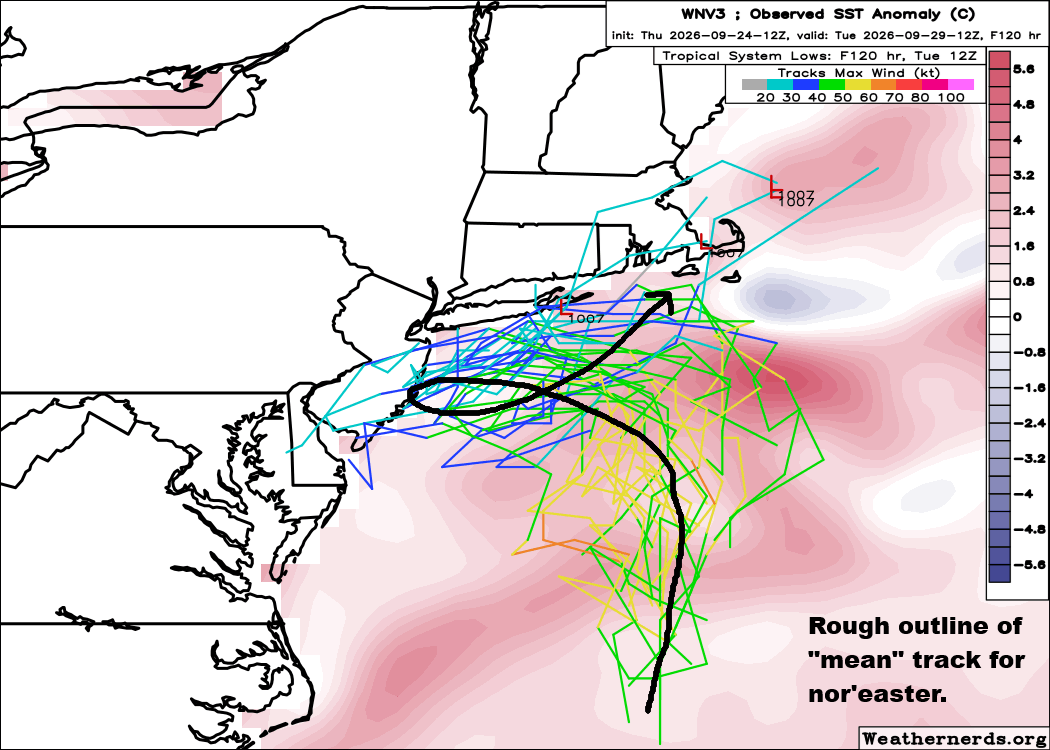
I annotated a rough mean of the track on the map. It will go north, then turn west, approach Long Island or New Jersey and then loop back north and east while abruptly weakening. The storm should be at its peak as it is coming west toward New Jersey.
Suffice to say, this is generally poor agreement on track specifics, with some model members going closer to Long Island and others not as far west as New Jersey or some even all the way inland across New Jersey. The high level outline is good to go, but the details are still being worked out.
Ultimately, this is all conjecture and what really matters are impacts.
Wind
With model disagreement on track specifics, there remains a little bit of uncertainty around how strong and where those winds will be. Some models will perform better than others in this type of scenario, and this is one where I think you have to treat the higher resolution models as less useful for details, as you would during a tropical storm or hurricane. The RRFS in particular is printing out some…wild…values for the Jersey Shore. It seems untethered from reality at this point. More realistically, I would look toward the European model.
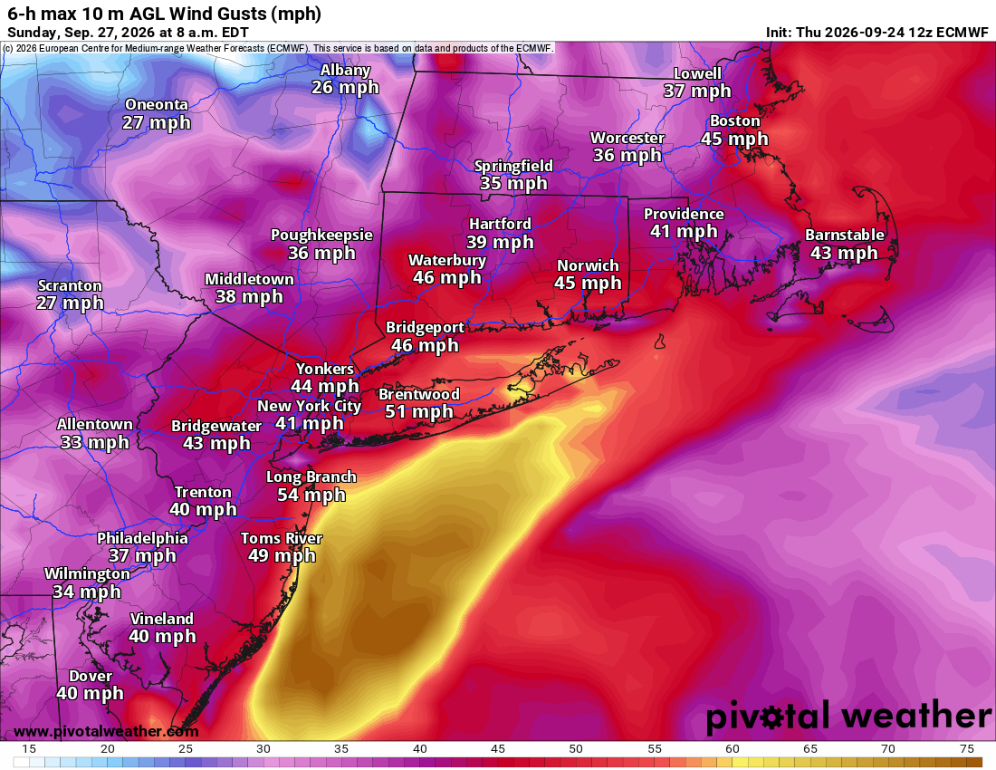
This sets an expectation of 40 to 50 mph gusts Saturday PM through Sunday on the coast between about the Delaware Beaches and Cape Cod or Boston. Subtract about 10 to 15 mph from that inland, except in some of the hills perhaps from North Jersey into southern Connecticut. The yellow on the map above indicates 60+ mph gusts, and those are most likely, if they happen at all, to occur either north of Atlantic City on the Jersey Shore or on the eastern end of Long Island. Yes, wind gusts of this magnitude can cause power outages, so folks should be prepared to possibly deal with that for a time.
Tides/flooding
Tidal flooding will be a big element of this storm. Minor to moderate tidal flooding will occur tonight and tomorrow, as we’ve been discussing all week. As we go into Saturday and Sunday, we may see more substantial tidal flooding, especially in the back bays for Delaware and New Jersey. For Long Island, we’ll likely see moderate coastal flooding for the southern part of Nassau County and minor to moderate flooding elsewhere. Tides may also be fairly elevated and produce moderate flooding in the western end of Long Island Sound.
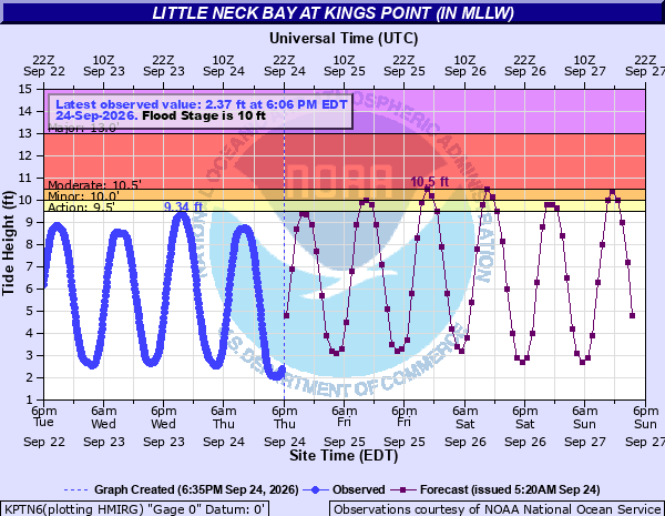
While this shouldn’t be a historic tidal flooding event by any means, it’ll be notable for the region.
Heavy rainfall
The Weather Prediction Center has highlighted southeast New England in a slight risk (2/4) for excessive rainfall and flash flooding on Saturday (shown below) and Sunday.
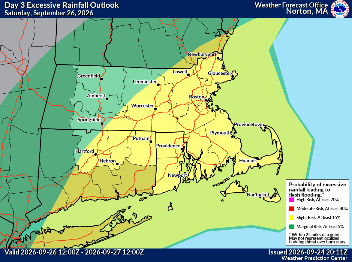
Since the rainfall from this event is going to be spread out over 2 days, that helps mitigate the flooding potential a bit. However, modeling has been fairly consistent in delivering a slightly more intense area of rainfall into the area south and east of a Boston to Providence line on Saturday night and Sunday, so that area may have the highest flash flooding risk. Areas outside of that may have slightly more nuisance flooding risk, not quite like what we’ve seen a few times this past summer here in southern Connecticut as an example, where 3 to 6 inches of rain fell over the course of 2 to 3 hours. This will come over a much more manageable period of time, reducing the “flashiness” and amplitude of the flooding.
The NBM model output of predicted rainfall:
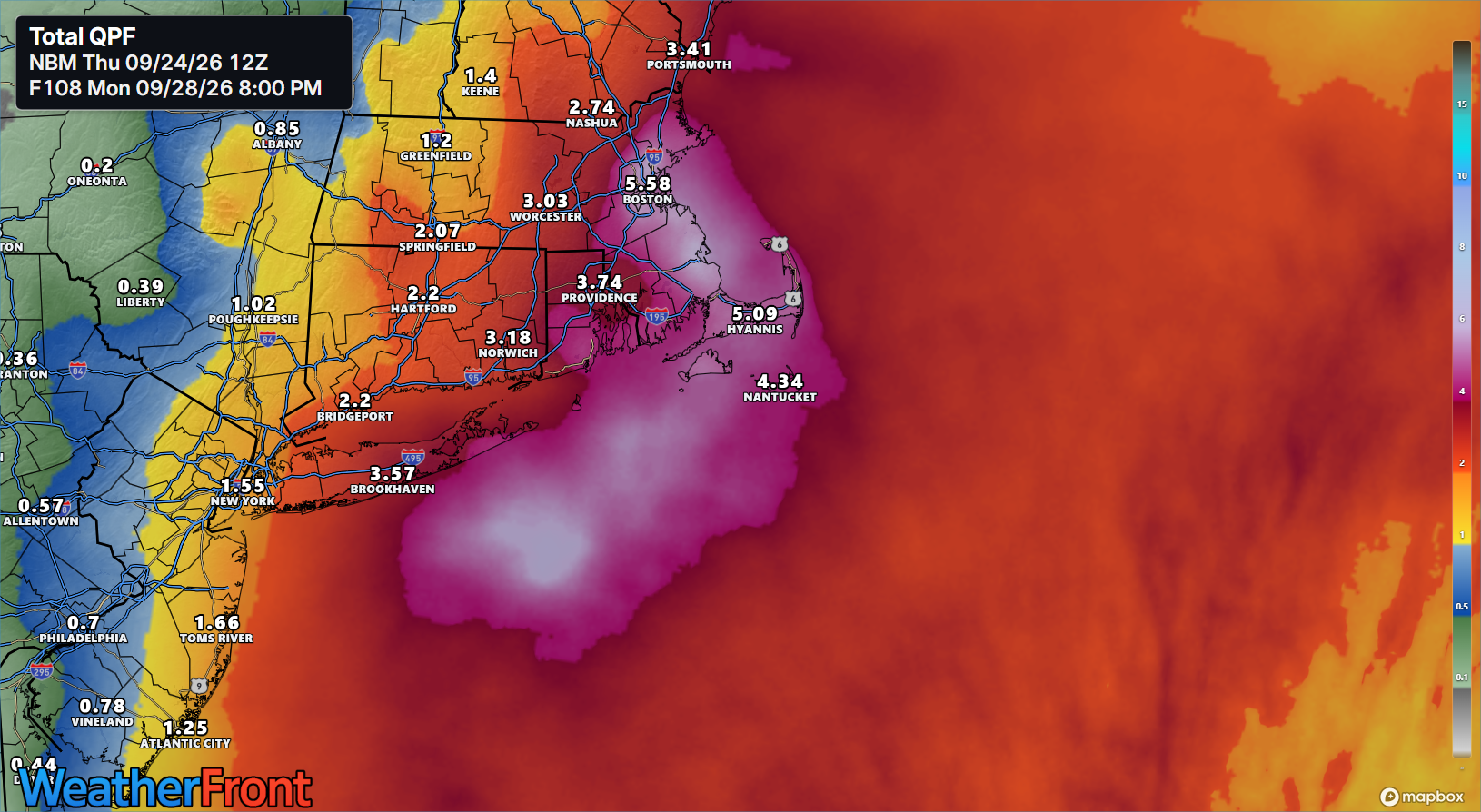
Again, 1 to 3 inches over 36 hours is not going to cause serious problems, but any areas that do see heavier downpours closer to Long Island or eastern New England, where 2 to 3 inches of rain could fall in a few hours will be more prone to flash flooding.
Bottom line: Main risks will be flash flooding in eastern New England or Long Island, gusty winds for Long Island or New Jersey, and tidal flooding for all coastal locations. Details may still wiggle around a bit into tomorrow, so check back for the latest.
Around the horn
Hurricane Polo
Polo remains a beastly hurricane today.

Polo’s maximum sustained winds are at 150 mph, a category 4 storm, and it is expected to strengthen some overnight, back up to category 5 intensity. It remains safely offshore of Mexico, delivering only fringe impacts. Thankfully, this is the case. Polo is expected to work west over the next couple days before shifting course to the north and northeast, while weakening. It will likely plow into Baja on Monday as a weakening hurricane.
From there, Polo’s remnant moisture is likely to expand north into the Southwest U.S. By Monday, much of that will enhance an already moist pattern in the Western U.S. and Plains.
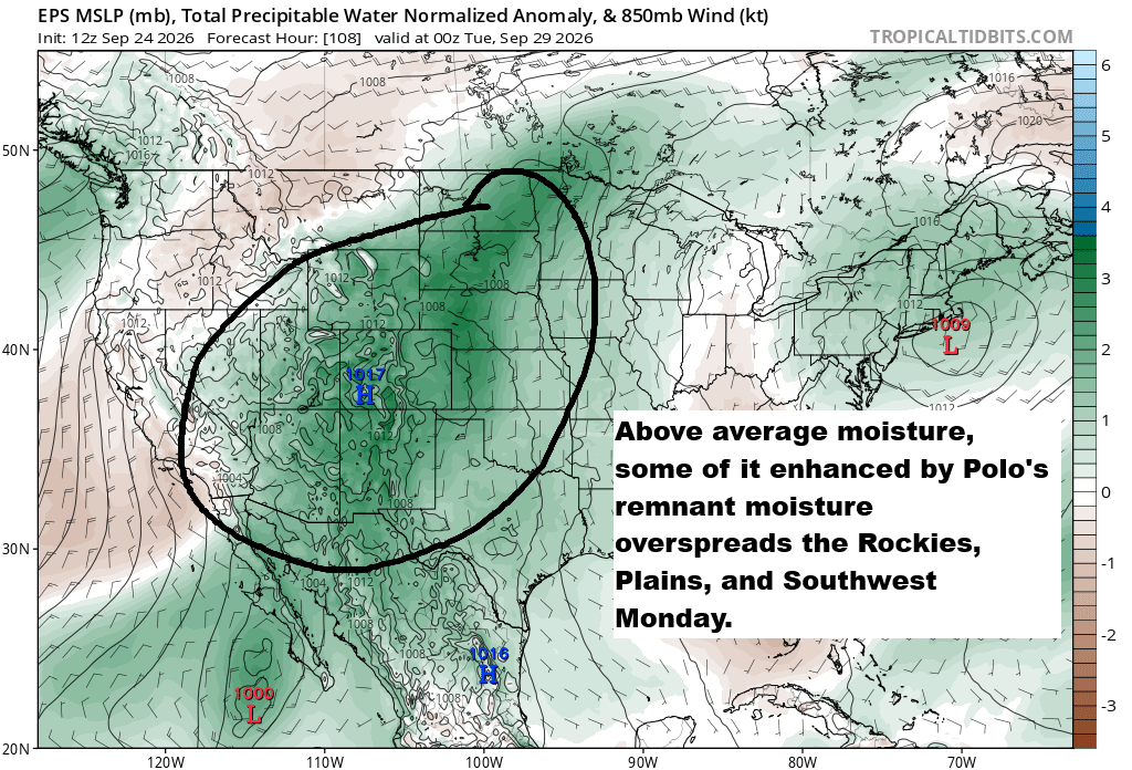
The southern part of this region has been placed in a slight risk (level 2/4) for excessive rainfall on Monday, and it is possible that this will escalate further as more details come to light.
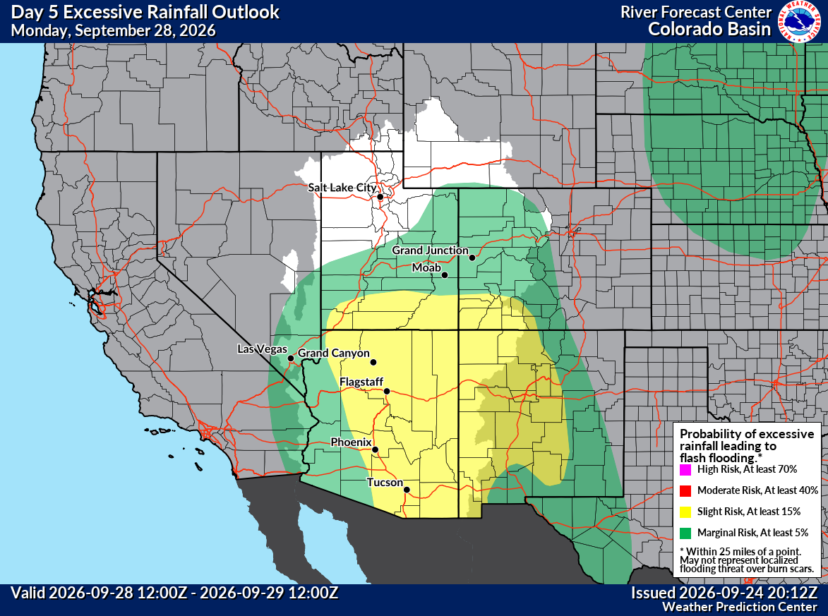
We should see this get tweaked in the days ahead.
Tropical Storm Nolo
The next storm targeting Hawaii, Nolo, is on the cusp of hurricane intensity this evening.
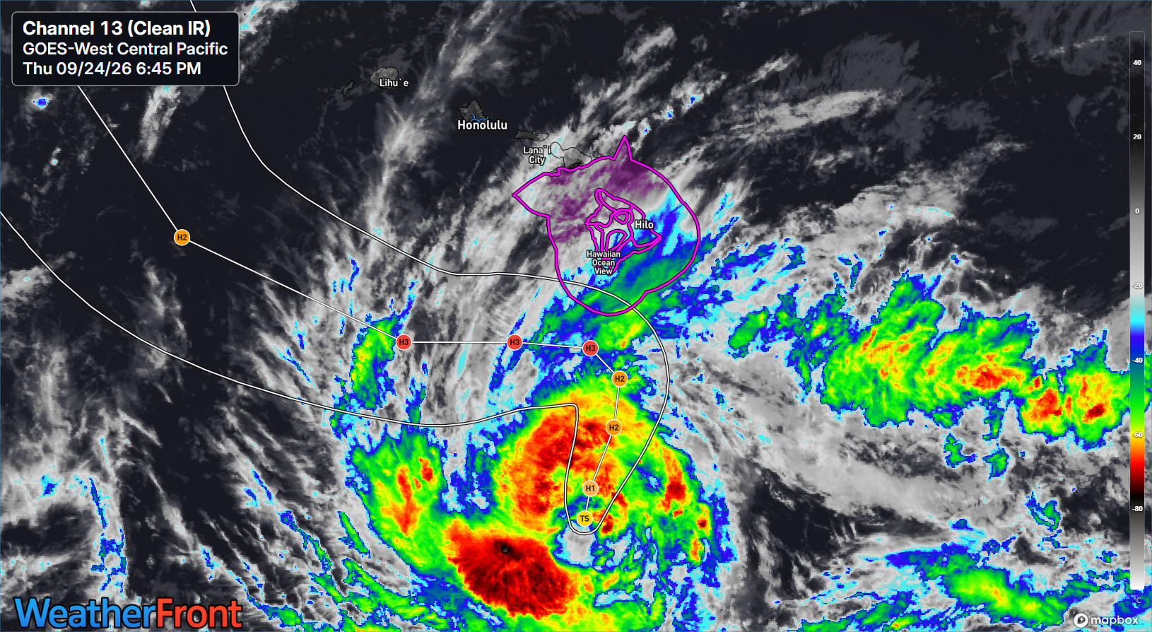
Nolo’s track will take it north toward the Big Island before it abruptly changes course and goes west. There is a bit of uncertainty here, as some ensemble members do bring Nolo farther north, only tens of miles off the coast of the Big Island. Even a storm tracking a hundred or so miles away can deliver serious impacts to Hawaii. In this case, that will come via some strong winds and flooding.
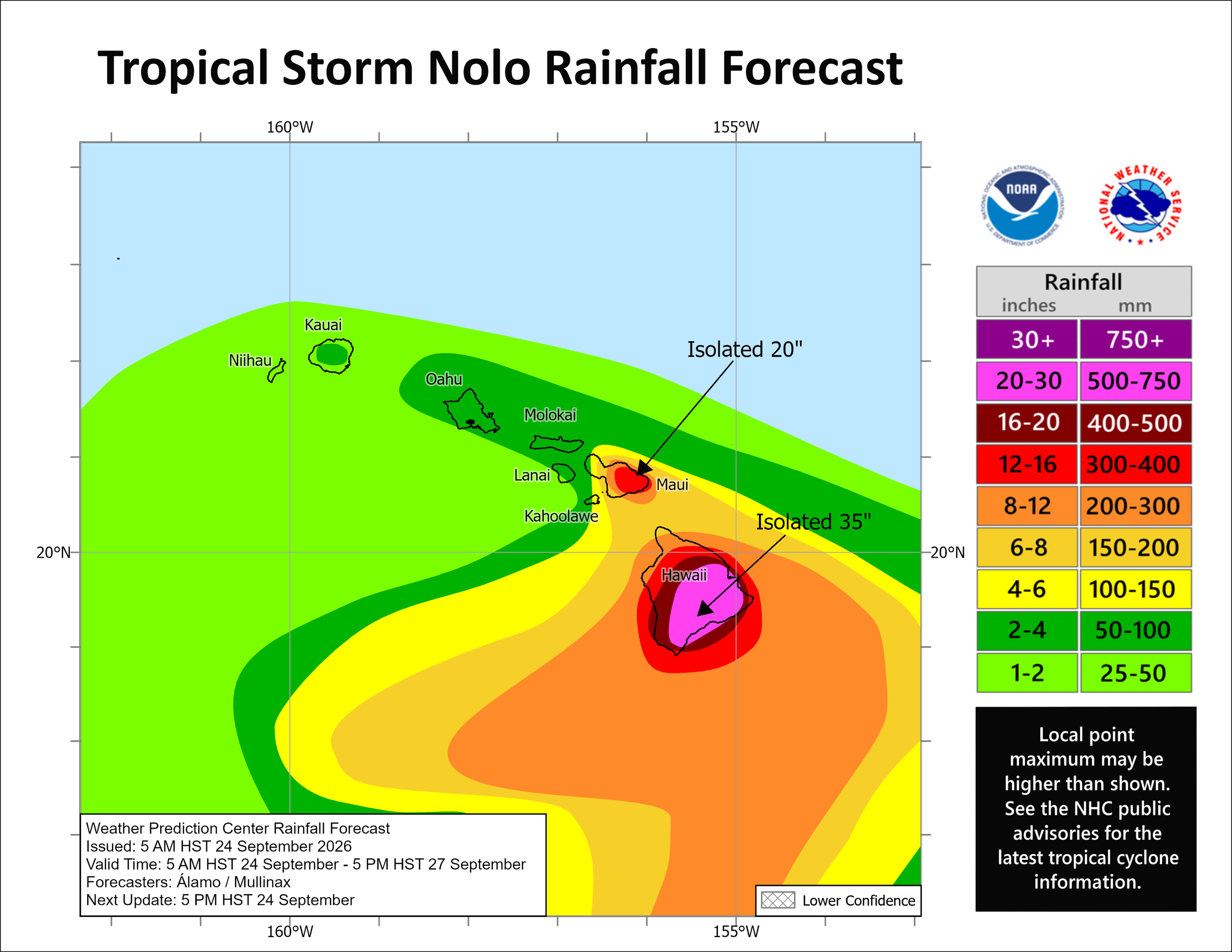
Rain totals of 20 inches up to as much as 35 inches will be possible in the higher terrain of the southeast Big Island. Totals of a foot up to as much as 20 inches will be possible in higher terrain of Maui as well. This rain has the potential to produce absolutely devastating impacts in some of these more sparsely populated mountain areas. Folks in and visitors to Hawaii should be taking this storm extremely seriously, especially if you’re on Maui or the Big Island.
Atlantic Basin
Congratulations to Tropical Storm Fay on pulling off an Undertaker type revival in the open Atlantic.
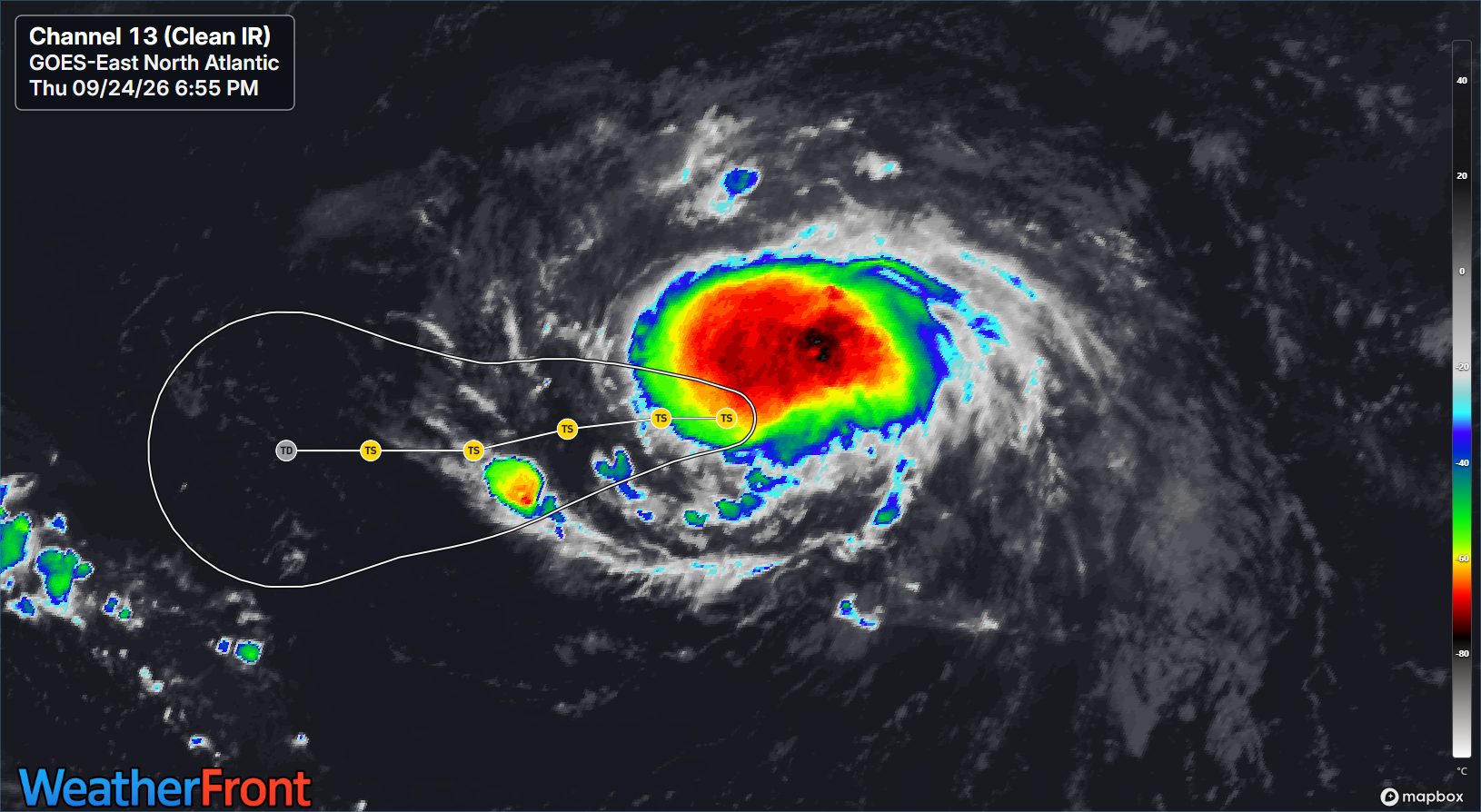
While Fay is no threat to land, it will now take the championship belt from Bertha for biggest ACE contribution this hurricane season in the Atlantic, which is akin to bragging that you won the AL Central or AL West this season. Sorry, Astros fans, I’m with you here. But man.
Elsewhere, the odds of another system forming way out in the far eastern Atlantic north of the Cabo Verde Islands are up to 70 percent today. We’ll see if that can move forward. Models give it about 72 hours to do something before weakening it. Nothing else is imminent in the Atlantic, with the requisite “noise” continuing in the longer range.